


Content created by Dr. Charles Flagg with the assistance of Mark Lang
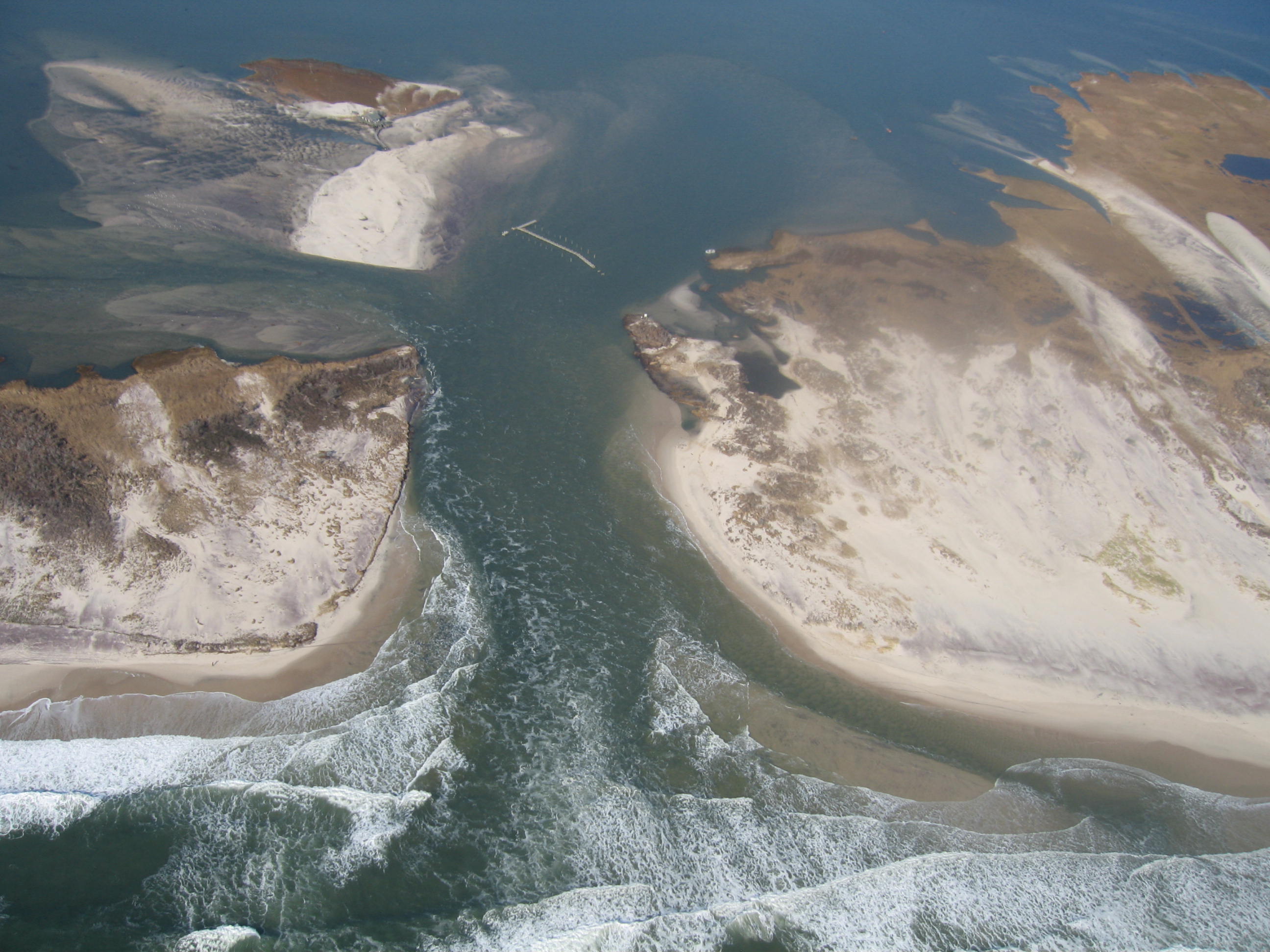
Hurricane Sandy caused significant over washes and three breaches in Fire Island in the area between the historic Old Inlet area and Moriches Inlet. Aerial video and photos were obtained Saturday, November 3rd, 5 days after the storm’s passage. A short description and photos of the breaches is available here while youtube videos are listed below.
A series of reports on the breach development are listed below.
December 14, 2012 report on the new inlet through November is available here.
On January 5, 2013 another aerial over flight took place and a photo summary of the evolving breach at Old Inlet to the present is available here.
January 14, 2013 report on the inlet that goes through December is available here.
The January 30th report on the status of the inlet is available here.
The February 27th report on the bay and inlet with new bathymetry of the inlet is here.
The March 15th report on the inlet and the impact of east-coast wide water level fluctuations is here.
The June 28th report on the inlet’s evolution. the cross-sectional area and changes in the Bay-wide salinity is here.
The 10th report on the inlet’s condition, issued Dec 12, 2013 is here.
The 11th report on the inlet’s condition, issued Oct 20, 2014 is here.
The 12th report on the inlet’s condition, issued Jan 9, 2015 is here.
The 14th report on the inlet’s condition, issued Aug 7, 2015 is here.
The 15th report on the inlet’s condition, issued March 16, 2016 is here.
The 16th report on the inlet’s condition, issued Sept 14, 2016 is here.
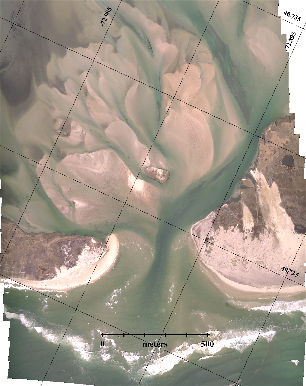
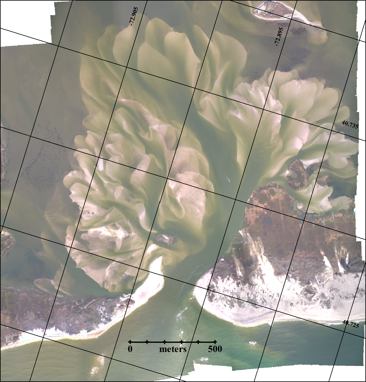
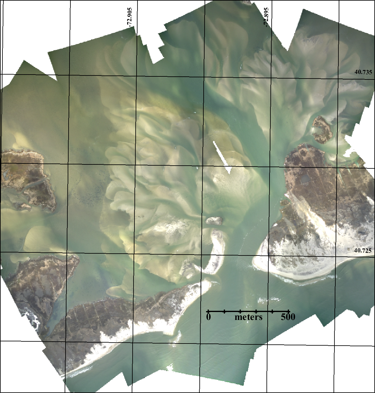
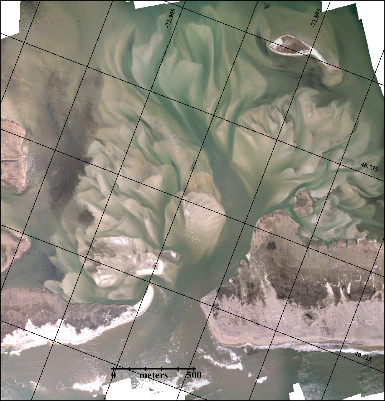
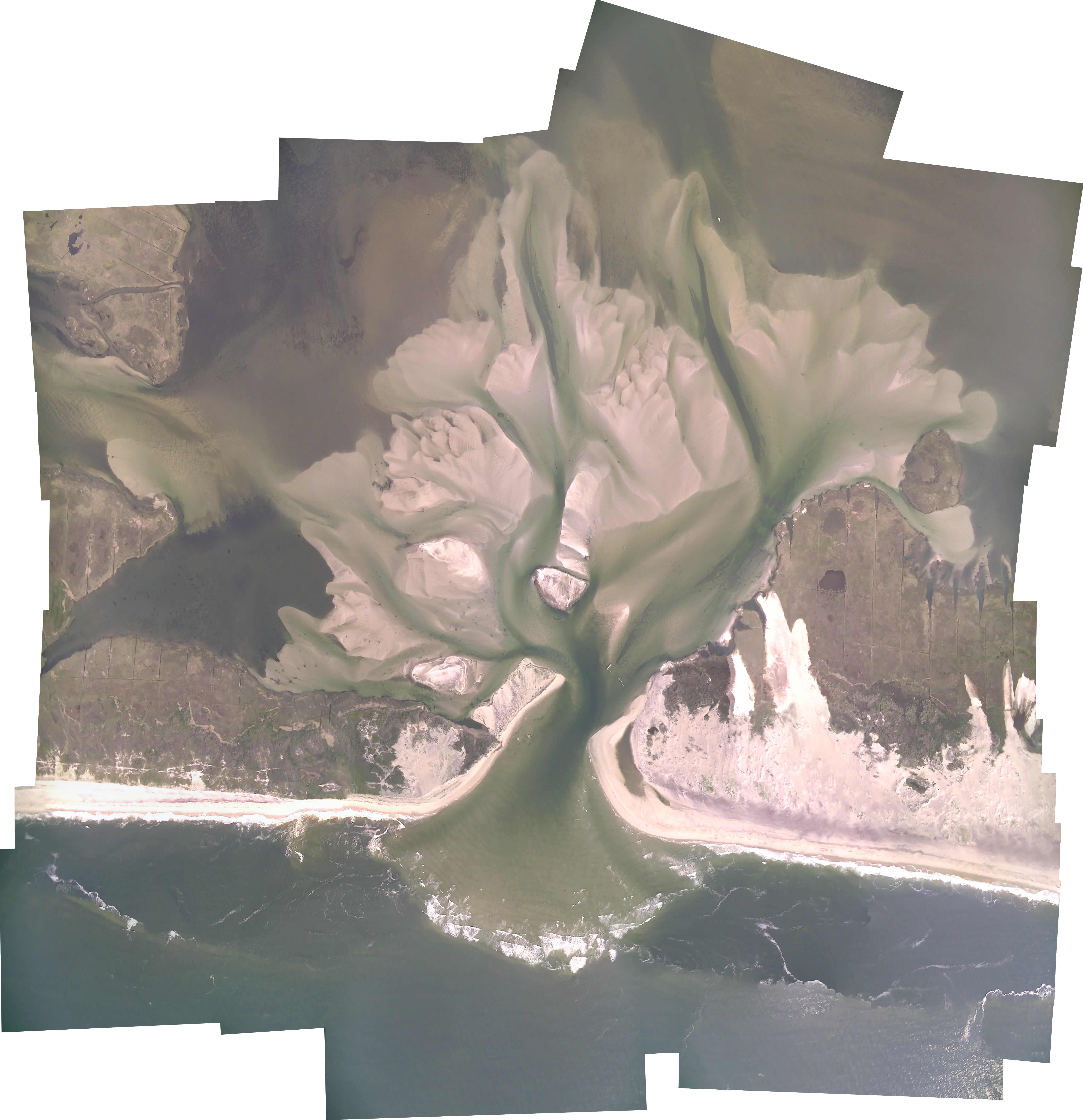
Below is the series of aerial photos of the New Inlet from the south looking north across Fire Island. The aerial photography has been a community effort with pilots Rich Giannotti, Don Richards, Charlie Flagg and Vinny Petruso and photographers Charlie Flagg, Mike Ferrigno, Rich Weismann, Justin Flagg, Brian Wasser, Jamie Shreeve, John Vahey, Brad Furman, Chris Gobler, Michael Busch, Art Leiz, Alejandra Sanchez-Franks and Claudia Hinrichs.
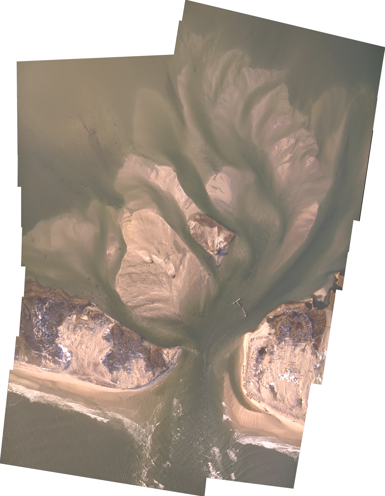
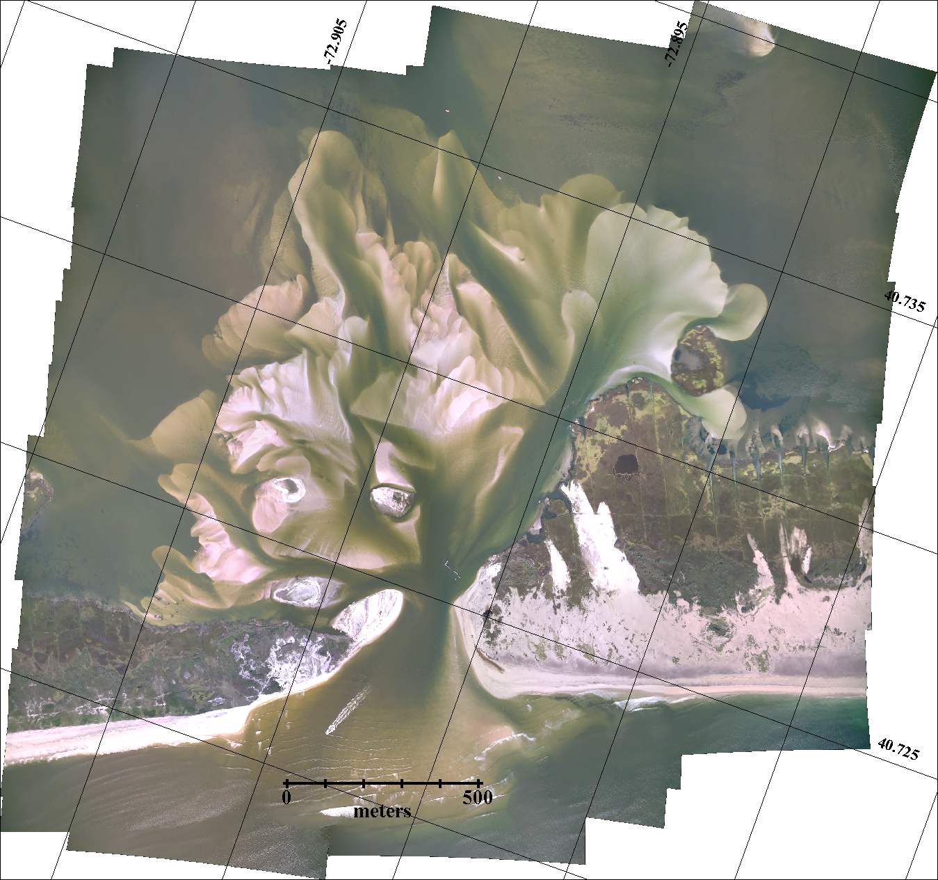
With Mark Lang’s help the series of overflights of the breach have produced detailed photo mosaics of the inlet and back bay area.
A complete collection of photos is available on Dr. Flagg’s Great South Bay Project Website
Click on an image or right-click on an image to open in a new tab to fully zoom in.
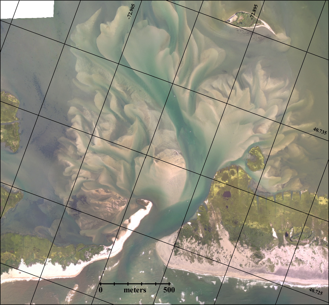
Apr 9, 2005
An image of the area from 2005, several years before Superstorm Sandy hit.

Nov 3, 2012
Aerial video and photos were obtained Saturday, November 3rd, 5 days after the storm’s passage. A short description and photos of the breaches is available here.

Nov 11, 2012
As a follow-up to the November 3rd aerial survey and after the nor’easter that occurred on November 7 and 8, a second aerial overflight of the Old Inlet area was carried out on November 11, 2012. Photos and a discussion of the results of that flight are available here. In addition, we recovered an oceanographic sensor from the Bellport marina on November 10, 2012 which had recorded the sea level, temperature and salinity variations caused by the hurricane and subsequent nor-easter.


Nov 18, 2012
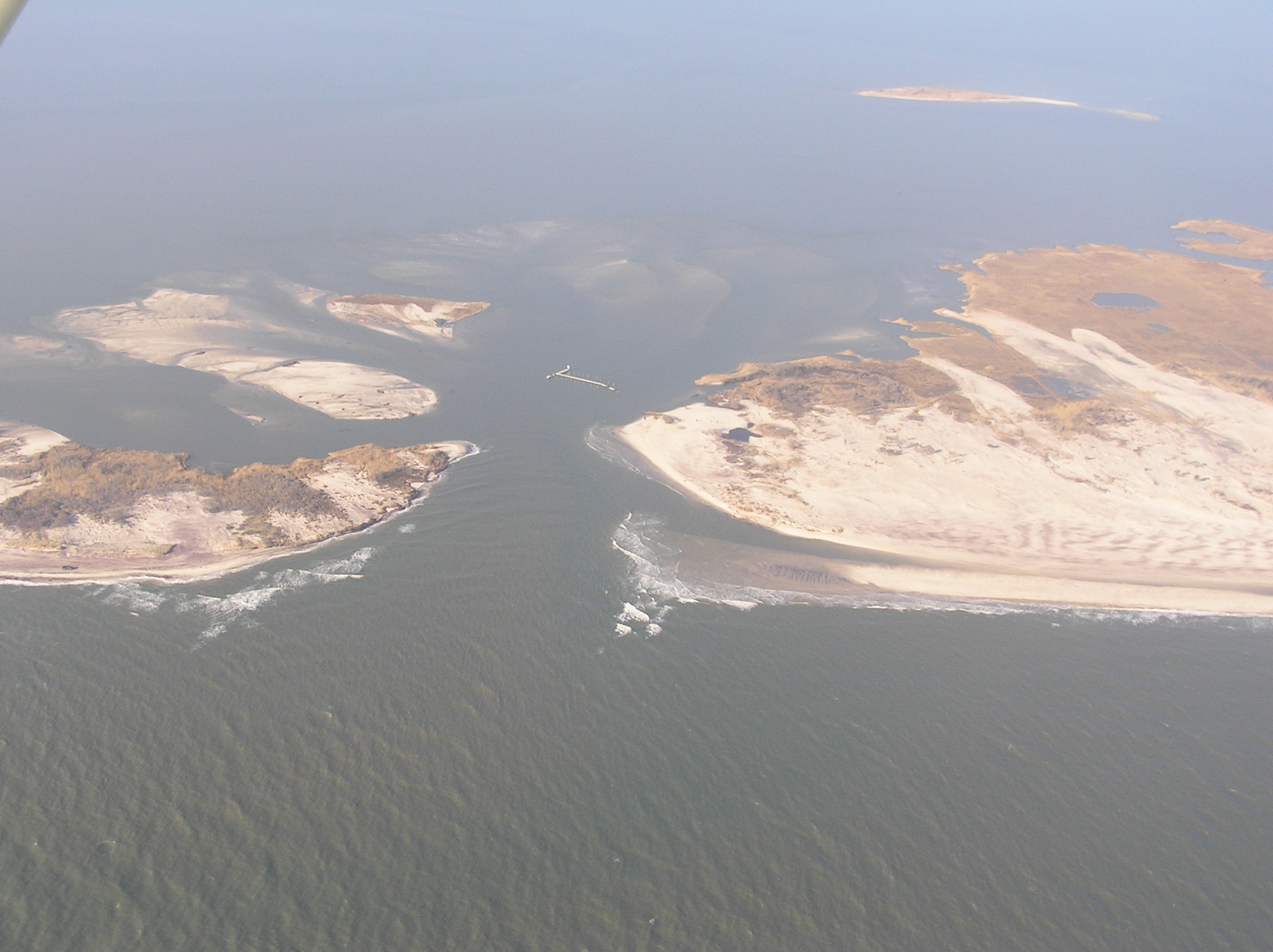
Another weekly aerial survey of the inlet was carried out on Sunday November 18th which showed that the sand island connecting Pelican Island to Fire Island had been cut by a new channel to the west. A series of photos showing the evolution of the inlet is given here.
Dec 20, 2012
On Saturday December 1, 2012 there was a meeting at Bellport’s community center to discuss the breach in the Old Inlet area. A power point presentation given at that meeting shows how the dynamics of the Great South Bay and the ocean resulted in the formation of the breach and how the breach has affected the tides, wind driven storm surge and the salinity of the eastern end of the Bay.
On December 20 another flight was completed.

Jan 6, 2013


Old Inlet Breach Flyover – June 7, 2022
Dr. Charles Flagg took another flight over the Breach at Old Inlet on Fire Island on June 7, 2022. The flyover mosaic is available below. Dr. Flagg noted that the breach is certainly closing, as the images clearly show. Mark Lang has assembled all the geo-referenced...
Old Inlet Breach Flyover 2022-04-25
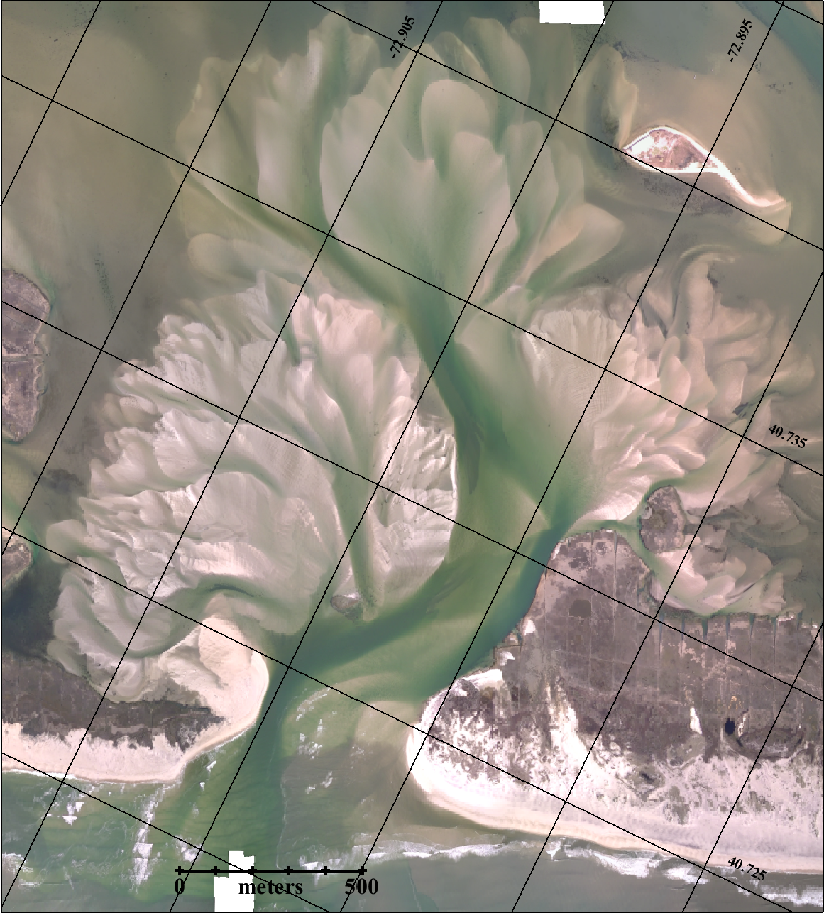
Dr. Charles Flagg took another flight over the Breach at Old Inlet on Fire Island on April 25, 2022. The flyover mosaic is available below. Dr. Flagg noted that everything continues to point to a closure. He reports that salinity is back at levels similar to before...
Old Inlet Breach Flyover 2022-03-16
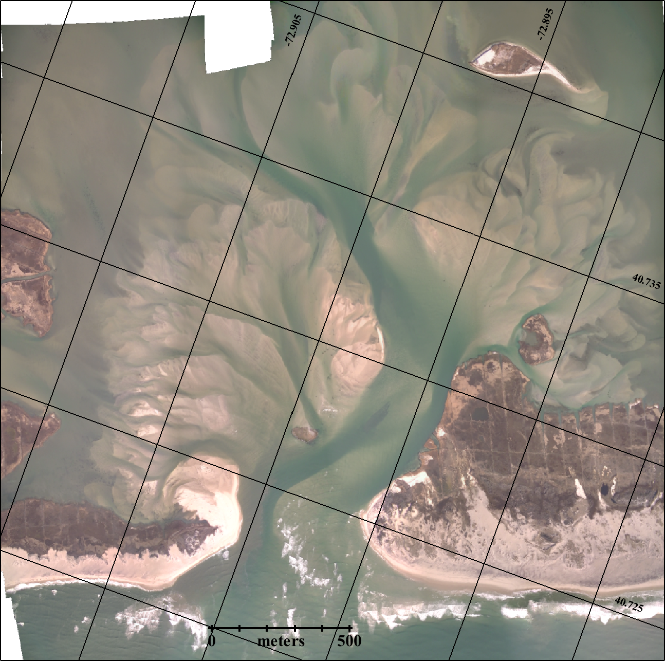
Dr. Charles Flagg took another flight over the Breach at Old Inlet on Fire Island on March 16, 2022, around 0930 EDT and shortly after high tide in the ocean.. The flyover mosaic is available below. Dr. Flagg documented the changes in Inlet Report 27, noting "that...
January 2022 News from SoMAS
Happy New Year and here's to a great start of the Spring 2022 Semester! Hopefully your recovery from the snow event over the weekend was successful. Atmospheric Science researchers spent most of the weekend collecting data at South P Lot and elsewhere as part of the...
Old Inlet Breach Flyover 2022-01-27
The weather, tides, and a functional Super Cub allowed Dr. Charles Flagg to take flight over the Breach at Old Inlet on Fire Island on January 27, 2022. The flyover mosaic is available below. Mark Lang has assembled all the geo-referenced photo mosaics into a kml...
Old Inlet Breach Flyover 2021-03-09
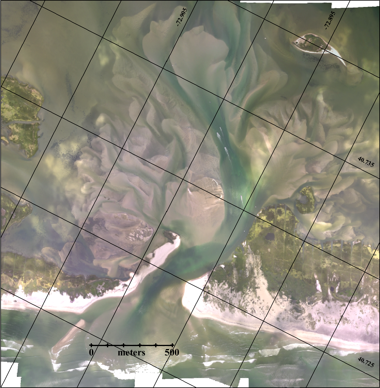
Dr. Charles Flagg took another flight over the Breach at Old Inlet on Fire Island on March 9, 2021. The flyover mosaic is available below. Dr. Flagg noted that there is a lot of sand building in the breach and it would appear that the breach is on the verge of...
Old Inlet Breach Flyover 2021-01-08
Dr. Charles Flagg is in the air early in 2021! He was able to take a flight over the Breach at Old Inlet on Fire Island on January 8, 2021. The flyover mosaic is available below. Dr. Flagg provided the latest report (PDF): At long last we have another aerial...
$2.1 Million Awarded for Sea Grant Research on NY’s Coastal Environment
From $2.1 Million Awarded for Sea Grant Research on NY’s Coastal Environment on Stony Brook University News, October 16, 2020. New York Sea Grant (NYSG) has awarded more than $2.1 million to support six coastal science research projects —three of which are being led...
Updates on the Breach at Old Inlet
Dr. Charles Flagg has continued his flights over the Breach at Old Inlet on Fire Island during quarantine. The last mosaic image was created back in January. Dr. Flagg has been using two different aircraft for the flights. The images that were taken from a much...
Old Inlet Breach Flyover 2020-01-22
Dr. Charles Flagg took another flight over the Breach at Old Inlet on Fire Island on January 22, 2020. The flyover mosaic is available below. Mark Lang has assembled all the geo-referenced photo mosaics into a kml file that can be viewed using Google Earth. By...