


Overview
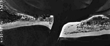
Shinnecock Inlet is the easternmost of six tidal inlets located on the south shore of Long Island, New York. The shoreline adjacent to the west jetty of the inlet is a site of exaggerated coastal erosion due to sand starvation. Due to this, a local road and a commercial fishery located on the bay side of the west barrier have been repeatedly threatened from shoreline erosion. In the period between 1948 and present, approximately 2,706,194 cubic yards of sand were placed on the downdrift beach fronting the commercial fishery (Morang, 1999). Forty percent of this total has been placed on the downdrift beach within the last six years.
In response to the increased rate of erosion at the site, a shoreline monitoring program was initiated in November 1997. Nine transects were established along a 475 meter reach adjacent to the west jetty in order to determine the dominate processes occurring at the site. The project presently spans two nourishment intervals: January 1997-October 1998 and October 1998-present.
Analysis of the profile data from the January 1997-October 1998 nourishment interval has been completed (Batten, 1999). The volume of the measured profiles were observed to decrease in a rapid, step-wise fashion in response to storm events. Due to the influence of the inlet and local hydrodynamics, post-storm recovery of the profiles was limited. Sediment eroded from the beach during storms was lost to downdrift beaches and/or the ebb-tidal shoal of the inlet. Events of nearshore bar welding were observed to occur infrequently at the site. Significant events of profile accretion were limited to periods of favorable wave conditions (swell) through the summer months.
In conclusion, the magnitude of erosion at the site exceeds the shoreline’s ability to recover through natural processes. This condition is induced by the proximity of the site to the inlet. Due to this, beach nourishment must be continued in order to protect the back-barrier structures.
Monitoring Stations 
Originally nine transects were monitored along a 475-meter reach adjacent to the west jetty. The beach profiles were surveyed on biweekly to monthly intervals. Data from 11/97 – 2/00 were collected with an automatic level, subsequent to 2/00, data has been collected with a digital total station.
At present beach profiles are measured at five transects (1, 3, 7, 9, and 10) in the Shinnecock study area. Transect 10, which is not illustrated on the above figure is located near the second (western most) road.
