July 9, West Sayville to West Islip Town Beach


“I believe a good story, plotted or plotless, rightly told, is satisfying as such and in itself. But here, ‘rightly told,’ is my conundrum or mystery.” (Ursula K Le Guinn, “The Narrative Gift as a Moral Conundrum” in No Time To Spare: Thinking about What Matters)


Sayville was once called the “oyster capital of the world.” The 19th and early 20th centuries in Sayville were dominated by the oyster industry, but the hurricane of 1938, pollution from duck farms, and overharvesting made the business untenable. https://patch.com/new-york/sayville/the-oyster-makes-its-mark-on-sayville-history

“Now it’s an oyster ghost town,” Chris Quartuccio, founder of Blue Island Oyster Company, said in 2017. “We’re trying to keep it alive.” https://psmag.com/environment/fighting-to-keep-an-oyster-ghost-town-alive. Chris and others on Long Island are in the process of re-establishing a viable oyster business and in the process, do the ocean waters and coastal lands around Long Island a favor too, by reducing nitrogen  and slowing storm surges by re-establishing the oyster reefs.

I’m sure for those old enough to remember how Long Island was, the good fishing, open land and farms, lobsters, puffers/”chicken o’ the sea,” it must at times seem a ghost of what it was. I can say, even for me, the farther west I paddle, the more mcmansions and bulkheads I see, less wildlife and more nightlife. The wildlife is there, if more sparse, and I certainly hear recovery stories (bunker, alewives, and the whales that follow) along with the stories of loss, and not surprisingly, in both kinds of stories people are telling me how much they care about this/their place.

But for those of us old enough, these Long Island stories is no different than most of the country. My old hometown of Lewisville, Texas is now swallowed by Dallas sprawl. What was a rural town with marginal, undeveloped land is now awash in apartment complexes separated by dying or resurrected strip malls of whatever was or now is fashionable big box stores. In part I think of this as a generational complex, the older we get the more we wish there wasn’t change. Whether on Long Island or Texas, the last fifty years, though, has brought with it change that overwhelms any kind of nostalgia of the aging. We have gone from the remnant rural, agrarian, family-owned stores and small market economies when the Sears catalogue represented the exoticism of so many choices as we thumbed through the book-sized wonder of capitalism. To now, when cheaper cars and cheaper gas promise us a cheaper price and only a short drive to Walmart, Target, Costco, on and on. What we want to buy is now closer and easier to get than ever before. Yesterday, I bought 3 dozen, organic, brown-shelled eggs for only a few dollars, shipped all the way from Seattle. Something in the previous sentence is at the root of the problem, I’m guessing. Of course, the other part of it is how we changed our places by over-developing, over-harvesting and prizing our personal returns over what many of us now say we value.

A story:

When I first started college, I walked to a used bookstore across town. I rarely had money, but I always had time. It was owned by a graduate of the same English Department in which I studied. Don and I talked of poetry for hours in his small store. I would sit and read the books on the shelves if I couldn’t afford them. When I went to Knoxville for my graduate studies, I loitered the stacks at the local Barnes & Nobles; few, if any, of the local book stores remained. Now, I peruse Amazon and can have almost any book I want delivered in days to my doorstep. The other day, Amazon suggested I order Don’s book of poetry which he had written when he was a student in our English Department a decade before me.

There are no shores without history.


After rounding Green’s Point, I made a straight line across Nicholl Bay, which is also the Connetquot River. Connetquot State Park Preserve is a 3473 acre conservation area along the river. If you look on a map, it is the largest green spot on the south shore east of Wertheim National Wildlife Refuge and the Carmens River. It was a calm morning and a clear day and only a few boats sauntered about. The shoreline was dominated by a golf course and Hecksher State Park. Heckscher Park is one of Robert Moses’ success stories; from a modern perspective, most would say there aren’t many of those. The State of New York with the financial assistance of August Heckscher purchased the land for public use.

Rounding Nicholl Point I decided to pull in to the beach for a bit of breakfast. Up above, I could see the beach areas for Heckscher Park and farther West Islip and Bayshore. Putting back in I decided to hold close to the shore until I reached the shores of the Seatuck National Wildlife Refuge https://www.fws.gov/refuge/Seatuck/about.html and Seatuck Environmental Association https://www.seatuck.org/index.php. More on Seatuck at a later date. From Islip Beach and Bayberry Point, I knew it would be best to cut the Great Cove as fast as possible, watching all the while for the Bay Shore-Fire Island ferries and bay boats, which were becoming more common with every warm day.

I headed for the boardwalk at Bay Shore Manor park as quickly as I could. Out of my entire trip to now, this was the only time I had to deal with an a-hole boater. The guy made a point to steer his boat with 30 feet of the kayak, even as the two women on the boat yelled at him to not be an a-hole. I heard them; they were that close. If death stares count on the water, I got my point across, but he was long gone on the bay horizon and their complaints to him disappeared behind the engine noise. A-hole.

I pulled over on the beach at Gardiner’s State Park, near Thompson’s Creek. For a quick moment of reflection, and a little water. The wind was starting to kick up against me and the paddling became slower. Too, I was starting to feel a little achy and all, but I notched it up to the a-hole and the wind. Off in the distance I could see the Robert Moses Bridge. Too, I noticed how the dead eel grass covered the beach.

The beach was covered with eel grass at the wrack line. Maria says is normal and fine and occurs naturally after strong currents and major storm activity. However, after a big boating weekend (such as July 4th) more eel grass will wash up on the shore from all the boat disturbance; this much likely signals a problem with the loss of habitat for microscopic oysters and clams, as well as newly hatched fish.


I had to get a picture with my phone while paddling under the bridge. The water was really choppy, though, and I needed to keep my hands on the paddle.


After the bridge, I decided to end the day as soon as I could. The winds seemed now to conspire against me. So after Willet’s Point, I decided to land at West Islip Marina and Beach. I lifted my kayak onto my shoulder and walked past a young woman tanning herself and her phone. If one can look through another as though he/she isn’t carrying a sea kayak, she did. I was happy for her.

The lifeguard told me that kayakers are not allowed to land on the beach, as it causes too many problems during the swimming season. I promised him it was my last time to do so, and he laughed. He told me of his return from the Iraq war and using the GI bill to get his degree. He wants to become a history teacher, but it’s hard. There so many people with degrees and only so many jobs–teaching public school in New York is still a valued job, unlike much of the rest of the country. They are paid fairly. “You gotta know a guy to get in,” he said. Yeah, the only people I know are Texans, and that doesn’t go very far on Long Island. A lesson I’ve learned over and over.

I waited with the kayak, feeling shakier and warmer as the afternoon went on. Next trip, I’ll make sure I don’t use the beach. But … I do know a guy, now.

July 1, Bellport Marina to West Sayville

Off in the distance of this photo is a bay boat coming my way. It was nice warm weather and calm waters, but it’s a Monday, so the boat traffic wasn’t so bad.

Behind the boat is the ridge of Fire Island.

Off to the left just out of the photo frame is the breach at Old Inlet–southeast across Bellport Bay.

All this orientation for the reader is a way of saying that while I am paddling deeper east into the built environment of Long Island, the unbuilt environment will always remind us who’s holding the straight flush. Yes, it’s a crappy pun on cards and breaches.

The breach at Old Inlet came about from SuperStorm Sandy, one of three breaches created in the storm but the only one not closed by the Corps of Engineers. Not surprisingly, a lot of local folks initially wanted this one closed too for fear of flooding from a storm surge. However, coastal scientists argued that the breach may in fact be the best thing possible for the bay; it would increase flushing/circulation of the bay waters and the open ocean. In fact, folks at Stony Brook found that flushing decreased from 19 to 5 days (https://www.hakaimagazine.com/news/the-unexpected-upsides-of-the-hole-in-fire-island/). Such exchange increases water clarity, decreases nitrogen levels in the bay, and helps bring back marine life. They say the inlet will close naturally over the years of sand deposition and the Corps and National Park Service have agreed to let it close.

We cut a straight line to Howell’s Point and stayed a few hundred yards off shore. We passed Peat Hole, a small pond that is said to be a public skating place for over a hundred years. It was preserved in 2004 and offers public access (https://www.nytimes.com/2004/01/25/realestate/in-the-region-long-island-more-historic-sites-in-suffolk-being-protected.html). Howell’s Point was named after Col. William Howell, who along with Thomas Bell, established Bellport in the mid-19th century. They did so with the idea that it would be a seaport, since Old Inlet offered access to the sea. The inlet, however, filled in and Bellport never became the seaport they imagined. Recently, citizens were asked to rename the inlet since it reopened, so they went with “New Inlet.” Some prefer “New Cut” and others, hunters most often, call it Pattersquash Inlet for the hunting shack that was on Fire Island and washed away during Sandy.

After rounding Howell’s Point, we had a straight shot to Mud Creek Dog Park, destination of many a dog and their owners. It was still early but one dog walked its human in and out of the low waves. The dog attended to us paddling through the bay more than the human but probably a good thing for all. Some of my best conversations have been with dogs.

The number of boats were increasing as we got closer to Patchogue, a harbinger for the trip until I started heading east again, up on the Sound. We aimed for Sandspit Marina and the long jetty on the left side. The  protection of the low speed zone made it easier to cross. From there we aimed for Sandspit Marina and the long jetty on the left side. Then we went straight to Blue Point, and pulled out for a protein bar and a swig of water.

It was a brief paddle to Green’s Creek County Park in West Sayville. Some say Green’s Creek is Maria’s and her students’ creek as they have done water quality monitoring and clean-ups for 20 years now. Her old friend Billy Hart at Hart’s Lobster is a stone’s throw down the road. She knows he’ll give her a ride back to our car in Bellport.

This area is Maria’s home. She has taught here for nearly two decades and worked to keep this place and the bay as healthy as possible. She is known widely as the science research teacher who gives tirelessly to her students, who gives tirelessly to teaching students, parents, and locals about environmental problems and responses, and who gives tirelessly to activism to protecting the Great South Bay. Oddly, she’s never tired.

While she’s with Billy to get our car, I have a bit of time to reflect on her long-term commitment to place and citizenship. I’ve moved so often during my adult life; I’ve never dug in the way she has. I’ve written a book here and a few essays there, but I’m usually on the move before I have to think about a lifetime of working for and with a place. I’d say it’s more wanderlust than wearing out my welcome, but the reality is, I haven’t been a part of the slow process of mini-setbacks and the forward steps of success in preservation of home. I/we have so much to learn from places and people like her.

June 27, Lashley Landing to Bellport Marina

A rhythm rocks

these boats, sails furled

tight as language ….

(“For Graham Everett,” Ray Freed)

Today’s ten-mile paddle was calm and uneventful. I’m sure there were more stories going on than I noticed, but I’d rather let the pictures do the work.

Moriches Inlet in the distance and a quiet place to have a snack.

Near the Smith Point Bridge I moved to the north side of the bay to stay close to my next few put-ins.

A few old duck blinds and fishing shacks dotted the less peopled parts of the shore.

I made it near to John Boyle Island, but the birds there did not want me to land. A black-backed gull even dive-bombed me a few times when I was close to shore.

I headed for the Bellport Marina along the northern shoreline and waited for my ride. Sometimes furled sails and language are the best way to tell a story with the detail. Less can be more.

The dockmaster at Bellport Marina is now one of my favorite Long Islanders.


June 24, Ponquogue Bridge to Lashley Landing

“Such is a glimpse of the Fire Island barrier, but what an infinitude remains, unlearned, unseen!” (Robert Cushman Murphy, “August on Fire Island” American Museum of Natural History pamphlet, 1950) 

We had left a car at Lashley Landing after the building manager Tom at Rogers Beach suggested it would be the better place to leave a car and for take out. We then drove 9-10 miles down Dune Rd. all the way to our starting point.

It was a foggy morning at Ponquogue Bridge. Maria and I parked the car and began unloading kayaks and gear. A couple with heavy Russian accents were readying their fishing gear for striped bass as we readied the kayaks on the western side of the parking area under the bridge.

You going fish in those? he asked, pointing to the kayaks.

No, I returned. Just paddling. Question marks do appear over people’s heads sometimes. I promise.

Luck to you, he said shaking his head side to side. He was worried about our safety.

I guess it’s a fair reflection about the efficacy of so much time given to paddling with no return of food or money. My Russian-American fisherman goes to the bay to enjoy the respite from work, neighborhood, and spend some time with his partner outside of cleaning, meals, TV, lawns, bills, and other such chores. I wanted to ask him if the goal was fish or reflection, but the language barrier would keep us from meeting at this far point of teleology. For myself,  I guess I’m still looking for threads to weave into a fabric, an artifact, a myth to drape around my shoulders. Murphy’s note about what is “unlearned, unseen” on Fire Island is about what people ignore, pass by, don’t notice or avoid. I guess I’m trying to pay attention, pass into, notice, and encounter and to do so, means I have to take up a new story, a new vantage point while drawing from the best of the old stories passed down.

Today’s trip was going to be far less turbulent and edgy than the last, in Shinnecock Bay and a mild, cooler day, and water depth for most of the trip stayed between 2-3 ft deep. That’s not to say there wasn’t a lot to see, but we did end up dragging the kayaks more than a few times until we got into the Quogue Canal. The eelgrass beds covered huge swaths of the shallows.

The birds were abundant: sanderlings, lesser egrets, and a heron every now and then. Least terns dipping and scooping breakfast and an osprey catching a good-sized menhaden.

We stayed to the south near the barrier land and found a channel around Lanes Island. I noted later on the computer the rectangular grid of trenching.

Lane Island Trenching

Salt marsh ditching became prevalent in the US as Public Works Programs in the 1930’s and was largely an attempt to combat mosquito-bourne illnesses (Koch & Gobler, 2010). Local agencies trench the marshes to drain them and reduce habitat for mosquitoes. However, not surprisingly, it also reduces habitat and food for crabs and fingerlings. Next to erosion control and coastal processes, trenching for mosquitoes may be one of the more controversial changes to the area and is currently thought to act as conduits for pollutants to enter our local bays.

Duck blinds also dotted the islands and marsh areas. The above blind offered a nice perch for an osprey who stared us down as we rounded the island. It was four days before full moon so female horseshoe crabs were beginning to find the shallows along the shoreline to lay their eggs and scuttled “across the floors of silent seas” (apologies to T.S. Eliot).

We saw only one with a small male attached.

Last year when I was helping with a horseshoe crab count, I saw one female with 3 males attached, where the satellite makes make sure they too get a chance to fertilize the eggs when laid. Horseshoe crabs are one of the oddest creatures you’ll come across on the night shores of Long Island in late May to September. They generally breed  during high tides of the new and full moons. And yes, as a species, they have been around since before dinosaurs (some suggest over 450 million years). Through the summer you’ll find dead ones and molted carapaces washed up on the shores and in the marshes. They’re harmless and in that strange/alien way, cute.

We paddled close to the southern shoreline but had to be careful off and on about hitting shallow water. I was amazed by the bravery of one intrepid boater flying in to Dockers Waterside Marina and Restaurant as the dredged channel was marked but a thin line to thread at his speed. Clearly, he had a hankering for some lunch.

The bay narrows at Penniman Creek to the north and signs warn boaters about the 5 mph speed limit and no wake zone. A couple of kayakers with fishing poles floated around the sign in the middle of the creek. Not far into the canal a local police boat sat in wait of violators. We smiled and waved at him as we slowly paddled by. I’ll try to keep the wake down officer, I through out as an icebreaker. He laughed enough to let us know he’s not just his job.

Entering Quogue Canal in kayaks is a little surreal. It was dug in 1895 to connect Quantuck and Shinnecock Bays. Around the same time, the train line made its way here and wealthy New Yorkers began to buy up property. By the time we passed the Quogue Field Club, the canal narrowed to bulkheads and mansions. We took the right side to cross under Post Lane bridge and the current was strong.

This time of the year was still a bit early for those returning to their summer homes, so the only folks around were the landscape people keeping green lawn green and topiary … uhhh … “topiaried”? Of all the kayaking I’ve done to this point, this waterway was the first I felt I didn’t belong. Yes, even the one boat or two that passed observed the 5 mph speed limit and didn’t crowd us in the canal. But between docks and bulkheads a kayaker should not stop.

The canal opens up to Quantuck Bay, fed in part by the wetlands of Quogue Wildlife Refuge to the north. The bay is small and was home that day to a flock of jetskiers, cutting swiftly one way or the other and flying off the wakes of their species. Murmuration describes the way large flocks of some species of birds seem to move in unison. These folks did not imitate that movement. It was a random, chaotic course they set. Perhaps there was alcohol involved, but I should not judge.

Quantuck Bay narrows to the west to the canal again and not far into this section is the Beach Lane draw bridge. It’s a busy lane as Rogers Beach is just across the bridge and is one of the larger beach areas around.

Clearly in the past, folks did not observe proper use of the area as the Village of Quogue made it abundantly clear. Under Article 1: Access and Use of Quogue Canal:

§ 118-1Access and use from Beach Lane. [1]
No person shall enter the Quogue Canal in the Village of Quogue for the purpose of bathing or swimming; nor shall any person fish, in any manner, from the highway in this Village known as “Beach Lane”; nor shall any person sit or walk upon the bulkheading along the banks of said Quogue Canal within the bounds of said Beach Lane; nor shall any person park any automobile or other vehicle or place any structure or obstruction whatsoever in that portion of said highway known as “Beach Lane,” on the mainland, within 50 feet of the bulkheading along the northerly bank of said Quogue Canal, nor in that portion of said highway known as “Beach Lane,” on the ocean strand, between the highway known as “Dune Road” and said Quogue Canal.

Maria and I thought it best paddle on into Moneybogue Bay, which for the day’s trip seemed aptly named and made our way past Reedy Island, a small collection of trees on an upland area. We pushed on below the Jessup Lane Bridge to the west which has its draw bridge over to the north side so we headed to the south side to avoid any larger boats.

Just past the Jessup Lane bridge to the south is a small beach with a bulkhead to keep erosion from a large parking lot. 

We had stopped for a protein bar and water and to make sure about how far it was to Lashley Landing, about 1 mile. We were guessing the parking was for the Swordfish Beach Club and since it was around 1PM, no one would mind our resting. Within five minutes, a middle-aged guy and his middle-aged dog came to the edge of the bulkhead and proceeded with a series of questions and awkwardness that said to us we shouldn’t be here.

It was a quick paddle to Lashley Landing, though the road and parking are on the bay side where it is called Picket Point Road. Picket Point is a gorgeous little marsh area reaching out into Moriches Bay. The landing area is just west and the trail to the parking area is short. No one else was parked there, but it seems the kind of area that you’d need to be told where it is.

Maria took some time to wander the marsh where she feels more at home than with humans–just one of the reasons I like paddling with her. She pointed out to me the mutualism between the ribbed mussels and Spartina alterniflora. The mussels take up nitrogen and release it into marsh sediments which helps with Spartina growth which provides predator and heat cover for the mussels.

She went deeper into the marsh following a willet and other birds with foreign calls. I told here to go and find out what they are. I would stand watch.

I did.

PS Any of the above pictures worth a damn are Maria’s.

June 22, Sagaponack Pond to Ponquogue Bridge

Of Swells and Surf

A particular danger of the sea is the fact that after successfully getting through one wave, you discover that there is another behind it.

(Stephen Crane, “The Open Boat”)

Today’s jaunt was supposed to be the last in open ocean as I would cross over into Shinnecock Bay at Shinnecock Inlet. However, I had been warned by Chris Paparo, naturalist, writer, photographer and friend, about today’s maritime weather. There’s a bit more wind and bigger swells, he offered. hmmmm.

When I arrived at Sagg Main Beach, the only person around was a young man fishing from shore. I dragged the kayak to the ocean’s edge and readied myself for taking on the surf. I asked him how it was going. Good, lots of hits. Oh, and I saw a shark fin in the water, he offered in a deadpan voice.

Overnight, it seems, newly placed old signs about least tern and plover habitat were put in. Dunes to the south then were closed to the public. It was a cloudy and windy day, but nothing ominous. Spray skirt on, and few pushes put me into the first wave. A few more to crash through, and I was beyond the surf only a bit wet for the wear.

*****

Gentle reader. At this point you might expect a few nice photos of the rolling ocean as in the day before. You will not see these for two reasons: first, the rudder line fouled and did not allow me to lower the rudder; two, the swells were already about two feet high, and the wind and current were stronger than I had noticed on shore. I thought about heading ashore and fixing the rudder, but that meant dealing with the landing and I thought to myself … let’s see how it goes. So the camera did not leave my pocket during the first few hours as I concentrated on keeping the kayak upright!

The menhaden were going about their work of finding striped bass mouths, and I remained on alert for sharks, though I think the young fisherman was trying to create a feeling of adventure for me. He didn’t need to. As I paddled west, pushed by wind and current, the swells grew by the hour. It is a bit of an exaggeration to say I sailed past the Bridgehampton Tennis and Surf Club. It was clearly more of a tennis day as no surfers made their way past the waves.

Soon I could see the area where Mecox Bay sometimes cuts its way to the ocean; however, often these days, local officials decide to bring in heavy equipment and artificially open it in order to flush the pond and lower the risk of blue-green algae blooms. It gets complicated again by locals wanting to open the trench to keep Mecox clear of harmful algal blooms but can’t disturb the terns and plovers, some want the pond flushed to lower the water levels which sometimes flood basements, and others want the beach to remain as is because of erosion concerns. My students like to use the word “natural” about places they see as less-developed. I often will introduce the word “anthropogenic” (meaning originating from humans) to remind them that often areas we might see as “natural” might also be anthropogenically shaped, perhaps even created. I offer them that there is likely nowhere on the globe that we might call “pristine wilderness” because climate change and human impact in one way or another has shaped likely everywhere. Now what do we do? Lament? Or think carefully and critically about how to balance interests of nonhuman and human. It’s never as easy as signs, bulldozers, and nostalgia. Their generation needs a better imagination than mine about how to integrate good science with personal hopes for a healthier environment and balance impacts with our desires for dry basements.

To say I was sailing westward is an overstatement, but my paddling was more about keeping balance in the now 3 ft. swells, and I was being pushed quickly westward by a strong wind. The swells had increased within the first hour from the put-in. Needless to say, without a rudder making the kayak less stable and needing to work harder to keep it outside the surf and not too far out to sea, I became interested in swells. Larry Swanson, Professor in SoMAS, later explained to me that the energy for swells begins potentially a thousand miles away where storms and wind blow across the ocean surface creating friction. This continued friction transfers energy from wind to ocean and swells are formed. Without immediate objects in the way, these swells move from far away, so swell doesn’t necessarily have anything to do with local weather. As these swells get closer to land, the energy comes into contact with the ocean bottom and slows the bottom of the swell and as the top moves faster a wave begins and eventually, here, surf. A sea kayaker tries to find that area beyond the bar of sand where swell becomes wave because fighting cresting waves all day isn’t just unpleasant, it’s dangerous.

However, on a day like today, riding the swells up and down about fifty yards offshore, is also a little unnerving. At the bottom of these 3 ft. swells, I could see only the water around me, and the cresting waves to my right. I learned to let the right-handed side of my paddle ride flat, down the backside of a swell to stabilize the kayak and paddle a little harder when heading up the swell. The few folks walking along the shore watched me disappear and appear behind the swell and waves. I went on the hypothesis that they were worried about my safety, but concomitantly, they likely had a sentiment about that dumbass out there on a day like today. I had a little of the same thought about myself.

I hung on for a couple of hours in this situation–a good sea kayak but no rudder, a blustery wind, 3 ft. swells and growing. I knew Shinnecock Inlet was 7-8 miles away, and I was hoping to arrive when the tide was going in because I would lose any fight against the tide there. But I was making at least 2-2.5 miles an hour and soon saw Cooper’s Beach and the restaurant there. I weighed my options: try to get to the inlet about 2-3 miles away or land here and see if it was possible to carry my boat down Meadow Lane to the beginnings of Shinnecock Bay. The waves and surf were large, but it seemed the most prudent choice.

The lifeguards were still setting up at 10 Am, but they saw me and seemed to understand my situation. A few folks seemed intrigued that I would land in the waves and one took out her cell phone to hope for a youtube moment. Somehow the oceanic gods smiled on me as I entered the waves and rode the cresting waves like a very nervous beginner surfer. When I got to shore, I was able to slide far enough up the beach that next wave didn’t crash the kayak into me. The young woman near where I landed put down her phone with a hint of disappointment. It was usually doesn’t go that well, I said. She returned to Instagram.

I dragged the kayak far enough up the beach to avoid bothering the few beachgoers and left my soaked spray skirt and hat to dry on the boat. I was checking my phone to see how far it would be to put in on the bay side, but the Cooper’s Beach Cafe was just opening and the idea of a good breakfast sandwich deeply appealed to me. I left my Tevas and dry bag outside where a couple of guys were putting a new coat of white paint on the trim work on the deck. How’s it going? I offered. They laughed, Better than for you. I guess I looked like what my mom would call a soaked cat. Inside a young person asked me what I’d like and the chalkboard menu listed all the breakfast sandwich possibilities. One was called something like The Chunk, The Kitchen Sink, or The Everything and More. Sounded good.

As I sat on the deck, a stocky 40-something year-old came out and asked me how I was. He’d seen me land and had readied himself to help if it didn’t go well. Danny Sweezy was the new owner of the cafe. He told me he had retired early as a surgery nurse at Stony Brook Hospital because the hours were difficult on his young family. He said now he works his six to seven months of the year and can spend time with his wife and kids the rest of the year. Best decision ever! he noted. I told him about my circumnavigation, and he laughed a bit but also seemed supportive of this kind of encounter. He was a local, having grown up not far from here, and had made his way as fisherman to construction to school to nursing and to something new–a more common progression on Long Island than you’d imagine. I asked him about going back out to sea here and paddling through the Shinnecock Inlet. No, he said with the voice of someone who has worked in medicine dealing with unstable patients. My sandwich arrived with its multiple meats, cheeses, and perhaps a baker’s dozen of eggs. I ate every bite. A damned good hearty breakfast made into a sandwich!

Without saying anything, Danny got up and disappeared into the cafe. About the time I finished the sandwich, he pulled up in his Ford F350 and backed it up toward the deck. Get your kayak, he said. I’ll give you a ride to the bay put in. I don’t want to worry about you all day. I loaded the kayak into his truck and sat in the back to hold it down as Danny drove the mile down to the first dirt road access to the bay (Road A and Meadow Lane). He backed the truck down the road until the bay was only a few yards away. Sometimes, as a southerner, we hold to the idea that in the south people are more caring, sharing, and amenable to others. We think because we say howdy to most everyone we see walking down the street that we hold to our parents’ and grandparents’ values of being good people. Now that I’ve been on Long Island for four years, I have to say, yes, it’s different from the south that people don’t open up as easily, but when you need someone’s help, good people are good people, North or South. He shook my hand and gave me a quick nod to keep going on my trip. Someone needs to do it. It seems like it ought to be you.

I readied the kayak for put in around the Heady Creek area of Shinnecock Bay, directly south of the Shinnecock Bay Indian Reservation. The bay is shallow here, no more than 2-3 feet and lots of eel grass beds. I hung close to the southern spit of land, though that also meant I had to get out a couple of times and walk the kayak to deeper water.

The wind blew hard from east to west, so oftentimes, I didn’t need to paddle at all. As I got closer to the inlet, I noticed 9-10 boats lined up along the channel at the inlet fishing for striped bass. Ponquogue Bridge was my destination for the day, and it made its west horizon appearance as I rounded the busyness of inlet fishermen.

I pulled onto the beach-marsh area just east of the bridge. Old Ponquogue Bridge Marine Park gave me a place to wait for Maria to come and pick me up . It had been an adventurous day, perhaps too adventurous at times. I was thinking to myself that I also need to remind my students that as much we need to understand that “nature” might be anthropogenic, it does not mean it cares about us. Swells do what they do in becoming waves and surf. Sometimes we are just riding them in a rudderless kayak, hoping for the best.

And sometimes, along with hope, there’s a good breakfast sandwich.


June 20, Amagansett Park to Sagaponack Pond

One careful old man picks

his way across the waves

toward shore. Life

is a balance of

fragile parts.

(“Existence and Beach Days,” D.B. Axelrod, Starting from Paumanok)

 (gull tracks on the morning beach)

Today’s trip was overly planned. I was going to stop at Sagg Main Beach, and so Maria and I did the car/kayak dropoff two-step for a hour this morning before returning to Amangansett for my to launch. That also meant I was alone for a day of paddling, something I hadn’t done yet. I had started the trip with Scott and then Maria had a few days of freedom between her summer teaching jobs. Both are amazing people and very patient with me. But I was ready for a day alone on the waves.

The lifeguards were setting up their area when we arrived. A few folks and gulls wandered the beach, but only a few of each. 

Though it is hard to see, note the blue flag and the sign saying “No swimming past this point.” The Town of Southampton uses the blue flag to warn “Moderate Hazard – strong sweep and undertow, use caution” (http://southamptontownny.gov/DocumentCenter/View/7225/TOS-Condition-Flags-PDF?bidId=). However, other times, the blue flag warns of dangerous marine animals such as jellyfish or sharks (“What Do Beach Warning Flags Mean?”). I should have asked the lifeguards which it meant, but I was ready to be underway. I knew the maritime weather was fine, and as for sharks, well, if a great white is going after my 17.5 kayak, then there might be some destiny at work. Quick histories:

  • Amagansett Atlantic Ave. Beach was the site of one of WWII’s most noted Nazi espionage cases. Six Nazi spies landed form their U-boat right here as part of Operation Pastorius  (https://en.wikipedia.org/wiki/Operation_Pastorius). Their goal was to disrupt/sabotage infrastructure sites: dams, railroads, etc. One of them later turned himself in in Washington DC and gave the location of the remaining spies. Most were executed and later the remaining two were deported back to Germany.
  • Another odd note, Lou Reed died here in 2013 (https://www.nytimes.com/2013/10/28/arts/music/lou-reed-dies-at-71.html?_r=0). It’s an even odder thing to remembered this as I prepared the kayak, a slight wind blowing in from the surf.

“Does anybody need to be told over and over / Spitting in the wind comes back at you twice as hard.” (“Strawman,” Lou Reed)

It was an easy launch, I seemed to catch the low waves just right and soon I was passing by the Amagansett National Wildlife Refuge and the Atlantic Double Dunes Preserve. There was a long stretch of beach with few folks taking it in. There’s likely some good reasons for this. The refuges here make it more challenging to get to the beach and behind them are some of the more expensive homes, estates, and mansions on Long Island. I’m not sure when the second-/third-home folks make their way here, but it wasn’t today.

It’s an odd feeling finding my way among the homes and houses to the beaches. If you end up on one of those streets with the really large houses, you realize humans in fresh air are outnumbered by security cameras. And if there are folks in the neighborhood, they most likely are lawn, construction, or cleaning people. I usually saw one or two people walk-ercising (new word) with a boutique-bred dog but if those were locals, they were outnumbered by the work crews. I wondered if folks knew or met their neighbors. The boxwood hedges suggested otherwise, but I was a foreigner traveling through, so what do I know. I enjoy my neighbors, but I’m a loquacious Texan. My daddy used to say I’d to talk to stump for a few hours before I’d find out it’s bored. I have found in Riverhead that there is a lot more interaction among people of differing classes, work, and interests than many other places on Long Island. But even in my neighborhood the price of houses have gone up $50-75K in just this past year. Now, we’ll never be a hamptons, but I worry that encroaching security cameras will change the more egalitarian scenery we have.

Not much farther west, I saw the beach road access just by Hook Pond. There is a small bit of a rubble jetty from the beach. Hook Pond like many other ponds on the East End of Long Island is a freshwater pond. It lies  4 ft. above sea level (https://www.dec.ny.gov/outdoor/24168.html). The pond, according to local newspapers, has its good days (fishing, walking trails, etc.) and bad days (nitrogen run-off, dangerous algal blooms, invasive plants, etc). There’s much more to be written about the struggles and preservation of East End natural ponds. Mike Bottini’s Trail Guide to the South Fork gives an excellent history and natural history of the ponds out here and their relative health.

Also, Thomas Moran of the Hudson River School lived much of his adult life in Easthampton and the subject of prints and paintings. One I particularly like is a 1907 painting titled “The Old Bridge over Hook Pond.”

Image result for hook pond long island The Old Bridge over Hook Pond

Moran is well known for his grand paintings of the American west, which helped raise public awareness and played a role in creating the need for preservation in the American psyche. Would that someone could paint such a pastiche of Long Island and inspire such a reaction for this place.

Just over and north of Georgica Beach is the estate of Grey Gardens. The Beale women (mother and daughter) were the subject of a 1975 documentary Grey Gardens about their lives in the estate and the questionable conditions and squalor. In late March, my friend and colleague Melinda Levin was in town giving a talk at SBU. She asked me to drive her past the home to take a picture for her husband; he’s a fan of the documentary.

Just after Georgica Beach are three jetties which have been the source of debate and court cases for over 50 years (“Jetties I Have Known: The Amazing History of Hamptons Jetties”. I have much more more to write on this topic in another entry.

I had finally gotten into a groove moving with the kayak which moved well with the mild, 1-2 ft. swells. I even had the chance to take out my phone and make a short video. It’s not the most visually stunning work, but it sort of mimicked the day.


As part of my research, I’m reading the long-time poets of Long Island as another way to deepen my sense of cultural place. I was struck by D.B. Axelrod’s lines:

One careful old man picks

his way across the waves

toward shore. Life

is a balance of

fragile parts.

I couldn’t help a little personal reflection on the lines. I am not an adventure kayaker. I am not staying out on the water for 12-14 hours. If there’s a storm coming in, I’m at home. I’ll finish this trip around the island when I get to it and it will take a looong time. I’m a bit honored to offer that line to myself, as I’ve gotten to be an old-ish man. Too, I sometimes too easily employ a tone of certainty about people, land/shore use and power-slash-money. Maybe it’s my very blue-collar Texan background tinged with an academic flourish that lets me want to say how places and people ought to be. But as Axelrod rightly says, “Life is a balance of fragile parts.” I’m riding waves and learning. Maybe I should spend more time listening and observing. There’s time enough later for judgement.

*****

My final destination was Sagg Main Beach just by Sagaponack Pond. It was by today’s standards a busy day here–there might have been 20-30 people. As landings go, my kayak and I caught the largest wave in and landed in a graceful manner far enough ashore that the next wave didn’t crash into me. I told friends later it was the only elegant surf landing to date. They pointed out I was by myself, so who the hell knows how elegant it was. Fair enough.

Maria had left my car in the parking lot, and I had left my ubiquitous note about conducting research hoping to avoid a parking ticket. Best, it worked. I made a quick run to a very swanky porta-potty and still had a bit of the mild swaying feeling from a few hours in rolling sea.

The ride home felt right somehow, even though today’s paddle was 7-8 miles of similar swells. I looked forward to my home and the scarlet oaks and pitch pines in my backyard. I figured I’d ride out the swaying feeling with a beer or two in the backyard. Fragile parts. Back on the water tomorrow.


June 17, Montauk to Atlantic Ave. Beach, Amagansett

Montauk, Kirk Park Beach to Atlantic Ave. Beach, Amagansett

 
(hastily taken photo in ocean swells)
Sea of stretch’d ground-swells,
Sea breathing broad and convulsive breathes,
Sea of the brine of life and unshovell’d yet always ready graves,
Howler and scooper of storms, capricious and dainty sea,
I am integral with you, I too am one phase and of all phases. 
I too am Paumanok …. (Walt Whitman, “Starting from Paumanok”) 

While paddling in open ocean, staying in the sweet spot between sand bars and beyond surf is a good life study. There is a shifting zone of swells outside shore that happens just before surf and yet is inside the outer bar. Even on a day like today, which was mild, a paddler will still ride up and down 2-ft swells but nothing good sea kayaks weren’t made for. It’s not tippy, but if you get motion sickness, it’s probably not a fun trip either. Yes, a good life study.

The IGA store in Montauk always seems to be busy. Restaurants, delis, and convenience stores are common, but grocery stores are rare. A young woman driving a stretch electric cart asked us if we wanted some organic fruit juices–it was the last day for this promotion. She said she was interning this summer for a marketing group, and her job was giving free rides along the beach areas in Montauk and handing out samples. Can’t say I’m learning a lot about marketing, but I got a sweet gig in Montauk for a summer, she mused.

Our trip today was only 10 miles or so, but our only experience on the open ocean was on rounding Montauk Point. The maritime weather report said it would be a mild day and low wind and swells. Yeah!

From Kirk Park Beach going west, Old Montauk Highway takes a southerly beach route from Montauk Highway. Most of the homes in that rise of land up to Hither Hills State Park have been around for a long time. One of my dear friends Susan Cohen, writer, professor, and model human (https://sites.google.com/site/susanacohenphd/), has a house in that neighborhood. She grew up in Montauk back when Mick Jagger came to town and trashed a hotel room; she still tells the lovely story of seeing her first bar fight when she was serving at a pub by Montauk Harbor in the 70s. She said she hid under a table and watched for flying glass. Susan has been one of my Long Island heroes since I came here four years ago (I’ve known her for over 25 years though), encouraging me to ride out the wave of discomfort and find a sweet spot for myself. She bought me a St. John’s-wort to plant in my yard to help me through the darkness of winters here.

Maria had found her stride in the Sea Lion kayak, and the mild wind and the blues between ocean and sky were not too different. Hither Hills State Park Campground marks the end of Susan’s neighborhood. The RVs and pop-up campers lined the beach for a half-mile or more and then after a series of resorts all the way to Napeague and Beach Hampton.

Out on the swells, menhaden popped the surface over and over and skimmed the water in schools thick and densely packed. I’m guessing the bluefish and striped bass are hunting them, and at other times and much further at sea, tuna, humpback whales, dolphins and a few other predators I’m not aware of. The schooling seems to be a protective action as individuals are easy prey; however, it is also allows for a more effective haul by humpback whales when lunge-feeding.

Speaking of high-volume feeding, The Lobster Roll was now almost directly north of us. It wasn’t visible from our ocean vantage point, but Maria noted she’s been going there since she was a little girl. It’s been a fixture here since the mid-sixties. I took her to The Lobster Roll for her birthday a few days earlier, and we had puffers for an appetizer before the requisite titular entree. Northern puffers used to be plentiful for for Long Island folks Maria’s age and were an easy meal often called “chicken of the sea” for its meaty texture and flavor. The waitress noted they’re making a comeback with fishermen and patrons alike (“On the East End, the Humble Blowfish Mounts a Comeback”). Reader, if you haven’t had puffers, you’re missing something in your gastronomical life!

 (photo by Maria Brown)

A note on mylar balloons! grrrrrrrrrrrrrrrrr. By now, we’d picked up, popped and stored away a few balloons. It was high school graduation week on Long Island and not surprisingly a few celebratory items had escaped and landed in the ocean. Mylar balloons often look like prey to marine animals, and they ingest them or get tangled up in the ribbons (“Hold on to Those Balloons: They Could End Up in the Ocean” ). Who knows if the graduates knew what happened to these fleeting/fleeing balloons of congratulations? However, if we approached such things with the same conviction we do our lobster rolls I’m guessing I’d find fewer getaways.

It was a Sunday and the beach at Atlantic Ave. in Amagansett was smattered with families. The surf was a bit higher than before, so Maria headed toward a landing with fewer people but still near our take-out. It was a rough landing; she made it to beach just fine, but as the next wave came in, she stood up next to the kayak. It was slammed into her shins and she went head over heels to the other side, landing awkwardly. The lifeguard and a couple of the adults came to her aid, and I was waiting for the crowd to disperse before trying my own landing.

Mine was equally elbowy and sketchy; I took on a lot of sand and water while being helped by the same folks. The lifeguard suggested we jump out of the kayaks in knee-high water next time. O…K…A…Y… I thought to myself that this plan too had its flaws. Maria ended up with two big bruised knots on her shins and I spat sand for an hour or so.

I pulled the kayaks up the beach near the parking lot and waited on Maria to get the car with the kayak racks. A nice warm bench sits near The Beach Hut, the close-by beach bistro, which was obviously a popular place.

The beach-goers seemed amused by our crash landings and as they left the beach came over to check on the kayaks and then me. Oh, no worries. Good learning moments, I chuckled. I’m not sure Maria would have had the same answer.

On the dunes near the bench, beach pea vine (Lathyrus japonicus) flowered in the grasses and bayberry. It was a searing purple in the late afternoon sun.

*****

A colleague and friend of mine Sharon Pochron told me I need to put more of me into these entries. She’s a great writer and I asked for her thoughts as she is the kind of writer, thinker and friend I aspire to be. Sharon said I needed more story, more emotion and trajectory.

She’s right I’m sure. Sharon is a damn good editor and reader. But what to say, I thought sitting on the beach, drying out, spitting sand, with the watchful purples of beach pea vine to my left. As I started this project, I wanted to find a myth of home-making here in Long Island. Whitman’s “Starting from Paumanok” is his myth of childhood and place bound in a spirit bundle/poem of memory, place, sinew, and home. Mine is the searing heat of a north-central Texas summer, spring fields of blue, red, yellows and oranges. Buzzards soaring in thermals and horny toads (now almost entirely gone from my home) spitting “tobacco juice” on your hand. The smell of manure in the field around the “cattle tank” where you cast a topwater Rapala lure in hopes of a black bass strike. Post oaks, elm groves, and muddy rivers winding their way through sycamore and burr oaks. I am integral with that place. It seeps into my dialect as well as word choice.

Maybe now, with lots of planned starts and stops of this paddling trip, the beginning of a cursory history of the places I’ve seen and read about, maybe with a few of the challenges and scrapes and bumbles and ecstasies too, seeing more and for the first time from a new vantage, maybe even as a more than middle-aged man, I’m on the way to finding a story, my story–immersed in this sea, this land, these communities.

That’s as personal as I can be to now. All else is fiction. Or I just don’t want to tell you.


June 15, Montauk Harbor around the Lighthouse and to Montauk

Montauk, like the rest of the east end of the island, has a history rooted in land grabs and unfair land deals with natives (here, the Montauk), speculative dreams of marine or tourist wealth, use by the military, fish stories and fish histories. Much of the land east of Montauk Harbor is preserved now. There are some great stories about the radar at Camp Hero and alterations in the space-time continuum (“Under the Radar, a Montauk Park”). We’re here today, though, to take a turn in ordination, to go from heading east to heading west.

Our put-in at Gosman’s beach is just west of the jetties for Montauk Harbor, blasted, dredged and opened by Carl Fisher in 1927. He went bankrupt two years later, and during WWII the US Navy owned and operated most of the area as a base. Later, Montauk Harbor became one of the leading fishing ports on the east coast and housed Frank Mundus, the role model (by most accounts, except for Benchley) for Quint of Jaws fame. Gosman’s fish market, restaurant, clam bar, etc. now operates much of the western point of the harbor.

*A note on sea kayaks, foot pedals and rudders. Maria and I knew we’d be going through some rougher water today. Her Seaward Navigator is a great kayak; it is light (kevlar), but it is intended for a larger person–certainly over 200 lbs. Otherwise it floats just a bit high in the water with someone of Maria’s weight at 120 lbs. The foot petals are aluminum locks and braces with a nylon strap to adjust the tension for rudder control. My Perception Sea Lion is a heavy plastic boat and sits lower in the water. It is very stable and great for someone as light as Maria. We had actually tried to make the rounding of Montauk Lighthouse a day before, but the seas were a bit high and Maria couldn’t get her foot pedals to work right in the Navigator. I told her the gods were against us that day and to acknowledge their warning. When we came back the next day, we switched kayaks–I’m a blocky 205 lbs., so we adopted each other’s kayak according to the ocean’s desires.

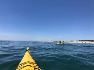
 (Maria sitting a little better in the Perception)

On the beach just east of Montauk Harbor is usually a row of RVs and a few tents at the Montauk County Park. 

A few waved from their lawn chairs and one grandma tipped a can of IPA our way as we moved east. A single Cessna ambled its way to the airport just behind the dunes. Shagwong Point was the first destination. The name “appears to mean ‘on the side of a hill,’ from the Delaware Indian ‘schajawonge'” (http://easthamptonstar.com/Archive/2/Whats-Name-Shagwong). From there, a few glacial erratics dot the shore line, but the birding improved dramatically. Certainly the laughing and black-backed gulls, cormorants, terns and ospreys remained, but we saw an eider and later even a common loon. Waterfowl not as common to the area this time of year.

A slight fog came in as we crossed the shallow bay to the lighthouse.


The swells picked up a little and the wind too, but nothing that created much difficulty. Maria had warned me many times about the currents and tide at Montauk. No fishermen or boats dotted the sea around the lighthouse, so we didn’t have to deal with anything but the elements. The swells did get bigger to 2 ft. or so as we rounded the bend and turned west. Too, the currents seemed to collide in a way that left us needing to paddle harder and not be pushed toward to riprap onshore. Whereas, a few days before I pondered the placid paddling trip, I now paddled hard and kept an eye on Maria, who always keeps a close eye on my kayaking shenanigans. There was a hundred-yard section of swirling water–like water in a pot just before it comes to a boil. I did shout out once to paddle hard to Maria, who simultaneously shouted out to me paddle hard. Ah, semiotics. However, we made it around without much drama and pulled ashore just to the west of the lighthouse to laugh a bit and reflect on the currents.

The beach there has a lot of glacial till and displaced riprap. Someone of an artistic nature had stacked a few rocks for some aesthetic reason.

 (photos by Maria Brown)

I am not much for this kind of art if you want to call it that. I’d take the stacking of water and gravity over ours any day.

 (photo by Maria Brown)

I told Maria I’d take the littered coke can as art more than stacked rocks. I can recycle cans but even unstacking rocks seems an unnatural act.

We only had another 3-4 miles to our takeout at Kirk Park Beach. Now, however, we had open ocean on one side and surf on the other. The goal was to stay around 40-50 yards off shore, close enough to see folks on the beach and not so close we would have to deal with cresting waves. For the first time on the trip, we were glad to have 17-ft kayaks with rudders and spray skirts. Riding the small swells up and down were no problem. The wind began to blow form east to west and a strong current began to pull us along. Maria reminded me some of the isolated mansions dotting the ridge were owned by celebrity sorts. Ah, the shores are lined with them I expect. 

Ditch Plains Beach was not that far, and we paddled past the surfers straddling their boards for the right ride. It’s a local, hang-out place for kids, dogs, and old geezers with a surf board. The famed Ditch Witch sits close enough to water for us to see, serving fast food to those burning lots of calories and those burning calories at a slower rate. We landed a little past the surfers, not wanting to disturb them. We learned then about the delicate dance of landing a sea kayak in surf. It seems to be going well until you hit sand and the next wave turns your kayak sideways and either you (if the sprayskirt is still on) or your kayak (if the spray skirt is open) takes on a lot of sand and water. It was an ugly ballet, but the surfer kids seemed to move from concern to laughter as we stood up laughing and spitting out sand.

 (surfers and fishing boat)

We had a protein bar and some water and soon launched again. Funny note: one of the surfers came up to say hi. He was the young man attending Stony Brook in the fall and lifeguarding at Albert’s Landing from a few days before. He asked about the trip and its success. Soon, his father came up and introduced himself and talked in glowing terms about his son. Sometimes, Long Island is a very small island. If you are here for a few years, you meet a lot of locals again and again in different locales.

Going into surf isn’t nearly as bad as landing. Just wet when the waves crash over the bow. Paddle hard and stay straight. Think of Tom Hanks’ island-escape scene in Castaway without such imposing waves and the need for a plastic-stall sail and angel wings divine intervention.

Our last stop was Kirk Park Beach in downtown Montauk, just a mile or two away. We made it quickly and Maria went to pick up the car with racks back as Gosman’s. A few surfers and paddleboarders played around in the surf.

I wandered over the dunes to the parking lot to wash off our life jackets and equipment. I met an older couple who asked about the trip and my goals. I tried to explain, but the gentleman interrupted. Thanks, he said, shaking my hand. I wish more people gave a shit when they moved here. But what you’re doing is stupid. And laughed. Sometimes, I love New Yorkers and their sense of humor and honesty.


June 9, Albert’s Landing to Montauk Harbor

“Part of the joy of sea kayaking is exploring new places and creating your own experiences.” Kevin Stiegelmaier, Paddling Long Island and New York City)

  (me taking a quick nap, photo by Maria Brown)

The water today was smoother than any previous day, and a light wind seemed to pull across Napeague Bay on our way to Montauk Harbor. I would never say a day of sea kayaking is a lazy day; every day on the water offers a new experience or a new perspective. But today was relaxed, quiet and full.

Three young men were setting up the lifeguard stand for their work. One was entering Stony Brook next fall and was majoring in Marine Vertebrate Biology. His excitement reminded me of my own feelings years ago. I still enjoy seeing that sense of possibility. The best of professors still take a bit of that feeling into their work–curiosity and possibility. I remind him I am not a scientist, but I want to learn all I can about this place, scientifically and culturally.

What does that mean?, he asked.

Well, in a specific place, we need science to understand what’s there and how and why it’s come to be, but we need culture to explore the values of what’s changed it or even why it might be preserved, I posited, fumbling with my chin hair.

He surveyed the beach at Albert’s Landing and seemed to connect the lifeguard stand he’d be working at all day with the beach surrounding it and the Peconic Bay stretching out before us. He nodded a thanks and returned to prepping his station for the day’s beachgoers.

*****

We were able to cut across Napeague Bay since the wind was mild. We were aiming for Cherry Point and after that the village of Napeague. Napaegue Harbor is guarded by Hicks Island. According to Larry Penny, in the 19th century, there were two inlets into the harbor and left Hicks Island, just that, an island. Now, Hicks Island is more of a tombolo, a former island that is now attached by the rising bar of sand.

We could see rusted chunks of machinery on the beach before landing at Hicks Island. Also a large partial, brick chimney stack stood watch over the metal ruins. An osprey had made a nest in its top and watched us closely from the fish trap poles.

In a nature column titled “The Gems of Napeague,” Mr. Penny notes in the 1940s the area was “residence to a thriving menhaden rendering factory owned by the Smith Meal Company which produced fish meal and fish oils” (Penny, “The Gems of Napeague”). Menhaden were ground into meal to make oil and fertilizer. By the late 60s, the menhaden or bunker were starting to disappear, and this plant had closed with all but a skeleton crew by 1972 (“Dismantling the old Smith Meal fish factory in Promised Land, 1972”). The area is under some dispute about ownership and protection; we did not venture from the beach, nor did we see signs about restricting access due to plovers, terns, etc.

Just after Goff Point, Hither Hills State Park begins. And while we could see only parts of them, the Walking Dunes are just on the east side of Napague Harbor. Hither Hills Park extends the width of the South Fork here and we would be crossing the southern beach in a few days. The park is an extensive forest just above the beach area.

We began to cross Fort Pond Bay which dips south near to Fort Pond in Montauk. A few big boats came in fast and wake-filled, until they neared the buoy. Just across the bay was Culloden Point, which got its name from the ship that ran aground in 1781 (http://easthamptonstar.com/Archive/1/Whats-Name-Culloden-Point). Divers can still see some of the wreckage not far from the shore. We had planned to stop at the beach near Gosman’s, not far at all from the point. It was a leisurely paddle to beach. We knew the next trip would not be as easy, so we could plan the trip around Montauk Lighthouse for another day.

*****

A note on paddling on calm water.

As I would find out when sea paddling in open ocean and riding 3-4 swells, sometimes kayaking keeps you highly attentive to the task at hand. You pay constant heed to balance, paddle height, rudder direction, the next wave, the menhaden popping the top of the water around you as though you are in a popcorn kettle. You notice a slight change in wind direction. or when a large bubble/gurgle/splash happens just in front of you and the water around your kayak shimmers with menhaden fleeing the scene of some predation by something large, all happening inches beneath you. Your focus during these times is clear and a sense of self-preservation and safety stokes the fires of whatever endocrine system reaction needs to take place for you to notice … where … you … are.

What do we do when the wind is calm and the seas smooth, and the only task is light repetitive paddle strokes, over and over, over and over, hour and hour? Are we OK with noticing the smaller and less obvious landmarks and “seamarks” (I’m guessing this isn’t a word)? Here is the day … a slight sound of water trickling the front of the kayak, perhaps the wind moving languorously through the bayberry and oaks, a tern here and there diving for silversides, an osprey returning with a bunker in its talons, the next land point to aim for, which in all honesty from the kayaker’s vantage looks similar to the previous points we’ve aimed at all day. There’s the easy way to pass time with a paddling partner, talk. Maria knows the area and the science to understand it well. She knows Larry Penny and has worked with and against folks to preserve parts, places and critters on this island since the 1980s. If the day gets monotonous, all I have to do is ask a question relating to the above and she’s there as hedge fund of information and history. She’s also wise and patient, so most times, she waits on me to ask. I notice sometimes I’m asking out of a sincere desire to know, others to pass time. There’s a moment in Beckett’s Waiting for Godot where the two characters mull such a scene:

Vladimir: That passed the time.
Estragon: It would have passed in any case.
Vladimir: Yes, but not so rapidly. 

However, when we let unneeded talk go silent, the next way to conjure up a perspective to keep a kayak going forward is to dig deeper with the paddle into the repetition of strokes, counting them as breaths to ten, much as one does sitting through the first meditation sessions. Make it to ten without losing your place for a few times, and you notice time does pass rapidly. Task, task, task, wait butterfly wing distraction, and return. Task, task, task, task, why is there a moth floating toward Gardiner’s Island 50 yards offshore, and return. What’s really rough on the novice buddhist is when your teacher changes it to counting inhales, not exhales, and later still no counting at all. Task is comforting for us; we are a species who need work. The problem is when task or work becomes habit, instead of constant and calm awareness. Paddle stroke one to ten, paddle stroke 4,137, each nothing special and each new.

I’m learning much about Long Island’s history on the trip; I’m also learning about the ecology and places with a smattering of their history. Others lessons are even more local, personal I might say. What is this circumnavigation when the water is smooth and I can’t avoid being stuck with myself in the kayak? Then, even a 17-foot sea kayak doesn’t seem long enough for all of myselves. At other times, when I let the slight wind do the talking, and count for a while … one, two, three, ….

and then, quit counting,

and just paddle, just paddle,

and let the water density and my shoulder curl move me forward. Finding and making home arises as much from this practice as doing the homework and knowing what’s here. In another way, maybe this is the greater activism … to listen and begin to see more clearly with more than just our eyes and minds. Maybe we can slow down and do the hard work every day, making our tea or coffee in the morning and remembering where our water, tea bags, and gas for the burner come from, or putting the kids to bed and telling them a story about this place that has some resonance with a deep history and the naïve creativity of a newcomer’s view, and be in our place with creative engagement instead of opinion or habit.

A couple of years ago I came across Wendell Berry’s line: “The dominant tendency of our age is the breaking of faith and the making of divisions among things that were once joined. This story obviously must be told by somebody. Perhaps, in one form or another, it must be told (because it must be experienced) by everybody.” Wendell Berry, “Toward a Change in Standards” in Life is a Miracle : An Essay Against Modern Superstition (Washington, D.C.: Counterpoint, 2000), 133-34.

It struck me this is exactly how most of us are living, and while it is a sobering story, it isn’t necessarily a tragedy. We are living in an age of divisions, so too we are living in a politics and communities of divisions, and a natural world of managed plots of preserved nature separated by marginalized landscape. However, this doesn’t exclude the hope of finding connection; it just excludes all the idealized connections we’ve been given to now. It’s a story that’s painful and beautiful, full of loss and promise, but now, it is a story that must be told. Most of our homes are made up of some kind of fractures; most of our watersheds and bioregions are remnants too. These fractures are not just external; they begin with our too easily allowing our daily lives to fall into habit. Recognizing this is a time to begin to honestly and truthfully see the loss, begin to listen, and live without rigid ideals which are never the way things are. Maybe the real restoration of home is that fragile and beautiful moment where domesticity meets wildness again and again, when ritual doesn’t become routine or habit, when we do our best to benefit all those around us, humans and nature, our neighborhoods and the environment, by having consideration and style about our lives, meals, partners, homes, and places. Maybe I can just paddle.

*****

A few folks lounged on the beach, but they had little interest in us. I smiled at a child who came to play with the boat’s rudder. His dad told him to leave it alone and not bother us. Please, it’s OK. It’s good to be bothered, I said.

We wandered out onto the riprap of the jetty to watch the fishing boats wandering in and out. It has been a good day’s work.

We have time to grow old. The air is full of our cries. But habit is a great deadener.
― Samuel Beckett, Waiting for Godot


June 8, Charlie’s Beach, Mile Hill Rd. to Albert’s Landing

I had to take a week off (May 30-June 6) from the trip to make a quick (read sarcasm) drive to Texas for my niece’s wedding and for a few days with my daughter and mom. It’s a 26-hour drive each way, so I usually try to stop in or around Knoxville (near halfway) where I finished my PhD and still have a few friends. No matter it’s an exhausting drive, but well worth it to see family and loved ones along the way and in Texas, slip back into my drawl, and practice a few cowboy tunes along the way.

(signs at Charlie’s Beach for man and beast)

Charlie’s Beach was mostly abandoned this morning. The paddling would be a 7-8 mile trip, again a mild wind and a few ripples to keep the gurgle of water against our kayaks.

(view of Charlie’s Beach from offshore)

The first stopping point was Cedar Point, a small neck of land to the north. First, off to our right is Alewife Brook and above it Alewife Pond (“What’s In A Name?: Alewife Brook”). Some suggest alewives were given this name because their belly shape: ” … named from the word for female tavern keepers (late 14c.), from ale + wife; the fish so called in reference to its large abdomen” (https://www.etymonline.com/word/alewife). I’m not fully convinced; it sounds fishy. Why not alemen?

(photos by Maria Brown)

We rightly assumed most of the island would be fenced off for tern and plover preservation, so we headed for the closest point to land hoping for an easy portage. Folks can walk all the way around the spit of land if they stay close to the beach. That way they can see the Cedar Point Lighthouse on the far end (Cedar Point County Park). We noticed quite a few deer tracks (an adult and a fawn) along the beach. A woman walked the beach with a small, nondescript dog of various heritage. I like mutts; I’ve always felt a common genealogy with them.

Once across, we turn left and Gardiner’s Island appears to the northeast. With the wind being so slight, we cut across the small bay and stayed far offshore from Three Mile Harbor. No real reason other than timing and shortening the trip.  As we were closer to the harbor, some very impressive homes appeared on the bluff. Homeowners who buy or build their ocean-side home face a few concerns. If you want a view, you need to clear away forest and vegetation. When that happens, erosion begins. Some then bring in boulders for erosion control. It is an old story between humans and the land they live on. We want it to meet all of our desires, whether those desires take into account the physics of coastal processes. For someone with more time than I, here’s a book about Long Island needing to be researched and written: what’s here, what historically happens in this place and is going to happen, AND how do we reconcile our desires and dollars with this history/science/projections. I’m baffled sometimes by those denying anthropogenic (human-caused) climate change. It’s not that hard to see the clear data. My guess is the Scott Pruitts of the world don’t really deny climate change in private, but their desires for cash through their industrial pasts don’t allow them to publicly admit fact. Desire has been “trump”ing fact since our species has been around. It’s not a new story.

Once across to Hog Creek Point, we take a southeast turn and move down the East Hampton coastline.

Along the way, we’ve come across a few pound traps–something I have no background with.

One of the better articles I’ve come across is Russell Drumm’s “Working a Pound Trap On a Calm Gardiner’s Bay” printed in The Easthampton Star in 2003. Some were in good repair, and early on, I saw a fisherman collecting his haul from the final circle at the end of the netting extending all the way from the shore. Others were left with only poles, and some with partial netting and poor condition. Lots of cormorants and a few osprey loved them all, perching on the netting lines and poles, dipping in and out of the water when hungry.

Gardiner’s Island was now in full view off to the east. Like much of the forks, Gardiner’s Island has a complex and mixed history. East Long Island says:

Lion Gardiner reportedly purchased the island in 1639 from the Montaukett Indians for “a large black dog, some powder and shot, and a few Dutch blankets.” The Indians called the island Manchonake, while the Gardiners initially called it Isle of Wight. The Montauketts gave Gardiner title at least in part because of his support for them in the Pequot War. https://www.eastlongisland.com/gardiners-island/history/

Captain Kidd, wars, and the inevitable family squabbles have followed the island and ownership, such that now most of it is under a conservation easement until 2025, but there is hope it will stay that way into the future (“Plan to Conserve Gardiner’s Island”).

As we got closer to needing to turn south toward Napeague Harbor, some of the houses along the shore became even more actively worried about erosion and beach habitat–bulwarks, riprap, and rock jetties.

We decided to stop at one for a bite of protein bar, an apple, and a lot of water. A guy wandered out of his house to look over the bulwark and check in on us. We explained the project and the estimated time and effort. He had a bemused but distant look on his face. Maria launched into her work about eel grass restoration, algal blooms and hypoxic zones, bats, and …. Without a goodbye, our host turned and walked back into his house.

Works every time, she said.
Why does he care if we are here? We’d make awful burglars in kayaks, not the best getaway vehicles, I noted.
It is private property, even the beach here, so we are trespassing. Time to go, Maria nodded.

An odd note. Maria says she heard an explosion while we were packing up the kayaks. I think I did too, but it may have been an after-the-fact memory. In any case, as we rounded the edge of houses and shore, we saw a trail of black smoke on the horizon.

We couldn’t tell the source, but the terminus was just off the sandy southern spit of Gardiner’s Island called Cartwright Island. Now and then a boat would rush out of Acabonac Harbor, but it wasn’t until we were closer that we could see it was a boat on fire. We both looked at each other and hoped all were safe, but it wasn’t until that evening I was able to read about the fire. The boat engine caught fire and some Jetskiers rescued the three onboard: “Three Escape Boat That Caught Fire Off Gardiner’s Island”. By the time we were passed, the local fire department boat had arrived and were putting the fire out.

Albert’s Landing was only a short ways away, and the day had been full of adventure. It was a lazy Friday on the beach with only a few folks and a very nervous cocker spaniel. I’m sorry. He’s so obnoxious, she bemoaned. Bark, barkbark, barkbarkbark, the dog complained. He doesn’t like hats, she said apologetically. I took my hat off and offered amends. Barkbarkbark, bark, the dog responded. Sometimes the fence between species makes good neighbors I thought to myself and readied the kayaks for loading. It’s ashamed. I really like dogs.