
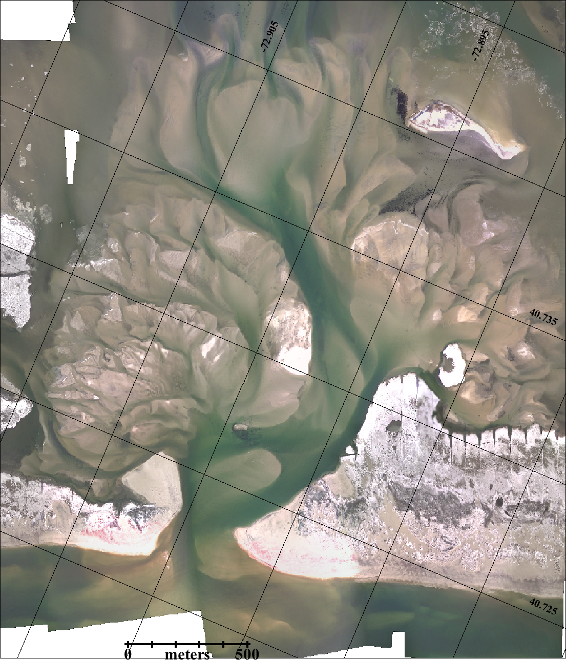
Dr. Charles Flagg took another flight over the Breach at Old Inlet on Fire Island on June 30, 2016. The flyover mosaic is available below. Dr. Flagg provided the following report:
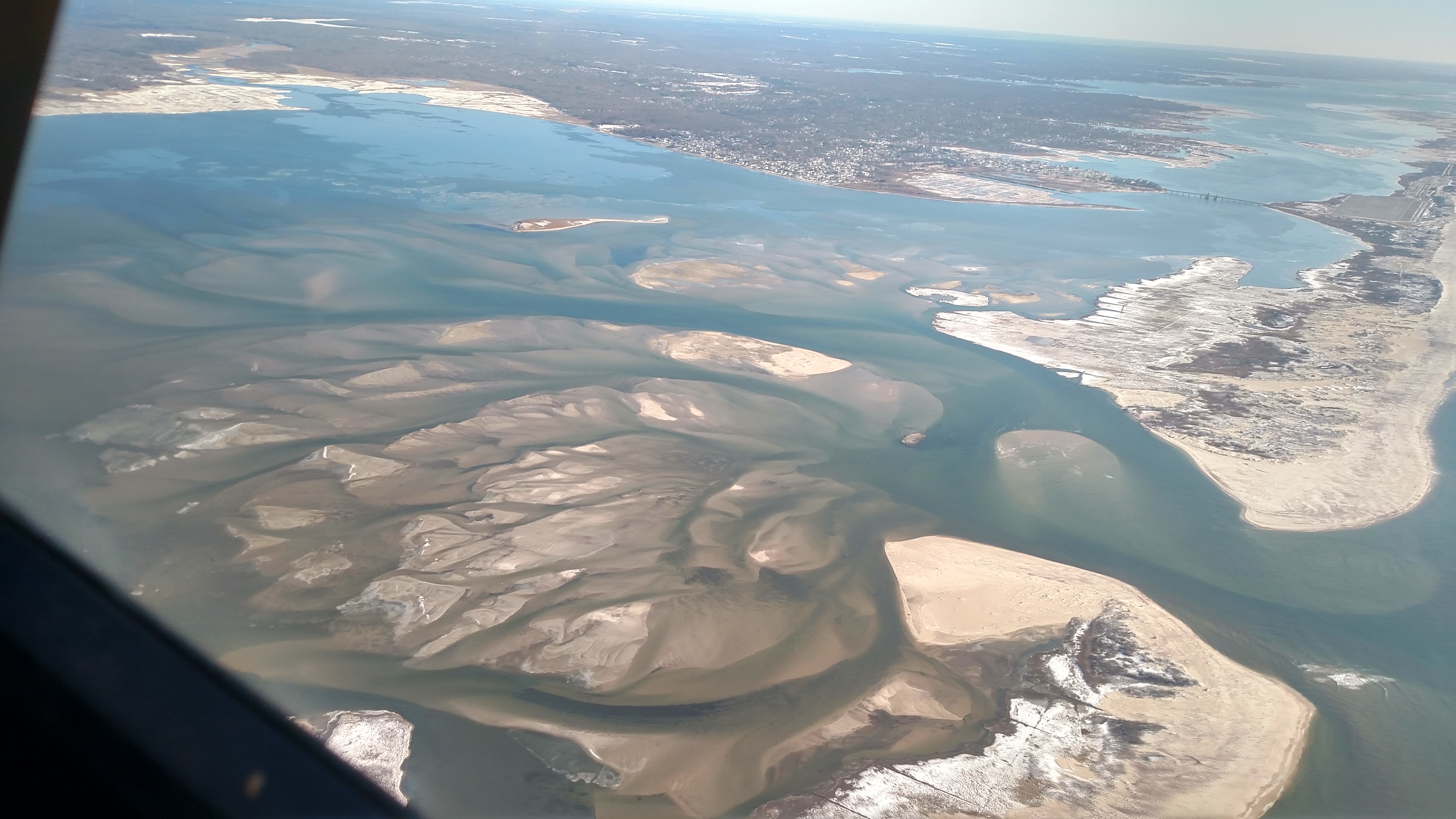
Today was the first time in a couple of weeks that we’ve had flyable weather so I took advantage of it and carried out another photo run to the breach. The flight took place between 0915 and 0930 EDT near high tide in the ocean. The resulting photo mosaic and one of the oblique shots are attached.
The situation looks much as it has for the past couple of months. The eastern shoreline seems to have recovered some of the lost ground evident in last month’s photo while the western shore has been fairly stable. One notable feature, although it may be due to the stage of the tide, is that the channel along the shore north of Fire Island to the east, seems to be reasserting itself. If that continues then there may be a readjustment of the exit channel in the ocean which has been heading off to the east for several months.
We are due for a significant nor’easter tomorrow which may change things so I will carry out another flight as soon as feasible.
Mark Lang has assembled all the geo-referenced photo mosaics into a kml file that can be viewed using Google Earth. By clicking between images and using the fade in-out button you can clearly see how the inlet is changing with time. An offline version of the KML file is available as KMZ.
For more information, please visit Dr. Charles Flagg’s website.
I would like to see what the Breach looks like after 3/14/17 Nor’Easter.