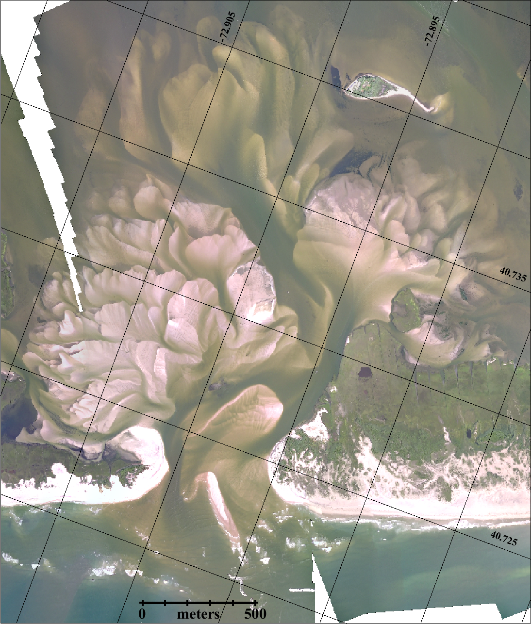
Dr. Charles Flagg took another flight over the Breach at Old Inlet on Fire Island on July 16, 2017. The flyover mosaic is available below. Dr. Flagg provided the following report:
A breach flight yesterday revealed some interesting changes from just a month ago. The photos were taken about an hour after low tide in the ocean and a strong ebb flow was evident through the western channel even from the air. And lots of brown tide waters were being flushed from the bay. Two items of note are that the eastern shore has retreated significantly and that the offshore oriented sand shoal in the middle of the breach has greatly increased in size. Roughly 300 meters of the shoal were above water at the time of the photos. With the erosion of the eastern shoreline the previous channel north of Fire Island to the east, seems to have pushed farther into the breach. Hard to tell for sure but with the partial blockage of the main channel south of Pelican Island, perhaps the whole system is shifting back to the east.
In case you missed it, Dr. Flagg recently released his June Report on the status of the Breach. Mark Lang has assembled all the geo-referenced photo mosaics into a kml file that can be viewed using Google Earth. By clicking between images and using the fade in-out button you can clearly see how the inlet is changing with time. An offline version of the KML file is available as KMZ. For more information, please visit Dr. Charles Flagg’s website.