Fish Cove
by Claes Christian Rozenveld

Fish Cove is an area on the East side of the North Sea, separated from the Harbor by a small waterway. Fish Cove is known to be a breeding ground for alewifes, a species of North American herring.

Fish Cove, as well as the rest of the North Sea Harbor is home to a myriad of fauna. As previously stated, Fish Cove is known as a breeding ground for Alewife. As well as the animals on the map, we were able to see Eastern Painted Turtles lounging around on a dead tree. We were also able to spot Osprey before they migrated down to South America for the winter.

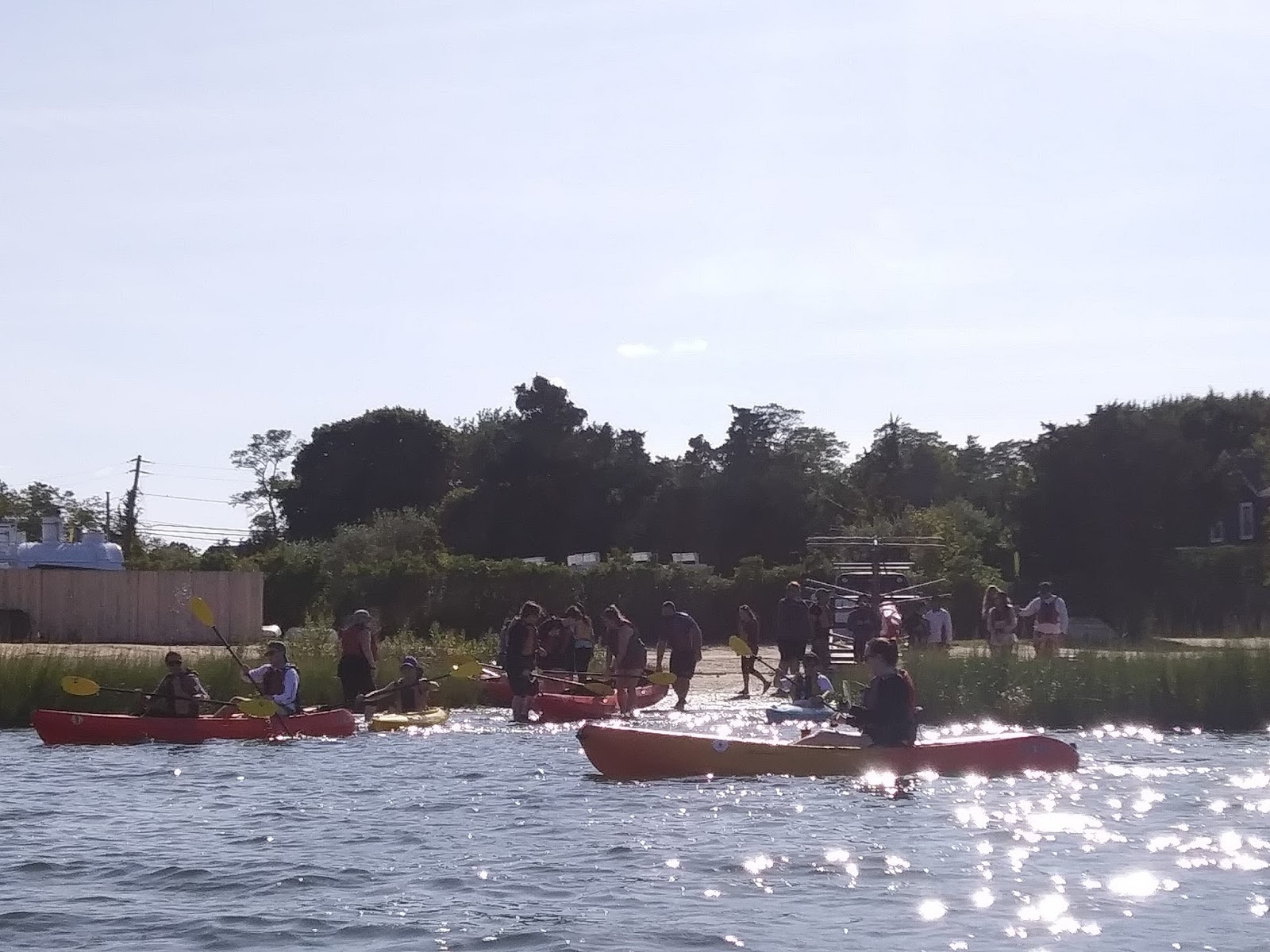
As we all lined our kayaks up next to each other, Professor Kurt gave us a talk detailing the past of Fish Cove and the different types of species living there. This included facts about alewifes, cormorants, osprey and more.

Alewifes are a very important species to most coastal people. They travel in large schools and as such can be caught in bulk, and used for a variety of things, such as lobster pot bait, fishing bait, fertilizer, or even food. However, as a result of mass fishing efforts, they are now considered a species of concern.
The Gang Goes Kayaking
by Josh Whitehead
This past Friday our class had a field trip to North Sea Harbor to where we went kayaking and ended the day with some swimming and a beach cookout. The whole day had this weird feeling about it as I couldn’t believe this was school. I started my day by fishing with Lucas, Jeff, and Brendan to hopefully catch some fish for the cookout Kurt and Tara had organized for us later that day. We were rewarded with five nice sized Sea Robbins, a spiny fish with very large wing like pectoral fins and six “legs” which are actually modified pectoral fins. They have a broad head and a very thick skull and wide mouth, despite their alien like appearance, I was informed they were “good eatin.” We filleted, (a messy and somewhat weird experience for my first-time filleting) seasoned, and wrapped them in tinfoil and they were ready for later.
 |
|
This was a Sea Robbin we caught in a trawl earlier in the week during Long Island Marine Habitats.
|
When we got to the water, we quickly picked kayaks, either a tandem or single and set off. We ended up at alewives run, where we had our first lecture. During this we learned about the different species of fish that you would find and what their purpose on the food chain was. We also learned about the Osprey that had once flourished on Long Island, had since dwindled and the reasons for it. DDT is a pesticide, more specifically an insecticide, that was found to be very effective in killing insects. However, this insecticide indiscriminately affected the environment around it, like the Ospreys. Ospreys are birds of prey and will typically eat fish as a major source of their diet. When they catch their food, they will always have the fish pointed forward for aerodynamics. When DDT was sprayed it didn’t just get to the insects, it got to the Ospreys’ nests affecting the thickness of the eggs they laid and cracking when the birds tried incubating them. This caused the population to deteriorate to an alarming level. DDT was banned by the EPA in 1972 after its disastrous effects were recognized. In the past twenty years Ospreys have made a strong return, thanks in part to a lot of conservations efforts getting them to a protected status, and a lot of artificial nests being built for them which have helped bring more of them back to Long Island.
 |
|
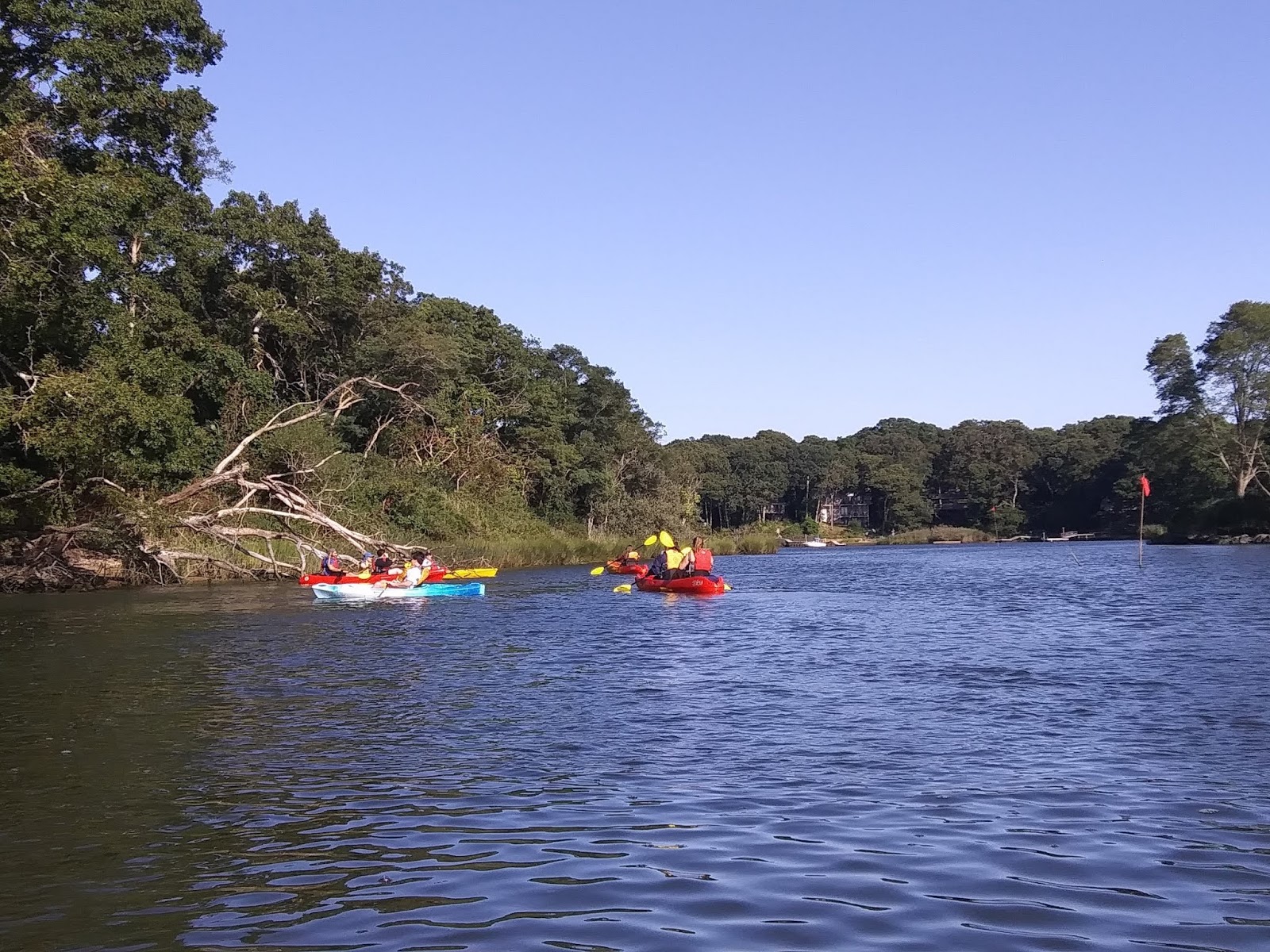
First lecture of the day after an easy paddle upstream
|
 |
|
Lecture at Conscience point where one of the settlers, who was pregnant at the time said, she could not in good conscience keep traveling. This set up the point of settlement for the first English Colony in NY in 1640.
|
 |
|
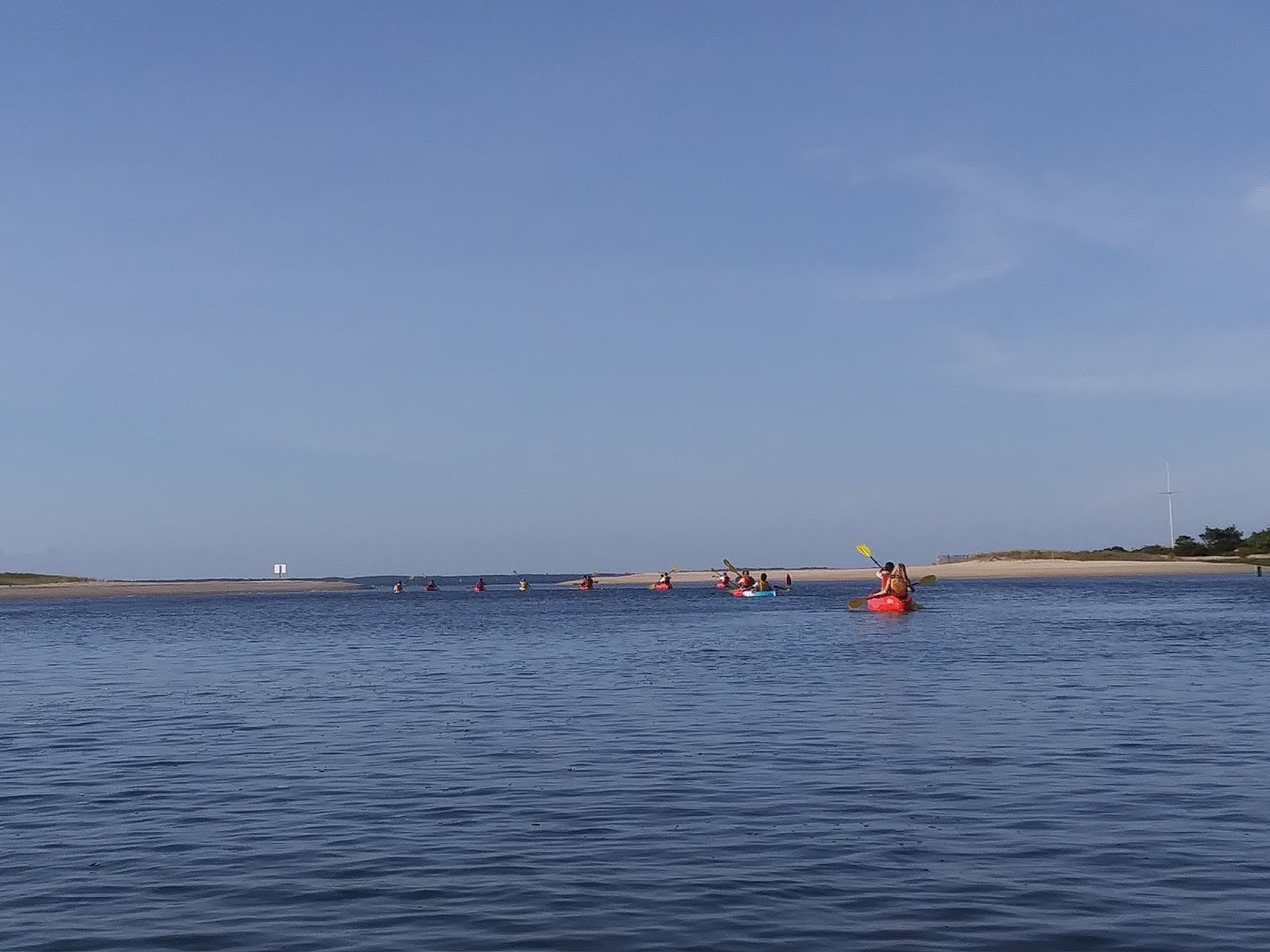
Beautiful day on the water with lots of sun, blue skies, and a slight breeze
|
When we were done paddling for the day, we went ashore at Towd Point to swim and have a cookout, where we had some delicious turkey chili, fish and some desserts including life changing brownies. We had our last lecture of the day around the warm fire and talked a bit about conservation versus preservation and some of the history of our campus, specifically the windmill. Our windmill is one of the oldest in the country dating 300 years old and built in the early 1700s. Being so old the windmill has seen its fair share of history. The windmill’s spot on the hill where it sits tall overlooking the water and surrounding area wasn’t where it was originally located, being moved from Hill street in Southampton to its current location sometime in the late 1800s by the Claflins. The Claflins, had a daughter named Beatrice, who the inside of the windmill was renovated for giving Beatrice her own space. She immediately recognized the windmill as a high point in town and would light candles on foggy and stormy nights in the window so the sailors could find their way home. Sadly, she contracted Tuberculosis and was unable to go anywhere. She was a favorite of everyone in town and would get visitors all the time, up until the time she died around the age of 11. It is said that on foggy nights you can still see a light in the windows, which is Beatrice bringing the sailors home.
Kayaking, with lecture on the water, followed by a beach cookout with delicious food and a lecture mixing in science history and a ghost story. Not a bad way to spend any Friday even if it’s for school!
 |
|
Our site for our cookout and lecture
|
 |
|
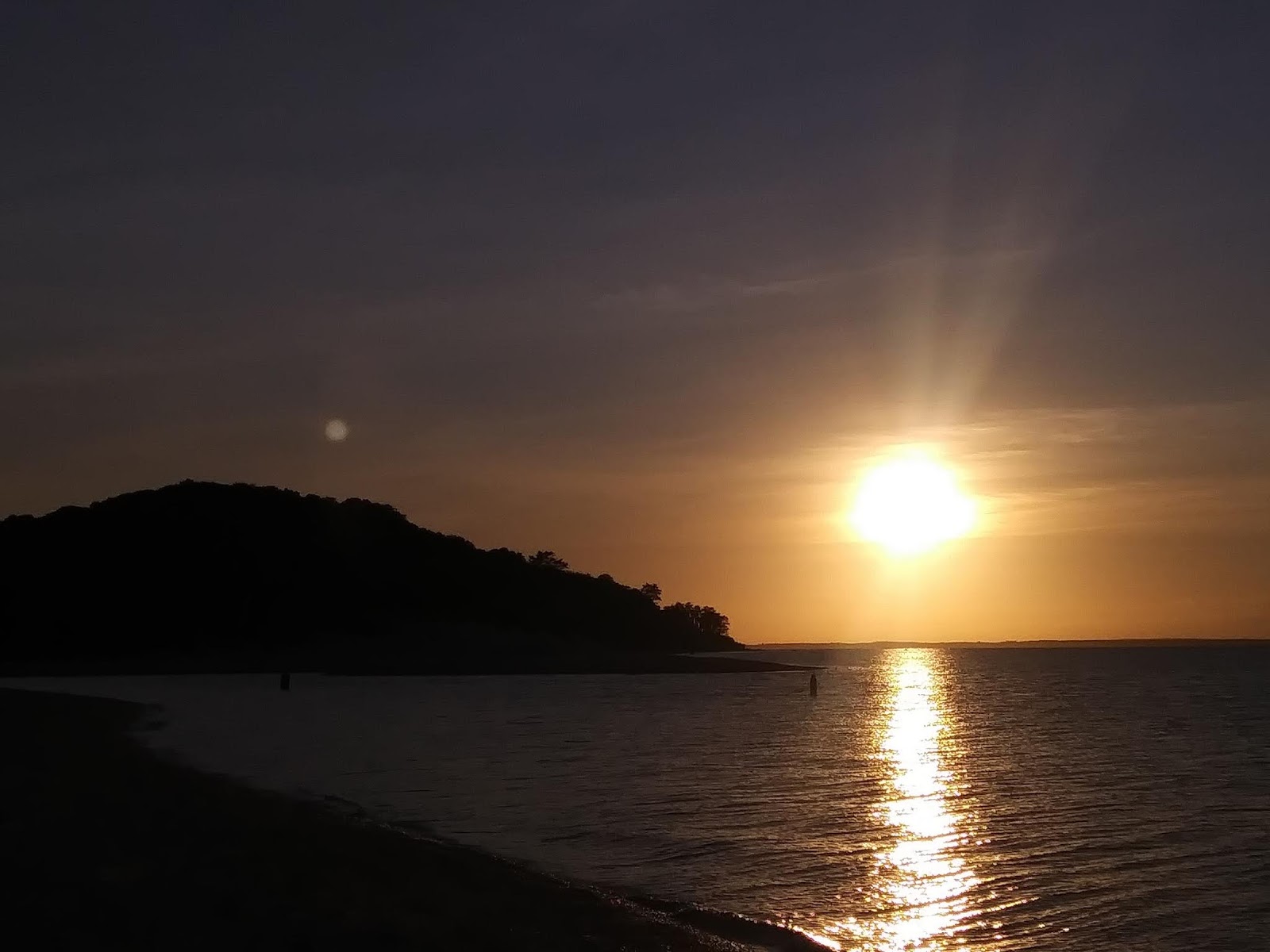
A beautiful sunset over Peconic Bay as we ended our day
|
Witnessing the Geological Features of the Long Island Glacial Moraine.
by Brendan Hallinan
Stony Brook Southampton’s Coastal Cultural Experience class took a kayaking trip on North Sea Harbor on September 13, 2019 to learn about the history of the harbor, local fauna and geography of Long Island. The class partook in a few short lecture topics while enjoying coastal leisure activities in the down time between lectures.
In a lecture by Kurt Bretsch (pictured), we learned that Long Island exists as a result of the last processions and recessions of the Wisconsin glaciation between 21,000 and 15,000 years ago. The glacier’s southernmost procession ended at modern day Long Island, leaving behind the sediment and rock that had been carried south by the glacier’s advancement down eastern North America. This formation is known as the Ronkonkoma terminal moraine. The other moraine that constitutes long island is the Harbor Hill moraine and was caused by a later procession of the glacier.
At the culmination of our paddle we landed on the northern shore of the Ronkonkoma moraine, in Peconic Bay. The beach here was rocky and had a steep descent to the water, since the glacier receded from this point leaving a mound of sediment. This texture and topography were in sharp contrast to the soft, gentle beaches of the southern shore which the class visited the week prior.
The southern shore’s geography was shaped by runoff erosion moving north to south across the island, fueled by the melt of glacial ice and carrying the finest sediments the farthest, resulting in the distinct features of northern beaches and southern beaches on the island.
 |
| Lecturer Kurt Bretsch enjoying the breeze over Peconic Bay by flying a kite on the rocky shore of the Ronkonkoma Moraine. In the foreground you can see how coarse the sediment is compared to sandy beaches typical of the south shore of Long Island. |
Unleash Your Enthusiasm A Tour Through the North Sea
by Max Bazante
The day of a full moon on Friday the 13th 2019 my Coastal Cultural Experience class had a guided tour with our two outdoorsy backpack wearing professors Dr. Kurt Bretsch and Dr. Tara Rider. My class of 20 students smiled cheek to cheek and we linked up our kayaks over a couple of blue crabs sitting on an underwater branch as our professor Kurt spoke to us about Fish cove and Alewife Drain. Sun on our faces and osprey nests in sight I sat in my kayak eager to learn of this North Sea that I have never seen before. We ended the trip with a cookout on the beach under the moon light sitting around the fire eating local fish.
I live in Elmont, Nassau County right on the edge of Queens and a quick train ride to Manhattan is more accessible to me then the far reaches of the eastern end of Long Island. History adds context so when I got home, I eventually did some research on this North Sea that is new to me.
Historically the North Sea has been a valuable resource for the colonists coming into the New World. They would debark before traveling and boats would bring news and trade goods to harbor. This small hamlet along the shore of the Peconic bay was the location of the first English colony in New York State. It was called Southampton Town. There is unforeseen history and wonder all around us and sometimes all it takes is a small StonyBrook Southampton class to unleash your enthusiasm.
Kayak and Beach Cookout
by Tyler Rodriguez
The day at the areas around North Sea Harbor was interesting for me in particular. As I learned very quickly, I am terrible at kayaking. However, that did not stop me from trying something new and enjoying the time we spent on the trip. I needed to be saved by Professor Tara, but that’s okay. It was still an incredible experience. And I learned that the water in North Sea Harbor is very cold this time of year (I fell in the water twice, but again that’s okay).

After we had lectures and explored Fish Cove and North Sea Harbor, most of us landed on a beach on the south shore of Peconic Bay. The beach itself was very rocky, but that didn’t stop most of us from going in the water. We enjoyed some time swimming in the bay, and as we found out the bay had a very high salinity. Someone in our group found saltwater snails, which I personally did not know existed. We then had a cookout with Professor Kurt’s chili and Professor Tara’s brownies and s’mores. The above image (figure 1) shows the sunset over the bay and nearby Robins Island. Overall, this part of our excursion was great because it allowed for us to bond as a group and just relax and enjoy our time together in a no-stress environment.
What we learn in the lectures by our instructors is important in the course, but so is the valuable time we get to spend bonding as a group. Less outgoing people like myself really benefit from a course like Coastal Cultural Experience that allows for time to just socialize and get to know the people I spend a considerable amount of time with each week.
Kayak and Beach Cookout
by Julia Sweeney
For this week’s trip we went kayaking and then went to the beach for a lesson and a cookout. Kayaking was a lot of fun and I definitely learned a lot about the history behind it all. We started our kayaking journey in the North Sea Harbor and made our way across the harbor and under a bridge into fish cove for a small lesson on the habitats and some of the species that live here.
 |
After learning about the habitat and species we moved locations and started to learn more about the history of these places. Our second stop was Conscious Point. This point received its name after a group of pilgrims who originally set out for Massachusetts, landed in Long Island. They were supposed to head back out on the boats for another long journey but were supposedly stopped by a pregnant woman who refused to go.
 |
Our last stop of the day was Towd Point beach. We kayaked to the beach and there set up all our things for a campfire and cookout. Before dinner most people went swimming while others stayed on the sand and played Frisbee. Afterwards we dried off by a fire and had our last lesson for the day. This one focused on the differences between three main points; sustainability, conservation, and preservation. Conservation is usually associated with the protection of nature and preservation could involve nature but also landscape and objects. The main difference is that conservation is involving the proper use of nature and preservation is no use at all. I found this to be the most interesting and something that I had not really thought too much about beforehand.
 |
|
Brendan Hallinan
|
Kayaking through North Sea Harbor