


Content created by Dr. Charles Flagg with the assistance of Mark Lang
Hurricane Sandy caused significant over washes and three breaches in Fire Island in the area between the historic Old Inlet area and Moriches Inlet. Aerial video and photos were obtained Saturday, November 3rd, 5 days after the storm’s passage. A short description and photos of the breaches is available here while youtube videos are listed below.
A series of reports on the breach development are listed below.
December 14, 2012 report on the new inlet through November is available here.
On January 5, 2013 another aerial over flight took place and a photo summary of the evolving breach at Old Inlet to the present is available here.
January 14, 2013 report on the inlet that goes through December is available here.
The January 30th report on the status of the inlet is available here.
The February 27th report on the bay and inlet with new bathymetry of the inlet is here.
The March 15th report on the inlet and the impact of east-coast wide water level fluctuations is here.
The June 28th report on the inlet’s evolution. the cross-sectional area and changes in the Bay-wide salinity is here.
The 10th report on the inlet’s condition, issued Dec 12, 2013 is here.
The 11th report on the inlet’s condition, issued Oct 20, 2014 is here.
The 12th report on the inlet’s condition, issued Jan 9, 2015 is here.
The 14th report on the inlet’s condition, issued Aug 7, 2015 is here.
The 15th report on the inlet’s condition, issued March 16, 2016 is here.
The 16th report on the inlet’s condition, issued Sept 14, 2016 is here.
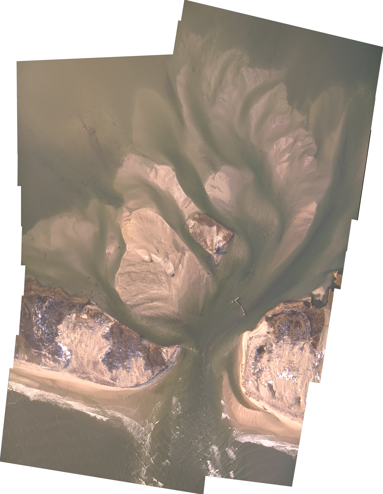
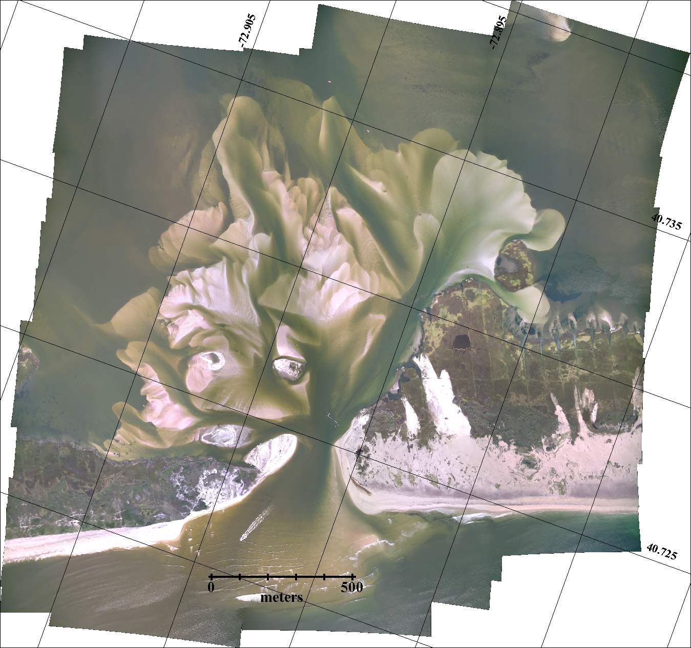
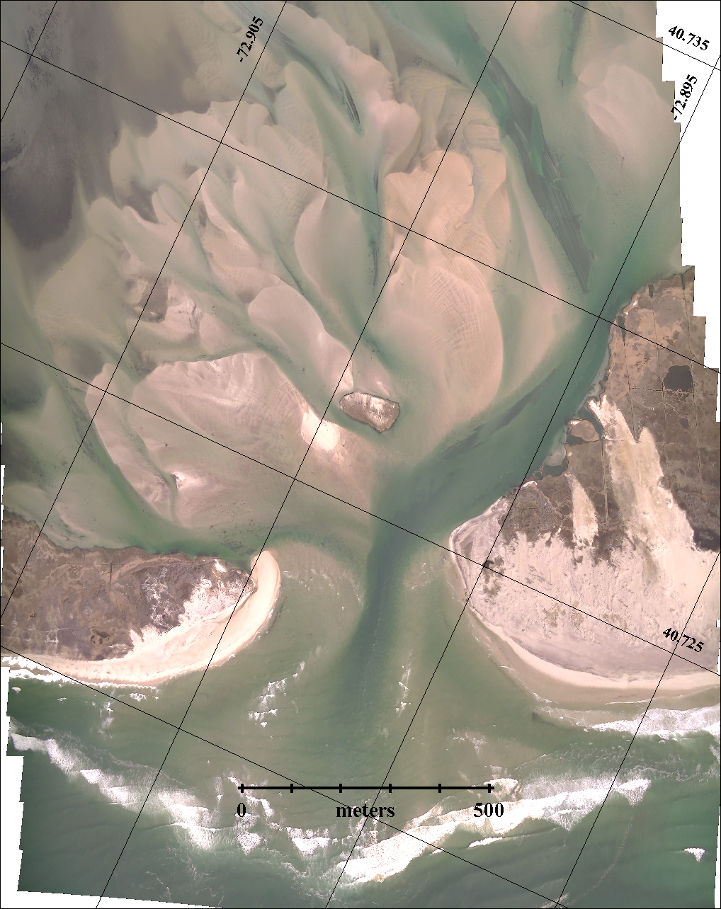
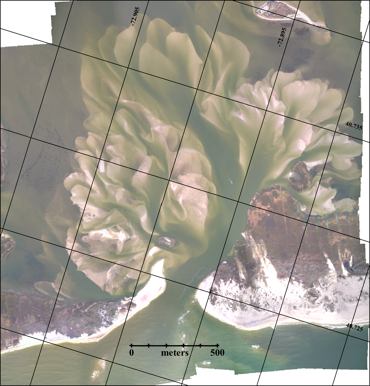
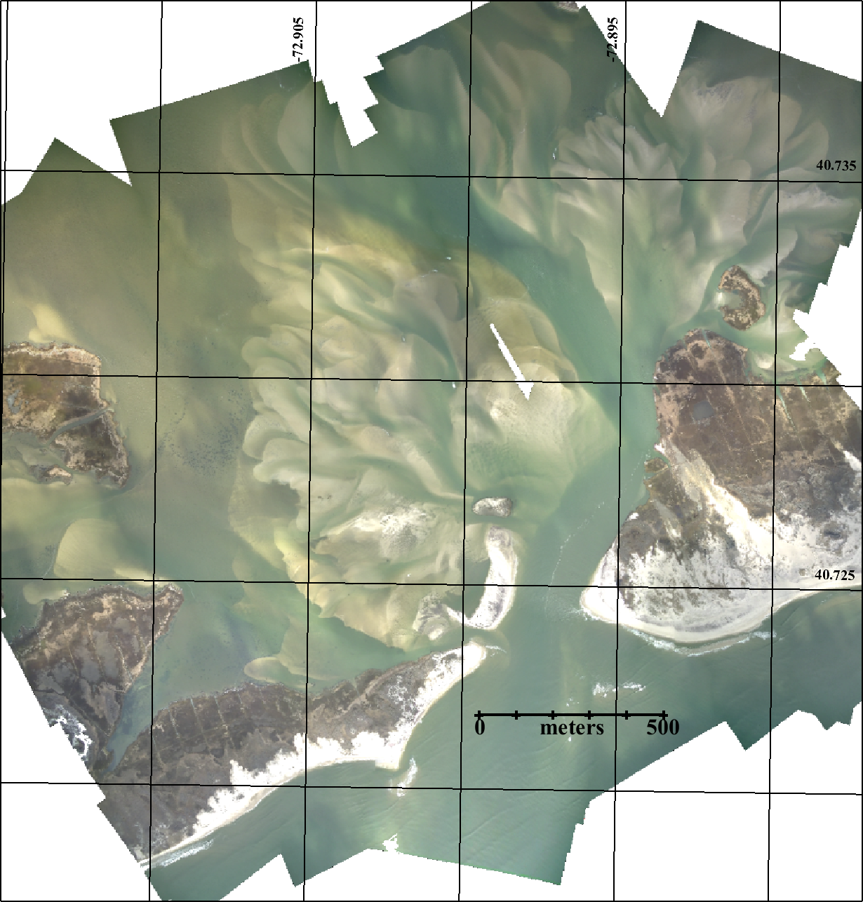
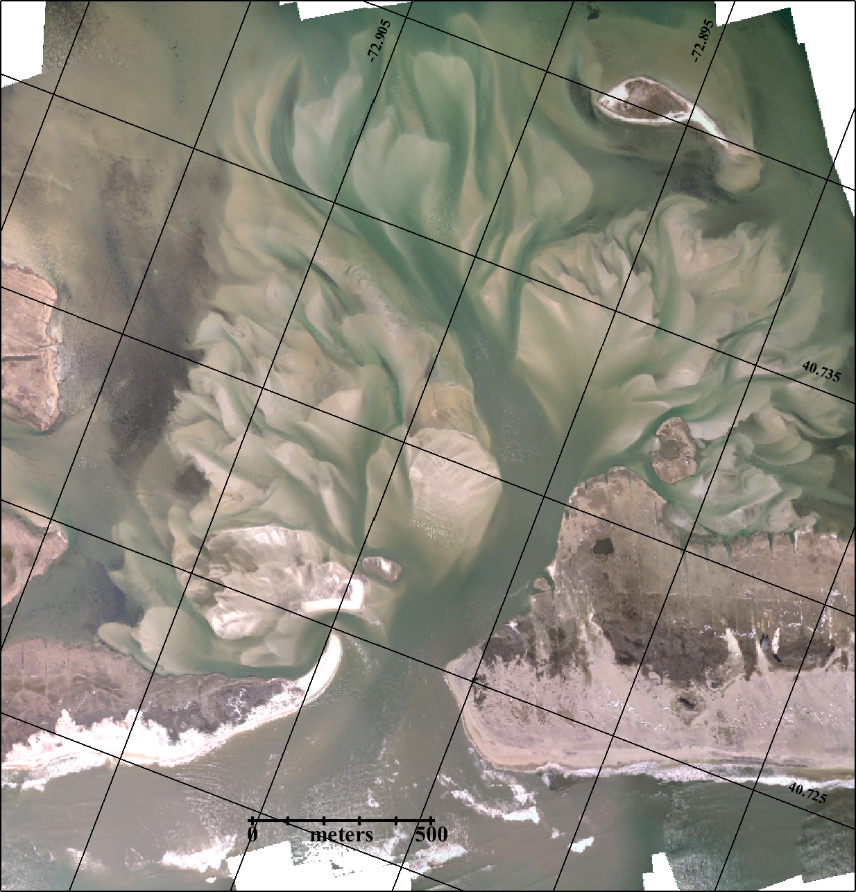
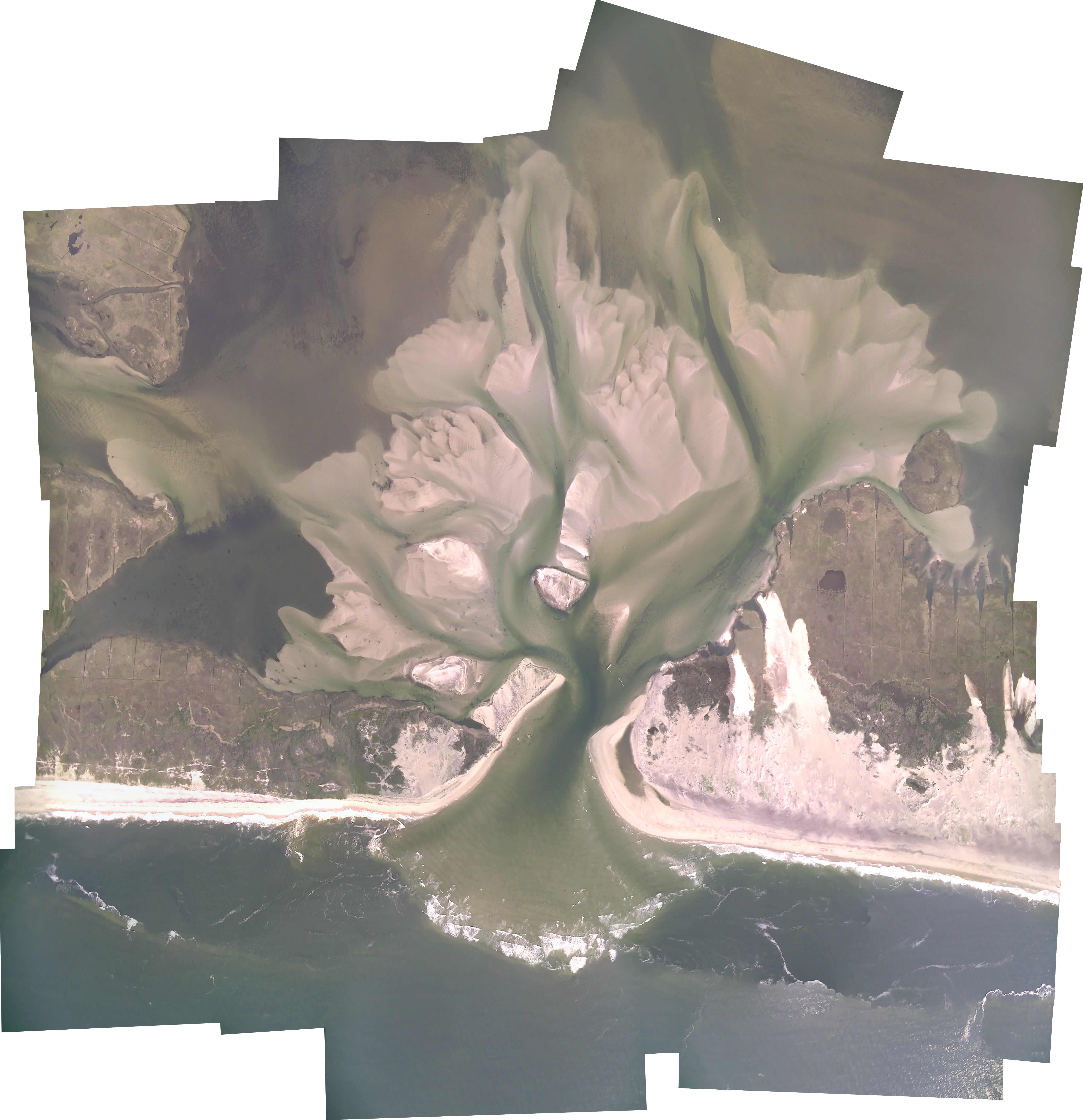
Below is the series of aerial photos of the New Inlet from the south looking north across Fire Island. The aerial photography has been a community effort with pilots Rich Giannotti, Don Richards, Charlie Flagg and Vinny Petruso and photographers Charlie Flagg, Mike Ferrigno, Rich Weismann, Justin Flagg, Brian Wasser, Jamie Shreeve, John Vahey, Brad Furman, Chris Gobler, Michael Busch, Art Leiz, Alejandra Sanchez-Franks and Claudia Hinrichs.
With Mark Lang’s help the series of overflights of the breach have produced detailed photo mosaics of the inlet and back bay area.
A complete collection of photos is available on Dr. Flagg’s Great South Bay Project Website
Click on an image or right-click on an image to open in a new tab to fully zoom in.
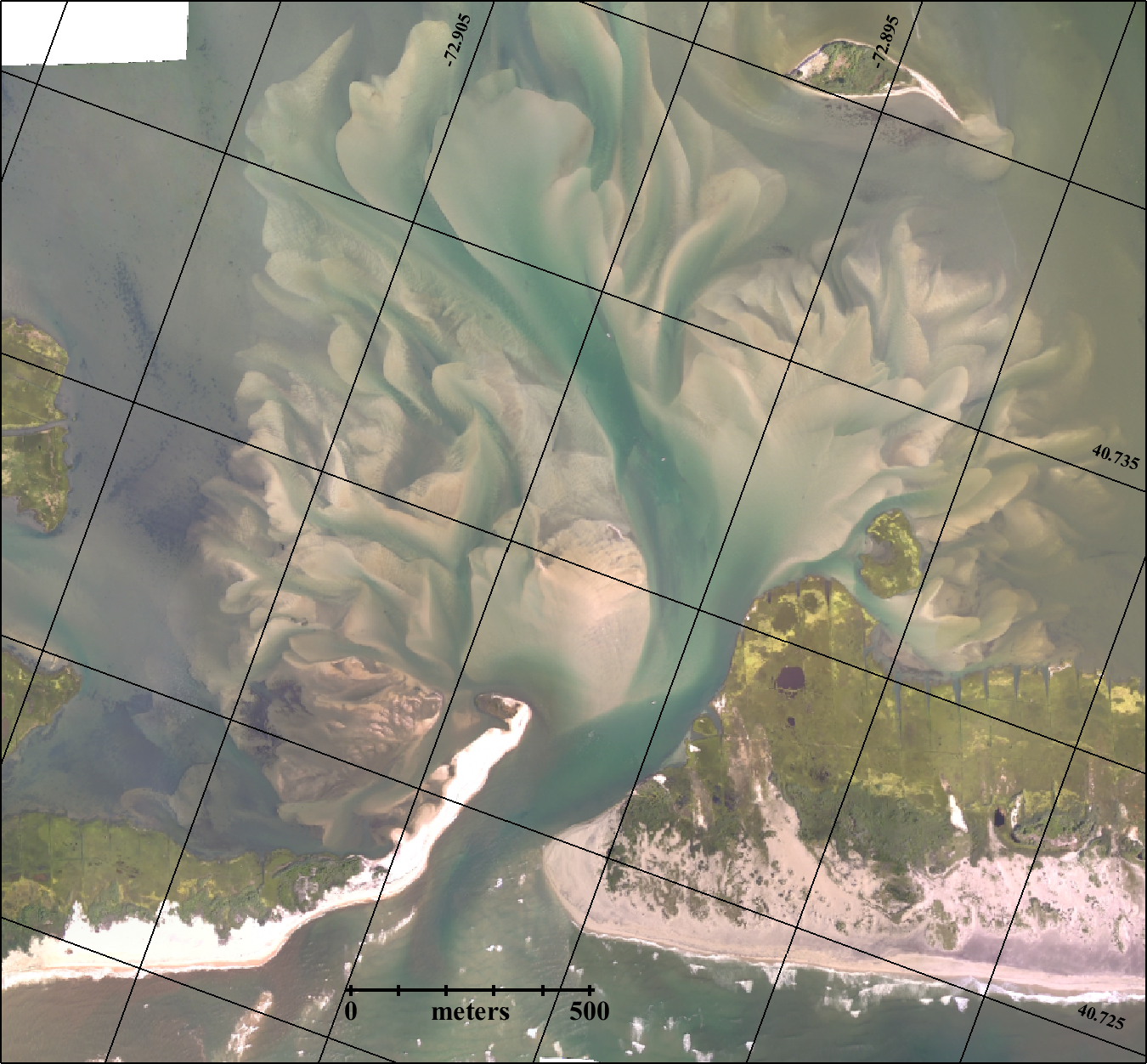
Apr 9, 2005
An image of the area from 2005, several years before Superstorm Sandy hit.

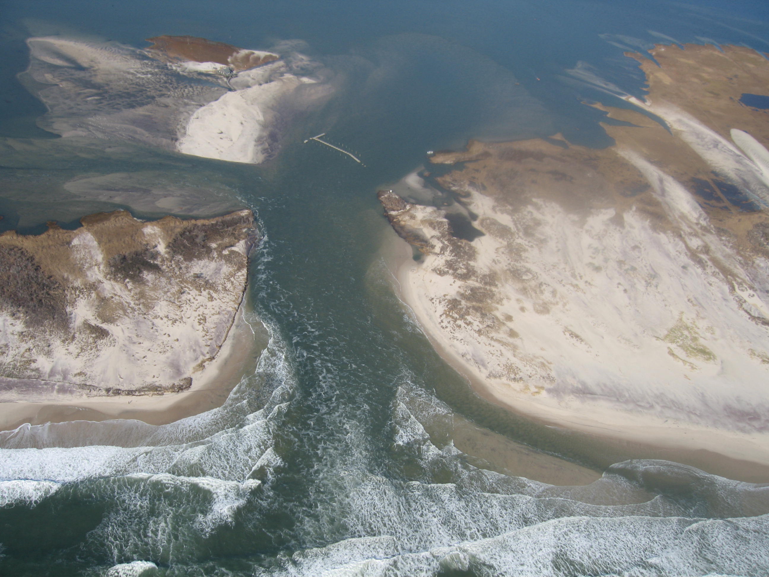
Nov 3, 2012
Aerial video and photos were obtained Saturday, November 3rd, 5 days after the storm’s passage. A short description and photos of the breaches is available here.

Nov 11, 2012
As a follow-up to the November 3rd aerial survey and after the nor’easter that occurred on November 7 and 8, a second aerial overflight of the Old Inlet area was carried out on November 11, 2012. Photos and a discussion of the results of that flight are available here. In addition, we recovered an oceanographic sensor from the Bellport marina on November 10, 2012 which had recorded the sea level, temperature and salinity variations caused by the hurricane and subsequent nor-easter.


Nov 18, 2012
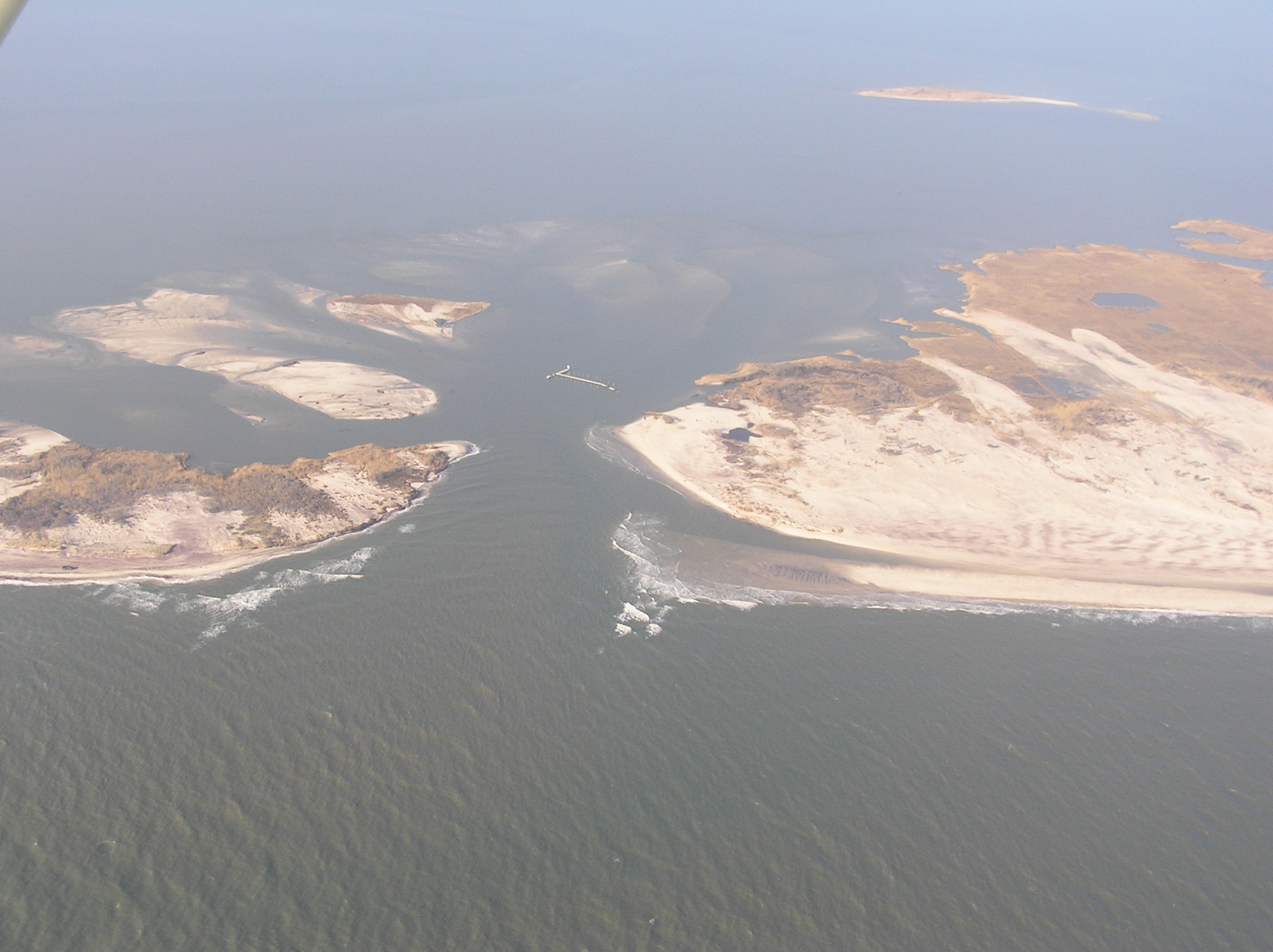
Another weekly aerial survey of the inlet was carried out on Sunday November 18th which showed that the sand island connecting Pelican Island to Fire Island had been cut by a new channel to the west. A series of photos showing the evolution of the inlet is given here.
Dec 20, 2012
On Saturday December 1, 2012 there was a meeting at Bellport’s community center to discuss the breach in the Old Inlet area. A power point presentation given at that meeting shows how the dynamics of the Great South Bay and the ocean resulted in the formation of the breach and how the breach has affected the tides, wind driven storm surge and the salinity of the eastern end of the Bay.
On December 20 another flight was completed.

Jan 6, 2013


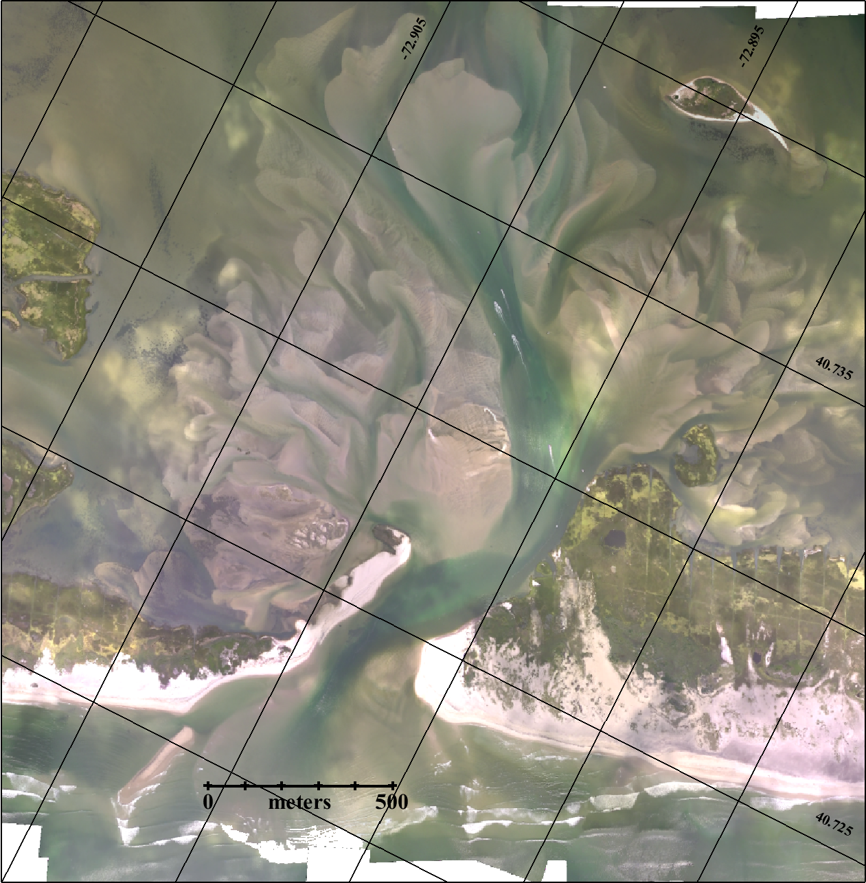
Old Inlet Breach Flyover 2019-12-8
Dr. Charles Flagg took another flight over the Breach at Old Inlet on Fire Island on December 8, 2019. The flyover mosaic is available below. Mark Lang has assembled all the geo-referenced photo mosaics into a kml file that can be viewed using Google Earth. By...
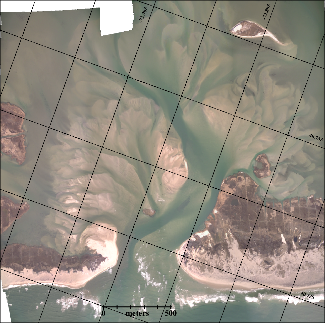
Old Inlet Breach Flyover 2019-10-24
As the 7th anniversary of Superstorm Sandy approaches, Dr. Charles Flagg took another flight over the Breach at Old Inlet on Fire Island on October 24, 2019. The flyover mosaic is available below. Dr. Flagg noted that the water " was very clear which showed a clear...
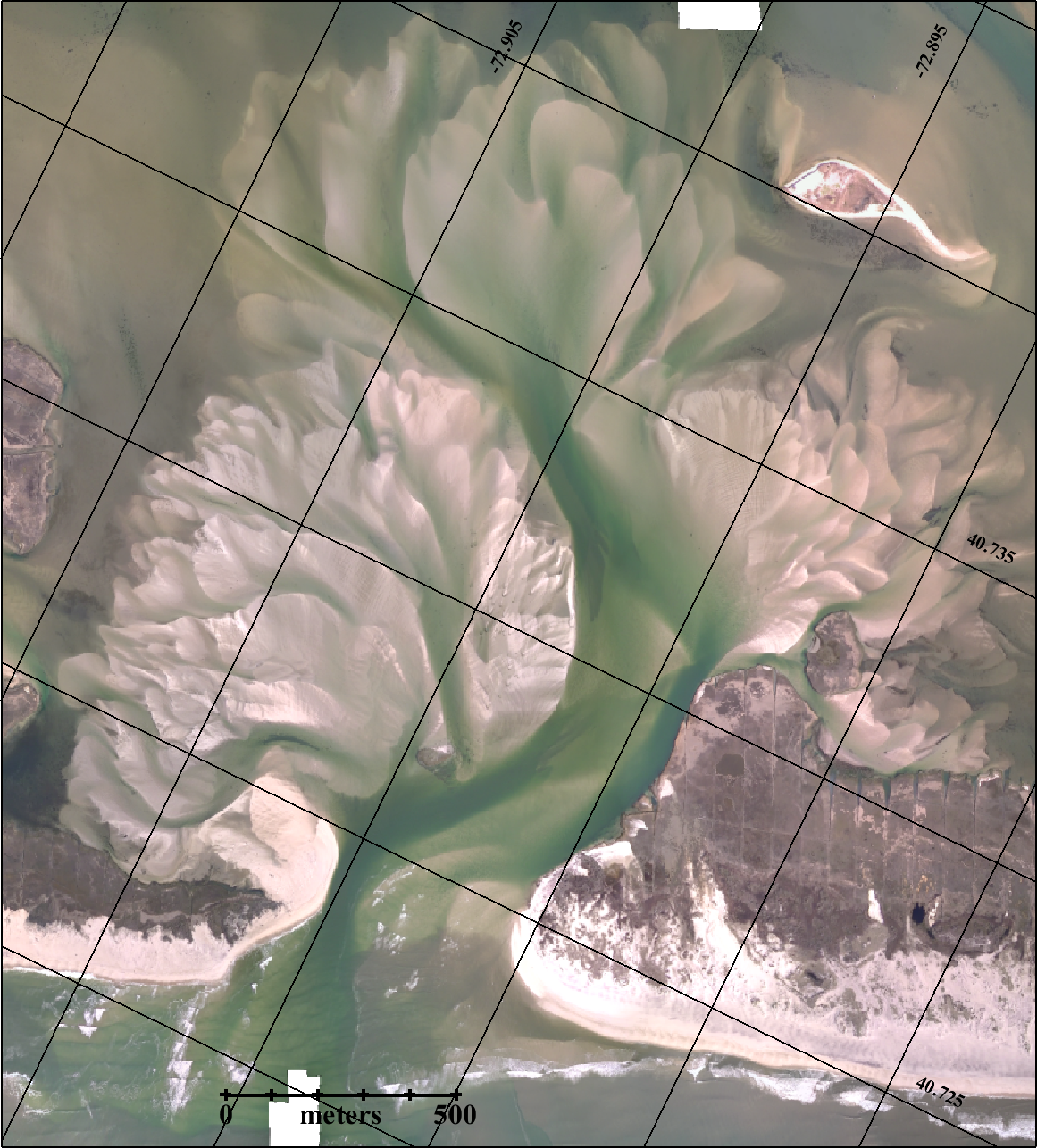
Old Inlet Breach Flyover 2019-09-23
Dr. Charles Flagg took another flight over the Breach at Old Inlet on Fire Island on September 23, 2019. The flyover mosaic is available below. Dr. Flagg provided the following report (PDF): Those of you have followed these reports may remember that in a February...
Old Inlet Breach Flyover 2019-08-24
Dr. Charles Flagg took another flight over the Breach at Old Inlet on Fire Island on August 24, 2019. The flyover mosaic is available below. Dr. Flagg was finally able to get back into the air after resolving some mechanical issues with his aircraft. Mark Lang has...
Old Inlet Breach Flyover 2019-06-26
Dr. Charles Flagg took another flight over the Breach at Old Inlet on Fire Island on June 26, 2019. The flyover mosaic is available below. This is the 77th geo-referenced photo mosaic in the series. Mark Lang has assembled all the geo-referenced photo mosaics into a...
Old Inlet Breach Flyover 2019-05-27
Dr. Charles Flagg took another flight over the Breach at Old Inlet on Fire Island on May 27, 2019. The flyover mosaic is available below. Mark Lang has assembled all the geo-referenced photo mosaics into a kml file that can be viewed using Google Earth. By...
Old Inlet Breach Flyover 2019-04-29
Dr. Charles Flagg took another flight over the Breach at Old Inlet on Fire Island on April 29, 2019. The flyover mosaic is available below. The water was very clear during the flight! Mark Lang has assembled all the geo-referenced photo mosaics into a kml file that...
Old Inlet Breach Flyover 2019-03-24
Dr. Charles Flagg took another flight over the Breach at Old Inlet on Fire Island on March 24, 2019. The flyover mosaic is available below. Mark Lang has assembled all the geo-referenced photo mosaics into a kml file that can be viewed using Google Earth. By...
Old Inlet Breach Flyover 2019-02-14
Dr. Charles Flagg took another flight over the Breach at Old Inlet on Fire Island on February 14, 2019. The flyover mosaic is available below. Dr. Flagg provided the following report (PDF): Another breach overflight was carried out Thursday Feb 14th near low tide in...
Old Inlet Breach Flyover 2019-01-17
Dr. Charles Flagg took another flight over the Breach at Old Inlet on Fire Island on January 17, 2019. The flyover mosaic is available below.Mark Lang has assembled all the geo-referenced photo mosaics into a kml file that can be viewed using Google Earth. By...