


Semester by the Sea
As part of the coursework for their classes, students create blog entries about their experiences. Read about their adventures below!
MAR 355 – Coastal Cultural Experience; Witches
Witches Around the World
 |
| Some common themes of witchcraft can be seen in the image above, with a woman riding backwards on a flying goat, a cat seen in the bottom right-hand corner, and all the witches portrayed without clothing. |
 |
| Nigerian witch doctors dressed in clothing and carrying amulets designed to combat Lassa Hemorrhagic Fever |
Native American Witchcraft
 |
| Portrayal of a Navajo skin-walker dressed in the skin of a coyote or bear. These witches were seen as dangerous, hence the spear in hand. |
 |
| A fox witch, or kitsune-mochi, scaring a prince. Fox witches were seen as tricksters, sometimes playful and sometimes more nefarious! |
Photo credits:
https://www.historytoday.com/archive/witch-hunting-and-women-art-renaissance
https://en.wikipedia.org/wiki/Witch_doctor#/media/File:Lassa_witch_doctors.jpg
https://rivercityghosts.com/the-terror-of-the-skinwalker-the-native-american-boogeyman/
It is the unfortunate truth that women tended to be the main target of the witch trials that took place throughout Europe and the American colonies in the 17th century. The main cause of this idea was information based on the Malleus Maleficarum, a book written for the public to aid the witch hunt. This book dubbed women to have “familiarity with the devils,” and that they were the gateway to the devil himself. In the Chritian community, it was widely believed that women were less than men due to Eve being birthed from one of Adam’s ribs. Women were also not trusted much, since a woman (Eve, again) was the one who caused all of humanity to be chased away from Eden.

While today when we think of a witch, we often think of an old green hag riding a broomstick at night, it was not until later that witches were linked to brooms. The original connection between the two is thought to have become common by the idea that female witches would put a broomstick in their place when leaving bed at night so their husbands would not notice their absence.

The Malleus Maleficarum: All You Need to Know About Witches
Now a reasonable question might be to ask, what inside this book makes it so popular? Well, the answer might shock you. As stated in the work, witches were said to kill babies and have sex with demons. Not only that, but they had a tendency to steal men’s penises. This was a witch’s way of taking away a man’s power. Some telltale signs that a witch is living amongst you, according to the work, is that a witch would have a “witch’s mark” aka a birthmark. It was said that if you prick this mark with a pin and the person doesn’t react, they’re a witch! Another useful tidbit was that witches cannot cry. So if you suspect someone is a witch, maybe ask them to cut you some onions. If their eyes stay cold and dry, they should be burned at the stake!
The Witchcraft of Easthampton
A few decades before the infamous events in Salem there were actually witch trials that happened even earlier in the town of Easthampton. In this town in 1658, a young girl named Elizabeth Gardiner got ill all of a sudden after recently giving birth. While people were treating her she all of a sudden said “A witch! A witch! Now you are come to torture me because I spoke two or three words against you!” And she said this because she saw a black figure standing at one foot of her bed while Goody Garlick, who was one of the people helping her, was standing on the other foot of her bed. Shortly after this Elizabeth’s father Lion Gardiner, who was the town’s most prominent person, was summoned and Elizabeth told him what she saw.
Unfortunately only a day later Elizabeth died, however, her actions would have a big impact on the forthcoming events of this town. And after Elizabeth’s death, many people started to accuse Goody Garlick of mischievous things such as blaming her for the death of livestock, sending out familiars to do her bidding and there was even an accusation where people said that she killed a baby just by holding it. So after all of these accusations and after Easthampton magistrates collected every testimony they went to a court in Connecticut. Once this happened a trial ensued where the court eventually came to a decision and declared Goody Garlick not guilty because there was not enough sufficient evidence to prove that she was a witch. After this decision, Goody Garlick returned to her normal life however with all the accusations though most of the townspeople still didn’t treat her very well.
Easthampton
by Nicholas Ring
The Wicked Witch of the West is a classic design that has lasted throughout the ages. But how original was this design? To answer this question we look back to the late 1400s to see where this design originated from, the Malleus Maleficarum.
The same monster that formerly hunted people’s nightmares and caused the direct or indirect deaths of over half a million people, is now a classic costume for people to wear for halloween. How did this happen? I think the answer lies with L. Frank Baum’s, The Wizard of Oz. First written in 1900, followed by a now classic movie adaptation in 1939, it depicted the Wicked Witch of the West as an old, sour, uggly, conniving, pilot of a broom stick. All of those ideas have their sources in Pope Innocent VII book the Malleus Maleficarum.
 |
| This is the original cover of the Wizard of Oz from 1900. |
Malleus Maleficarum, or The Hammer of Witches, was written by two Germanic monks, Heinrich Kramer and Jacob Sprenger, the Hammer of Witches was written in 1486 as an end-all be-all book of how to identify, capture, and kill a witch. According to the Malleus Maleficarum witches dealt with demons, and used them to spy on everyone in order to see when they were weak. A black cat was one demon they used to do this. After patrolling the streets they would return to the witch and and succle on a Mole, Wart, or any other deformation and transform the knowledge that way. They would also meet past midnight and work in their secret covans. In order to hide their disappearance from their husbands they would replace themselves with brooms. Not that they weren’t also claimed to fly on broomsticks. Witches were also infamous for putting curses on their victims to either create more witches, many of these spells requiring eye contact. One of the best ways to find a witch is with water, as water is pure enough to repel a witch, meaning they will float. This book along with its shortened successor, Demonology, was used to identify and prosecute witches throughout the 15th to the 18th century. Its use was so widespread that it held the record for being the second most printed books throughout that time. The novel is not used to identify witches any more, however the Malleus Maleficarum still influences our view of witches to this day.
 |
| The Malleus Maleficarum original cover from 1486 |
The Wicked Witch of the West is heavily influenced by the Malleus Maleficarum. Flying on a broomstick is a clear reference to the legends of witches flying on broomsticks. The wart found on the witch’s chin is also a reference to warts being an identifying mark of a witch. Her green color may seem like a creative choice by the author; it would seem that she turned green from a magic tonic fed to her mother while she was pregnant with the soon to be witch. This could be influenced by midwives’ history of accusations. While she has no black cats, an army of flying monkeys that go out and search for Dorothy are an adequate demonic replacement. The Wicked Witch of the West often uses spells to subdue or attempt to delay Dorothy. She does not need eye contact, she uses a crystal ball to see Dorothy to cast her spells while she can’t see Dorothy directly. The Wicked Witch of the West’s death was caused by water. While water was never used to directly kill a witch, it does portray the pure nature of water. These features might not have been taken directly from the Malleus Maleficarum, but display the cultural influence that witches held. Thanks to works like The Wizard of Oz, witches have become something harmless enough to let your children dress up as for halloween.
 |
| The embodiment of modern witches, The Wicked Witch of the West, here you can see her mole, inspired by the Malleus Maleficarum. |
Torture of Those Accused of Witchcraft


Trial by Water was one that didn’t require any devices. Women accused of witchcraft would be tied up and tossed into some body of running water, which was supposed to represent purity. If the women floated, they were considered guilty of being a witch. If they sank, they were innocent. The idea was that a woman that was a witch would have severed their ties to Christianity, and floating would be symbolic of being rejected by the purity of the running water. It was an outlawed practice due to the dangers the innocent faced, yet it was still carried out during these witch hunts.

It’s shocking to say that these aren’t even the worst of it all, but the ones more relevant to punishment of those accused of witchcraft. These were used not only used to get a confession, but to also force someone to name others as suspects. Surviving any of these would likely end with being burned alive, which was symbolic in that it representing the erasure of the individual’s existence both physically and spiritually.
MAR 355 – Mystic Seaport; Oct 22, 2021
In touring Mystic Seaport Museum, one becomes immersed in New England’s world of whaling in the 19th century. Whaling played a critical role in the development of New England as whale oil was their greatest export; it brought economic prosperity and shaped New England societies. Whale oil was a highly sought-after commodity as it was used to fuel lamps, provide lubrication, and make candles and soap. Whaling was one of the largest and most profitable businesses of its time, but it contained great risks and hardships for those involved.
The use of whale oil eventually began to decline in the late 19th century due to the introduction of petroleum, causing the whaling industry to die down. The United States officially banned whaling in 1971. Today, we understand that it is wrong to overhunt and exploit these animals. During the 19th century however, New Englanders only saw this animal as a commodity. Although it is devastating to imagine all the animals that died due to these activities, it is important to remember that the whaling industry helped to establish the economic and social foundation for New England to grow and become what it is today.
 |
| Image 1: A whaleboat in front of the Charles W. Morgan, a whaling ship that was active during the 19th century. On boats such as these, about 6 men used oars to get to the whale. Although they were simple, they were one of the most important pieces of equipment as this is where the hunting occurred. From the whaleboat, the whalers would harpoon, kill, then drag the whale back to the vessel. |
 |
| Image 2: Three harpoons and a try pot. The harpoons did not penetrate deeper than the blubber and acted as hooks to hold onto the whale. The middle harpoon is a temple toggle harpoon which increased the success rates of bringing in the whales as they featured two barbs to ensure a secure hold. Try pots are large iron cauldrons used on the ship to render the oil from the blubber. |
 |
| Image 3: A barrel that was used to hold the whale oil. It was very important that the barrels were watertight and secure for long term storage and transportation. The cooper was in charge of making the barrels and they received about 1/60 of the profits as they had the important duty of handling the product. Barrels such as this one feature roman numerals on the different planks to show what piece goes where to ensure it is built correctly. |
by Molly Showers
 |
| Image 1: Here were the living quarters of the cook and cooper. Though they seem small, these were much roomier than the bunks that the lower-ranked sailors had. Also, these beds were closer to the captain’s room, which denotes a higher rank than average. |
 |
| Image 2: Shown here are some of the barrels that a cooper would have made while on the vessel. These barrels might look standard, but they essentially held liquid gold – whale oil. Coopers were paid handsomely for their work, as there would be no profit if there was nothing to store the oil in. |
 |
| Image 3: Here is an interesting graphic that I found in the museum depicting the different wages of the workers on board the vessel as well as the vessel owners. I thought it was shocking that the cooper would get paid more than even the cook. It shows just how important this job was on board. |
by Jake Guyer
Scrimshaw is the act of taking the byproduct from any marine animal and either carving or engraving some type of image or art onto it. Scrimshaw was extremely common for sailors back in the day especially those who were on whaling vessels. Due to whaling trips being on average about 3-5 years eventually, the sailors on board would read all of the books that were on board thus in order to pass the time they would make scrimshaw. For whalers, the most common form of scrimshaw was of a sperm whale tooth since it was the only whale that they hunted that had teeth. Other forms of scrimshaw also include narwhal tusks as well as hippopotamus tusks.
 |
| This image shows the scrimshaw of many sperm whale teeth and as you can see there are many different engravings on them. The engravings vary from women and ships to even whales as well. |
 |
| After sperm whale teeth the most common form of scrimshaw is that of narwhal tusks. They offer a much larger canvas for the sailors’ engravings and in the picture above it appears on the left tusk that the sailor drew his family which he was probably missing while on his voyage. |
 |
| Hippopotamus tusks were some of the least common scrimshaw for sailors in the North Atlantic due to Hippos being native to Africa. However, some sailors were able to make scrimshaw out of their tusks, and using them for scrimshaw was similar to using narwhal tusks. |
 |
| Image 1 shows the captain’s stateroom and day cabin. This is where the medicine chest was stored because, as the ship’s medical officer, the captain consulted a manual and prescribed standard medications to treat the crew’s illnesses and injuries at sea. There is a private head or toilet in this stateroom, as well as a gimbaled bed, which was added in 1863 for Lydia Landers, the first of five captains’ wives to sail on the Morgan. |
 |
| Image 2 shows the bunkroom for the carpenter, cook, steward, and cooper. The cooper was the highest paid member of the crew under the captain and the first mate, and was responsible for assembling shooks into casks, and maintaining the seal of whale oil filled casks. |

 |
| Images 3 & 4 show what was known as the “blubber room,” where the processing of the whale in order to store the blubber and retrieve the oil took place. The ceilings were remarkably low in this part of the ship. I am 5’7” tall and found myself ducking under some of the cross beams. I would describe the ceiling height as around 5’4” in some areas and 5’9” in other parts. |


How Song Transformed the Sailing Life
Sea shanties have been a part of our life for as long as we can remember. We all, in one way or another, know some part of a sea shanty. We tend to think of these songs as a way for sailors to pass the time out at sea, in between their shifts or when on whaling vessels, maybe sung through the boredom when there were no whales to speak of. While that could be a part of the reason these songs are so well ingrained into our minds even today, sailors used these songs as a form of rhythm while they worked on the vessel. Working with heavy equipment and rigging held by ropes meant that a lot of men needed to work together to move the equipment, and they had to work in sync in order to work efficiently.
The oldest shanty that we know of is a poem called “The Complaynt of Scotland”, printed in 1549. Between then and up to the 18th century, there is not much about shanties that we are aware of. The 18th century was around the time where traveling the Atlantic was much more commonplace, as trade routes to different continents opened up.
There were a few shanties that we heard at Mystic Seaport of the many songs that exist today. A lot were used for rhythm, such as “Storm Along John”, which was used to keep the rhythm when raising the anchor, and “Haul Away Joe” was used to raise sails. Though there were songs that went further than that, a song about whaling specifically, to keep the crew focused on their mission. Another song, which was not a sea shanty, but was sung by the wives of sailors and whalers, and became the stepping stones for the modern feminist movement, as well as the abolitionist movement.
Shanties are not just the songs we think of as drinking songs, but they actually had a much greater purpose in the maritime world, and eventually, the world beyond. They were, and still are, a great part of culture today, even when we don’t often think about it.
The Best of Both Whaling Worlds
by Abighail McKinney
This week we visited Mystic Seaport in Connecticut. There was a portion of the trip where we learned of the history of whaling and the political relationships formed with different ethnic groups such as the Aivilk Inuits. This group of people lived in the western region of the Hudson Bay and had personal relations with some of the whalers who were heavily involved in trade.
As we know, in the 19th century the demand for whaling oil increased tremendously. Whale oil was the driving force for the industry, it was the preferred type of oil used in the daily lives of New Englanders during this time period. This type of oil was essential to the maintenance of lighthouses, it sustained the fishing/whaling industry and was used practically everywhere!
Sailors were usually at sea from somewhere to 3-5 years depending on their objective, the longest recorded voyage lasted 11 years on the ship Nile in 1858. As you can imagine, whalers at sea commonly missed their wives and children. As well as all the simple things of the land. As a way to remember this, they made art on the ivory made of various mammals/marine animals. This was a method of using many parts of the whale despite its main purpose being oil wax and other valuable commodities. It was also simply a way to pass the time.
Here is an example of the beautiful scrimshaw art created by sailors. Usually scrimshaw’s value wasn’t worth much but we see an increase in later years due to luxury and demand.

As stated above here is a photo of the whale-gut parka that was commonly utilized among the indigenous Inuit people. This is a display of how sustainable they were with their catches, and how important it is to make use of every part of the animal.

I personally think it’s interesting how an entire art form is derived by the simple relationship between two different groups of people. Such talent emerging from a common interest is truly a beautiful thing!
Here is a photo of other types of scrimshaw, we can assume these were tusks of walruses or other animals in the local area and were traded amongst different groups.

MAR 355 – Montauk Lighthouse & Walking Dunes; Oct 15, 2021
Montauk Point, Fishing Capital of the World
by Sasha Josinsky
When I saw that we had a trip to Montauk Lighthouse planned for October 15th on the syllabus for MAR 355, I was overcome by feelings of excitement and anticipation. These feelings came from my passion for fishing and previous experiences around Montauk. When I first visited the point with my family, we happened to visit on an overcast day during the fall around ten or so years ago. I remember witnessing fishermen wearing waders and wetsuits wielding long ten and eleven foot rods casting bucktails and all sorts of lures into a flurry of birds, landing some impressive sized striped bass. At the time I was still a novice in fishing, and the seven foot rod and Gulp! Shrimp we had on hand were terribly ineffective at catching anything, even though we could see the fish right in front of us. I was debating asking my professors if I could bring a fishing rod, as we would be visiting the Fishing Capital of the World during the height of the fall run.
While at the Point we visited the museum, which was filled with lots of information about the many facets of the history of Montauk Point. I was eager to see the exhibit focused on fishing. Images one, two, and three showcase notable catches in Montauk, placed in their respective places over a timeline of more general American history. Montauk was always known as a destination with awesome fishing, and although the fishing has generally declined, it can still be considered as one of the best destinations in the world during the summer and fall months. Of notable mention is the picture of the Blue Whale in Image one and the picture of Frank Mundus, the inspiration behind the character Quint in Jaws, holding the jaws of a White shark in Image three. There is also a mount of a 63lb Striped Bass, one of the most sought-after species of fish in the Northeast, at the top of Image two.
Images four and five showcase some of the gear used by fishermen in the early 20th century around Montauk Point. It’s interesting to note that while some parts like the rods and reels have greatly advanced since that time, other gear like the lures in Image four and the waders in Image five haven’t changed all that much and have remained essentially the same.
 |
| Image 1 |
 |
| Image 2 |
 |
| Image 3 |
 |
| Image 4 |
 |
| Image 5 |
Montauk Lighthouse
by Kay Berenter
There’s something so unusual about lighthouses and the idea that they seem to always house a spirit. The Montauk lighthouse is no different in that regard. This spirit, named Abigail, was said to have been in a wreck just off the coast by the lighthouse. The legend claims that while she was able to make it to shore, she got no further past the lighthouse when she passed. From what I was able to find, Abigail does not seem to be malicious, but a very classic case of furniture moving on its own, unexplained noises being heard, and visitors claiming they feel someone tugging on their clothes.
I’m not one to necessarily believe in the supernatural, though ghost stories have always been fascinating to me. What is the draw towards these stories of death? Why do we tend to bask in the macabre? Perhaps it’s our interest in the unknown afterwards, or the desperation to cling onto the idea of life after death. Or, perhaps, we just like to tell stories in order to keep our eyes open in the dark. Whatever the pull is to ghost stories, I have a feeling we, believer or not, will almost always listen to them.
Happy Halloween!
 |
| “The Ghost in the Lighthouse” Terry Flanagan This painting portrays Abigail in the Montauk lighthouse, looking out the window at the wreckage of the ship she was on. |
Model Boats!
 |
| Image 1: One of the boats on display. Model boats served as blueprints to plan out the construction logistics and physics behind a boat that was to be built. |
 |
| Image 2: The model of the Great Eastern. |
Protecting the Montauk Lighthouse
This past week our class went to visit the Montauk Lighthouse. Visiting the lighthouse made me think about why do we visit the lighthouse? And why is the lighthouse a tourist destination? The Montauk Lighthouse was commissioned in 1796 to help sailors navigate around Long Island. With time the Montauk Lighthouse evolved to be a symbol for Long Island. The lighthouse became a place of cultural and historical importance for the Long Island community, especially here on the east end, and a part of the local identity. Upon the lighthouses creation it was not built to still stand today because the land that it was built on was supposed to erode away by now. Montauk Lighthouse sits right at the end of Long Island and faces the full force of the Atlantic Ocean’s waves and winds that slowly chip away at the land there.
The Indigenous People of Montauk


I was surprised when Dr. Bretsch and Dr. Rider told us that for our last stop in Montauk, we would be stopping at the walking dunes. These dunes (Pic #1) are formed from predominant northwest winds that have pushed sand for over a hundred years towards inland. They are called the walking dunes not only because people can walk on them, but also because over time they appear to be “walking” through the forest. The sand dunes move roughly 3.5 inches a year, move directly through the land regardless of what is in the path, and they can get up to heights of approximately 80 feet.
 |
| Pic 1 |
 |
| Pic 2 |
 |
| Pic 3 |
MAR 355 – Fire Island Lighthouse; Oct 1, 2021
The Old, the New and the View: the lighthouses of Fire island
by Jonah Tom-Wong


Monarch Butterfly Migration
I have always had a special connection with butterflies. Perhaps it could be from running around in my backyard catching them in my net when I was little, or that I now view them as signs from people who are no longer with me. Regardless I view butterflies as beautifully unique, so when Dr. Bretsch said we were going to Fire Island to see the Monarch butterflies migrate south for the winter, I was excited. He discussed how in previous years there were so many butterflies that they would land on students, however, we went a couple of weeks early, so there were not as many butterflies. As we walked towards the lighthouse on the boardwalk, a few flew past me, but I was not quick enough to get a picture. When we finally arrived at the beach, Dr. Bretsch told us all about the Monarch butterfly.
Robert Moses, Fire Island
by Amanda Tepper
This past week my class and I took a trip to Robert Moses State Park, which is a part of Fire Island. Robert Moses State Park is a beautiful place to visit and to walk around, with trails that can lead you to the lighthouse or the sandy beach. It was designed as a place for New Yorkers to escape to and enjoy the fresh air and nature. The Park is a great place to explore, to take in the sights of the plant life that flourishes on either side of the path, enjoy the crashing waves on the shoreline or even bird watch if you are so inclined. Just be careful to avoid the poison ivy! There is much to see even if you do not manage to make it up the lighthouse (though I do recommend doing so since the sight from up top is breathtaking).

The Internal Mechanics of a Lighthouse
This week, we went out to Fire Island and visited the Fire Island Lighthouse. One thing we learned about was the mechanics inside of the lighthouse and its moving parts. We were shown the lamps of the lighthouse, beginning with the single circular wick Argand lamp which then developed into the multi-wick lamp. These multi-wick lenses were used in the Fresnel lenses of the lighthouse. In 1881, a four-wick lamp was used and had the brightness of about 400 candles. The Fresnel lens then turned that light into eight beams, each of the brightness of 65,000 candles.

Another mechanism we looked at was the clockwork, which controls the rotating lens to produce a periodic flash of light. Each lighthouse has a unique flash that helps to differentiate it from other lighthouses, something that was critical to sailors at night to determine which area of land they were near. The Fire Island Lighthouse clock rotates the lens every eight minutes to produce a 5 second flash every 55 seconds.

Image 2: This is the original clockwork, which was based off the standard pendulum clock that was then further modified for rotating Fresnel lenses.
Fresnel Lenses: The Invention that Saved a Million Ships
by Aaron Ohm
The Fresnel lens was invented by the French physicist, Augustin-Jean Fresnel in 1821 for use in lighthouses. It was based on the theory that light has the properties of a wave. Since its first usage in 1823, this invention quickly spread across the globe. Though it only arrived in the US in 1852, 500 new lighthouses were built within the next 10 years to support the more powerful lenses.


Image 1 is a picture taken at the top of the Fire Island lighthouse looking towards the southeast. In the center of the image towards the bottom you will notice a small triangular freshwater lake. Fire Island is large enough to have its own fresh water aquifer. Local wildlife including deer and fox drink here.

Image 2 is a picture taken at the top looking towards the northwest. We were very fortunate to have spectacular weather during this trip and the New York skyline can be seen in the distance. Uptown is towards the right and downtown towards the left.

Image 3 is an awesome photo taken by Stephen Mastrorocco with perfect timing. He was able to photograph a bolt of lightning next to the lighthouse right when the light was facing his direction.
Fire Island was also a hub for Rum Runners during Prohibition. There is a funny local story about a captain of a fishing boat out of Babylon village dock. During the day he took out fishermen. At night he ran his boat to the Coast Guard territory line to a large ship just outside the coast (3 miles) to buy liquor and haul it back to Babylon to sell. One night, he was about to be boarded by the Coast Guard and he had the money to buy the liquor. When he saw them coming, he put the money in the toilet. They did not find it. In the Fire Island town of Lonelyville, there is an abandoned track that was used to haul booze from the ocean side to the bay side for shipping to the mainland.

MAR 355 – Riverhead; Fish Ladders & New York Marine Rescue Center, Sept 24, 2021
Fish Ladders
What are fish ladders? In a way its fairly self-explanatory, fish ladders are a way for fish to get from one elevation to another. Granted, they don’t have rungs or generally look like human ladders, but the concept is the same.
The first fish ladder was built in the 1830s by an engineer in Scotland named James Smith. Smith created this with the same intention that we have today: Smith noticed that due to a dam being constructed for a mill, the salmon were unable to get upstream. He devised a series of pools at incremental heights so that the fish could jump over multiple smaller obstacles instead of a single large one. This technique is known as a pool-and-weir fish ladder and is still one of the most common types of fish ladders today.
 |
| Photo 1 |
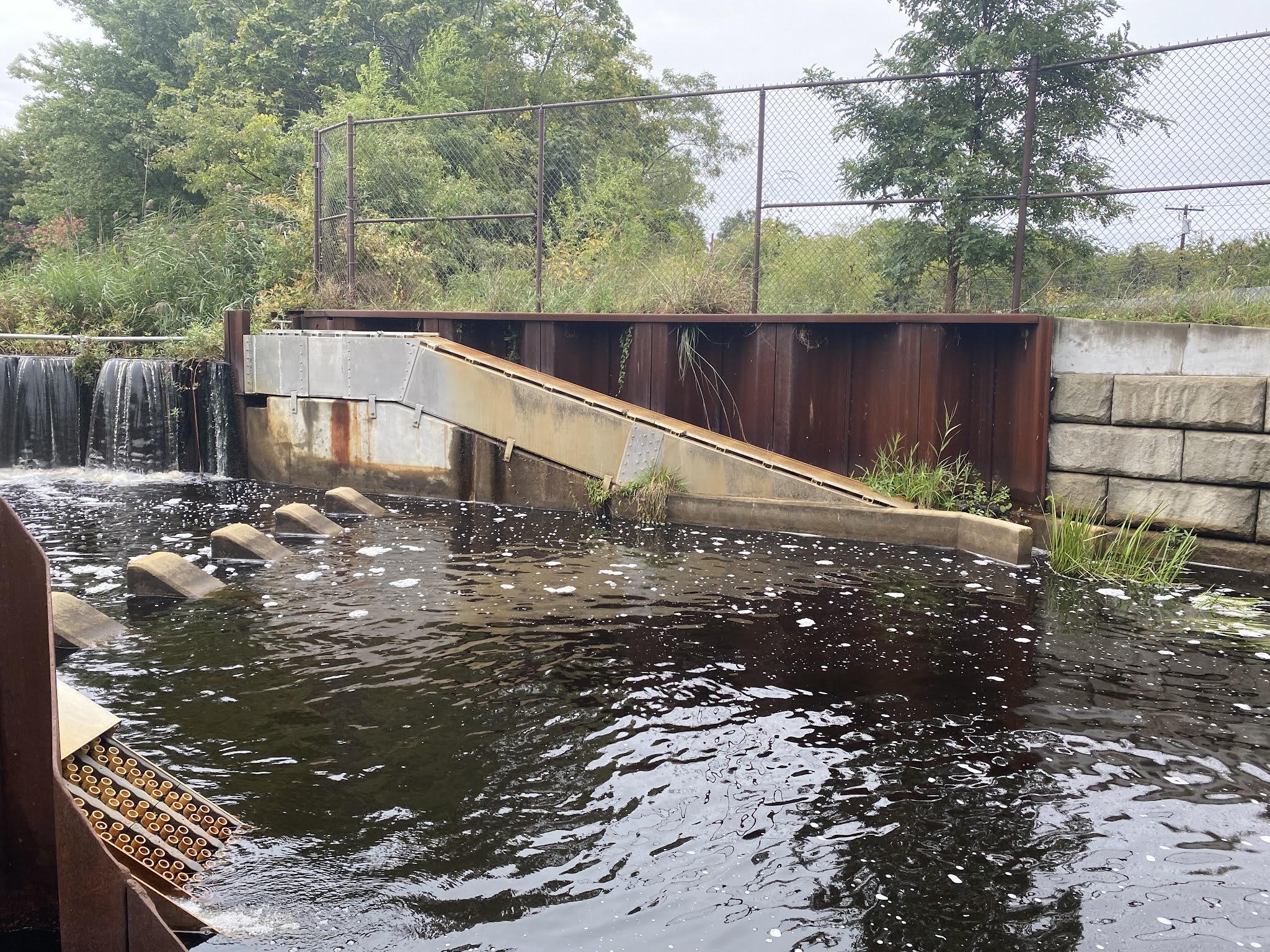 |
| Photo 2 |
 |
| Photo 3 |
Fish and Rescue


The Limits of Rehabilitation with Funding
by Clare Dana
This Friday we toured the New York Marine Rescue center in Riverhead, New York. We got a chance to tour their facilities, meet some of their current rehab residents, and learn about the ins and outs of the process and what it takes to run this rehabilitation center. The center currently has the ability to rehabilitate turtles, seals, and small cetaceans. Being the only affiliated Marine Rehabilitation Center in New York, they respond to all strandings and reports of injured marine animals in the area. Our guide, and the director of the center, mentioned that the center used to respond to large cetaceans but have stepped back from that because of resources. On top of that, they also had to step back from housing small cetaceans in their facilities for the same reason. This struck me and made me realize the limitations that arise due to funding in the marine conservation field. Seeing that the only center for rehabilitation in New York is limited to specific species because resources cannot be supported is quite saddening.
The director told us how up to 2017 the center would respond to whale strandings (which usually resulted in euthinasia) and could support small cetacean rehabilitation at the center. She also pointed out the tanks that used to be used for the small cetaceans, one of which is now being used for loggerhead being rehabilitated. We must recognize just how expensive this process is between uptake and maintenance of the facility, medications, and food all being provided by a not-for-profit organization. Even beyond the rehabilitation stage when animals are released, the tags used to track them can each cost somewhere between $5,000 and $15,000 so the center must choose what animals will receive these.

Image1: This is Chestnut, a forever resident at the rescue center. Chestnut was struck by a boat causing an imbalance of buoyancy in her shell so she cannot be released. The rescue center has created a contraption to help Chestnut to stay balanced. Chestnut’s little body band is just one example of what the rescue center needs proper funding for to ensure a comfortable life for the injured animals.

Image2: This is Queen. She is the loggerhead turtle that is currently residing in the tank that used to be used for the small cetaceans the rescue center used to house and rehabilitate.
by Abighail McKinney
This week’s class took a visit to the NY Marine Rescue Center. They showed us turtles, manta rays, and seals. They took us through the process of rescuing a marine animal and how they perform a physical before bringing them in. After a period of treatment usually they come to the conclusion on whether or not an animal is qualified for release. At the Rescue center, they have Chestnut, a green turtle there that is unreleasable. Due to the injuries caused by a recent boat accident, her shell grows more upward, inducing air pockets that cause imbalances during movement. Because of this, her home will remain in centers as such for the rest of her life.
Unfortunately not all animals are as lucky, if they are unable to find a forever home for animals such as one of the blind seals they had. They are resorted to being euthanized because they cannot be released under those conditions. This is normally the most ethical way to deliver a “good death” for marine reptiles/cetaceans/pinnipeds.
If animals are releasable, Rescue Centers usually take certain precautionary measures around these animals. There is usually no talking and minimal human contact to ensure these factors don’t make re-release more difficult/stressful.
 |
| NY Rescue center Biologist feeds Chestnut (green sea turtle) Romaine lettuce. Chestnut floating her way over to some delicious lettuce |
Why euthanize them? You may ask, Are there no other options? Usually there aren’t, Euthanization is the fastest, humane option for marine mammals. Upon evaluation by a veterinarian the euthanization of unreleasable animals allows rescue centers to use their carcasses for research. From this stems a better understanding of these animals which may lead to better treatments in the future.
 |
||
| Device used to keep Chestnut afloat, due to her injuries. One side of her shell is more buoyant than the other. |
The fingerprints of climate change can be seen all over our planet. Our warming ocean has caused worsting storms, bleached coral, and has had a strong impact on our glaciers, melting thing, causing climate change to worsen. However warming oceans has caused more damage the closer you look. Warmer oceans cause more tropical species to migrate to seasonal waters, only to die off if they don’t move back to tropical waters come winter. In a similar aspect, animals that migrate south for the winter now must adapt to waters colling down sooner. Sea turtles and other cold-blooded animals are often the victim of this “cold stun”. This phenomenon is called cold stun because as the environment gets colder their metabolism slows down, and eventually they’ll lose the energy to move, eat, and can die from this.
Here you can see Chesnutt’s flotation device as she swims towards the camera.


Riverhead Marine Rescue Center
by Ed LeMoine
On our trip to Riverhead, our main destination was the New York Marine Rescue Center located inside the Riverhead aquarium. The Rescue Center was first opened in 1966 and remains the largest marine rescue facility from Virginia to Maine coastwise. Maxine Montello, the director of the Rescue Program was kind enough to show us through all the facilities. While the aquarium itself is for-profit, the rescue center is a non-profit that works with volunteers and the community to find and hopefully rehabilitate turtles, seals, and other select pinnipeds and cetaceans. “Why is a Marine Rescue center necessary?” some may ask, and to them I’d ask if they would know what to do with a usually large, possibly irate sea creature on the beach before them. As mentioned, the rescue center works with the community to deal with situations akin to this.
MAR 355 – Sag Harbor Whaling Museum & Custom House, Sept 17, 2021
Art Imitates Life in a Whaley Interesting Way
by Clare Dana
I’m sure most of us have heard the saying “art imitates life” which is the observation of creative work that has been inspired by true events based on a story. While walking through the whaling museum, the art depicting the culture of whaling is clearly evident from portraits, figurines, and statues. Art is one of the main platforms to learn about a specific culture, and the use of whaling themes and whale parts in much of the art highlights how influential whaling was in defining the culture of Sag Harbor and much of New England.
 |
| Image 1: These are some of the scrimshaw pieces on display at the museum. You can see the images of both sailing and the action of hunting the whale. |
 |
| Image 2: Pie crimpers made out of the whale bone (teeth). These crimpers are very common and capture the “homey” feeling that these sailors tried to hold on to while out at sea for these long voyages. They also served as little gifts when returning home which to me is very endearing and helps you connect to their lives a little easier. |
 |
| Image 3: These are sewing instruments made of whale bone. An interesting note is that while women are usually associated with sewing during this time period, the sailors also needed to hold this skill to be able to fix sails, clothing, and other cloth materials on board. |
Harpoons evolved over time to be more reliable in its ability to remain in the whale. The number of harpoon’s barbs, called flue, was reduced from two to one because the narrower head allowed for deeper penetration; whereas the two-flue harpoon did not go deep and most likely fell out of the whale, the one-flue harpoon more often went deep enough to pass the layer of blubber. The toggle harpoons were used by the Native American tribes before the whalers started using them. The rotating head or the toggle head would rotate 90° to almost guarantee that the harpoon would get stuck in the whale but the early version had a difficult time preparing the harpoon. A grommet, likely a strap or metal ring, was used to hold the harpoon’s head in place so it could pierce the whale but the harpoon would often dislodge before it could properly set in the whale’s body. Later toggle harpoons were improved and made by Lewis Temple, an African American blacksmith, and were vastly superior because the toggle mechanism was contained within the harpoon head itself rather than an external component.
 |
| Figure 1 shows harpoons through the ages, oldest to newest from left to right; the description details the changes and improvements with each new model. Harpoon 3 was the first harpoon that had a head that could rotate but harpoons 4 and 5 had actual axles that the head rotated on. Harpoon 6 is the same make as harpoon 5 but oriented as if it were lodged in a whale. |
 |
| Figure 2 shows where ships went whaling and which whales can be caught where. It also shows abandoned whaling grounds by 1887 in white. The Atlantic whaling grounds have mostly been abandoned by 1887. This map is extremely detailed and well-made, the drawings of the whales on the other hand leave more to be desired. |
Real Recyclers: 17,18, and 19th Century Long Islanders
by Molly Showers
 |
| Image 1: This was the millstone originally used for grinding grain. It’s interesting to think about who carved this stone, and how they moved these heavy stones. It makes sense as to why they would want to reuse it – it’s large and sturdy. |
 |
| Image 2: The step up into the room is because the heights of the two houses that were mashed together didn’t quite match. For the time and technology available, I was surprised that this small step was the only way of knowing that there were originally two houses. I would think that it would have been messier. |
 |
| Image 3: This was the custom house with the new addition featured. From the outside, I never would have guessed that there were two parts to the house. I wonder what tools they used to make this move, since there was no heavy machinery at this time (like a crane or bulldozer). |
The Whaling Museum and Greek Revival


The Old Whalers’ Church and Egyptian Revival


by Mathew Amoedo

This is a photo of a sugar cone and a marble paperweight. The paperweight speaks for itself but the sugar cone I found to be interesting. Sugar was transported in that conical shape and was often so hard that one would need a tool like a hammer to break the sugar up, as sugar cubes were not popularized until the late 1800s.

This is a Certificate of Enrollment. This would be used as Americans to prove to the British that they were trading with that they were actually Americans. As you could imagine, they did not work very often.

You may notice something interesting about this clock. They actually had to raise the ceiling to accommodate for the sheer height of the clock. Its height and extravagance no doubt symbolized wealth and class.

This cane was made from the vertebrae of a shark. A cane back then was not always used out of necessity. It also represented class and wealth.

This may just look like a normal chair, but it is actually quite expensive. It was made from mahogany, which again would be a sign of wealth and status. This type of chair would be referred to as a great chair due to the fact that it has arms.
Life in the Customs House
by Amanda Tepper
The Sag Harbor customs house has a rich history, for not only was it the office of Henry Paker Dering but it was also his home where his family lived and his children were raised. Getting a tour of the Dering home gave special insights into how a household was run in the late 1700s that you could not truly get in a classroom. Even though the Dering family was well off financially, this peek into Henry Paker Dering’s, his wife Anna Dering’s, and their nine children’s lives also shows how many other people lived during this time.
One part of the tour that truly stood out to me was the kitchen. Standing in the kitchen you can instantly see the absence of basically all the appliances that we have in our modern kitchens. Now you may be sitting there thinking, “well of course not, it’s the 1700s”, however seeing the kitchen in person helps to give a perspective on how much more work had to go into sustaining a family during this time. The only way of cooking something was by using a fireplace, and the only way to bake something was to take coals into a sealed off stone cubby with dough and then carefully monitor it since they lacked the modern comforts of setting an oven to a specific temperature and starting a timer. The kitchen had no running water, thus time and energy were spent daily to go to a pump and collect some. The closest thing to a refrigerator was a “pie safe” which was just a cabinet that kept flies off food. However, all this being said about how much work keeping the kitchen running alone, the Dering’s did have enslaved people and indentured servants, so household chores were not the sole weight for Anna Dering to bear. Nevertheless, many families in this era had similar setups which just makes you think about how much time every day was put into simply keeping a household running. In the end I couldn’t help but feel thankful for the luxury of our modern technology.
MAR 355 – Kayaking in North Sea, Sept 10, 2021
Windy Kayak Adventure
by Lucas Chen

We took off for the kayak trip. The winds were blowing southwest at about 16 kts, but if felt more like 20 kts. The white caps were tough to maneuver in. First we went to Alewife Creek, Conscience Point, and then the beach.

This was at Alewife Creek. Kurt lectured about alewives that migrate through here in the spring to Big Fresh Pond to breed, and then migrate back to the sea at the end of the summer. We also learned about the ospreys that come to Long Island every summer to breed. They come back to the same mate every year and lay about 3-5 eggs a pair.

Pictured here is one of the oyster farms in the North Sea. This was right next to Conscience Point. The oysters are raised here in bags and sold when they reach size. They start out as seeds by the docks where we took off with the kayaks. They must be flipped to prevent biofouling from accumulating. It also helps create a typical bowl shape, which is what makes them more desirable to consume.

The Iconic Big Duck
For this week’s Friday trip, we all went out to Conscience Bay for a kayak day with a couple lectures on the water! One of the places we stopped for a lecture was by a duck blind, where our discussion on ducks began. The discussion drifted from hunters using duck blinds to conceal themselves when hunting to an iconic landmark on Long Island, the Big Duck! We learned that the Big Duck located in Flanders, LI was built in 1931 by Martin Maurer, a duck farmer. Maurer sold ducks and eggs from the shop located inside the Big Duck. It was built with the intention to attract drivers and vacationers traveling down the highway, hoping to encourage them to stop in.
The Big Duck is a symbol of architectural brilliance as well; moved by Maurer’s creation, architects Robert Venturi and Denise Scott Brown coined the architectural term “duck” to describe structures that plainly display their function or selling product in the design of the building itself — Maurer’s Big Duck, a building that is in the shape of a duck, was built to sell ducks and duck eggs. If a building is not considered a duck, it is said to be a “decorated shed” — a plain building which relies on an external symbol or ornament (like a sign) to convey its function. Today, the duck and decorated shed theory is taught in architecture courses as a revolutionary way of classifying buildings, and the theory can be traced back to Long Island’s Big Duck.
Here is a picture from a couple weeks ago of me, Nikole, and Clare when we stumbled upon the Big Duck on our day adventure in Riverhead. Sure enough, the Big Duck entices passersby to stop and visit — we did! Unfortunately, we missed the gift shop visiting hours by a half hour, but we decided we would have to come again to explore the gift shop.


Kayaking Trip
by Samantha Aplin
Everyone either hates or loves ghost stories, but our class was thrilled when Dr. Rider and Dr. Bretsch told us that after we filled up on chili and brownies at the marine science center, that they would give us a walking ghost tour of campus. This included the historic windmill on campus, and a few of us had heard that it was haunted. We were thrilled to finally learn if the rumors were true. We all climbed up a hill to get to the windmill and gathered around Dr. Rider to listen to her ghost stories.
This windmill, pictured below, Dr. Rider said was originally in the village of Southampton, but as more people arrived in the village, they needed more room. They were going to tear it down, but instead a woman that initially owned the land that the Southampton campus is on, said it was an important part of the history of the town and she wanted to keep it. They moved the windmill onto the property and turned it into a playhouse for their daughter. Their daughter became friends with the fishermen that would bring fish to her family, and as her playhouse on top of a hill, it could be seen from the bay as well as the ocean. On foggy nights, she would light a candle in the window of the windmill so the fishermen could find their way home. Unfortunately, she dies at the age of 10 due to tuberculosis, and while her family left the estate as there are too many memories there, rumors say that she stayed on campus with us. On a foggy night, you can look up into the window and still see a candle burning. When Dr. Rider said this, the lights around the pathway up to the windmill turned on and I got chills. This was the only rumor that I had heard of about the campus being haunted, so I did not know about the other ghost we have on campus.

Dr. Rider said that after the original family left, other families had owned it until LIU bought the land for their Southampton campus. This campus became well known for its marine biology department, much like it is now, but other than that, most of the students went to the main LIU campus. However, there were still enough student at Southampton LIU to have fraternities and sororities, that engaged in hazing. One fraternity in particular thought it would be a good idea to tied down a guy from Greenport to the blade of the windmill and have it turn. Unfortunately, he did not survive, and Dr. Rider said that if you ever feel a cool breeze walking through the trees on campus, it’s just him trying to get back home. Once Dr. Rider finished her statement, Dr. Bretsch jumped out from the trees and screamed. Half of the class had their backs facing him, including me, and he scared me so bad I just sat on the ground shaking in fear. It was overall a night I will never forget.
West Robins Oyster Farm
Oysters are a very valuable bivalve that lives in our local waters here on Long Island. Not only do they contribute to our region’s most valuable commercial fisheries, oysters also clean our waters and offer food and habitat to many animals. As filter feeders, oysters serve as a natural water filter where they can filter through and trap nutrients and sediments in around 50 gallons of water per day, which greatly improves water quality. With clearer water, more seagrasses can be supported, bringing an increase in oxygen levels. Oysters also create oyster reefs as they have a tendency to attach themselves to hard substrate or other oysters. Oyster reefs can then provide habitat for organisms such as fish and crabs.
Overharvesting, disease, and habitat loss have brought a significant decline in oyster populations, bringing many negative environmental impacts. Many companies and organizations in Long Island are making efforts to increase oyster population numbers and reverse these effects. During our kayak trip, we traveled through North Sea Harbor which contains West Robins Oyster Farm: an oyster farm aiming to increase oyster numbers through sustainable methods. Oyster farming is an aquaculture practice where oysters are bred and raised, not only to sell as food for humans, but also to improve water quality. West Robins Oyster Farm does not harvest wild oysters or seed from open fisheries on Long Island, which promotes raising population numbers instead of dropping them.
Not only do oyster farms provide oysters for our consumption in a sustainable way, they also provide many positive environmental effects. Harvesting the bivalves loosens and disperses sediment which improves the overall sediment quality, as well as adds oxygen to the lower waters and sediment. It is so important to bring back our oysters here on Long Island, and it is so great to see places such as West Robins Oyster Farm who are making the proper efforts to do so.
 |
| This image shows oysters that have attached to other oysters or oyster shells, creating an oyster reef. This oyster reef has created space for an Asian Shore Crab to hide in from predators. |
 |
| This image shows the cages of West Robins Oyster Farm. The oysters are suspended near the surface of the water in each cage. Here, their energy is focused on shell growth. |
Kayaking Trip
When thinking about wildlife, and how we treat it nowadays, it is hard to avoid the one little question: “should we preserve, or conserve? Sustain or let it all rot in vain?” “But wait!” You might cry before we can even try, “How are the three even different?! To Preserve, to conserve, or to sustain?” To answer such a question, I must recall a certain quotation, an interesting little point, something I learned past Friday at North Sea Harbor of Conscious Point.
The idea of preservation is perhaps the most simple. “Don’t touch nature! Do not pinch or even tickle. Leave it as it is now, with the only objective being: “Protect what we have left! Stop any new development or usage by any human being.”
Conservation, on the other hand, has a bit more leeway. “You may use the resources here!” They say, ah such music to my ears. But don’t go crazy, like any good deal, there’s a little caveat. The resources must be used, to not only aid you, but the maximum amount of people, the biggest bang for our nature buck. But take care, and beware, you must not snooze. After all, no matter how wisely you use your resources, it will run out one day, which will be terrible news.
Finally, sustainability! The 21st century’s modern trend, “it should be fine to take from nature, if in turn we help it mend.” This might be considered conservation but better. We take what we need and leave the rest for later. And while we leave and are enjoying our catch, we also help mother nature’s wounds patch. Planting trees, releasing fry, limiting hunting and fishing. We give back to nature what we used in our apple pie.
Fish Cove in Southampton

A shot of the Fish Cove I took while the class was instructed to get our kayaks in line. I found the most difficult part to be the spacing and avoiding the foliage along the coast, which is visible on the adjacent coastline in the photo.

This shot shows a wide shot of Fish Cove along with the bridge on Noyac Road we had to cross under. The wind made this task quite difficult, as the waves pushed the kayaks around like they were driftwood.
Once we had gotten ourselves situated in a suitable formation on the kayaks, Kurt gave a lecture on some of the local wildlife. Most notably we talked about ospreys, also known as fish hawks. Contrary to their nickname, they are not hawks, but raptors. During the colder months, they migrate as far south as the Amazon Basin in South America. Their peak migration time is in early October. They are also monogamous birds, meaning they pair for life, but they frequently separate during these migratory seasons. Unfortunately, osprey populations declined due to the use of harmful pesticides like DBT in the 60s. This was especially harmful due to the biomagnification and bioaccumulation of the pesticides as they moved through different organisms up the trophic levels. The pesticides would affect the thickness of the osprey’s eggshells, making them thin enough to where they would crack under the parent osprey’s weight. Luckily, the use of DBT was outlawed in the 1970s, so we are still able to enjoy the presence of this magnificent bird today.
MAR 355 – Tiana Beach, Shinnecock Inlet, & Rogers Mansion, Aug 3, 2021
Community efforts are large driving force in conservation. In this week’s trip we were able to observe a great example of community efforts to regrow a population. As a class, we headed over to Tiana beach and pavilion in Southampton. Across from the beach is the bayside, decorated with a large whale tail made from recycled waste. In the water were rows of partly submerged oyster cages. The cages were attached to a floating dock using various ropes and floatation devices. In these cages the oysters are protected from predators such as American oyster drills and Asian shore crabs.


A Walk Through History at Southampton’s History Museum


His whaling trips allowed him to bring back souvenirs that would fill the home with some of the history that we can still see today, such as the collection of fine china on the right.


Samuel Parrish was a successful lawyer with an interest in the arts. In fact, he established the Parrish Arts Museum to display his collection of art. He had an interest in the art of Italian Renaissance, pictured here with his collection of plaster copies of medals depicting Roman emperors and French rulers. I was surprised to learn that Parrish was actually the mayor of Southampton for a term. He initially purchased the Rogers Mansion as a summer home, but it seems the town became something dear to him. He invested a great deal into the town, hiring a company to liven up Main Street’s commercial aspect, establishing the Parrish Museum, and helping establish the Southampton Hospital and Rogers Memorial Library.

This past week, we visited the Southampton Historical Museum and one of the first things I noticed were the women’s clothing on display. These everyday outfits were extravagant by today’s standards. Women were covered from head to toe, even in the privacy of their own homes. We view these dresses as restrictive and appropriating, but these were simply the style of the time period. Beauty standards have been changing since the dawn of society, and there are always several different standards men and women want to abide by. In the Victorian era, corsets are the piece of clothing we picture the most. Corsets squeeze the waist, accentuating a woman’s bust and hips. This was desirable as a show of child bearing and motherhood.
 |
Southampton was, and is still today, a town of wealth. Clothing has always been a part of demonstrating that wealth to the public. Hats were a simple way to present a woman’s money. The more fanciful the hat, the more money it is implied the owner has. Hats were also a way to announce the marital status of a woman. Clothing was exceedingly important to the women of the Victorian era, as their reputations were dependent on the way they presented themselves. History is fascinating in many ways, but the Victorian era seems to capture our attention the most, particularly with the common styles of the time.
Southampton/Hampton Bays Orientation: Agawam Lake, Ponquogue, & Tiana
by Asher Novkov-Bloom


Other necessaries at the Rogers Mansion Museum complex include a barn, a decoy shed (used for carved duck decoys), a schoolhouse, and an outhouse. While not all of these were original to the property, all are original to the time period and similar structures likely existed on the property. These necessaries gave the wealthy homeowners access to services and resources right in their backyard, while less well-off families would have to share communal facilities or simply go without some services. When people think of historic estates, they rarely think about the necessaries surrounding the main house. That being said, these necessaries can be a unique look into what the upper classes considered essential to everyday life.
The Trustees of Southampton
by Ed LeMoine
If you live in the Southampton area, you should be all too well informed on trustees as they campaign to and are elected by the public. Trustees work with the mission of managing common land for common use and can in some cases overturn the decisions of local government in towns. Trustees can overturn local government on occasion if they feel that the decision(s) being made are not in the best interest of the town, primarily regarding land. This can and has unfortunately led to corruption as a position with this much power is likely sought after by people with deep pockets. However, the ideal trustee works to preserve the land of Southampton for many to enjoy.
MAR 355 – Shinnecock and Peconic Bay Tour, Aug 21 2021
Coastal Cultural Experience Explores Canoes and Canals
by Molly Showers
As a welcome into the Coastal Cultural Experience, we toured around the Shinnecock and Peconic Bays. The two are connected through a canal that was constructed in the late 17th century. Before that point, the local Native American tribes in the area, such as the Shinnecock (and possibly the Montaukets, who were nearby) would have to lug their canoes from the Shinnecock Bay to the Peconic Bay. Over time, they had cleared a path, which is where the canal would be placed in 1690, fifty years after the English settlers would first arrive on Long Island to form Southampton.
As we traveled into the canal from Shinnecock Bay (Image 1), I found it surprisingly easy to forget about the heat and humidity from the 90° day and imagine the settlers and Native Americans alike traveling from one bay to another. Although it is just a glorified man-made ditch, it is valuable for travel and economic purposes. For example, fishermen in the Peconic Bay (Image 2) have access to the Atlantic and Native Americans could reach other tribes in the North much easier. It was interesting to think about just how many people have used this canal for the hundreds of years it has existed (Image 3). Such a simple idea of a ditch has had a revolutionary impact in the area of Southampton.
From a scientific standpoint, I found this canal to be a marvel as well. As someone who is much more accustomed to freshwater canals, since I am from Upstate New York, I had never taken the time to think about the impacts of canals in saltwater systems. I just had assumed that water simply moved from one section to another, accounting for the differences in depth. However, I learned that there is a tangible difference in salinity between the two bays, with the Shinnecock Bay being saltier than the Peconic Bay. To move boats through the canal without too much damage from the different salinity levels, water can only flow from the Peconic Bay to the Shinnecock Bay.
Just from this one canal, I had learned so much about Long Island’s history and ecology. Perhaps during my Semester by the Sea, I should take a small trip to the canal and fish along it’s edges, basking in its historical significance.

Image 1: This is Shinnecock Bay, which faces the Atlantic Ocean. This is important for the placement of the canal, since the fishermen and other baymen could have direct access to the ocean for their industries. The coast of Shinnecock Bay housed the Shinnecock Native Americans as well. This phenomenon of naming places and towns after Native American tribes and important figures is common on Long Island, I have come to find out.

Image 2: This is Peconic Bay, which resides in between the North Fork and South Fork of Long Island. Since this houses the mouth of the Peconic River, this water is much fresher than the Shinnecock Bay. We sat along the jetty of the Peconic Bay, which was erected to stop the longshore drift of sand westward through the bay.

Image 3: This is the canal that connects the Shinnecock Bay and the Peconic Bays. It was very cool to see the water change in the canal lock as the level evened out to the bay in which we were entering. In this picture, one can see the Peconic Bay.
The Geographical Effects of The Great Hurricane of 1938
The opening of this inlet was not all positives, as you might imagine. In order to stabilize inlets, the use of jetties is commonly employed. This is exactly what was done at Shinnecock Inlet, but a problem is introduced when considering natural coastal erosion. Due to the angle at which water flows into the southern shore of Long Island, sand is gradually moved from east to west. This is called longshore drift. If an inlet is created, it becomes a sand trap, pulling in sand that was meant to continue its journey west. This opening had another non-obvious consequence: weaker water flow in another inlet further west called Moriches Inlet. This weaker water pressure induced the building of more jetties, further inhibiting longshore currents. All this culminating in rapid erosion of beaches west of Moriches Inlet that would have been naturally replaced by sediment moving from the east to the west due to longshore drift.
I think the takeaway from the eighty-three years since The Great Hurricane is that humans cannot control nature on as great a scale as we might like to think. People decided to find a silver lining in the hurricane the destroyed their homes by making a faster route from Shinnecock Bay to the Atlantic Ocean, however, we are ending up paying for it with the homes and habitats of those to our west.
Ed LeMoine

Coastal Cultural Experience: NY Marine Rescue Center & Peconic River Fish Ladders
The Use of Satellite Tags in Tracking Sea Turtles
by Ana Noel
The NY Marine Rescue Center uses methods to keep tabs on their animals after they are released. One way they do this is with flipper tags. These are tags that are inserted in the flippers of the sea turtles and seals after they release them with their organization name and number. This allows for them to keep track of the animal if it were to return to shore. For example, if someone found this animal and called the number, they would be able to get the location of the animal as well as know that the animal is still alive after they released it.
Another tracking device they use is satellite tags. These are placed on the shell of the sea turtle and connected to a satellite. The satellite connects to a computer to show not only where the sea turtle is located currently, but also the path it took and the places it was before. This is beneficial because it allows the sea turtle to be monitored. This can help show if the sea turtles are displaying normal behavior by looking if they are migrating at the appropriate time. This can also help show if the sea turtle is still in the colder waters and gives them an idea if this turtle may need to be rescued again because of cold stunning. In addition, these tags can help show if the animal survives after they release them to see if their efforts to save them are working. A problem with this technique is that the tags are expensive ($1000-2000) and can fall off since they are located on the outside of the turtle’s shell.


Diagram of how satellite tags work from the satellite to the computer.

Location of five sea turtles that were released from the New York Marine Rescue Center. This is an example of how satellite tags work by being able to track the turtle’s location since their release.


Satellite tags attached to a turtle and the different examples of satellite tags used. These tags are not only used to locate the turtle, but also to collect the temperature and dive data of the turtle to see if the turtle may be experiencing cold stunning.

Example of data collected on the dive depth of the Atlantic green sea turtle with the use of satellite tags.
The New York Marine Rescue Center with Connection to Pinniped Stranding
by Mateo Rivera


Pinnipeds, which consist of seals, sea lions and walruses, are highly susceptible of becoming stranded on beaches along the East and West Coast. These strandings are caused by a multitude of reasons, but the most common are from fishing gear entanglements, boat strikes, and starvation. The factos that lead the mammals landing on these beaches can lead to their ultimate deaths. It is crucial that the information gathered be reported to NOAA so response and tratment methods can be improved. Also, it can support in educating the community and preventing fisheries from making fatal mistakes that can result in increased strandings. The pinnipeds in the pictures are from the Long Island Aquarium, NY and are represented by harbor seals and grey seals. They are extremely playful as you can witness by the picture on the right as they glide through the water in the enclosure.

The New York Marine Rescue Center is the only location that services these stranded organisms in the state and is stationed in Riverhead. Their effort is crucial to addressing these events and facilitating their rehabilitation. This part of the rescue center is known as “seal row” and it consisting of 16 tanks for holding small seals. Keeping them in an area where they are able to heal and in the water is important so that their recovery occurs rapidly. They are kept at a constant temperature and salinity, since the saltwater is apparently good for healing. Water quality is checked and maintained every single day. However, seals haven’t been stranded recently so they are adapting this part of the center for large loggerhead sea turtles.
NY Marine Rescue Center
by Sandra Reyes
During the trip to the New York Marine Rescue Center we learned a lot about the animals that they can care for and how small things we do can help reduce the number of animals they have to rescue. They are a nonprofit organization that helps rehabilitate, release and relocate marine animals that get entangled or need medical assistance. They are the only respondents for cetaceans, pinnipeds and sea turtles for the whole state of New York. They even have 3 volunteer veterinarians on call; two of which I have had the privilege to meet, Doctor Rob and Doctor Jen (Doctor Jen loves Stony Brook students because she is a Stony Brook graduate).
During the months of late October to mid-January is referred to as “cold stunt season” and since we are currently in that season Maxine Montello was telling all about it. The cold stunt season effects the sea turtles; and besides boat crashes, entanglements, and fish hook mishaps, it’s what brings in the most sea turtles. When a cold stunt sea turtle is called in the first thing that they do (as well as to any animal that is brought into the hospital) is give them a full physical. The physical includes x-ray scans, physical touch for reflexes as well as abnormalities and even blood work.

Figure 1. Maxine Montello displays two x-rays (one of a loggerhead sea turtle and one of a seal pup), talking about the x-ray procedure for each animal.
After they get a physical, they are categorized into one of four classes depending on the severity of their condition. There are four different types of sea turtles; the Atlantic green, the Loggerhead, Kemp’s Ridley and the Leatherback sea turtles. Out of the four the leatherback is the largest and the only sea turtle said to not be affected by the cold stunt; therefore, the other three take up most of their rescue calls. Class one cases are usually if they are still alert and have normal reflexes and class four means they have to responses and can’t even breath on their own. Once the turtles have had a full exam they want to warm them up to 15°C but very slowly (2-3 degrees per day) to make sure not to cause internal body damage. They go through a critical five-day intensive care protocol in which they are not left in the pools alone overnight and kept in a room that matches their internal body temperature. They say that the first 48 hours are the hardest and that if they survive past day 3 that they usually don’t have to worry too much after that.

Figure 2. This image displays the posters that the staff reference when trying to place a turtle in one of the four classes. The poster on the bottom helps the staff know what to look for in specifically a Kemp’s Ridley sea turtle.
Once they have made it past the five days they are usually in the clear, however, they are still not permitted to stay in the pools overnight unless they can swim stably on their own. This includes being able to lift their heads above the water, swim to the bottom and back up, and interact in a non-threatening way with the enrichment around them. They must maintain the pools to make sure that they stay at the turtle’s body temperature as well as a constant 32 ppt in terms of salinity. After the turtles pass their physical exam and the five-day mark, they get charted and all their information gets sent to NOWA to be determined if they are releasable or not. Unfortunately, once the cold stunt patients are deemed releasable, they can’t be released here due to the cold weather, so they usually stay “in house” with them until the warmer weather comes back. If they have a large amount of them, they will partner up with a team in Florida so that they drive them to Boston and the other team drive them straight to Florida to be released there.

Figure 3. This is turtle 90, a baby Atlantic Green sea turtle who had been affected by the cold stunt and brought to the rescue center for a week ago. 90 is doing very well, and will have her first overnight in the pool soon
Deadliest Predator in the Ocean
by Katelyn Castler
The Riverhead NY Marine Rescue Center focuses on helping strained marine mammals and sea turtles. The biggest problem that these workers noticed the marine life have been facing is entanglement issues with nets or other marine debris. They provide a hazard as they may prevent an animal from feeding, limit movements, or even cause deadly wounds or infections. Once these animals face a problem like this, they can then become even more susceptible to other predators or ship strikes. The issue these marine mammals or sea turtles face is considered one of the top known human-caused mortality events. It is very dangerous and has become a serious problem today.

Figure 1. Image of nets/line that have or may cause marine mammal or sea turtle entanglements.
There are many ways to help prevent these entanglement issues. One way is to clean up after yourself. No matter where you are in the world, all the surrounding water ways are connected to the ocean. By picking up your trash, plastic bags, straws, ect. you are helping to prevent unneeded material from going into the ocean. Another way to help is to be cautious of your surroundings. If you are out fishing, be on the look out for protected marine mammals or sea turtles. Also be cautious of where you are putting line out and what you might be expected to catch. Lastly, spread the knowledge to your friends and family. The best way to protect marine life is to make everyone knowledgeable about the issue at hand so everyone can contribute to the protection. The more people who want to protect our oceans, the cleaner and safer it will be for marine life.
Permanent residents of the Long Island Aquarium
by Arthur Cody

During our trip to Long Island Aquarium and the New York marine Research Center, we saw a number of permanent residents to the aquarium and research center. The exhibit housed harbor seals and one gray seal by the name of Gray beauty. Gray Beauty was blind from cataracts in both her eyes and was rescued By New York Marine Rescue Center.

Other residents of the aquarium are the skates and rays that live in the display at the front of the aquarium. While we were there we saw a small baby in the tank and were informed not to touch it as it is very fragile as it was only recently born.

Another resident of the aquarium inside of the New York Marine Rescue Center is chestnut the Atlantic green Sea Turtle, housed within one of the tanks used by the rescue center for seals. Chestnut was struck by a boat that damaged its shell, the shell then began to reform. But instead of growing out throughout the entire shell, the shells carapace grew up, and this means that Chestnut was now top heavy and was more buoyant, which means he would never survive out in the wild. Overall, the trip showed us how these permanent residents rely on facilities like these to survive.
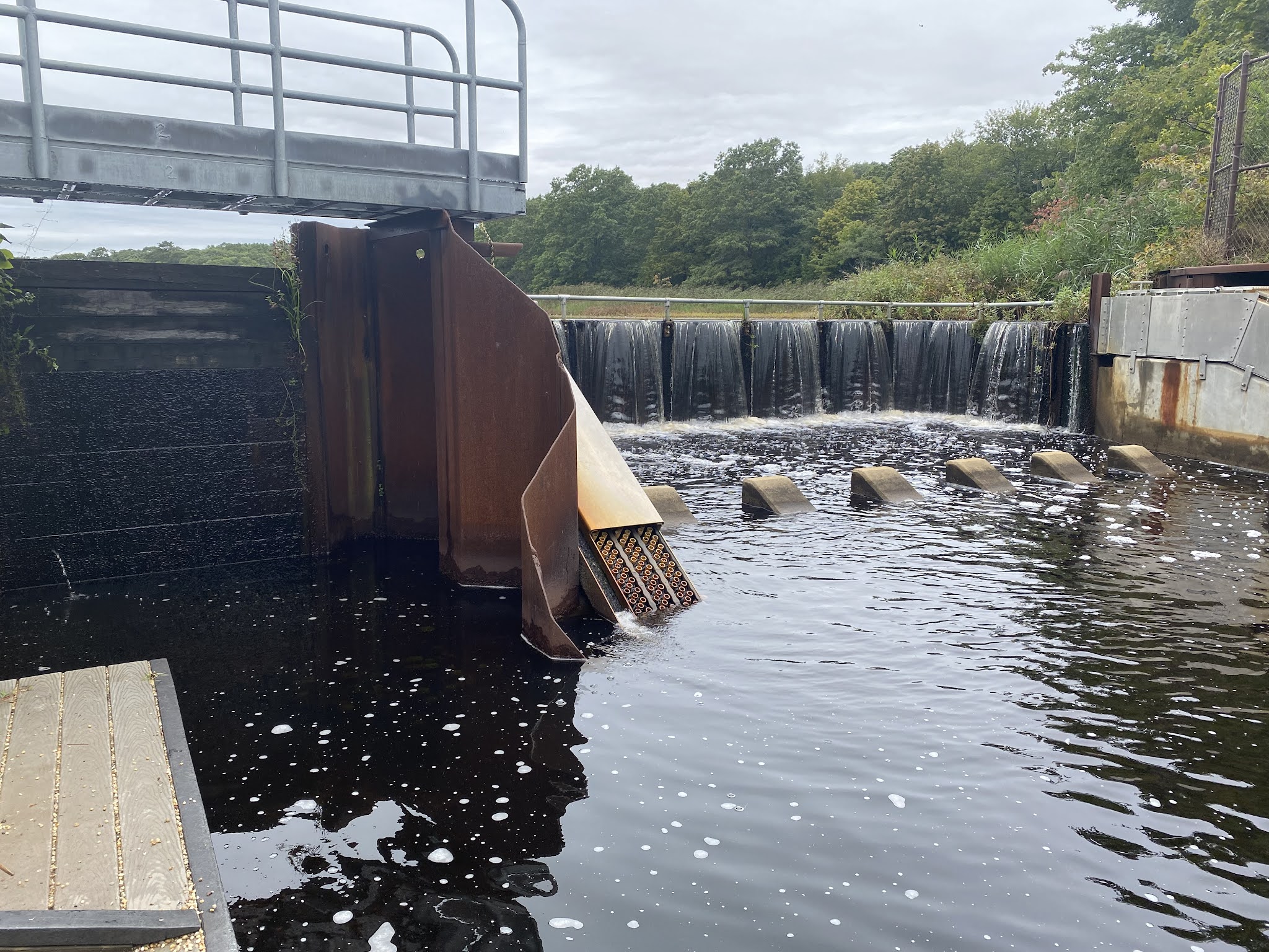
The History of Riverhead’s Alewife Ladder
by Charlotte Brennan
The Peconic River is an estuary meaning that there’s a mixture of salt and freshwater within the same body of water. The brackish water flows east and there’s saltier water on the bottom. As a result of this, there are brackish species within the river, including alewives, a species of fish. However, many estuaries are in trouble due to increased development around them. This affects migratory species such as alewives and American eels.
Within the Peconic River, alewives weren’t able to get over drops which endangers their ability to spawn and survive as a species. The population of Peconic alewives has plummeted since colonialism because we blocked their path within the river. In order to solve this problem, Bob Conklin developed a metal shoot in the early 2000s to place in the water to help the fish swim. However, while it worked okay, leaves would clog within the shoot and it required too much maintenance.
In 2010, a new natural slope, similar to a creek, was built within the river to replace the old shoot. It also includes rocks that helped slow water. Unfortunately, Bob Conklin died before it was put in, but the project has been a success for alewives and has helped their population. There is also a deep 12ft pool close to the ladder where 5000 alewives lay their eggs.

This is an example of signs that are posted all along the Peconic River where alewives live in order to protect their species and keep them away from further harm.

This is a rock located within the park dedicated to Bob Conklin who originally designed the fish ladder but wasn’t around to see the final form unveiled.

Here’s the alewife ladder in its full glory. To the untrained eye, it looks like a normal creek, but it actually is manmade and helps alewives greatly.

Right where the alewife ladder is, there’s an indentation in the concrete where an old gate used to be located that has since been removed to make way for the alewife ladder.
Attention to Detail
by Kristi Flanigan
When we visited the NY Marine Rescue Center, the first critters we encountered were the seals outside, swimming peaceably in their enclosure. Inside, there was a touch tank comprised mostly of stingrays. Past then, and all of this before our tour even began, we saw fish. One of my favorite things about aquariums is how much information is everywhere if you can drag your eyes away from the animals long enough to read it. Now starting to contain my excitement enough to take notice of the posted signs, I read up on the Gulf Stream and how it affects fish distributions while we were given time to look around pre-tour. Gulf Stream riders are tropical fish that are carried, as the name suggests, by the Gulf Stream, which can transport them hundreds of miles away from the warm southern waters we most immediately associate them with. It’s such an impossibly massive thing to imagine, watching the fish in the tank wind their way through the water so serenely, that in the wild they could see hundreds of miles of ocean in their lifetime. The vastness and complexity of so many small lives is certainly not something I’m really able to fathom even when I look out at the ocean. I kind of hope I’ll never lose that sense of wonder.
Speaking of a sense of wonder, we move from the main part of the aquarium into the repurposed warehouse that is the animal hospital for our tour, and I find it worth reflecting on that I’m passing through a space that makes a constant impact on the health of various types of marine life. In such a short time span I’ve walked past seals, fish, and turtles, and was we stand in front of the rows of tanks, we learn about why dolphins are not present and are never present inside the NY Marine Rescue Center. The reason? Viral disease. It’s a different kind of detail not exactly visible or easily fathomed, especially looking at the up-to-code cleanliness of the animal hospital. But that’s what happened – a highly contagious and airborne disease was becoming an issue in local waters to an uncontrollable degree and the facility happened to test positive. It could have spread to other animals in the facility, so for the safety of the animals the facility complied with regulations and no longer houses dolphins. It’s the kind of information I find hard to believe, even saddening – a place so dedicated to the care of their animals, so committed to the health of marine life, simply unlucky enough to lose an invisible fight against microbes. That said, and very much so to the facility’s credit, they have been able to move forward and help more sea turtles, in particular, than ever, and are doing so wonderfully. While we’re there we see a sea turtle finally go to the bottom of its tank on its own. The viral disease situation might be called a setback, but the center has moved forward to make an in-house impact where it can. It’s that attention to detail and love for the ocean that I really enjoy and respect. Aquariums and rescue centers for marine life are truly inspiring, fulfilling places in the face of the challenges inherent in caring for the world’s oceans.
Estuaries (Riverhead)
by Tyler Rodriguez

The above image is from an estuary in Riverhead, New York. An estuary is a semi-enclosed body of water where saltwater and freshwater meet. This type of mixed water is known as brackish water. Estuaries are a unique environment that are home to a large and diverse set of wildlife, including fish such as alewifes and birds such as seagulls and ducks. Because of the influence of tides and freshwater rivers draining into saltwater, these areas are rich in nutrients and contribute to a very productive ecosystem. The below image is of Mallards that live in the estuary area in Riverhead.

Estuaries have been important to coastal communities for hundreds of years. Early coastal communities realized the benefit of these areas and many harbors were developed in estuary regions. Because they are semi-enclosed, they are generally protected from ocean hazards such as large waves from storms. The very nature of estuaries provide protection to boats and harbors that development at the open ocean would not. As we have seen in past trips for this class, many harbors and maritime points of significance (such as the launching point for trans-Long Island Sound ferries) are in protected areas. Estuaries, historically, have been the perfect location for coastal development.
The Atlantic Green Sea Turtle #90: on the way to Recovery
by Joanna Zhu
During our visit to the New York Marine Rescue Center, we saw three cold-stunned sea turtles in rehabilitation. All three were rescued on Saturday, November 9th, 2019; one of them is a loggerhead and the other two are both Atlantic green sea turtles. The Atlantic greens are given the numbers 90 and 91 in order to identify them. #90 was discovered in Southampton by the founder of Tate’s house, in front of her house. It is the tiniest Atlantic green sea turtle the facility had ever rehabbed; this species is the largest hard-shelled sea turtle species so it can potentially grow very large.
We were very lucky to witness #90 diving, which indicated it was recovering from cold stunning. It was swimming slowly on the surface of the tank when we just arrived. It was very weak when it arrived at the rescue center, classified as a type III, meaning that it could respond to touching but with shallow breathing. According to Maxine Montello, the director of the rescue program, #90 cannot dive yet. However, after a few minutes we were all surprised to see #90 repeatedly diving slowly to the bottom and swimming up to the surface to breathe.

Photo 1: #90 when we first arrived, floating on the surface with heads raised above water (©NY Marine Rescue Center).

Photo 2: #90 slowly diving to the bottom of the tank (©NY Marine Rescue Center).
From #90, we can see the efforts the rescue team putted into rehabilitating these animals. Before #90 can dive, it was in a critical period and could not be left in the tank alone overnight. One team member was needed every night to watch over it before it can dive. Also, the tanks were decorated with red ribbons to help with recovery. These ribbons were imitating kelps in which juvenile sea turtles like to hang around for protection. We frequently saw #90 swim around and under them. Now that #90 can dive on its own, it is showing great signs of recovery and increase in strength. We hope that all cold stunned sea turtles in the facility can be successfully rehabbed and released back to the ocean!

[Photo 3] Photo 3: #90 swimming and floating below red ribbon which imitates kelp (©NY Marine Rescue Center).
Coastal Cultural Experience: Mystic Seaport
The Living Experience on The Charles W. Morgan, America’s Oldest Commercial Ship
by Tiffany Cui
During our trip to Mystic Seaport, we boarded The Charles W. Morgan, a 124-foot-long whaleship built in 1841 and the oldest commercial ship still afloat in America. While on the ship, we were guided below deck and shown the living quarters of the crewmates.
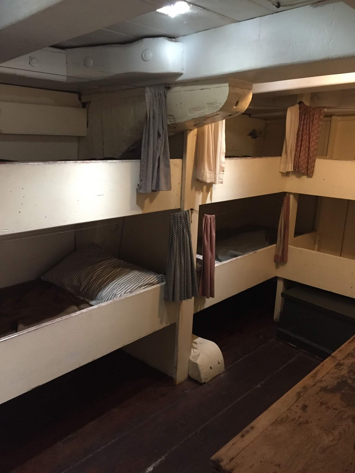
In this first picture is the boatsteerer’s bunkroom. There are about 6 beds in the room, but more people shared the room, since whaling vessels often operated in shifts, and when one worker got up from bed to go on shift, another would be getting off from their shift and occupy the same bed. This was the same case for greenhands, the lowest rank in a ship’s crew, who shared a room of 24 beds (not pictured) located in the forecastle of the ship. However, it was not just a place to sleep for them but was also where they ate all their meals and spent their time when they were not on duty. Imagine sleeping and eating in a cramped room with 20 other people when the seas were rough, oh the stench that would come out of it. That goes to show how tough being a sailor was.

In comparison, the Captain’s Quarters looks like paradise (pictured above). Located in the stern of the ship, it is much wider and roomier, enough to fit a lounge and bed more than twice the size of the sailor’s beds. The location is significant because the stern of a ship is generally more stable than the forecastle, where waves did not hit as hard and there was less noise. Being shown the living quarters of the ship was interesting, because it shows just how important hierarchy was in a ship’s crew.
Plastic and the Ocean
by Kristi Flanigan
When we visited Mystic Seaport today, we were immersed in whaling history, and in maritime history in general. The thing about learning, though, is that it seems to involve reframing your thought process at every turn – so while I was expecting to learn a lot about the arduous process of whaling and the value of whale oil (which I did), I also found that there were a lot of interesting notes about our oceans and our history with plastic. I think we often try to categorize plastic as a now idea, something only modern technologies and innovations can help – but I think it’s worth considering that maybe there are answers deeply rooted in our history.
First, although not literally plastic is the point of baleen fibers. Nicknamed “the plastic of the 1800s,” this fiber became more valuable as whale oil started to lose momentum as the prime reason to catch a whale. It was prized for it’s unique sturdiness, and was used in items like corsets and horse whips – things that warranted a rare but sturdy fiber. In hindsight, though, we know that neither of these baleen fiber goods remained popular and in demand forever. This decline in demand as fashions and consumer needs changed contributed to the fall of whaling. I think the idea of baleen fibers brings up an interesting bit of food for thought, though – in today’s thinking, and this is a fair bit of paraphrasing, anything that isn’t plastic is often considered the better option. In the 1800s, a natural fiber was akin to plastic now. What if we move towards a natural replacement for plastic that ultimately loses its viability? And, alternatively, are there plastic alternatives (sustainable ones, so I’m not suggesting baleen fibers) that were used historically that we’re currently overlooking?
 |
| Figure 1. Raw Baleen on display. |
I think we sometimes overlook our history in our search for answers. For example, in the fishing industry today, plastic buoys are deployed on nets. Historically, though, glass buoys were used, and we saw some at the Special Collections vault. You might expect glass to break too easily, but there it was, good as new – and the glass buoys have been surfacing in Hawaii, probably after deployment in Japan. It does raise that question – are we simply overlooking better alternatives to plastic? The glass buoys have a history of working, and are much safer for the ocean than plastic. On the other hand, cost comes into play. When you want the food source for a massive percentage of the world to be sustainable, can every consumer afford an increase in price? History is a multi-faceted, complex thing, but so are the problems we face today. After all, history starts as soon as yesterday.
Whaling of the sperm and other whales
by Ana Noel


Sailors would stand in hoops on top of whaling vessels in order to look for breathing whales. One blowhole indicates an Odontoceti, or toothed whaled, whereas two blowholes indicate a Mysticeti, or baleen whale. This is because Odontoceti use echolocation, which replaces the second blowhole.

This is how they would cut a sperm whale after they captured it. The blanket is where the blubber is stored and gave the largest amount of oil: 60-80% oil by weight. The spermaceti was found in the case and was used to help the whale dive deep in order to locate giant squid. This feature was used to make finer oil and candles.


Jawbone and teeth of a sperm whale. Unlike humans, whales only have teeth on the bottom part of their mouth as opposed to the top and bottom. Sperm whales would use their jaws and teeth to feed on squid and fish. Ambergris is a waxy substance found in the whale’s digestive tract to help it digest the squid beak. This substance was also used to make perfume. The teeth were extracted form the jaw and used to create scrimshaw.

Populations of sperm, humpback, and right whales over the years as an effect of whaling. In 1900, there was a large decline in whales because of the high-powered vessels and new technology. Today, the populations are beginning to recover because whaling is no longer legal in the US. However, the biggest threat to whales today are still human caused: entanglement in fishing nets, boat strikes, and noise disturbance, disrupting their ability to communicate and hunt via echolocation.
What makes the pizza so mystic?
by Joshua Whitehead
What do you do with a drunken sailor? You put him in the scuppers with a hose pipe on ‘im of course. Many people know the famous song, but not many know the origin. We had the opportunity to learn this along with other fascinating topics at Mystic Seaport last Friday during a long day of ferry rides, van rides, and harpoon throwing. The food from the night before along with video games and soda from the potluck the night before however, helped fuel us for the long and very cold day.
After touring the maritime museum, the vault (a place with thousands of artifacts) and the Charles W. Morgan we gathered into the church to learn about the history of sea shanties and sing some of them, we even got Tara to sing a little bit. When you think of a sea shanty you think of rough rugged pirates, singing and having a good time. The reality is that these songs were work songs and the age of shanties didn’t overlap with the age of pirates. These songs were used to make sailors work more efficiently, also helped morale while doing work. The idea of a shanty is that a song would have a certain rhythm or beat that the sailors would the follow based on the task at hand. Tasks such as raising the anchor by use of a capstan could take hours, so they would make a song with rhyming couplets that just kept evolving into different stories about a sailor due to the length of time. Raising the halyard and other sails they used the song drunken sailor. The songs chosen would be different lengths each time because the song stops once the work is finished. The shantymen would also communicate with the mates about when the work would be finished and communicate it by song with the sailors.
The sea shanty has the same lineage as Afro-American work songs such as blues, railroad, and chain gang songs. This is due to the idea of work songs being brought over by African traders as a means of dock working songs. Originally scholars didn’t think the work songs in America could be of African origin, mostly due to prejudice views, linking them to different European countries. Today however, it is agreed that the songs are clearly of African origins. Polynesian culture also influenced work songs, with many of their names not fitting on the records book, their names were shortened to Kanaka and given an English first name. This became a very popular character name in many shanties.
To end the day, we went to Mystic Pizza, where they were very shocked when a group of 22 people suddenly showed up. We all got great food that was hot, a necessity now that it was even colder without the sun, who would’ve guessed? We packed up got into the vans, took another ferry ride (Kurt stayed on the top deck the entire time again which is absolute insanity) and I managed to anger everyone with super confusing riddles. All in all another great trip in coastal cultural experience.


Whale Oil
by Lucas Wong
Mystic Seaport was once a whaling community that thrived from the whaling industry. Today, the Mystic Seaport Museum recreated what the town would have looked like back when whaling was at its peak. The Museum houses the Charles W. Morgan, the last wooden whaling vessel that was first built in 1841. Whales were caught for their blubber which was turned into oil or their baleen which was used for various everyday items. The blubber from these giants were put in giant pots and cooked to extract the oil. However, the blubber wasn’t the purest quality oil. The best quality of oil came from the head of the whale. It wasn’t uncommon for people to hunt whales for oil. People like the Inuit harvested whales for heating, cooking and lighting. It wasn’t until industrialization happened that the demand for whale oil skyrocketed.

Inuit populations used whales for heating, lighting and other purposes.
The push for oil started in the 19th century when industrialization kicked off. Some of the most hunted whales were the sperm whales, bowhead whales and the right whales. These whales were slow moving which made them the easiest to hunt. The whales were harvested for their blubber which was turned into oil. This whale oil was used for various purposes. The demand for light and lubrication drove the whaling industry. People found that whale oil burned brighter and smelled less than animal grease. With the rise of industrialization, people would use whale oil or lubrication for the big machines.

Oil was used for lighting since it burned brighter and smelled less than tallow.
The Tradition and Innovation of Arctic Whaling
by Charlotte Brennan
At the Mystic Seaport Museum, we learned a lot about American whaling during the 18th and 19th centuries on ships using sail power. However, from the 1860s onwards, this industry slowly died due to the Civil War and the emergence of new foreign technologies for sailing. When petroleum was discovered in 1859, the United States was slow to adopt its use for whaling which directly lead to the ultimate demise.
On the other hand, Norwegian whalers began to use petroleum in their whaling efforts and developed new weapons and methods that helped the whaling business boom. These new weapons and methods helped them catch more whales and diversified the types of whales they could catch which was beneficial as to prevent the same species of whales from being overcaught. The American response to the whaling innovation going on in Norway was to move on to new businesses because they couldn’t keep up with the change.
While Americans left the whaling business, Norway and others started whaling more than ever and began to hunt with extreme efficiency and success. With vessels running on steam and diesel, the process of whaling could go much faster than in the past. Unfortunately, due to the successes of this new period of modern whaling, the numbers of some species of whales dropped to almost near extinction.
One interesting fact about modern whaling that I learned at the museum is that whaling still goes on in some places in the Arctic including Norway, Iceland and various Inuit tribes. However, these enterprises are not as bountiful as in the past, are done due to tradition, and don’t have a significant effect on the population of whale species globally.

In contrast to modern whaling, indigenous whaling is a sacred tradition and does not harm whale populations. One of the reasons it’s not impactful is because the process is very simple so they’re not able to catch many whales. This is a typical vessel that would be used to catch marine mammals and birds by indigenous people.
“When is history?”
by Katelyn Castler
Maritime history is a vast time period starting back when the first group of people started evolving waterways in their daily lifetime. However, the bigger question becomes “When does the history end?”. There is a big importance around the idea of what should be preserved and when. Back at the Mystic Seaport Museum, the associates talked highly about the person who took in consideration to preserve the Charles W. Morgan. The Morgan, for short, is one of the last American whaling ships and the oldest commercial ship still in use. Without the preservation of the ship, today’s society wouldn’t be able to learn or enjoy it today. It became an impressive artifact that is surrounded by a vast historical story.
Artifacts are any objects produced by humans that has interest and based on historical definition, artifacts can be dated anywhere from one second ago to millions of years ago. However, they are only valuable if the bigger story is known; aka their history. Back in the Mystic Seaport’s artifact vault, one noticeable item that stood out was a set of 1960’s water skis. The year 1960 is not a long time ago when you think about it. However, there is a historical event that is associated with the skis, the modern Environmental movement. The skis represent how people where actively using the waterways for recreational sport. Since these people were associated with water in their everyday life, they were driven to protect it. The drive lead to the Modern Environmentalist movement which aided in pollution through the push for Congress to pass an act promoting clean air and water.
Artifacts are important to learn from so historical scholars or other day to day people could interpret them into today’s world. At the Mystic Seaport museum there even was an exhibit about the plastic in today’s oceans and more modern shipping industries. Both which contained artifacts with wide age ranges from today’s time to a couple decades old. Artifacts are even added into their vault regularly. Each holding historical significance and their own stories. Preserving the artifacts, from any time frame, is the most important step in telling a historical story and their impact on today’s culture.
History and Evolution of Whaling Weapons
by Christian Rozenveld
1) The harpoon is the main instrument that was used around the world to hunt whales for hundreds of years. While there are many types of harpoon heads, the general ability for each is to hook into the flesh of the whale, so that the boat can be attached to it to tire it out. After the fight when the whale is exhausted, harpoons are used by experienced whalers to stab between the ribs and into the lungs.

2) With the advancement of technology came an easier method of whaling, this being a whale gun. These brass guns weighed much more than a harpoon and could kill a whale much faster, however they come with their share of danger. Due to the strength at which the gun fires, if the person firing was not balanced, they could be blown right off the boat, or even have the boat flip.

3) In current times, although whaling is illegal in most countries, some do not follow the rest of the world in protecting these species. Countries like japan use much more modernized weapons such as harpoon cannons. These cannons are mounted onto the heavy metal ships. They are fired using gunpowder or smokeless powder, and are tipped with explosives to quickly kill the creature.

Restoration on the Morgan at Mystic Seaport Museum
by Tessa Reynolds

Photo #1 (Credit to the Mystic Seaport Museum)
The columns on the Morgan were restored in the recent restoration project that spanned from 2006 to 2014. This restoration brought the Morgan back to sea worthy conditions and allowed for her to go on a 38th voyage in 2014. The columns in the cargo hold needed restoring due to the way barrels were stored on the ship.

Photo #2 (Credit to the Mystic Seaport Museum)
This is an original column that was left after the restoration project ended in 2014. Compared to the restored columns, the original column has curved indentations that look similar to the shape of the barrels displayed on the Morgan. The whalers wanted to fit as many barrels of oil into the Morgan’s cargo hold as possible to maximize the money they could make on the trip. The column’s indentations are the result of barrels being pressed against the column repeatedly over the years that the Morgan was used for whaling.
A Piece of American Whaling History
by Maxwell Bazante

The Charles W. Morgan is the oldest commercial ship that is still afloat in America. She was named after her original owner, whaling merchant Charles W. Morgan. She was built in 1841 and was launched out of New Bedford Massachusetts. When it launched it joined about 600 other American whaling vessels in search for whales to supply the worlds need for oil for illumination and lubrication for machines in factories. The Morgan is the last remaining American whaling boat and over time the fleet was compromised of about 2,700 vessels.

The Morgan is about 106 feet long and embarked on 37 whaling voyages in its 80-year whaling career. She could carry about 3,000 barrels or 90,000 gallons of oil when its hold was filled to capacity. Whaling was a very risky business and not every whaling ship came up with a profit on every voyage. But the Morgan was considered a lucky or a “greasy” ship referring to the abundance of whale oil collected on most voyages. She mostly hunted in the Pacific Ocean and usually spent over 3 years at sea per voyage. The ship usually needed a crew of about 35 men in order to sail, row the six-man whaleboats, and to render oil from whale blubber.

The Charles W. Morgan whaling vessels was declared a National Historic Landmark and listed on the National Register of Historic places in 1966. The Morgan also received the prestigious World Ship Trust Award. Her purpose is no longer for whaling but for education on our nation’s Maritime heritage and is a piece of history for our future generations. She now rests in Mystic Seaport, Connecticut in a restored state.
The Marvelous Mystic
by Julia Sweeney
For this week’s trip we went to Mystic Seaport in Connecticut. The day started very early because we needed to catch the ferry from Orient Point Long Island to Connecticut. The ferry ride was super fun and extremely cold. I think it was preparing me for what the rest of the day would be like. We stayed on the top deck for a little bit, looking out at the Long Island sound and the Peconic Bay.

Figure 1 View from the ferry
Once we arrived in Mystic we took a tour of the grounds and all of the different buildings that made up the seaport. We also took a tour of the whaling vessel that they have docked, which was pretty amazing. It is the last one of its kind. We got to go below deck to see where the crew would have slept and even the captains room.

Figure 2 The Charles W Morgan
The building that I found to be the most interesting though was one that showed a variety of figure heads. Figure heads are the figures placed on the front of the vessel for a variety of reasons and beliefs. Most of the figure heads on display were women but could also be men and even animals. The figures of people were almost always carved with the hands either by their side or to their chest. This is done to prevent the arms from breaking off at sea with the rough conditions. In some cases the arms would be removed when at sea and then fastened back on upon arrival to land. Another tell tale sign to show if a figure head is actually a figure head is based on the posture. Statues would be arced to fit the shape of the boat.


Figure 3&4 Left figure head and right description of specific figure head.
Mystic Seaport and the Charles W. Morgan
by Nancy Liang
I looked forward to our trip to the Mystic Seaport all semester because I heard so many wonderful things about the museum there. One of the highlights of our field trip was visiting the Charles W. Morgan, a nineteenth century wooden whaling vessel.

The Morgan was built in 1841 and made thirty-seven whaling voyages until it was retired in 1921. The Morgan completed eighty years worth of whaling trips, which is around four times the lifespan of the average wooden whaling ship. As a matter of fact, the Charles W. Morgan is now the only wooden whaling vessel remaining in the entire world and the oldest commercial vessel that is still afloat.
When we toured the vessel, we learned a bit about what it takes to keep this historical ship afloat and functioning. An estimated 15% to 40% of the Charles W. Morgan is comprised of restored material, which is not surprising for a wooden ship of this age. Restoration involves fixing and repairing the ship while preserving as much of the original material and form as possible. Items or materials that have been added to the ship during restoration efforts have to be easily distinguishable from the original pieces as well. On the ship, we saw many examples of restoration, such as a restored column in a different color of wood compared to the original column. The original column was also dented inwards from years of whalers propping barrels of whale oil against it. Our tour guides pointed out that doors that were cut out of the original ship to allow visitors easy passage between sections of the ship were cut with wavy doorframes to signify that they are new modifications to the vessel. In this picture, you can see the original wooden peg holding two sections of the ship together. On the outside of the peg is a metal ring that was fastened on during restoration to help keep the older wooden peg in place.

There is a clear difference in materials used from the original wood peg to the new metal fastener so that people will not be confused as to what was part of the original boat and what is a modern addition.
Aside from regular maintenance and restoration, the Charles W. Morgan underwent a major restoration effort starting in 2008 to make it seaworthy again. The ship had to be outfitted with new wooden planks, new copper sheathing, and a new mast hoop among other materials to make it fit for sailing again. Even though the Morgan is a tall ship and sailed using traditional methods, the crew installed an engine system and modern technology into the ship to abide by US Coast Guard regulations.

Once the restoration process was finally complete, the Charles W. Morgan set sail in May of 2014. During the sailing process, people around the world were able to follow its progress into various New England ports. The voyage gave historians first-hand experience on what life was like aboard a tall ship and how maneuverable a whaling ship such as the Morgan was.

The purpose of this 38th voyage of the Morgan was to celebrate and recognize the importance of America’s maritime past and the way that whaling impacted America’s history and development. When the ship sailed into Stellwagen Bank, a humpback whale nursing ground, whales came up to inspect the ship and interact with the whale boats in the water. The 38th voyage of the Charles W. Morgan was a way to emphasize the connection between America’s past and present maritime communities and to recognize the impact that our activities have on marine life such as whales.

Mystic Scrimshaw
by Tyler Rodriguez
The Mystic Seaport Museum is home to one of the largest collections of scrimshaw in the United States. Scrimshaw is a form of art common among whalers where the art is carved into whale’s teeth.

In the above image, an unpolished whale tooth is shown. Making scrimshaw is labor-intensive, as the tooth needs to be polished to a smooth surface before any carving can be done. This process of polishing a tooth can take upwards of 100 hours to complete. Once the surface is smoothed, a design is sketched on it, and then it is carved. Common themes among scrimshaw art include national symbols, ships, and homes. Scrimshaw can be as simple as a sketch, and as detailed as what is seen in the image below.

As a historian, I would view scrimshaw as a primary source (which I have written about in a past blog post), as it can tell us about the lives of whalers; stories that would otherwise go untold and lost to time. Scrimshaw can reveal what was most important to whalers, which is clearly revealed by the images carved. Whalers who made scrimshaw featuring national symbols such as flags and soldiers would have most likely felt a very strong connection to their nation and have a strong sense of national pride. Those who carved ships could have been very proud of the work they did as a whaler, and those who carved home were most likely homesick. Scrimshaw was a way for whalers at sea to reconnect to what was most important to them through artwork. It is also a primary historical source that can be used to better understand the people onboard these whaling vessels.
Mystic Seaports history of Ship Models
by Arthur Cody

On our trip we went to the Collection Vault, a storage warehouse and research center that housed many different Models of ships in varying scale and size. This collection housed over 200,000 items including the ship models, with some of these models being over 250 years old.

One of the displays within the vault plaques of ship models, often seen hung in someone’s home. As it was explained to us, these are a part of maritime history as well and therefore belong in the vault as a showcase of how maritime traditions have an effect on how we even choose to decorate our homes.

This is a display of a clipper ship, a cargo ship used around the mid 1800’s. This type of ship design was later out classed by the “Down Easters” design of ships like the Benjamin F. Packard, which had an exhibit on display during our trip which gave a detailed layout of the ships cabin. These clipper ships became obsolete due to “Down Easters” being able to carry larger cargo, as businesses were demanding larger drop offs of cargo over a longer period of time, rather than less cargo over a shorter period of time.

Often, these ships would only be half models instead of full models. This was due to how most half models were used as not only display pieces, but also as 3-D models of plans for a full-scale ship. Often, they would draw up the plans for the ship, then create a half model to detail the inner and outer design of the ship in full 3-D, then finally begin construction. Overall the use of ship models is varied and widely a practice among both architects of ships as well as the avid boat enthusiasts.
Coastal Cultural Experience: Setauket Spy Museum & Port Jefferson Harbor
Culper Sr. and Culper Jr. – Agents of Intelligence Behind American Revolution
by Joanna Zhu
Abraham Woodhull and Robert Townsend were two important spies that contributed to the success of the American Revolution War. They were part of the Culper Spy Ring with code names Culper Senior and Culper Junior respectively, which was named after George Washington’s birth county, the Culpeper County. Abraham Woodhull was asked by Benjamin Tallmadge, his childhood friend and the chief of intelligence, to become a spy and help Washington gather information on British forces in New York City. Woodhull was the first candidate Tallmadge considered because although Woodhull lived in Setauket, he had a sister who owned a boardinghouse in Manhattan. So, he had a legitimate reason to visit NYC and stay for some time to oversee British activities. Then he would bring the information back to Setauket and relay it to Washington through other spies in the Culper Spy Ring.

Picture 1: Original quote by George Washington to Abraham Woodhull, telling him to travel to NYC and gather intelligence, information from spying, on British soldiers (©three village historical society).
As you can expect, spying on British soldiers and traveling back and forth between NYC and Setauket placed great dangers and pressures on Woodhull. That caused his anxiety to flare up and this was when Robert Townsend started to get involved. Under the influence of his severe anxiety, Woodhull revealed his identity as a spy to Townsend, a man he met at his sister’s boardinghouse. Robert Townsend was a better candidate to gather information on British troops than Woodhull because he was a store owner in Manhattan whose customers were often British soldiers. Also, the British thought him as a loyalist because he wrote columns for another loyalist, James Rivington. As a result, he could listen to the conversations without attracting suspicions of British soldiers; then he would send the message to Woodhull, who now stayed in Setauket, through a courier. Surprisingly they were only in their late 20s when they start working as spy. I cannot imagine the hardships and pressures they were constantly living under, I personally don’t think I can handle such work at that age. These two men, Culper Sr. and Culper Jr., were key agents of the Culper Spy Ring. Although their real names were never disclosed to even Washington himself, they were critical to the ultimate victory of patriots in this war.
Picture 2: A map showing important locations in New York City where spy activities occurred. Including the quote from Washington to Townsend, acknowledging the pass of hand to Culper Jr. from Culper Sr., and ordering him to remain in the city to gather information on British soldiers (©three village historical society)
Port Jefferson and the Ship Builders
by Lucas Wong
After leaving the 3 Villages Historical Society, we traveled to Port Jefferson, a few miles from the museum. Port Jefferson, named in honor of Thomas Jefferson, was once a drowned meadow which flooded regularly. Port Jeff is sheltered and deep that allowed ships to come in and out of the harbor for trade.

The narrow entrance to the Port Jefferson harbor. The harbor is sheltered by sand bars and is deep for ships to pass through, such as the Port Jeff ferry to Connecticut.
The town started off heavily on ship building. Long island had plenty of wood that supplied the ship building industry. This led to a demand for people who can build ships, people that know about carpentry, sewing, blacksmithing, etc. This demand for people developed the Port Jeff town, it became a maritime community that heavily relied on ships and ship building. The community shifted to whaling when the ships were built. This required sailors and people that have knowledge of the sea and the ships. The families that lived in Port Jeff revolved around these people and the people that built the ships. More towns like this started to grow as ship building communities.

The town of Port Jefferson made a sculpture to commemorate the people that started the town and how it started.
With the decline of the whaling industry, Port Jeff struggled to get people to stay and prosper. The town started to decline even more in the 20th century when boats started to be powered by engines and the hulls were being built from metal. The need for carpenters and sail makers diminished and were slowly replaced. This also led to the decline in ship building around Long Island. The town attempted to bring a new industry into their town by bringing a watch making company. That didn’t last long because there wasn’t a high demand for watches. The town also brought a man, PT Barnum who started the Barnum and Bailey Circus. Barnum used Port Jeff as a winter training grounds for the circus but received a lot of criticism because not many people wanted the circus in ton because of its exotic and unusual things. The circus ended up moving its winter training grounds to Connecticut. The town then started selling its quaintness of the town to the upper class. From this, we start to see a flux of people from the city move out to Port Jeff and that’s how we get the Port Jeff we see today.
Blog Post: Setauket, Port Jefferson Harbor
by Sandra Reyes
During our trip to the Three Village Historical Society we learned a lot about George Washington and his succession in creating a spy ring. Although, since everything in the spy ring was so secret there are still many unanswered questions related to how the spies communicated. Due to this, we have only been able to go off folklores that have been passed down families that stretch generations. One of the more famous stories is the one regarding Anna Smith Strong and her hand in helping Caleb Brewster and Abraham Woodhull, spies for Washington.

Anna Smith Strong came from a wealthy family and ended up marrying Cilia Strong at the age of 20. Soon after Anna and her husband settle down in their house on the lake and have six kids the Battle of Long Island happened. Her husband ends up getting arrested, although because Anna had family (the Tories) in the war, she was able to get him released. He felt it unsafe to return since he would be watched so he didn’t and instead of following him Anna stayed in the house with her six kids. The folklore goes that she chose not to follow him because she was a spy for Washington. Her part was one that could also keep her safe, she was simply to put out a black petticoat if she knew Abraham Woodhull was waiting in the cove and then she’d place different color handkerchiefs to identify which cove he was in.

The reason there is little proof of this folktale is said to be because they took extra precautions in the safety of their female spies. Women spies typically were kept out of all letters and weren’t even given a number to be associated with. Benjamin Tallmadge was entrusted to make spying safer and one way in which he did this was to make a codebook dictionary of around 800 words he thought the spies might need in their messages to Washington or each other. Some spies got numbers as part of the code, however, the females typically never did. Another way they tried to keep them safe was by using invisible ink in their letters in case it was taken by the British.

Spies from the City, to Long Island and Upstate
by Jeffrey Kraemer
Picture 1: This map shows an extended view of the colonies at the time of the revolution. Although most of the fighting was done in the New England Colonies and New York, towards the end of the war fighting moved to the south around Virginia and the Carolinas.

Picture 2: This picture showed the route that valuable information traveled on its way to General Washington while he was somewhere in upstate New York. The letters passed through many hands on its way going from spy to currier to another spy and then another currier to end up at the chief intelligence officer for the revolutionary war. This officer would then translate a coded message and send it on its way to Washington.
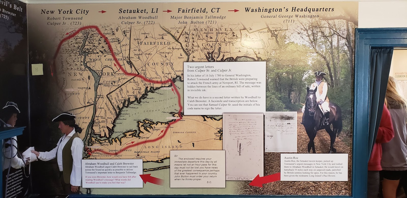
Picture 3: The letters from the city would be delivered to Setauket, NY and arrive at mark number 2 in this image at Abraham Woodhull’s farm. Each of the other dots signified a important player in the transferring of letters up the ranks.

Spy Techniques of Long Island’s Culper Spy Ring
by Meaghan Sullivan
On November 1, 2019, the Coastal Cultural Experience class visited The Three Village Historical Society’s exhibit on spies on Long Island during the American Revolution. This was a very exciting topic to learn about, especially for the ones from Long Island, because we had no clue about this interesting part of our history. We learned all about the Culper Spy Ring, which was used to transport crucial information about the movement of the British to George Washington, that may have very well caused the Patriots to win the war.
The letters that were passed from courier to courier along the path to Benjamin Tallmadge, the creator of the spy network, and then to Washington, were extremely sensitive. If they were to ever get in the wrong hands, or found out about, it could have ruined the whole operation. For this reason, there were many precautions that were put in place to hide the information within the letters. One strategy they used was creating a codebook. This meant that letters, words, or numbers could be read one way, but then could be translated into something else with a key. An alphabet switch meant having pairs of letters that could be switched to spell out a new word. For example, based on the picture below GEV is translated to CAT. Numbers were also used to mean letters, specific words, or even people’s names or aliases. This meant that a seemingly boring letter from one friend to another could be decoded to hold secrets about war plans. Another tactic that was used was invisible ink. One form of this secretive writing used heat to reveal the letter’s hidden contents. This was proven to not be that great of an idea because that meant that anyone could reveal the writings. Instead of this type of invisible writing, a special solution was accidentally created by a physician and then used as ink, except this could only be revealed with another special solution. The contents of the solution were kept secret, therefore if anyone found a letter, it would be impossible to show message. The message was often written in between lines of the fake letter, so that it could easily be read once revealed.

This museum was a great experience for the class because it showed a side of Long Island and the American Revolution in general that we were not taught about when we were younger. It was amazing to learn about the inner workings of the spy network that occurred right where we go to school today. We even got to write a few secret messages of our own using lemon juice.
Setauket Spy Exhibit at the Three Village Historical Society
by Tessa Reynolds
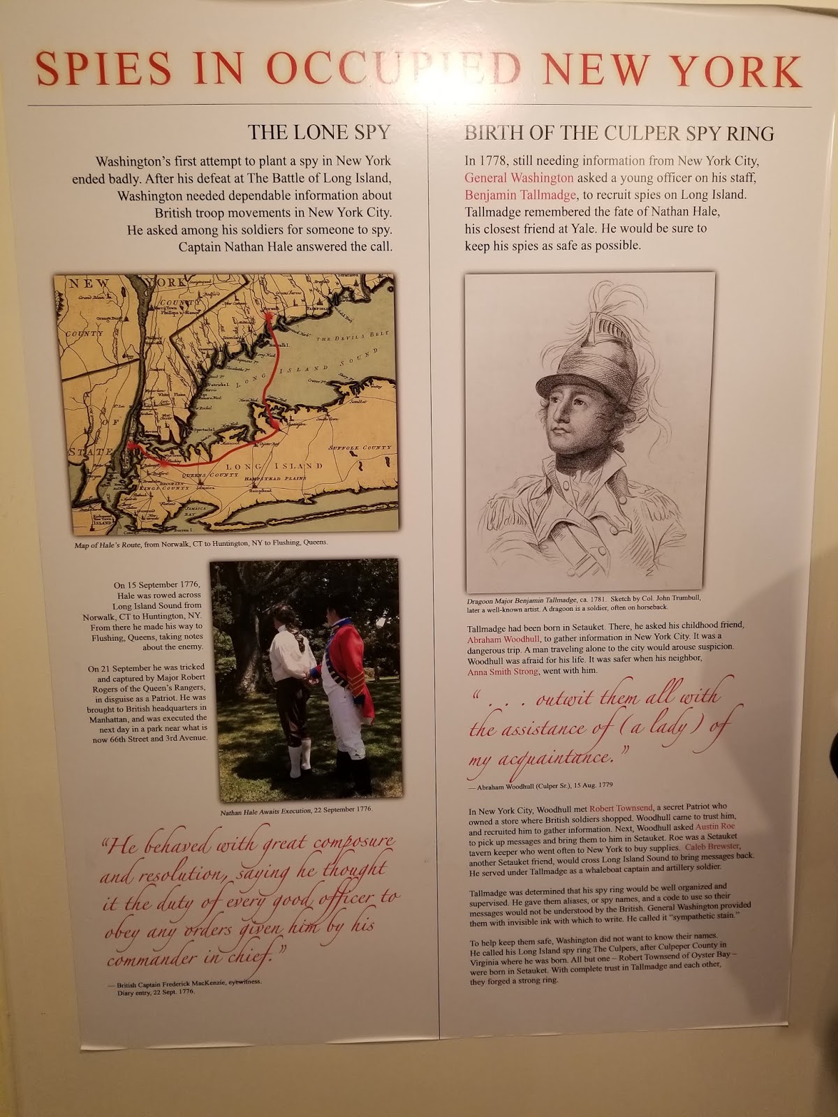
(Credit to the Three Village Historical Society)
George Washington knew that to win the Revolutionary War the colonies would need information on the British movements. When Washington asked around to find someone willing to spy on the British, the first person to volunteer was Captain Nathan Hale.
Hale went to New York City on July 15th, 1776 and made maps of the city and took notes on the British for General Washington. Hale spent a few days in the city before being captured by Major Robert Rogers, a British soldier who disguised himself as a Patriot. Major Rogers turned Hale over to the British headquarters in Manhattan and Hale was executed the next day.
Hale’s last words were supposedly “I only regret that I have but one life to give for my country”, which is actually a paraphrase from a Greek play. A firsthand account by British Captain Frederick Mackenzie claims that Hale went to his death with composure, stating it was his duty to obey the orders given to him by his commander in chief. This differs from the story passed down of his last words, hinting at how the Revolution was romanticized.
After Nathan Hale’s failure in 1776, Washington did not set up a spy ring based on Long Island until 1778. The new attempt was run by Benjamin Tallmadge, who was close friends with Nathan Hale during their time at Yale. The fate of Hale influenced how Tallmadge managed the spy ring and led to him working to keep his spies safe.
The Battle that almost ended the War
by Maxwell Bazante
The Continental Army led by President and General George Washington fought the first and largest battle in the American Revolution in August 1776 against Major General William Howe. This was about a month after the signing of the Declaration of Independence. The British Army invaded Brooklyn as a strategic attempt to turn the tide of the war. Britain attempted to take over New York and to isolate it from the colonies. A defeat of the Continental Army could have easily forced their entire army into surrender.

During the Battle of Long Island, the Continental Army was severely disadvantaged by the most powerful and best-equipped army in the entire world. There were about 20,000 British soldiers fighting about 10,000 American soldiers. Washington’s men had very little training and ammunition compared to the British. The American army did not even have a standard issue uniform at this time.
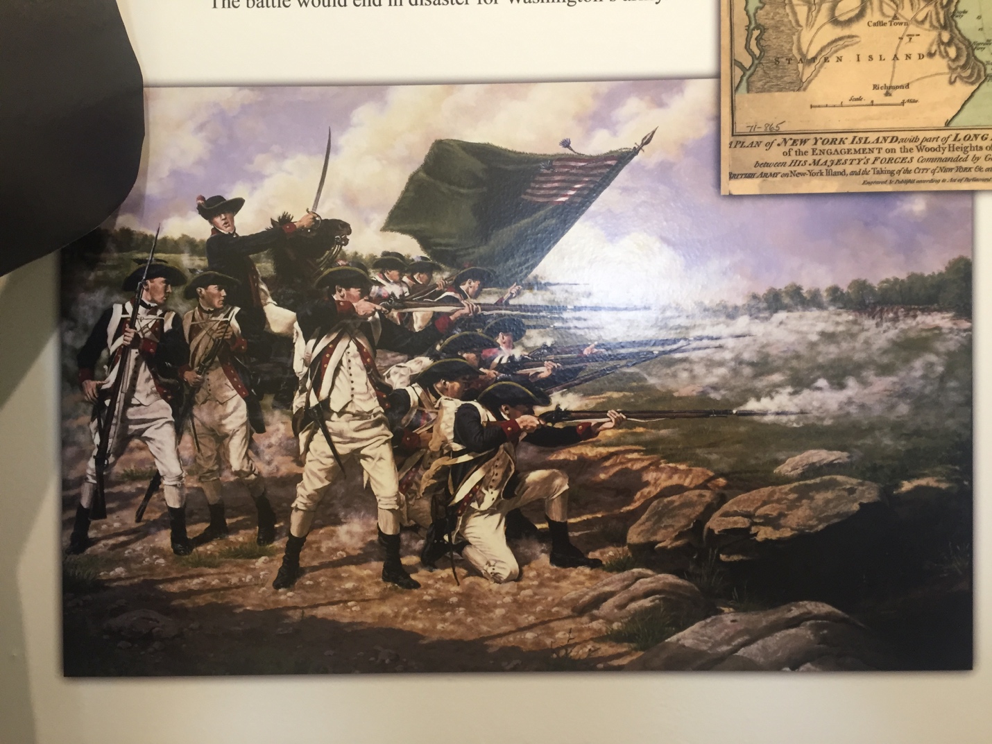
After about ten weeks of battle Washington led his men to escape after crossing over the Hudson river and fleeing into Pennsylvania. The British Army were victorious and successful in taking over New York. Washington and his men wouldn’t come back to New York city for the next seven years.

Three Village Historical Society
by Tyler Rodriguez
One of the places we visited on this week;s trip was the Three Village Historical Society in Setauket. We visited the SPIES! exhibit, and this blog post will be about one critical aspect of said exhibit: primary sources. So what exactly are primary sources? Primary sources are documents created at the time period which is being studied by a historian. This can include letters, personal diaries, journals, photographs, and artwork. These sources are critical to historians as they allow for insight into what was happening at a given time period through the eyes of the people who were around during that time period. One must always view primary sources with a critical eye, as they can be biased or inaccurate. It is up to the person analyzing these documents to determine what information is true, useful, and factual.
The vast majority of the SPIES! exhibit utilized primary sources as the information reference. Direct quotes from primary sources such as the one seen above were used heavily in the exhibit. The means of procuring these documents is also worth mentioning, as some documents are in places such as the National Archives. These sources hold significant power, as they are some of the few remaining connections to the time period covered in SPIES!. I as an aspiring historian am particularly interested in primary sources because they provide information that could have otherwise been lost to time. It is also very interesting and fun for me to determine what in the primary sources is relevant and factual, as the lines between fact and fiction can become very blurred through time. SPIES! was an excellent exhibit that exemplified the usefulness of primary sources.
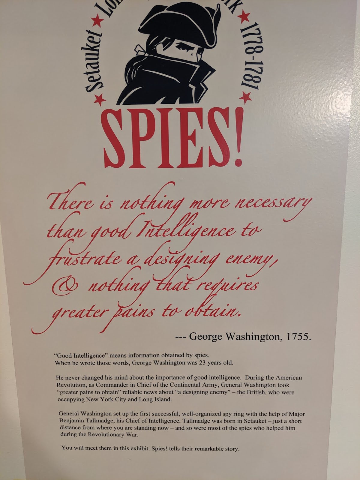
Is Whaling the Right Industry for Your Community?
by Josh Whitehead
For our last field trip, we went to Setauket and Port Jeff, to learn both about the communities during the American Revolution and their role as spies during the British occupation of Long Island, and their culture as a sea faring community. It was a chilly but sunny day which was a welcome break from the past week of being rainy and dreary, excellent weather for a waterfront talk from Tara.
During this Tara explained how Port Jeff came to be as we know it today, and not as it was in the beginning when it was called Drowned Meadows, due to the very swampy land. Named after Thomas Jefferson, Port Jeff was solidified by its inhabitants to become a town. The land once solidified was very productive for them as it allowed them access to Long Island Sound, the harbor for trade and the waterways for fishing, but more importantly whaling. Whaling was a lucrative business and before being commercialized it would be a community ordeal. You would’ve had spotters, often yelling to the men who would go hunt the whale, who would take off immediately in their boats. In near shore whaling these boats would be smaller and would have to be rowed back into shore once they got their whale. Once back the whale would be processed and the men would parade around town showing off the whale bits they have on them from their hunt, apparently this was found to be appealing, to each their own I guess.
Whaling, for Port Jeff was like the car companies for twentieth century America. It was a huge industry that fed more jobs and skills that were all necessary for successful whaling. From whaling you supported jobs like carpentry, blacksmiths, coopers (barrel makers), sail makers, and the sailors themselves. The whale these men were after were called the right whale, a slow-moving large whale with lots of oil. These reasons led it to being named the right whale, as it was the right whale for them to hunt, even in the 1700s there were dad jokes. These whales could fill sixty barrels with oil of which could be sold or used for the village. Whaling made the town boom, but just as with the car manufacturers, when the productivity dried up the town suffered as well. When whaling left Port Jeff, there was a large gap that needed to be filled, which they tried to by bringing in watchmakers that wasn’t very successful.
 |
|
Port Jeff was also known for shipbuilding, this monument depicts the men who would build the boats that the whalers would use.
|
Port Jeff eventually saw that tourism was going to be the best industry to replace whaling, as they had beautiful waterfront property and natural surroundings. Everything the rich New York City socialites were trying to escape. This movement towards tourism earned Port Jeff and surrounding areas the name “the gold coast”. There are some parallels culturally between the whaling and the tourism that replaced it, mainly in the diverse crowd that both brought in. People from all backgrounds were involved with whaling and the same is true for those who come for the touristic side of Port Jeff.
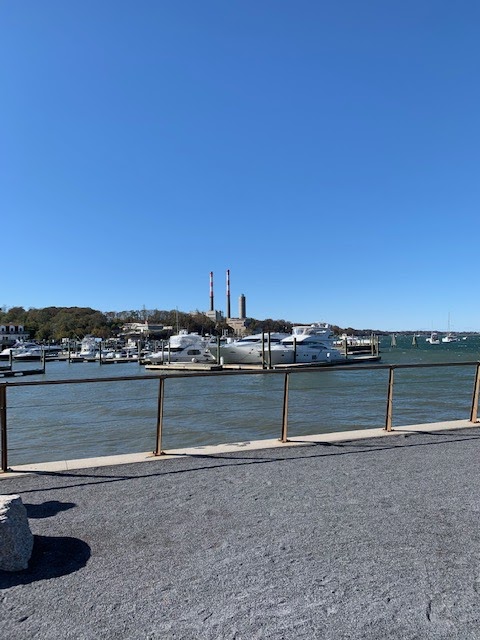 |
|
Port Jeff’s water front and access to long island sound makes it a popular summer spot for people to dock their boats.
|
George Washington, MAR355, and SPIES! Oh My
by Kristi Flanigan
When I think of the Revolutionary War, I don’t think about spies, or a young George Washington creating a spy ring. I don’t think about young men wracked with anxiety from the high stakes situations they took part in. I don’t think about the women who might have clandestinely helped by applying a code to the way they hang clothes out to dry. I think about the Boston Tea Party, and about a bunch of wars and battles and dates I had to try memorizing in grade school, as much as I hate to admit it. But that’s the wonderful thing about Coastal Cultural Experience – the class really takes you to places you might not have even realized were nearby where you’re already going to school. This class brings so much culture and history right to your doorstep. It encourages you to rethink what you know, and to really appreciate the significance of the ground you’re standing on. Take George Washington, for example. I, for one, learned so much about him that I wasn’t aware of when we visited the SPIES! exhibit at the Three Villages Historical Society.
It’s easy to picture George Washington as older, with a white wig and wooden teeth. Maybe you’ve paid in cash for something and watched his face silently judge your financial decisions. But he was actually age twenty-three when he said, “there is nothing more necessary than good Intelligence to frustrate a designing enemy, and nothing that requires great pains to obtain.” Not only is 23 quite young to be thinking so strategically, but it is also quite young to have the experience that lead him to that quote — that was knowledge he probably gleaned from the French and Indian War (the quote is from 1755). It was this knowledge that preceded his creation of a spy ring right here on Long Island during the Revolutionary War.
What’s important to keep in mind when revisiting what you know about history (in this case, George Washington) is to sort folklore and mythos from reality. Consider the cherry tree story about George Washington. That never happened – it’s merely a story to commend his character. It’s important to make note of folklore and why it came about, yes, but it’s also unfortunate the it was the cherry tree story taught in grade school, instead of something truthful and inspiring and honest about how young George Washington was when was living a life that would lead to presidency. Not to say that he was a person without flaws, for the record, just that showcasing his actual accomplishments might have left a bigger impression on grade-school me. The SPIES! exhibit did a wonderful, fascinating job of piecing stories together from primary source documents. That’s the takeaway here, I think: learn from the source, and never hesitate to dig deeper. Look around! The stories might surprise you.
Coastal Cultural Experience: Greenport & Southold Indian Museum
Southold Museum, Greenport, and the Development of the Long Island Railroad
by Nancy Liang
Usually on our Friday trips, I fall asleep in the back of the van until we reach our destination. On this trip to Southold, I stayed up to admire all of the picturesque little towns and vineyards that we drove past. Long Island has a sparse population made up of tiny clusters of houses spread far apart from other communities. The island is split at the end and made up of a northern “fork” and a southern “fork.” For this field trip, we drove from our campus on the South Fork to the town of Southold on the North Fork of Long Island. We stopped at the village of Greenport within in Southold and sat down at the amphitheater to learn a bit about the development of Long Island.

The North Fork of Long Island was settled by the 17th century. It had access to the Long Island Sound, which was a calmer and more protected body of water than the Atlantic Ocean. The Sound connected to New York City, which made port towns, such as Greenport, very popular docking places for ships coming into the Eastern Seaboard. By the late 18th century to the early 19th century, Greenport’s economy depended on shipbuilding and maritime trade. Merchant ships often docked at Greenport and offloaded products for local communities before continuing onwards to New York City. Now, Greenport’s docks generate more income from tourism than from commercial shipping. Occasionally, tall ships and other historic boats (including a replica of a Viking boat!) dock at Greenport. In this picture, you can see a fire boat. In the background of the picture to the right of the boat is Claudio’s, a restaurant that was involved in the alcohol smuggling rings during the Prohibition Era.

Aside from ships, the Long Island Railroad also stops at Greenport. Greenport houses the Railroad Museum of Long Island.

Although we did not visit that museum, we did have the opportunity to learn a bit more about the creation of the Long Island Railroad. The Long Island Railroad (LIRR) is the largest commuter railroad in the United States. It is also one of the earliest railroads developed and one of the most disorganized and inefficient transportation systems in the United States. It was built in the 1860s and opened in 1884 as a way to travel between New York City and Boston. The train was much faster than horse and buggy transportation, so people could take the ferry from Manhattan to Brooklyn, take the LIRR out to Greenport, and then take a ferry up towards Boston. With the development of better technology, trains could go over hills and take tighter turns, and it became easier to take trains straight from Manhattan to Boston without taking the LIRR to Greenport first. The LIRR lost revenue and went bankrupt seven times by the 1940s. Instead of transporting people, the railroad began making deals with farmers on the eastern end of Long Island to transport their products into the city. Because of this, most LIRR tracks radiate out from the city with very few interconnecting trains to link different railroad lines together.
It was very interesting learning about how the history of Greenport affected the development of the local community and the ships that dock there today. I also enjoyed learning about the creation of the Long Island Railroad. I take the LIRR from my home to college, and I have never really thought about the reason behind why all of the different rail lines don’t link together.
Soapstone Pot: An Indicator of Native American Lives and Cultures in Archaic Period
by Joanna Zhu
Without any prior knowledge of rocks, what came to mind when you first heard of Soapstone? When I first saw soapstone pot on display in Southold Indian Museum, I thought it was something the natives used for bathing because of its name. However, it served the same function as our pots in the kitchens: for cooking. Soapstone, also known as steatite, is a type of soft and heat resistant rock; which was perfect for the natives to carve out pots and bowls from during the Archaic Period. The nomadic tribes would bury the soapstone pots underground and retrieve them once they return to the same area, so that they do not have to carry these heavy items while migrating.
The museum has a fabulous collection of these soapstone pots and bowls. Most preserved very well from being buried underground and were discovered by local farmers when plowing the lands. Many of the soapstone pots and bowls have drilled holes on them. Why would the natives drill holes in their utensils? Holes on the sides were probably holes used to repair cracked pots; leather strap was likely used to hold the pieces together through the holes. What about the holes on the bottom? If our pots or bowls have holes on the bottom, that meant their lives as utensils ended, and this was the same for the natives. They ceremonially killed the pots and bowls by drilling these “kill holes” through their bottoms when the owner died. The natives believed they released the spirit from the utensils through these holes, and now they are ready to be buried with the owner so that the spirit can follow the owner to the afterlife. From these everyday items, we can remake what life and culture was like for these Native Americans 3000 years ago.

Picture 1: Many soapstone pots and bowls dated back 3000 years ago were dug up in Long Island. The middle right pot showed a large crack down its side, holes next to the crack, and traces of a strap through the holes; this indicated repairment was done by the natives. (photo permission of Southold Indian Museum)

Picture 2: Some fragments of soapstone pots and bowls were found. The upper pot showed the “kill hole” on the bottom. It was ceremonially killed and was likely buried with the owner as part of Native American practices and beliefs. (photo permission of Southold Indian Museum)
The Native American Tradition of Wampum
by Charlotte Brennan
At the Southold Indian Museum, there was a great display on the background of Wampumpeage, the Algonquin word for “a white string of beads,” often shorted to wampum. These beads were woven into intricate designs that represented past events, stories, laws, and ideas important to the Native Americans. According to the display at the museum, wampum was used for meetings, to elect chiefs, for adoptions, in ceremonies, for treaties, deeds, gifts, mourning purposes, and as decoration. However, one interesting fact that I didn’t know before was that until contact with the European settlers, it was never used as currency.
The European settlers began to appropriate wampum as currency in the 17th century because their home countries wouldn’t let them use gold and silver to make coins. The colonists then decided it was a good idea to continue the Native American tradition of wampum for their own purposes. In addition, the white beads were very plentiful compared to gold. Colonial leaders started to assign specific monetary value to the beads. For example, according to the museum display, six white beads equaled one penny.
However, wampum wasn’t a perfect currency. It had to be traded in strings so that the person receiving it could make sure that it was good quality. This meant that the wampum had to be bored through the center. Also, Native Americans were particularly strict about the quality of the wampum and would refuse beads that they deemed substandard. This created a problem when colonial governments received poor wampum that the Indians wouldn’t accept.

Courtesy of Southold Indian Museum
Here are some examples of wampum beads that were typically used. You can see how small they were and how there’s a whole right through the middle. This display also includes disc beads which were an earlier form of wampum and were significantly larger than their successors. On the right, is a shell that would be eventually made into wampum. This is really interesting because it’s cool to imagine how they took a large shell and divided it up into tiny beads.

Courtesy of Southold Indian Museum
Here are some necklaces made of wampum beads that I assume would not be used for monetary purposes but more of the ceremonial or ornamental uses that were originally done by the Native Americans. The “unusual” necklace on the right is especially interesting because, at first, I thought the pointy shells were shark teeth. It shows how diverse the wampum shells were and how many cool, different shapes you could make them into.
Primitive Weapons of Native Americans
by Brendan Hallinan
At the Southold Indian Museum, we saw a large collection of points and weapons used by native peoples. The most notable of which were the Clovis point, Folsom point, and the Atlatl. The Clovis point is a fluted point that was fixed to the end of a spear for the hunting of megafauna in North America. This style of point dates back to the Clovis people (8000-1000 b.c.) who are believed to have migrated to N. America from northeast Asia. It is very interesting to learn how historians have traced the migration of people across the continent through the modifications in their hunting tools. The oldest Folsom point for example was discovered in the south/Midwest and dates back 6000-8000 b.c., coinciding with the die off of the megafauna of N. America such as the mammoth. So, from the change in style of spear point we learned a few things, how quickly these wandering people moved from coast to coast, what they were hunting, and what path they took. By tracing the discovered points’ locations and ages it is believed the Clovis then later the Folsom cultures moved down the west coast to modern day Mexico then into South America and east through the southern states and up the east coast. This route helps to explain why the west and Midwest have much older artifacts and native culture than the east and specifically Long Island.
Another fascinating artifact on display at the Southold Indian Museum is the Atlatl. The Atlatl is a primitive weapon that predates the bow and arrow and is likely a precursor to it. The Atlatl utilizes a long, weighted shaft with a small point that resembles a modern arrow. A short stick with a counterweight is used to launch the Atlatl point upwards of 100 yards (pictured). The hunting weapon required a running start and good coordination to keep the shaft parallel to the ground for a good launch. It is a simple tool to construct and requires less material and engineering than a bow and arrow. The shaft weights of the Atlatl spear became a cultural art where they would have ornate sculpting that made them a decorative piece and an ineffective as a practical weight. This suggests the Atlatl’s importance to Native American societies.

Picture 1: The Clovis and Folsom points are pictured in the center of the image. There is a distinct difference in the shape of each as well as similarities between the two fluted points. Surrounding these two points are other points used throughout N. and S. America by various native peoples. Photo by Brendan Hallinan, Credit to Southold Indian Museum.

Picture 2: Pictured here is the Atlatl handle with its counterweight. The handle and twine used to attach the weight are made from organic material and decay shortly after being buried. In the background is a modernized version of an atlatl spear with feathering instead of a rock weight. Between the handle and modern shaft is an example of a traditional spear which had a sharpened rock point attached by string or twine. Photo by Brendan Hallinan, Credit to Southold Indian Museum.
Long Island Native American Food and Agriculture
by Jeffrey Kraemer
On our trip to the Southold Indian Museum, a couple of the cases about what they ate and growing and gathering food in the Long Island area peaked my interest. I saw that one of the most important systems in growing their food was the concept of the ‘three sisters’ where corn, beans, and squash were grown together to maximize productivity. The corn provides shade for the squash and structure for the beans, while the beans supply nutrients back into the soil, and the squash deters herbivores. Consuming all of these food items together provides almost all the nutrition humans need. Besides food the husks from the corn served other uses like making cordage, starting fires, and wrapping things to cook. In addition to the growing of these crops they gathered things like nuts, berries, sap, tea, seaweed, honey, mushrooms, and onions to name a few.

Picture 1: This picture shows 2 sides of a display case in the museum talking about growing and gathering food in Native American cultures on Long Island. Some examples of food and materials used to prepare the food are included. Credit: Southold Indian Museum.

Picture 2: This picture shows some of the seafood that Native Americans would have eaten on Long Island. Most of the items shown in this picture came from middens, or shellfish garbage pits. As the organisms were eaten the shells were just thrown onto the pile which stacked up for generations, and then was buried under sediment. Some animals that are eaten today are included in this example like oysters, scallops, clams, and lobster. But evidently the natives also ate things like welks, turtles, and sturgeon; most people today would not consider these items food. Credit: Southold Indian Museum.

Picture 3: In this picture the land animals that the Natives on Long Island ate are shown. These animals include deer, rabbit, turkey, bear, and beavers. These bones and teeth would also be tossed into the middens as garbage. The most striking item in this display however is the size of the lobster claw on the bottom; one that size could have taken off a limb if someone wasn’t too careful when handling it. Credit: Southold Indian Museum.
Southold Indian Museum Trip


Greenport and Native American Museum
by Mateo Rivera
It is speculated that the first native American people, going by the name of the Clovis, set foot in North America at the same time Mammoths were still on Earth. They arrived through the Bering land bridge that formed between modern day Alaska and Russia. The Clovis people used what is called an Atlatl to hunt very large megafauna like Wooly Mammoths. This is due to the fact that they could launch a spear at a football fields’ length. The wooden handle is used to launch the spear and a counterweight keeps the pole balanced allowing a longer throw. Picture copyright ©Southold Indian Museum

Native people had to be innovative in order to survive off of the land for so long. We have modern machinery to help us create certain tools like the ones shown above, but these tools were the first that were handcrafted from nature and by the natives. The comparison between modern day tools and those of the natives display how they paved the way for technology to evolve and still be a part of our daily lives today, just as they were many years ago. Picture copyright ©Southold Indian Museum

It is most likely that you would find native tribe to be located near moving bodies of water such as rivers and lakes. There had to be a way for the people to get around from place to place quickly and to go out to fish. The dugout canoe was created by taking a whole tree trunk and hollowing it out so that people could get in it. It worked so well because other materials weren’t necessarily needed to tie the boat together and support it. Above displays only a fragment of a dugout canoe and how it looked like back then. Picture copyright ©Southold Indian Museum

Southold Corn
by Tyler Rodriguez
On this week’s trip, we went to the Southold Indian Museum. One exhibit in particular caught my attention, and will be the subject of this blog post: corn. Corn is significant in the history of the world due to its versatility as a nutrient source. According to the museum, “before European contact, the Indians had developed the five major types of corn: flint, dent, flour, sweet, and popcorn.” The exhibit continues by saying that within 50 years of the European contact with the American continent in 1492, corn was in cultivation all across the world. In the five centuries since the European contact with the Americas, corn has become a global staple. This is not by accident, as corn can be used as a grain, a vegetable, and for flour. The image above shows various types of corn, as seen in the Southold Indian Museum.
In the display, it is interesting to see how each of the types of corn is different. Sweet corn and popcorn are the varieties I am most familiar with, and prior to seeing this exhibit I did not realize there was such a diversity of corn. This diversity does make sense due to the versatility of the grain. As the exhibit displays, modern corn was found as early as 2000 BC. I am particularly grateful for this development, as I am a huge fan of corn. I cannot help but wonder how the world’s history would have been different had corn not been developed by the Indians of the American continent.

Southold

When humans first entered the American continent, they did so by crossing a land bridge between Sibira and Alaska; and then proceeded to populate the rest of North and South America. Many tribes separated across the Americas, however, the Southold Indian Museum, really focuses on the collection of artifacts from the Indians that populated the northeast of North America, the Algonquin tribe.

Here is a typical medicine bag that the Algonquins’ Medicine Keeper would have with them at all times. Some items they would generally carry with them were herbs, eagle and hawk feathers, shells, stones, and even protective charms. The Medicine Keeper in native society could not only heal the sick but spiritually bring success during difficult hunting times, bring needed rain or even word off storms. I found it interesting that the purpose of the protective charms, was to not only protect the patient from death but to also protect the Medicine Keeper from becoming ill while tending to his patients.

Native American clothing was very unique and people are able to tell a lot about what they hunted based on their clothing. Natives did not waste any resources, after they would hunt and eat an animal they made sure every part of it was used for something; from the skins, furs, teeth and even their claws or talons. They would even use the bark of mulberry trees and turn that into a type of cloth for clothing, although they usually only turned to this when hunting was scarce.

Steatite pots, or soapstone pots, was the pottery used in the Archaic period; this was before ceramic pottery. These heavy pots were carved from soapstone, and the biggest source of soapstone back then was found in southern New England. This made people think that they either traveled or even traded for these pots. Because these pots were very valuable, many of them have signs that they were repaired, which makes sense since they were very fragile. As the Algonquin culture changed from the Archaic to the early woodland period the production of ceramic pottery began. The Algonquins learned use clay to form pots for various uses. Unlike the soapstone, the ceramic pottery could be made with designs. Pottery was mostly made by women and the styles changed depending on what region they were in. They used shells, stone, and even bone to make designs on the pots; most patterns on pots were made by woven rope that was pressed into the clay.
Coastal Cultural Experience: Fire Island Lighthouse
Up and Around the Fire Island Lighthouse
by Tiffany Cui
If you’re going to visit the Fire Island Light House, it’s expected that you should climb it! And we did, up and around the rickety metal staircase we went, right to the top. When climbing the steps, there are 4 window landings where you could take a moment to catch your breath and read up on some trivia about the lighthouse, such as the lighthouse being constructed from the inside out, and differing wall thickness between each window landing.

In this first picture is the First Window Landing at step 26, and a wall thickness of 8 feet. Like many other lighthouses, the structures are usually thicker at the base, giving it an overall tapered shape.

Pictured above is the Second Window Landing, and in this photo is the building that houses the original first-order Fresnel lens used by the lighthouse. It was built in 2011, specifically to display the lens that returned from storage at the Franklin Institute in Philadelphia, PA.

In this third photo is the view from the Third Window Landing. You can spot a red-roofed building, which is the National Park Service Ranger Station.

Here is the Fourth Window Landing. At this point, you would’ve climbed 104 steps, which is almost to the top! You will notice another red-roofed building, slightly cut off due to the windowpanes in this photo, which the Boathouse. It is not the original however, as the first one was destroyed in a hurricane in 1938 and was rebuilt a year later.

Finally, we reached the top! It was very windy, but the view was amazing, especially on this day since the weather was clear enough to out super far. You could even spot the Freedom Tower in Manhattan (not pictured), located about 42 miles away from the lighthouse.
Fire Island
by Tyler Rodriguez

During our beach lecture on Fire Island, Professor Tara discussed the formation of communities on Fire Island. In order to understand this, it was explained that Fire Island is a barrier island of Long Island, meaning that it is made of sand and changes with tides, waves, and currents. In short, the island is not a permanent feature on a geologic time scale, rather it is a fluid thing. Historically, barrier islands such as Fire Island have not been home to permanent settlements. Native Americans in Long Island had used Fire Island for gathering food during certain times of the year, but they never lived on the island. Nor did early European settlers. It did, however, have a lighthouse that is pictured above, constructed in the nineteenth century. It was not until the establishment and development of New York City as a metropolis that Fire Island was seen as a place that could be settled. By the early twentieth century, with the rise in popularity of the Hamptons to the east, Fire Island was settled as an escape from the pressures of city life.
Professor Tara emphasized the culture of Fire Island and how it differed from the Hamptons. While the Hamptons were (and still are) associated with wealth and class, Fire Island was seen by many as a refuge from societal pressures. For example, it became home to a thriving LGBTQ community as it was the only place people were free to be openly queer in the early twentieth century. In the present day, Fire Island is still a very popular summer vacation destination, although the island is home to a few hundred permanent residents.
Fire Island
by Jeffrey Kraemer
While at the Fire Island Light House we were able to experience the full extent of longshore drift. In the past the light house was right on the western edge of the barrier island but now is five miles from the inlet. Where the picture of the light house was taken would have been right about where the water of the inlet started but now it is shrub and marshland. The predominant current in the longshore drift is westward, so sand from the rest of fire island and other places on the south shore east of fire island are losing sand on their beaches through erosion. This sand is then deposited at the end of barrier islands in spits and extends the island westward while the eastern end is getting smaller. This can be seen in the two images from the museum under the light house. Today the island is not getting longer due to the inlet being dredged, but the rest of the island continues to be eroded.
To combat this erosion, the beaches constantly need to be replenished. Sand from other areas is trucked in and deposited on the beaches. Millions of dollars are spent every year to replenish these beaches to keep them suitable for tourism. But it is also important to keep the island health for the organisms that have come to live there to escape the urbanization of the rest of long island. Although the debate now is whether to continue replenishing the beaches at an increasing rate or to save the taxpayer money.

Picture 1: This is a view of the fire island light house on its western side; the white and black day marks are especially prominent in this photo. Although it is not the original construction, it uses the same materials and was moved only a few yards to the east.

Picture 2: This image shows the early progression of the spit on fire island after the light house was built in the years 1825-1867. For many years after this the light house will become further and further away from the inlet that it was built to signify.

Picture 3: This continuation of the previous image shows the later progression of the spit on the west edge of fire island from 1909-1955. This depicts the furthest point that the island will reach, but the shape of the tip continues to change due to erosion.
Fire Island After Hurricane Sandy: Damaged but not Destroyed
by Charlotte Brennan
After the devastating effects of Superstorm Sandy in Fall 2012, you would think that Fire Island, a vulnerable barrier island, would be very badly hit and take an immense amount of beating. While this is true, and the island is still recovering, the effects could have been much worse but preventive measures taken by the community saved them in the end. In Summer 2012, islanders agreed to a 17% increase in taxes to protect the dunes from tourists and deer.
Tourists and deer are both a huge threat to the environmental health of Fire Island because throughout its history, it’s never seen the number of people and deer that come in every summer. In order to help the dunes specifically, massive dune restoration was performed during the summer of 2012. This proved to be a saving grace for the island during Hurricane Sandy. Without this dune restoration, the effects of the storm would have been much worse and permanent damage probably would have occurred. Even though it’s not as bad as it could have been, significant damage was still done, which the island is recovering from even today.

Here are some pictures from the lighthouse museum that show damage that the island sustained during Hurricane Sandy. One of the most significant effects was that many of the boardwalks were destroyed, excluding the ones surrounding the lighthouse. However, the biggest damage done was to the beaches and dunes. According to an article on display in the museum, half of the beaches and dunes on the island were destroyed. But again, it would have been worse if it wasn’t for the dune restoration project that was done before the storm.

Here’s a picture taken from the top of the lighthouse. If you look closely, you can see that the brush areas between the trees are regions that were flooded and damaged during Hurricane Sandy that still haven’t recovered completely. This is a great visual representation of how the consequences of the storm are still present on Fire Island.
The Fire Island Lighthouse and Its Light
by Nancy Liang
What would a lighthouse be without its light? On our class trip to Fire Island, we had the chance to climb up the lighthouse and see the area where the light source was housed. After climbing the lighthouse, we had the opportunity to visit a nearby building and learn about the various light sources and lenses used over time to power the Fire Island Lighthouse. Even when our van was miles away from the lighthouse location, I could still see the flash of the light at the top every few seconds. When I went into the museum, I expected the light source to be enormous, but it turned out to be a regular electric bulb. What actually was gigantic was the Fresnel lens surrounding the bulb.

Here is a picture of the tiny lightbulb in the middle of this giant cage of glass for reference.

The Fresnel lens is made of large sheets of glass layered in a slightly boxy, egg shape around the bulb. The concentric circles of lenses help capture the light given off by the bulb and focus the rays to make the light stronger. The first-order Fresnel lens used by the Fire Island Lighthouse can be seen from 22 miles offshore! The museum has helpful displays of other lens types and information about them as well. This is a smaller, fourth-order Fresnel lens.

For reference, the fourth-order lens is about one-half to two-thirds the height of a person, while the first-order lens requires two viewing decks for people to observe it properly. And even then, the top of the lens still towers over the people on the higher observation level.
The museum was about more than just the Fresnel lenses; the building also contained an incandescent oil vapor (IOV) lamp.

The IOV lamp was introduced in 1908 and used until 1933. These lamps were three times brighter and twice as efficient as previous oil lamps. However, these lamps still had the risk of gas explosions, and they were replaced by electric bulbs in the 1930s. A smaller exhibit towards the side of the building held a Crouse-Hinds lens that was in use from 1949 to 1974.

The lens has two sets of glass reflectors and lenses, set off from each other at 90° angles. The offset double lenses allowed the light to flash every 7.5 seconds.
The trip to the Fire Island Lighthouse was very fun and informative at the same time. I enjoyed learning about the significance of the lighthouse and the development of the communities in Fire Island. It was interesting learning about the different light sources and methods of light concentration and reflection that the lighthouse used. The museum was very helpful in learning about how the lighthouse, and Fire Island as a whole, changed over time with the advancement in technology.
Migrating Monarchs in the Fall
by Max Bazante
 |
| Monarch Butterflies like to stay warm on the beach during the daytime. |
Fire Island National Seashore is about 30 miles of beautiful ocean property and shoreline. It is known for its laid-back small-town charm. Fire island is a large barrier island off of Long Island. Conservation of wildlife is very important here. This pristine and very well looked after beachfront acts a significant corridor for migrating animals including monarch butterflies.
 |
| Without many predators, the butterflies were not timid to say hello to our class. |
We visited the Fire Island lighthouse in perfect timing to be in view of a massive group of monarch butterflies who start their migration heading South from August-October. The butterflies make their stop in Fire Island to rest and feed on milkweed. Predators learn to stay away from monarch butterflies. They accumulate a toxin in their bodies as caterpillars from eating milkweed leaves which aids in their development into butterflies.
 |
| The Monarch Highway map inside the Fire Island Lighthouse building. |
Some of these butterflies have traveled over thousands of miles. These monarch butterflies we saw on October 4, 2019 will be traveling all the way to the Oyamel fir trees in the mountains of Mexico for the winter season. Butterflies don’t fly at night and they prefer to stick together to stay warm.
 |
| Found inside the Protecting Monarchs pamphlet inside the Lighthouse showing all of the monarch butterflies migration paths. |
Monarch Butterflies are the only insects that make such a tremendously long migration. The same Monarchs that migrate south will not return here. The ones we see in the Spring will not be the same butterflies we saw in the Fall. They will go through a handful of generations before returning up North. The monarch butterfly’s migration is one of the most well-known and exciting natural events in the world.
Coastal Cultural Experience: Montauk Lighthouse and Napeague Harbor
Ocean Exhibit at the Montauk Lighthouse Shares the Dismal Facts of Shark Finning and Whaling, But there’s Hope!
by Brendan Hallinan
During our September 27th trip to the Montauk Lighthouse on the eastern most point of Long Island the Coastal Cultural Experience class of SBUSH was reminded of the present-day tragedies happening to our whale and shark populations. It is very wildly known that Sharks and Whales are target for their fins, teeth, meat, and oil and that these industries are leading to devastating declines in both shark and whale populations. One of the things that the Ocean Exhibit at Montauk Lighthouse Museum does a fine job of is education the public of target problems that are leading to the continuation of the Shark Finning and Whaling industries.
A placard in the entrance to the exhibit informs that while shark finning is banned in the United States, the trade and sale of shark fins is legal. By banning the hunt but allowing the trade of shark fins the US has done nothing to reduce the impact of finning on shark populations, all we have done is encourage other nations to export fins to the US. There is a push to pass the Shark Fin Trade Elimination Act in congress. As of September 18, 2019, the bill has been ordered to be reported by the Yeas and Nays with 16 for and 13 opposed to the bill in the subcommittee in its current form (https://www.congress.gov/bill/116th-congress/house-bill/737). This bill would ban the sale and possession of shark fins nationwide and thus remove all US demand from the shark finning market. It is a good step towards protecting our shark populations worldwide.
The other major industry that this exhibit elucidated was the whaling industry and how the Right Whale population of Long Island is doing today. Whaling is historically a huge trade for long islanders. Sag Harbor and Sagoponack were part of the largest whale oil trades in the state in the 17th and 18th century, and the Montauk Lighthouse relied on 450+ gallons on whale oil a year to operate until the Oil Vapor Lamps replacement by electric lights. The exhibit featured 450 Right Whales painted along the floor of the fog house building representing all members of the remaining population. With a gestation period of 12 months and one calf per pregnancy coupled with a first reproductive age of 10 the Right Whale needs long periods to recuperate its population (https://www.fisheries.noaa.gov/species/north-atlantic-right-whale). As of late 2018 there were 3 mortalities and no births recorded, meaning a further decline in the population. There have been 3 calf sightings in 2019 which should be added to records at the end of the year. Threats that whales are facing today include vessel strikes, being caught in fishing gear, and underwater noise pollution which interferes with whale communications, long distance travel, and hunting.
The Silver lining to this is that through research and education we can spread awareness of the endangered or declining populations of whales and sharks and encourage legislation and human practices that reduce our impact. The use of shark fins is declining in younger generations and the consumption of whale and shark product is tabooer than ever before. Groups such as OCEANA, who provided the information for the ocean room at Montauk, are helping to pass new scientific research on to the public which can lead to the support for appropriate legislation and shifts the cultural importance of products that are not sustainable.
 |
|
Pictured is the 450 painted Right whales on the floor of the old foghorn building by Miles Partington. Each image once represented a Right Whale in the wild but today the painted whales outnumber the real ones.
Photo by Ana Noel, Sept. 2019 |
Erosion, Changing Life as we Know it
by Katelyn Castler
Erosion is a natural occurrence that occurs just about everywhere on earth. The slow process is not always noticeable to the eye. But within a few decades, where you thought there was land, may have disappeared. The natural phenomena has been a great problem for Long Island’s historical symbol; the Montauk Lighthouse. When the lighthouse was first constructed in 1796, there was about 300 feet between the light house and the ocean. Today, due to erosion, there now exists less than 100 feet.
 |
| Figure 1. Replica of the Montauk light house in 1796. (Notice the vast distance of land between the lighthouse and the coast. |
 |
| Figure 2. The light house on Septempber 27th, 2019. Over 200 years have past and the coastline has significantly been washed away. |
Erosion occurs by waves hitting the coast, wind along the land, and even precipitation. To start, the ground underneath the lighthouse consists of different layers of sediment. The sediment is layered similarly to this order; soil, clay, sand, maybe more clay, rock, ect.. When the wind and rain hit the island and run down towards the coast, they carry along these sediments. The waves will then pick up the sediment and carry them along further west along the southern coastline of Long Island.
Giorgina Reid, a Long Island local, recognized the erosion problem in 1970. She came up with an idea to stabilize the Long Island coastline with a system of terraces. These terraces would prevent sediment from washing off the coast into the sea. The terraces were built with reeds which act as a seal, preventing sand from sifting out. They also hold the soil together with their roots. Her project took about 17 years to complete. Her terraces were a great success. Now today she is celebrated in the Montauk lighthouse museum as the one who saved the lighthouse.
 |
| Figure 3. An image of the reeds used to protect the sediment from erosion. |
Renovations to the Lighthouse
by Claes Christian Rozenveld

Photo 1 (Lighthouse circa 1796)
When the lighthouse was first built in 1796, it had only the bare necessities. Having just the lighthouse and the keeper’s dwelling on the property, it was very low tech compared to today. At the time, the tower was 297 feet away from the edge of the bluff.

Photo 2 (Lighthouse circa 1860)
After 64 years of the lighthouse being in its original state, it was finally given upgrades. A new house was built onto the base of the lighthouse, and the tower was built taller to accommodate the introduction of the Fresnel lens.

Photo 3 (Lighthouse circa 1903)
In 1903, the first Fresnel lens was replaced with the 3 ½ order Fresnel lens. The Day Mark was also added, which is a way of differentiating the lighthouses. A wireless telegraph station was also built at this point.

Photo 4 (Lighthouse circa 1943)
During the Second World War, a camouflage tower was built to the side of the lighthouse. This tower was used by the military as a protection of sorts against any damage being done to the lighthouse. A gun bunker was built to the south and was equipped with cannons and other weapons for defense. A fishing pier was also built to facilitate surf casting.
Exploring “The End” of Long Island
by Arthur Cody

The first site of our trip was the montauk lighthouse. Montauk itself has often been referred to as “The End” as its the farthest east point on Long Island before the Ocean. The point has also been known as a place that marks the end of Journeys. Whether it was a voyage at sea for whaling, or as a symbol that welcomes immigrants to America, the Montauk Lighthouse stands as a light to sailors on dark nights.

The picture above shows the remains of a building that used to sit at the top of the cliffside of Montauk Lighthouse. It was knocked down the cliff due to the instability of the ground around it and flipped upside down as it fell. It is an example of how strong the erosion is at Montauk.

When we had finished our discussions and trekking at Montauk, we stopped at the Napeague bay overlook. Which gave us a view of Napeague Bay and Harbor. This area has the thinnest stretch of land on Long Island that disconnects the Ocean from the bay.

The beach we stopped at was located right across from the Walking dunes, an area in which large piles of sand, upwards of 50 feet, are piled up due to the angle at which the winds push sand into that area. This beach is more orange looking than most due to a higher than normal concentration of Iron in the sand. This harbor is also known to be an excellent are for seagrass beds and has recently been involved in seagrass restoration.
Montauk and World War 2
by Lucas Wong
This past Friday, we went to “The End”, Montauk Point. We explored the lighthouse and had a lecture on the history of it. The light house was built in 1796 and continued to be used until today. When World War 2 started, the US Army took over the light house. They built a tower to look out for German battle ships and submarines.

Montauk Light House (right) and the watch tower (left).
Next to the lighthouse, the Army opened Camp Hero in 1942, a military base that had two small bunkers with two 16 inch guns in each. They also had a bunker with two smaller 6 inch guns. The bunkers were buried underground for more camouflage and protection from any attacks. Camp Hero was built to protect New York from being invaded. If the watch tower saw any German ships, they would notify the bunkers and they would shoot the ships down.

The old bunker that held the 16 inch guns now rests at the bottom of the sea wall around the lighthouse.
Post World War 2, Camp Hero was decommissioned. Due to erosion, one of the bunkers were showing. They hosed the layer of dirt below the bunker and brought it down. The bunker can be seen today when you walk around the lighthouse. There were rumors of the military running secret experiments. A show was created, called Stranger Things, based on the rumors of the experiments.
Montauk Lighthouse Blog Post
by Sandra Reyes

Lighthouses in themselves played a very important economic and social role during the time of the colonies. The Montauk lighthouse was approved by President Washington in 1792, who at the time represented the New York Chamber of Commerce on discussions related to the construction of the lighthouse. Since trade with Europe helped the economy in a positive way, Washington believed that, with the help of the lighthouse, New York would become a major spot for national trade with other countries. The main purpose of the lighthouse was to guide ships towards the harbor, but it also warned ships when they were getting too close to land on dark, foggy or stormy nights.

The site for the montauk lighthouse was purchased for $250 and consisted of 13 acrs; the purchase was approved by Washington. The whole project took 5 months to complete and by 1797 the lighthouse keeper lit the candles for the lamps in the tower, thus making it operational. It was kept under civilan command until World War II when the united states army took it over as part of the Eastern Coastal Defense Shield. In 1942, the US army even built a watch tower next to the lighthouse to be able to watch for germans attempting to reach the coast; which consisted of two 16-inch gun batteries of two guns each, and a battery of two 6-inch guns. The lighthouse tower itself was originally all white and its single brown stripe was added in 1903 to make it easier for ships to recognize it; as well as also this being the year they changed the lens to make it easier to see from farther away.
Coastal Cultural Experience: Sag Harbor Whaling Museum, Custom House, Wharf
Community Connected Together Through Whaling
by Katelyn Castler
Shore whaling was an important part of the Long Island community in the 1700’s. The whole community would come together to help capture these magnificent creatures. They brought great profit and materials to the community which is why it is such a big effort. Whales could be used for candles, oils, soups, and even lubricants. The whaling process starts out with children. The children, especially in the fall season, would wait along the coastal banks of Long Island. They were looking for sightings of whales. Once a whale is spotted, they would shout out to the town and anyone that could hear that they found a whale. Seamen would come running down to the shore with their boats and row out and find the whale.
 |
| Figure 1: (Harpoons) These are the evolution of Harpoons used during the whaling period. Seamen would use these Harpoons to stab the whale. However, these were not designed for killing the whale. They were designed to attach the boat to the whale. The whale would then drag the boat until it got tired and slowed. The seamen would then proceed to attack the whale, aiming for the lungs and heart. Once they thought the whale was dead, they would stab it in the eye for good measures. |
 |
| Figure 2: Once the whale was dead, they would drag the whale back on shore. The men would proceed to cut back the skin to get to the blubber. They would often sharpen tools, as well, as they worked. Men would do this job since there was a lot of physical strength involved. However, they would pass the blubber off to the woman and children for the processing step. |
 |
| Figure 3: The processing step would involve these giant pots, called the try pots. These pots were used by the woman and children to turn the blubber into oil. Once into oil, they could process it into all the various materials they needed to. These pots, in the photograph, were used on sailing boars in the 19th century. The actual shore pots are rounded and slightly larger. |
Sag Harbor: The Historic and Current Cosmopolitan Capital of the Hamptons
by Charlotte Brennan
Throughout our trip to Sag Harbor, we continually learned that this village was historically, and is still, more “cosmopolitan” than surrounding neighborhoods. This was due to the success that Sag Harbor had as a whaling town because of its deep-sea port. This wealth led to the community having greater luxuries than most would have at the time. One example of this was that Sag Harbor was among the first villages to have milk delivered which was a great sign of wealth because it showed that a family didn’t have to farm and could buy goods with actual money. Today, this cosmopolitan status survives through Sag Harbor’s nightlife that lasts all year.

Another consequence of Sag Harbor being prosperous and cosmopolitan was that there were less racial tensions than would usually be found around this time. This can be seen in this photograph from 1902 where a rich man is posing for a picture with two African American girls and touching one of their shoulders which was very unusual for the time. However, there were definitely still racial tensions and racism present unfortunately.

Here is an interesting diorama from the whaling museum that depicts shore whaling around 1675. I found this particular piece fun because it shows many different tools and processes that would be used to prepare the whale all at once. Also, it shows how Native Americans and women would be involved in the process. The description the museum provided said that it was “somewhat fanciful in detail” and I wasn’t sure if that meant that it was very detailed or exaggerated because the women all the way in the back wearing red and green are dressed up almost like what I imagine royalty would look like from that time period.

Lastly, this picture shows the exterior of the custom house where the clapboards and shingles meet. Back during the time the house was built, it was common for one side of the house to have clapboards, which were more expensive because they’re long, continuous pieces of wood. This one side was usually facing the front or where the public would see it the most. However, other sides of the house were made of shingles which were cheaper because they were smaller pieces of wood. At the customs house, the side with clapboards was the entrance to the post office which makes sense because people would go in and out of there all the time.
Sag Harbor
by Mateo Rivera
 |
|
Shore whaling was the beginning of an era where native tribes such as the Shinnecock tribe and others were working together with colonists. This image depicts what the fresh catch of a whale would look like, with the tribe assisting to the right of the whale. Their involvement was crucial so that colonists could learn the skill of whaling. Eventually people would take their knowledge out on the high seas in search for bigger prize.
|
 |
| Although there was a misinterpretation of the meaning of the Wampum Beads, the Native American tribes displayed kind gestures in this manner in the between themselves. It eventually turned into a currency that the colonists exploited for more land by the Natives. These beads and the variety of color associated with them could mean things like health if worn with pearls/whites, and war if gifted to another tribe with red color. |
 |
| The interactions that were happening between the early Long Islanders and the natives were centered around wampum as currency which lead to conflict between neighboring tribes, the Pequot tribe. The paint pot that is displayed in the picture would have been utilized for ceremonial purposes or even war paint. |
Whaling History of New England – Why there was no tax on whaling?
by Joanna Zhu
It was surprising to know that the first colonists were unfamiliar with whaling due to their nonmarine backgrounds. They saw how Native Americans whaled, and realized that whaling could bring in tons of profits; so they learned whaling from the natives. Just like what they thought, the oils from whale blubbers were sold for great amounts in England. Even the crown had an eye on the profit, he wanted 50% of it. Of course, the colonists were not all happy about this. Out of them, one man named Samuel Mulford stood out.
Samuel Mulford was a-hot headed man who decided to protest the whaling tax by talking to the king himself. He took a ship to London and attempted to meet the king on the day when the crown is open to hear favors from the people. It was a once per month chance, however he did not get to see the king and he discovered that he was being pickpocketed. He came up with an idea of sewing a fish hook to his pockets for the next month’s visit and as he planned, he successfully captured a thief who attempted to steal his wallet again. This story became so popular that everyone in London heard of it, and people of Long Island heard that he also succeeded in talking the king out of posting a whaling tax on the colonies.
Today, we do not know whether Samuel Mulford’s story is true or not but interestingly there was no record of any whaling tax on the colonies. If the tax was applied, then it would be difficult for New England to gain the wealth needed to further increase its power. So, one man’s action ultimately changed the fate of New England and contributed to the forming of the America we lived in today.
Deep Sea Whaling Off of Long Island
by Meaghan Sullivan

Whaling is an important part of the history of Long Island. This is why the Coastal Cultural Experience class visited the Sag Harbor Whaling Museum on September 20, 2019. One of the topics that we discussed while in the museum was the transition from onshore whaling to offshore or deep sea whaling. Deep sea whaling occurred on Long Island from the 1820s to the 1860s. It was a very dangerous and grueling way of making a living. Most men were out to sea for months to years at a time. With a ship of about 30 men, they were not allowed to go home until the cargo was completely full, which could take anywhere from 20-50 whales and almost every voyage had at least one casualty. The living conditions were also unsafe and cramped, causing disease and tension to occur.
The actual act of deep sea whaling is also extremely dangerous and exhausting. After a whale is sighted and sailor screams “There she blows!”, about 6 to 8 sailors jump in a smaller boat aboard the vessel and row out to the whale, in order to try and harpoon it. This can be very dangerous because it was very common for the men to lose limbs when the whale accelerated off causing the boat to while around and the men getting caught in the ropes. The rope also had to always remain wet to prevent fires due to the friction. It was possible for the whale to drag the boat many miles away from the original location over hours to days. The bleeding and tired whale also caused an attraction of other predators, like sharks. After a while, the whale would be tired therefore the boat would get closer and try to kill it. This was very difficult because of the thickness of the blubber that the whale had. They knew it was dead by either seeing blood come out of their blowhole or by stabbing the eye and seeing no reaction.
They might have caught the whale, but their exhaustion was not over. Now that they had the whale, they had to drag that very heavy dead animal miles back to where the main vessel was. Once back to the ship, the crew had to help lift the whale up in order to process it. They were interested in the teeth, bone and blubber, which could be processed into oil using trypots. Whale oil was a popular commodity that they could get good money for. The teeth were also used to make tools like pie crimpers, jewelry, or for artistry known as scrimshaw.
These men risked their lives for adventure and a way to support themselves and their families. It was random, dangerous, and uncomfortable, but they still did it. Today we question ourselves why many of these men would sign up for such uncertainty and horrible working conditions, but it’s important to remember that many did not have a choice if they wanted to support their families or they just wanted an escape from whatever was waiting for them at home. This museum showed myself and much of the rest of the group a side of Long Island’s history that none of us knew existed and I’m excited to explore this topic more in future classes and trips.
The Historical Kitchen of Henry Dering
by Ana Noel
When learning about Henry Dering and seeing his house, the kitchen gave an insight on the utensils and technology we have today in modern day kitchens. For example, there was a chair that resembles a highchair used for children today. At the time, it was called a child tender because when the children were in the chair, they could not get out. This was used to protect them from running into the fire while the food was being cooked. There were many devices used to make food over the fire. One item that was used was a waffle press. This is similar to the waffle press seen today except that it was not electric. It is a handheld device that was put over the fire in order to make waffles. Another item was a popcorn maker where seeds were placed into a small container and popped. A frame of a toaster was also used in order to make toast. They had a cabbage chopper used to make coleslaw and a fruit press that was an early version of a juicer. Something that was also interesting was the use of the brick oven. Instead of cooking pizzas like we think of today, it was used to cook pies and bread. These goods were then stored in a pie safe. The use of a refrigerator was not used. In order to keep things cool, ice would be collected and wrapped in straw in order to prevent the ice from melting.
Another aspect of the kitchen that was interesting was how the space was utilized. There would have been three tables stored in the kitchen, not giving a lot of space to move around. There is a separate dining room that was used specifically for special occasions or guests. The family would eat in the cramped kitchen for most of their meals. There was also a pantry used to store food items, such as fermented peaches from 1840.

This is the dining area used for special occasions and guests. There is a cloth below the table to prevent spills from getting onto the carpet.

Many kitchen utensils that we use today are shown here. Some that are displayed include a ladle, rolling pin, cookie cutter, strainer, and a mandolin. The ladle was made from a hollowed-out coconut from Hawaii and decorated with animal drawings. The rolling pin is unique because of the ivory handles.

This is a reflector oven and was where they would cook their meals over a fire. They had many pots and pans that could be placed on hooks in order so that they wouldn’t have to hold them. There is also a brick oven (left) to bake the bread and pies.

This is a pie safe used to store the pies and bread once they were done baking. This was a good place to keep them warm as well as keep out any animals such as mice.
Silent Storytellers
by Kristi Flannigan
When you go looking for the story of a place, where do you look? To written words, to people who might remember? Have you looked right past the architecture, the window (pun intended) to how people wanted their lives represented to the outside world? A lot of the story is right there in what people choose to express their lives. In our visit to the Sag Harbor Whaling Museum and Custom House, we saw exactly what this can mean.


Figure 1A & B. The Sag Harbor Museum house once belonged to a prosperous whaling family. Take a look at the details. Shapes invoke imagery of waves and whaling tools. Nautical designs like these were a show of wealth, but also a show of pride in how the family contributed to the community. Not only did they have the money to detail their house at all, they had the money because of their whaling success.


Figure 2A & B. Nautical detailing continues inside the whaling museum. There’s lots of allusions to waves here, a stylistic choice which can also be seen in the sitting room of the Custom House. Worth noting is why these details continue to the inside of this building and the custom house. Not only does the outer mage matter, but the inside image matters too. Both rooms (the museum gallery, shown here, and the Custom House sitting room, not pictured) would have been very public spaces, so having these details inside your home was a reminder to your guests of your success and importance.

Figure 3. The Custom House has different siding on one of its four sides. Ever heard the saying of putting your best face or foot forward? It comes from colonial times, when the British Crown owned all the trees tall enough to make the longer wooden boards. So, if you wanted that style siding, you needed to be rich enough to make a bribe. Then you could flaunt your wealth by having the front of your home sided with the longer wooden boards, instead of wooden shingles – which could be made from smaller pieces of wood – all the way around. It’s just a small way the building itself tells a story: the people that lived here (and yes, the Custom House was equal parts tax office and home) had wealth.
Coastal Cultural Experience: North Sea Kayaking and Cookout
Fish Cove
by Claes Christian Rozenveld

Fish Cove is an area on the East side of the North Sea, separated from the Harbor by a small waterway. Fish Cove is known to be a breeding ground for alewifes, a species of North American herring.

Fish Cove, as well as the rest of the North Sea Harbor is home to a myriad of fauna. As previously stated, Fish Cove is known as a breeding ground for Alewife. As well as the animals on the map, we were able to see Eastern Painted Turtles lounging around on a dead tree. We were also able to spot Osprey before they migrated down to South America for the winter.

As we all lined our kayaks up next to each other, Professor Kurt gave us a talk detailing the past of Fish Cove and the different types of species living there. This included facts about alewifes, cormorants, osprey and more.

Alewifes are a very important species to most coastal people. They travel in large schools and as such can be caught in bulk, and used for a variety of things, such as lobster pot bait, fishing bait, fertilizer, or even food. However, as a result of mass fishing efforts, they are now considered a species of concern.
The Gang Goes Kayaking
by Josh Whitehead
This past Friday our class had a field trip to North Sea Harbor to where we went kayaking and ended the day with some swimming and a beach cookout. The whole day had this weird feeling about it as I couldn’t believe this was school. I started my day by fishing with Lucas, Jeff, and Brendan to hopefully catch some fish for the cookout Kurt and Tara had organized for us later that day. We were rewarded with five nice sized Sea Robbins, a spiny fish with very large wing like pectoral fins and six “legs” which are actually modified pectoral fins. They have a broad head and a very thick skull and wide mouth, despite their alien like appearance, I was informed they were “good eatin.” We filleted, (a messy and somewhat weird experience for my first-time filleting) seasoned, and wrapped them in tinfoil and they were ready for later.
 |
|
This was a Sea Robbin we caught in a trawl earlier in the week during Long Island Marine Habitats.
|
When we got to the water, we quickly picked kayaks, either a tandem or single and set off. We ended up at alewives run, where we had our first lecture. During this we learned about the different species of fish that you would find and what their purpose on the food chain was. We also learned about the Osprey that had once flourished on Long Island, had since dwindled and the reasons for it. DDT is a pesticide, more specifically an insecticide, that was found to be very effective in killing insects. However, this insecticide indiscriminately affected the environment around it, like the Ospreys. Ospreys are birds of prey and will typically eat fish as a major source of their diet. When they catch their food, they will always have the fish pointed forward for aerodynamics. When DDT was sprayed it didn’t just get to the insects, it got to the Ospreys’ nests affecting the thickness of the eggs they laid and cracking when the birds tried incubating them. This caused the population to deteriorate to an alarming level. DDT was banned by the EPA in 1972 after its disastrous effects were recognized. In the past twenty years Ospreys have made a strong return, thanks in part to a lot of conservations efforts getting them to a protected status, and a lot of artificial nests being built for them which have helped bring more of them back to Long Island.
 |
|
First lecture of the day after an easy paddle upstream
|
 |
|
Lecture at Conscience point where one of the settlers, who was pregnant at the time said, she could not in good conscience keep traveling. This set up the point of settlement for the first English Colony in NY in 1640.
|
 |
|
Beautiful day on the water with lots of sun, blue skies, and a slight breeze
|
When we were done paddling for the day, we went ashore at Towd Point to swim and have a cookout, where we had some delicious turkey chili, fish and some desserts including life changing brownies. We had our last lecture of the day around the warm fire and talked a bit about conservation versus preservation and some of the history of our campus, specifically the windmill. Our windmill is one of the oldest in the country dating 300 years old and built in the early 1700s. Being so old the windmill has seen its fair share of history. The windmill’s spot on the hill where it sits tall overlooking the water and surrounding area wasn’t where it was originally located, being moved from Hill street in Southampton to its current location sometime in the late 1800s by the Claflins. The Claflins, had a daughter named Beatrice, who the inside of the windmill was renovated for giving Beatrice her own space. She immediately recognized the windmill as a high point in town and would light candles on foggy and stormy nights in the window so the sailors could find their way home. Sadly, she contracted Tuberculosis and was unable to go anywhere. She was a favorite of everyone in town and would get visitors all the time, up until the time she died around the age of 11. It is said that on foggy nights you can still see a light in the windows, which is Beatrice bringing the sailors home.
Kayaking, with lecture on the water, followed by a beach cookout with delicious food and a lecture mixing in science history and a ghost story. Not a bad way to spend any Friday even if it’s for school!
 |
|
Our site for our cookout and lecture
|
 |
|
A beautiful sunset over Peconic Bay as we ended our day
|
Witnessing the Geological Features of the Long Island Glacial Moraine.
by Brendan Hallinan
Stony Brook Southampton’s Coastal Cultural Experience class took a kayaking trip on North Sea Harbor on September 13, 2019 to learn about the history of the harbor, local fauna and geography of Long Island. The class partook in a few short lecture topics while enjoying coastal leisure activities in the down time between lectures.
In a lecture by Kurt Bretsch (pictured), we learned that Long Island exists as a result of the last processions and recessions of the Wisconsin glaciation between 21,000 and 15,000 years ago. The glacier’s southernmost procession ended at modern day Long Island, leaving behind the sediment and rock that had been carried south by the glacier’s advancement down eastern North America. This formation is known as the Ronkonkoma terminal moraine. The other moraine that constitutes long island is the Harbor Hill moraine and was caused by a later procession of the glacier.
At the culmination of our paddle we landed on the northern shore of the Ronkonkoma moraine, in Peconic Bay. The beach here was rocky and had a steep descent to the water, since the glacier receded from this point leaving a mound of sediment. This texture and topography were in sharp contrast to the soft, gentle beaches of the southern shore which the class visited the week prior.
The southern shore’s geography was shaped by runoff erosion moving north to south across the island, fueled by the melt of glacial ice and carrying the finest sediments the farthest, resulting in the distinct features of northern beaches and southern beaches on the island.
 |
| Lecturer Kurt Bretsch enjoying the breeze over Peconic Bay by flying a kite on the rocky shore of the Ronkonkoma Moraine. In the foreground you can see how coarse the sediment is compared to sandy beaches typical of the south shore of Long Island. |
Unleash Your Enthusiasm A Tour Through the North Sea
by Max Bazante
The day of a full moon on Friday the 13th 2019 my Coastal Cultural Experience class had a guided tour with our two outdoorsy backpack wearing professors Dr. Kurt Bretsch and Dr. Tara Rider. My class of 20 students smiled cheek to cheek and we linked up our kayaks over a couple of blue crabs sitting on an underwater branch as our professor Kurt spoke to us about Fish cove and Alewife Drain. Sun on our faces and osprey nests in sight I sat in my kayak eager to learn of this North Sea that I have never seen before. We ended the trip with a cookout on the beach under the moon light sitting around the fire eating local fish.
I live in Elmont, Nassau County right on the edge of Queens and a quick train ride to Manhattan is more accessible to me then the far reaches of the eastern end of Long Island. History adds context so when I got home, I eventually did some research on this North Sea that is new to me.
Historically the North Sea has been a valuable resource for the colonists coming into the New World. They would debark before traveling and boats would bring news and trade goods to harbor. This small hamlet along the shore of the Peconic bay was the location of the first English colony in New York State. It was called Southampton Town. There is unforeseen history and wonder all around us and sometimes all it takes is a small StonyBrook Southampton class to unleash your enthusiasm.
Kayak and Beach Cookout
by Tyler Rodriguez
The day at the areas around North Sea Harbor was interesting for me in particular. As I learned very quickly, I am terrible at kayaking. However, that did not stop me from trying something new and enjoying the time we spent on the trip. I needed to be saved by Professor Tara, but that’s okay. It was still an incredible experience. And I learned that the water in North Sea Harbor is very cold this time of year (I fell in the water twice, but again that’s okay).

After we had lectures and explored Fish Cove and North Sea Harbor, most of us landed on a beach on the south shore of Peconic Bay. The beach itself was very rocky, but that didn’t stop most of us from going in the water. We enjoyed some time swimming in the bay, and as we found out the bay had a very high salinity. Someone in our group found saltwater snails, which I personally did not know existed. We then had a cookout with Professor Kurt’s chili and Professor Tara’s brownies and s’mores. The above image (figure 1) shows the sunset over the bay and nearby Robins Island. Overall, this part of our excursion was great because it allowed for us to bond as a group and just relax and enjoy our time together in a no-stress environment.
What we learn in the lectures by our instructors is important in the course, but so is the valuable time we get to spend bonding as a group. Less outgoing people like myself really benefit from a course like Coastal Cultural Experience that allows for time to just socialize and get to know the people I spend a considerable amount of time with each week.
Kayak and Beach Cookout
by Julia Sweeney
For this week’s trip we went kayaking and then went to the beach for a lesson and a cookout. Kayaking was a lot of fun and I definitely learned a lot about the history behind it all. We started our kayaking journey in the North Sea Harbor and made our way across the harbor and under a bridge into fish cove for a small lesson on the habitats and some of the species that live here.
 |
After learning about the habitat and species we moved locations and started to learn more about the history of these places. Our second stop was Conscious Point. This point received its name after a group of pilgrims who originally set out for Massachusetts, landed in Long Island. They were supposed to head back out on the boats for another long journey but were supposedly stopped by a pregnant woman who refused to go.
 |
Our last stop of the day was Towd Point beach. We kayaked to the beach and there set up all our things for a campfire and cookout. Before dinner most people went swimming while others stayed on the sand and played Frisbee. Afterwards we dried off by a fire and had our last lesson for the day. This one focused on the differences between three main points; sustainability, conservation, and preservation. Conservation is usually associated with the protection of nature and preservation could involve nature but also landscape and objects. The main difference is that conservation is involving the proper use of nature and preservation is no use at all. I found this to be the most interesting and something that I had not really thought too much about beforehand.
 |
|
Brendan Hallinan
|
Kayaking through North Sea Harbor
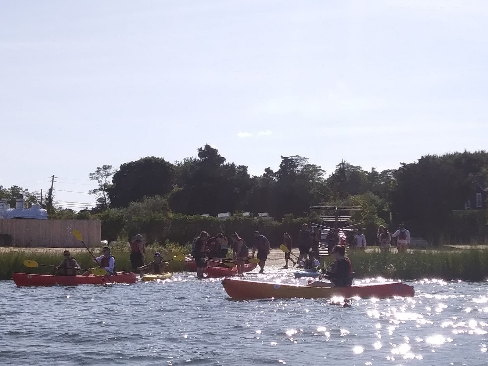
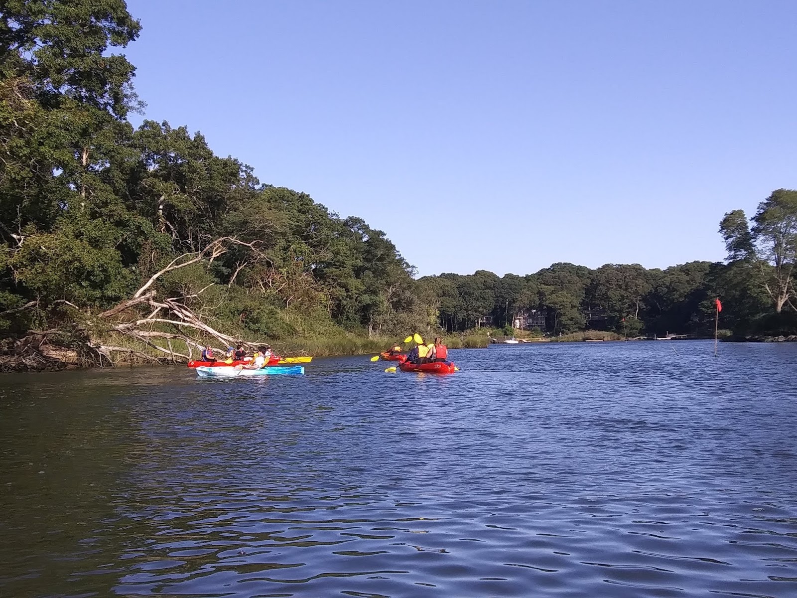
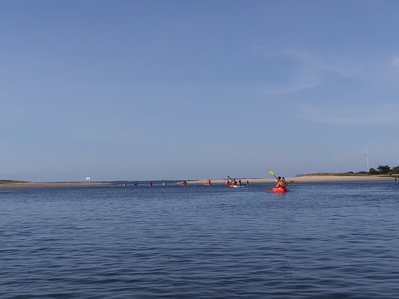
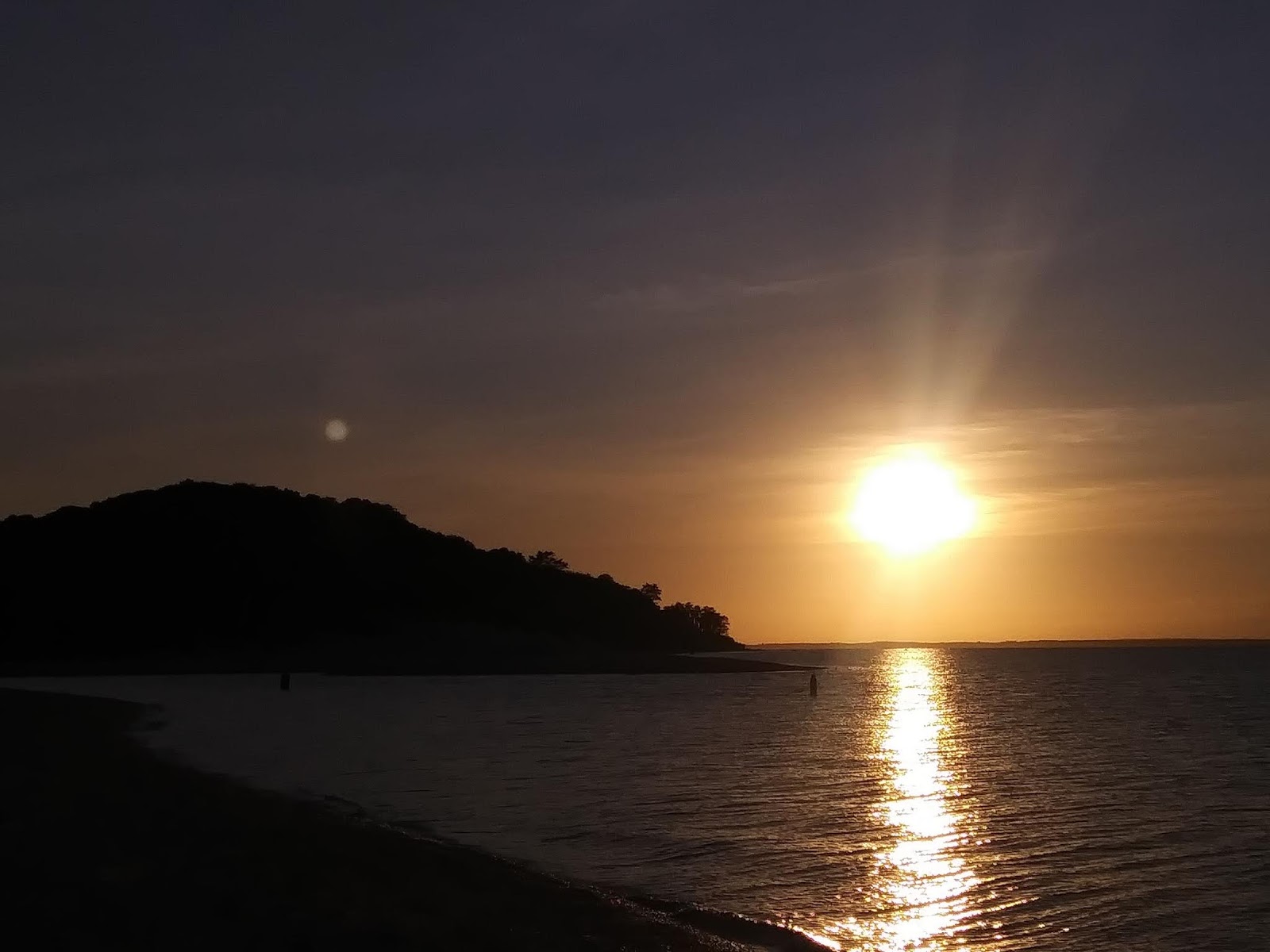
Coastal Cultural Experience: Southampton Rogers Mansion & Beach
Trip to the Southampton Historical Museum (and Tiana Beach)
by Nancy Liang
I’ve never been to a museum where the exhibits are displayed in what used to be someone’s house! The Rogers Mansion is filled with furniture and decorations from the Victorian Era. Wandering around, I found I preferred this style of museum because I was able to examine artifacts in context, in the environment that they were meant to be in. (19th century embroidered throw pillows are a lot more fun when you can flop around on them instead of just view them from behind a glass display case — and yes, I checked that we could touch them!) Most of all, I appreciated the way that the pieces in the mansion fit together to tell a story about the living conditions of the family and the social values of their time period.

The dress in this picture is very long and tightly cinched at the waist. The long folds of fabric hinder mobility, which indicates that the woman wearing this dress did not have to work to support her family. The hem of the dress would get dirty from dragging on the ground, so the woman who owned this dress likely did not walk around the city very often and could afford to replace dresses whenever they became stained from debris on the street.

This bookcase holds piles of maritime books, some china plates, and a few shells. From looking at this case, our professors were able to discern that this family was well-educated, wealthy, and well-traveled. The bookcase is a subtle way to display the family’s wealth and cosmopolitan lifestyle.
I learned quite a lot about how to gather information from different historical sources. I used to think that historical information was only gathered from people’s journals or government records. However, during this class trip, I became more aware of how historians can piece together information about people and time periods from things as overlooked (by me, at least) as clothing length and house decor. This trip was an all-around wonderful experience, and I can’t wait for next week’s trip.

Side note: I also learned that we would be on local news! A Channel 4 film team stopped us while we were at Tiana Beach learning about wave-action and observing the smaller effects of the (thankfully still very far away) Hurricane Dorian. Professors Bretsch and Rider gave an interview about Semester by the Sea to the news crew.
Hurricane Dorian Coming to Southampton
by Meaghan Sullivan
On September 6, 2018, the Coastal Cultural Experiences Class visited both Tiana Beach and Ponquogue Beach on the Southshore of Long Island to discuss the effects of the storm that was Hurricane Dorian would have on the beaches. The discussion started off with a little background on hurricanes in general. We learned that hurricanes in the Northern Hemisphere move in a counterclockwise rotation and typically move to the right due to the Coriolis Effect. The center of the hurricane has a lower pressure than the outside of the system, therefore causing air to rise and wind to be sucked in from the sides.
While at the beach, we observed that the winds were coming from the east and the waves were moving in a southeast direction. This caused us to move into a discussion about how the sand would be affected by these factors. We learned about something called long-shore drift. This is the movement of sediment along a coast that is caused by the waves coming in at an angle. On the south shore of Long Island, the sand is moved to the west. The storm would not only make the sand move westerly, but it would also create small sand cliffs known as scarps. This caused from the erosion of the sediment by the waves. Unlike the ocean, the Shinnecock Bay was a lot more protected from the storm. Because it is partially surrounded by land, the water is usually much calmer and less likely to experience major damage or change from storms.
Overall, I believe that this was a great experience for the group, especially for the ones not from the Long Island area. Being from Long Island myself, I still found it exciting because its not usual of me to go to a beach on a day that isn’t hot and sunny. We even got to be on the Channel 4 News, which was a great opportunity to advertise the Semester by the Sea Program and to teach people valuable information about our Long Island beaches.
 |
| Photo Citation: Meaghan Sullivan (2019) |
 |
| Photo Citation: Meaghan Sullivan (2019) |
The Wondrous and Elegant Life of the Parrish Family
by Mateo Rivera

Picture 1 (Piano): What other house do you know to have 3 pianos? This portion of the Rogers Mansion was mainly utilized for the entertainment of guests, although it wasn’t the only one. The amount of comfort and the attention to detail speaks volumes about the level of wealth in this gilded era.

Picture 2 (Ship): Being a well-established whaling family, the Parrish’s were displaying their interest in yacht racing. The painting of the S.Y. Henrietta beings this fascination to life. If that wasn’t enough, tiny ships are bordering the underside of the artwork.

Picture 3 (Dining Room): Welcome to the fine dining area of the Parrish household! In my opinion this was my favorite part of the mansion. Elegance is the essence that the table set brings this central gathering place of this family. The time period was a perfect example of what we now call classy dining, as dishware like this is still utilized in some homes in the modern day.
Punishment of the Past
by Tiffany Cui
For our last stop at the Southampton History Museum, we journeyed outside in the rainy and slowly picking-up winds (courtesy of Hurricane Dorian) to a part of the courtyard where two wooden structures were brandished on display. Slightly eerie looking with the backdrop of the gloomy weather, we settled around them as Professor Rider explained what they were. Devices made for punishment! Not particularly of the violent kind, to my honest surprise (I thought they were whipping posts at first), but pillories and stocks, as they were called, were placed in town centers and more for public shaming for transgressions ranging from missing church service to more extreme offenses.
Although the purpose of these structures was mostly for public humiliation, sitting or standing while strapped in one of these things could’ve also been extremely uncomfortable. One brave student volunteered to sit in the stock, and after only a few minutes he started shifting around uncomfortably. If it was uncomfortable after a few minutes, I couldn’t imagine how painful it might’ve felt after hours of sitting/standing there. This was more of an darker aspect of life during the time period, but it was interesting to look at how crime, petty or serious, was dealt with in the past.
 |
|
Pictured above is a Stock, which functioned by locking the captive’s feet between two holed slabs of wood and left there for public ridicule, often for hours on end.
|
Rogers Memorial Mansion in Southampton, New York
by Tessa Reynolds

Photo #1:
Nineteenth century dresses with work with full length skirts that covered the ankles. This made it harder for women to walk around, as the dresses would drag and end up dirty at the bottom. This fashion was better suited for upper-class women who didn’t walk around outside as much as working-class women.

Photo #2:
A tea break in the afternoon was used as a show of class and status. Those who partook were well off enough to stop their activities and take a break, something the working class was unable to do during the day.
Photo #3:
Families in the nineteenth century would decorate their homes in a way that displayed their identities and what they did for a living. The Rogers family were whalers and used marine aspects to decorate their home and show off their travels.
Coastal Cultural Experience: Shinnecock Bay Tour
by Julia Sweeney
The Shinnecock canal is the only canal in long island and connects the Great Peconic Bay and the north fork of Long Island with Shinnecock Bay and the Atlantic Ocean. The canal stretches 4,700 feet and was opened to the public for use in 1892. Since then the canal has been used by a diverse range of people for a variety of different reasons.
 |
| Fig 1. Melton, Tom. “SHINNECOCK CANAL, NY.” TheFisherman.com, www.thefisherman.com/index.cfm?fuseaction=feature.display&feature_ID=90&ParentCat=8. |
 |
|
Figure 2. Taken by me
|
 |
| Figure 3S, Ray. “Shinnecock Locks.” Foursquare, 22 May 2013, foursquare.com/v/shinnecock-locks/4c001bdb369476b056e08e1f?openPhotoId=519d453a498ef688fd6bce32. |
Orient Yourself: Location Matters
by Kristi Flanigan
Amongst the first major points to be learned from day one of MAR355 is this: one of the most important things to do on the water is to become spatially oriented. Having a sense of where you are, and the history of that place, can and should inform you of how those waters might act, and what uses or challenges that may create. Whether you’re standing on the shore or in a boat, you’re also standing on the past and, simultaneously, on the dynamic present. That’s the heart of what we discussed in our first day of MAR355 – the importance of environmental context, first in terms of geography determining how waters move and what that means for the environment, and second in terms of Southampton’s history. Thinking about how an environment shapes a culture and also about how the environment shapes its environmental challenges really gives you a better understanding of how and why nature and humankind unfold the way they do in a given area.
Paying attention to the geography of Shinnecock Bay is very informative. First, a tiny note – on a boat, what looks like a map is called a chart. On the chart, we learn about how the geography of Shinnecock Bay actually means that the side of the bay near Quogue and feeding into Tiana Bay experiences more water stagnation than the side of Shinnecock Bay that touches the Shinnecock Nation reserve. This is because an inlet is positioned in such a way that part of the bay receives a more direct influx of water, making that half less prone to all of the problems that come with less water movement – harmful algal blooms being a main concern to that effect.
Another concept we discuss is how the geography of an area also lends itself to the way people make use of it. In Southampton, the beaches and bays have lent themselves historically to a variety of uses including vacationing, luxury homes, and trade and distribution of goods like seafood and alcohol. Luxury homes on the water in particular is an interesting concept, one rooted in wealth and the idea of private property. As we took the boat through the Shinnecock Locks (much smaller than those of the Erie Canal), private property “keep out” signs popped up on some of the beaches. But really, building a house along the coast makes no sense – coastal erosion and natural disaster make the lifespan of a coastal home rather short. And, looking at the Shinnecock Nation coastline, there are trees instead of houses. It’s a visible cultural contrast, a difference in the way land is utilized, but it all ties back to the geography of the land and the ways in which people inhabit it.
References
All concepts and facts presented here were learned from MAR355 as taught by Dr. Rider and Dr. Bretsch through the Semester by the Sea program at Stony Brook Southampton.
Rum Runners Debut on the Coast
by Katelyn Castler
The 1920’s was an important time in Long Island’s history. The 1920’s is when the National Prohibition Act was placed over the early American colonists. The National Prohibition Act prohibited importation and consumption of alcohol. However, American’s had a problem with this act due to its high demand. American’s then resorted to making homemade alcohols and smuggling. The European, Canadian, and Caribbean colonies were happy to assist in the importation of alcohol, but they needed people to retrieve it once it got to America. Thus, Rumrunners became some of the most important people during the time period.
Rumrunners aided in the smuggling of alcohol into American. They mainly subsided in the beaches of Long Island. Long Island was important due to over 1,180 miles of beaches that stretched around the coast. The vast length made smuggling alcohol easier because the coast guard could not possibly oversee every inch of the beach. The rumrunners would run out along the beach and gather the alcohol to smuggle into Long Island. Long Island was also perfect because due to the proximity of the area to other colonies. It was the perfect distribution site to transport alcohol.
Some interesting places and artifacts that aided Rumrunners in their pursuit was boats and The Canoe Inn. The boats were a contribution from society by the Freeport Point Boatyard. They were against the act, along with many other people. They helped rumrunners in their acts by providing ships to collect the shipments from other over sea’s colonists. The Canoe Inn was also an important place associated with rumrunners. The Inn was connected to a tunnel that was easily accessible to Rumrunners. The tunnel ran from the coast to the basement of the inn. Rumrunners would use these tunnels to help smuggle alcohol in which provided a perfect hiding place. The Inn soon became a popular place for tourists from all over due to the fact their shelves were always heavily stocked with the imported alcohol. It also helped distribute the alcohol due their close proximity with the railroads.

Coastal Cultural Experience: end of semester reflections on the course
Reflections
by Delphine Mossman
I’m an immigrant, in multiple different ways. For one, I was born in Calgary, Canada; my family moved to the U.S. when I was just under one year old. I don’t remember our old house at all, but growing up with parents who were born and raised in Canada has given me somewhat of a different perspective, I think, than I would have had they been American. Closer to the present day, my family home is in landlocked Pennsylvania, in a suburb about 20 minutes outside of Philadelphia and about four hours on a good day from West Campus. So coming to Stony Brook University, I only knew what my U.S. history textbooks taught me about the history and culture of New York (New Amsterdam, Ellis Island, the Hudson River). I knew even less about Long Island; I knew it was an island, and it was long, and not much else. I think that’s why I found this course, Coastal Cultural Experiences, so valuable and fascinating.
I’m neither a history buff, nor particularly good at geography, so I deeply appreciated the hands-on nature of the course. This is the first class I’ve taken since I began my college career at Stony Brook where I felt totally immersed in the material. We were not just learning about lighthouses and whaling and fisheries in a classroom, we were going out and seeing those historical monuments, and talking to the people who are directly involved in their preservation. I remember the kind docents who showed us around the Sag Harbor Custom House, walking and talking us through the lives of the Dering family that lived in it. It was an amazingly innovative way of illustrating Long Island’s cultural and historical significance, and I enjoyed myself a lot more, and learned a lot more, than I would have in a traditional class. Climbing aboard that van most weeks had an added benefit as well: it carved out precious free time and allowed us students to just be. Away from schoolwork, lab work, work work, we could chat, absorb the scenery, breathe.
|
| View from the top of the Fire Island Lighthouse, nearly 200 feet above ground level. |
As a student without a car on campus, it was also nice to be able to get off campus one day a week and see the various sights of Long Island. Although I pedaled my way to a few nearby beaches, I doubt I would have been able to get to all these museums and points of interest without taking this class. I also appreciated how engaging the professors, Tara Rider and Kurt Bretsch, were through all the lectures on all the trips. Of all the excursions we went on this semester, the one that stands out in my mind is the kayak trip we took in the latter half of September. The weather was lovely as we paddled and discussed the various protected areas and species of Long Island, ending with an amazing barbeque of fresh fish on a twilit beach.
 |
| Sunset on the beach as we closed out the kayak trip. |
Yes, some weeks we had to get up early to get on the van; yes, some weeks they were long, exhausting days. But how encouraging to spend time with a small group of people who are determined to make a difference; how moving to meet dedicated caretakers driven to preserve a bit of history; how inspiring to be taught by generous instructors willing to step out of the classroom. I love the ocean, its majesty and its bounty. This course has taught me that I am not alone.

Coastal Cultural Experience: Mystic Seaport
What Were the Whales Used For?
by Sabrina Simone
While it is not prominent today, whaling was important for New England people in the 18th century. As whalers began hunting more whales, they saw that their oils, teeth and bones could be used for a large range of resources. These included soap, various textiles, light sources, perfumes, and lubrication for machinery. The whales that were hunted the most for these resources were right whales, bowhead whales and sperm whales.
Sperm whales were highly favored for their spermaceti organ as the spermaceti oil could be used in both solid and liquid form. The oil was in liquid form in the sperm whale’s head (Figure 1) and would solidify when removed because the body heat would not be present to keep it in liquid form. This solid form of the oil was waxy and could be made into candles. As a liquid form, the oil could be used in lamps and burn for a longer period of time than a candle (Figure 2). The light power from the oil was not that much more powerful than that of the candle, yet it helped to illuminate the dark rooms of New England homes.
The 1860s spelled the end for the use of spermaceti oil due to the easier access, and increased use, of petroleum. However, this did not stop the need for hunting whales. Whalers began hunting for baleen whales, or whales that did not have teeth. The baleen in these whales were a flexible material that, while dried could still bend to whatever form they were needed. Items like corsets and umbrellas were created with this material. The stays of the corsets were made by using intertwined pieces of the baleen to help hold the body in the desired shape. The busk of the corset, or the part that kept the corset straight, were sometimes made out of polished whalebone (Figure 3).
Figure 1 – A diagram of the inside of a sperm whale’s head. This is to represent where the spermaceti organ is and therefore where whalers must go to obtain the oil. Source: https://en.wikipedia.org/wiki/Spermaceti_organ

Figure 2 – The picture I took of spermaceti wax and flakes on display at the Mystic Seaport Museum.

Figure 3 – A picture I took of corsets made from baleen on display at the Mystic Seaport Museum.
Lay-ing Down the Law
by Courtney Stuart
This week we visited the Charles W. Morgan, the last remaining wooden whaleship. This world-famous American whaling vessel was active from 1841 to 1921. Just like other whaleships of her time, the Morgan voyaged on years-long journeys to sea in pursuit of blubber-rich right, bowhead, and sperm whales. With a crew of around 30-35 men, the Morgan attempted to catch as many whales a possible, trading casks of whale oil for profit in New England seaports. With so many men on board, a sense of order and hierarchy needed to be established. What can we use today to infer the social status of men on board the Charles W. Morgan and other whaleships alike? The location in which a sailor slept.
Sleeping quarters may seem like an unusual indicator of social structure, but in fact they are a key descriptor of rank, power, and financial stability on board whaling vessels. As we went below deck on the Charles W. Morgan, we got a first hand look at how the location of a man’s pillow relates to the hours of sleep he got and the amount of money in his pocket at the end of a journey. At the stern (backside) of the vessel lies the Captain’s quarters, a spacious (for the time) area featuring an office, bedroom, and dining area. This is elaborate arrangement offered privacy and a more luxurious trip for the Captain and his family members. Although we may see the space as cramped and cluttered based on modern standards, this was a grandiose space in comparison the quarters of the lower ranking crew members. In fact, the Captain’s quarters—shared by only the captain and his wife and children if they were on board—was the same area as the space shared by all 25-30 crew members on the other side of the ship. In addition to physical space, the location of the quarters at the stern of the vessel meant that the Captain’s bed was the last to pass through waves—ensuring that he always had the most peaceful sleep, even on the stormiest of nights.
Other than the Captain and his family, the First Mate was the only other member allowed to have a room to himself at the stern of the vessel. This privilege was as a sort of compensation for the mate’s most difficult and crucial duty—having to maintain the logbook. The log, as a legal document, was just as important as the whale oil that the ship brought home to port. If it were lost, damaged, and filled incorrectly, the mate would be severely punished and would quickly lose his cushy, comfortable living quarters at the stern and be forced to move to the forecastle with rest of the men.
Between the stern and the bow (front) lies the mid-ship, an area featuring a few rooms shared by members of the crew who were not necessarily high-ranking, but also not as low on the totem pole as ordinary sailors. These men included the harpooner, boatsteerers, blacksmiths, cooks, and coopers. Though they started the journey with this comfortable living situation, they did not always end that way. Their location was not set in stone, it was dynamic and depended on how well they performed their designated duties. For instance, if the captain deemed that the harpooner was not doing a good enough job of locating and capturing whales, he may be downranked to the role of a general sailor and be sent to live in the forecastle—losing a significant amount of his pay and his hours of sleep.
What is the forecastle? It’s the forward-most portion of the vessel, featuring a small living area for all of the low-ranking, ordinary sailors. As we saw on the Morgan, the forecastle was a tight space featuring bunk beds throughout. There was minimal space and the men were expected to keep all of their belongings in their bunks or below their bedframes. Beyond the lack of personal space, the area must’ve smelled absolutely terrible—for the men only had one or two sets of clothing, scarcely (if ever) bathed, and were almost permanently covered in whale gunk. To make matters worse, the forecastle offered consistent thumping and movement as the bow of the vessel cut through swells and was constantly smacked by incoming waves. This undoubtably caused many headaches and resulted in minimal sleep for these overworked sailors.
For the men, the money at the end of a trip was more important than the hours of sleep gained during the journey. However, the location of their sleeping quarters and their final paycheck were directly related. This was known as the lay system, with a man’s “lay” correlating to his rank and corresponding pay. Moving from the stern to the bow meant less money. So, at the back of the boat, the well-rested captain also received the largest portion of the profits (behind the boat’s owners), 1/15th on average. Next came the First Mate, who usually made around 1/24th. Boat steerers made 1/100th and ordinary crew members brought home a measly 1/190th. The lowest income was that of the Cabin Boy, who was paid only 1/400th. Although a crew member may have signed a contract at the start of the journey agreeing to serve as a mate (making 1/50th of the profit), this agreement was not binding, and he could be downranked at any point throughout the trip—in the end only making the lay of his final position. This was surely incentive to do your job and do it well!
 |
| Figure 1. Part of the exhibit “Whaling Financed American Enterprise”. Photo credit: Courtney Stuart; Content credit: Mystic Seaport Museum. |
Ambergris: The Treasure of the Sea
by Brandy Jones
For centuries, ambergris, a hard and waxy substance found in the oceans and along its shores, was a mystery to many. Scientists, sailors, and denizens of coastal areas were unsure as to how and where ambergris was made. It was not until the 1800’s when whaling was at its peak that ambergris mystery dissipated. Whalers would occasionally come across a whale they had killed that had a strange substance inside it (Osterloff 2017). Ambergris was found to be produced by sperm whales in their stomachs and intestines due to their diet. They primarily eat cephalopods, which includes squid and octopus, and the beaks of these animals can potentially damage a sperm whale’s internal structures (Osterloff 2017). Ambergris hardens all of the beaks into a large waxy ball to protect the whale. Scientists are unsure whether the whale expels this mass by excretion or by regurgitation, but it has been commonly named ‘whale vomit’ by many people (Osterloff 2017).
 |
|
Figure 1: Ambergris from the Mystic Seaport Museum in Mystic, CT.
|
Ambergris is considered extremely rare and illegal to possess, sell, or buy in the United States. It has been used by humans for over 1,000 years for purposes such as incense, as an aphrodisiac, and for medical purposes related to the brain, the heart, and the senses (Osterloff 2017). It has also traditionally been used to help the scent of perfume last longer. We were able to see a large sample of ambergris while visiting the Mystic Seaport Museum during our Coastal Cultural Experiences class, which is pictured above. Nowadays, synthetic ambergris has been created to keep perfumes lasting longer, and only very expensive perfumes use real ambergris, as it is so rare and expensive. Over the years, people have stumbled upon these ambergris pieces and are able to sell them sanctioned organizations. In 2016 a group of friends stumbled upon a 176-pound piece of ambergris worth almost 3 million dollars and another couple in the United Kingdom found a 3.4-pound piece worth $70,000 (Hrala 2016). Who knew whale waste would be considered the “treasure of the sea” (Osterloff 2017)?
References
Hrala, Josh. (2016). Lucky Fishermen Have Stumbled Across a $3 Million Lump of Whale Vomit. Science Alert. Retrieved from https://www.sciencealert.com/fisherman-have-just-found-a-us-3-million-lump-of-whale-vomit
Osterloff, Emily. (2017). What is ambergris? Natural History Museum. Retrieved from http://www.nhm.ac.uk/discover/what-is-ambergris.html
Scrimshaw: A Sailor’s Past Time
by Alyssa Shanley-Lente
When visiting the Special Collections at the Mystic Seaport Museum I learned about the different ways that ivory could be used. One way would be to make designs for cane tops, but the most popular way would be to use the teeth of whales to make scrimshaw. “What is scrimshaw?” one may ask. Well scrimshaw is the design into bone, ivory or baleen of marine animals done by whaling sailors who are out at sea on a whaling ship. Scrimshaw can range in great detail to very little detail and the pictures drawn mainly depict themes of scantily clad women, ships or carvings of the scenes they saw while out at sea.
 |
| Picture 1. A photo of a scrimshaw drawing of a young woman done on a sperm whale’s tooth that is yellow in color from exposure to changing temperatures and humidity. |
 |
| Picture 2. A photo of some scrimshaw drawings done on various forms of ivory from marine mammals. |
Sea Shanties
by Amanda Ackermann
At Mystic Seaport, we got to visit a man who explained the uses of sea shanties and demonstrated a few for us. Two of the shanties he did were from Moby Dick, where there was musical accompaniment. Typically, shanties were sung without an instrument, and were used only for giving a rhythm for work and not entertainment. It was considered bad luck to sing a shanty while not working. The shanties would be sung by a shantyman, one of the sailors who had a prominent voice and knew the lyrics of shanties. He would sing a shanty that had a phrase or rhythm that the sailors could pull the ropes or row to: “blow, boys, blow” was one such phrase in a shanty that meant the sailors would pull the line to raise the sails. Some of these shanties were songs that were borrowed from folk or minstrel music and modified or improvised for work.1
Shanties prominently arose in the early 19th century. There have been references to a sailor’s hauling chant in a book written in 1549, but most historians agree that shanties were defined by the 19th century. There was an early form of shanties in the 18th century that were more like chants or phrases rather than songs. This was referred to by Richard Henry Dana as “singing out”.2 One of the first songs to make an appearance in historical text is “Cheer’ly Man” and is referenced by Herman Melville.3 Instruments weren’t commonly used, but fiddles would sometimes be incorporated during the earlier part of the century.
Sea shanties draw a lot of inspiration from African Americans. African Americans were known for singing work songs while out in the fields, and working in rhythm to it. They typically sang in a “call and response” format, and sailors based their shanties on this format. Most shanties have “double-pull” format, and this was based off of the work songs by African Americans.4 Some of the types of shanties are:
Long-drag shanty: Usually pulling a line for a long period of time
Short-drag shanty: Pulling for a short burst of strength
Seating-up chant: Brief hauling songs
Capstan shanty: heaving an anchor
Pump shanty: pumping out water that might have leaked into the boat 1
1Wikipedia.com/Sea Shanty
2Dana, Richard Henry, Jr., Two Years Before the Mast, Harper & Brothers (1840) p. 11
3Melville, Herman, Omoo: A Narrative of Adventures in the South Seas, John Murray (1847) p. 151.
4Schreffler, Gibb, “Ethnic Choices in the Presentation of Chanties: A Study in Repertoire”, paper presented at the Society for Ethnomusicology Southern California and Hawai’i Chapter conference (February, 2011), p. 2.
Indigenous whaling
by Diana Beckenhaupt
As part of the whaling exhibit, there was a case containing a waterproof parka made by Inuits.

Photo credit: Brandy Jones
This parka is made from whale intestines, dried and cleaned. Apparently this was a common material to make waterproof coverings to cover warmer clothes the far north, including in Russia and the Aleutian Islands. The parka and surrounding artifacts (Inuit tools, etc) interested me because Indigenous approaches to whaling differ from Western ones. The history of Western whaling is closely tied to industrial growth, the shift to mass-production in factories, and new inventions – ultimately, an unsustainable endeavor. Indigenous whaling on the other hand has a different purpose, subsistence, and has ties to tradition, not “progress”.
Another part of the whaling exhibit featured some anti-whaling slogans from the past twenty or thirty years, an important effort to preserve whales. Regarding that, I think it’s ultimately important to understand the context of why exactly whaling was harmful, and preserve a sociologically balanced view that prioritizes Indigenous interests rather than just blanket condemnation of all whaling. Anti-whaling activists need to realize that their perspective is limited when dealing with non-Western cultures. To conclude, I really enjoyed visiting Mystic, would like to go back, and the whaling exhibit in particular was well designed and thought-provoking.
Source: https://educators.mysticseaport.org/artifacts/intestine_raincoat/
Barrels
by Stephen Havens
Barrels were extremely important to a whaling town. Whalers would need a place to put the whale oil that they collected, and barrels were the perfect thing. Barrels are a remarkable piece of engineering, made in a place called the Cooperage [Barrel4]. The curved nature of a barrel made it possible for one person to move a lot of weight by themselves, simply by rolling the barrel. This would not be possible with a crate, which would require several people to move. If a barrel tipped over, instead of shattering like a crate may do, it would just roll up onto the other side. The most incredible thing about barrels is that a complete seal is formed just by the amount of pressure put on the staves (slabs of wood that a barrel is made up of). Upwards of 4000 pounds per square inch of force can be put on the staves, depending on how many hoops are hammered around it. This allows a watertight seal, without any sort of resin or sealant between the staves. This tool [Barrel 3] is called the schnitzelbank and allows the cooper to hold a piece of wood in place with his foot so that he can use both hands to shape the wood into a stave. The windless [Barrel6] is a useful device that can help tighten the staves of the barrel together with relative ease. A wooden pole is inserted into a slot in the wooden cylinder that has roped wrapped around it. The wooden cylinder is twisted using the pole, and the rope around the staves tightens, pulling then together into place, where an iron hoop is hammered onto it. The Bung [Barrel7], shown circled in red, was how the barrels were sealed once they were filled. Barrels would be filled on their side, via a hole. Once filled to the desired level, the wooden bung was hammered into the hole to seal the barrel. To give an idea of how many barrels were being produced during the time of whaling, there were entire factories solely responsible for producing bungs.
 |
| Barrel 4 |
 |
| Barrel 3 |
 |
| Barrel 6 |
 |
| Barrel 7 |
Hanging Out on the Joseph Conrad
by Flynn DeLany
During our immersive day at Mystic Seaport in Connecticut we spent our time understanding the day to day lives of mariners. One of the most exciting activities that we were able to participate in was climbing the rigging of the Joseph Conrad (Figure 1) More specifically, we climb up the shrouds of the vessel. These are pieces of standing rigging, i.e. fixed lines, meant to hold up the masts. Shrouds were used by the crew to climb up to the sails when they needed which was often during their voyages. Sailors would also climb up the masts for some much-needed alone time called sky larking. Sailors can be out at sea for months to years, as you can imagine you may not get much privacy on a crowed and compact vessel.
Sailors had a rule for when they climb which we emulated in our activity: there should always be three points of contact (Figure 2). For our sake we were strapped to a safety line and guided by the Mystic employees, however the climb was not as easy as I first thought. The lines were fairly cold, moved slightly, and the rule constantly in my mind. Now imagine climbing the rigging with no harness, above the arctic circle, on a swaying vessel. The skill of a sailor permeated into every day on the water. We were lucky enough to get a taste of this minute aspect for them but made us realize more how difficult being at sea could be.

Figure 1: The Joseph Conrad is shown above. This vessel was built by the Danish as a training vessel for their Merchant Service and for this reason was built at ¾ size of a normal vessel. This makes it a perfect ship to try climbing the shrouds for the first time.

Figure 2: Cassidy Bell (facing away) and I (facing camera) climbing the Shrouds of the Joseph Conrad while being sure to keep three points of contact.

Coastal Cultural Experience: Riverhead Foundation, Iron Pier Beach, Fish Ladder
Sea Turtles and Seals go to the Doctor too!
by Kim Marko
With winter right around the corner, we are quickly approaching the cold stunning season for sea turtles. When the water gets too cold and a sea turtles internal body temperature gets below 55 degrees, they start to go into a state of hypothermia and their bodies start to slow down. This often results in them being washed ashore and without the proper medical help, they have a small chance of survival; this is where the Riverhead Foundation comes in. In addition to sea turtles, the Riverhead Foundation does a lot of work rehabilitating seals that have stranded. Seals strand for many different reasons such as, being hit by a boat, getting caught in debris or they might be ill. Regardless of the reason they come into the facility, they do everything in their power to help the animal be strong enough to go back into the wild.
When any animal enters the foundation, they go through an initial medial check to see how severe of a case it is, so they can tailor the treatment to the specific animal. Each animal gets a sample of blood taken, this blood work will tell them a few different things like their total protein levels, glucose levels and their kidney functions. Knowing this information is crucial when determining if the animal needs any medicine. They will also perform an x-ray on the animals which allows them to see if their is any internal problems that they may need to worry about. Seals do not drink water, but they still need water to survive. They get their water from the fish they consume, but sometimes when the seals come in they are unable to eat the fish on their own. In cases like this they actually stick a tube into their stomach where they blend the fish and they are able to assist them in the eating process and also give them any additional medicine they may need. Like I mentioned earlier a cold stunned sea turtles body temperature is below 55 degrees and it severely slows down their body. The average heart rate for a turtle is about 30 beats per minute, but in severe cold stun cases, the heart rate could be as slow as one beat every three minutes. The normal average body temperature for a sea turtle is 75 degrees. It is important for them not to raise their body temperature too quickly, so they slowly raise their body temperature about 5 degrees everyday until they get to their normal temperature. Once at a normal body temperature they can keep moving forward with any other medical treatments needed and get them back into the water as soon as possible.
 |
| In the room where they perform the initial assessment of the animals, they have signs hanging up showing where you perform the blood sampling. |
Returning Marine Animals Home
by Cassidy Bell
While visiting the Riverhead Foundation for Marine Research and Preservation, it was amazing to hear all of the different methods that they use to take in and care for injured marine animals. But perhaps even more amazing than what they did at their facility was what they did after the animals no longer needed their care. The Riverhead Foundation takes in a large number of sick and injured seals, sea turtles, and even occasionally cetaceans in order to help them after they catch illnesses or get injuries from natural causes, like shark bites, or human causes, like boat strikes. Many of these animals are released back into the wild, such as the Kemp’s Ridley sea turtle Cardamom in the front room of the Foundation that is waiting for release. However, this isn’t where most of these animals’ stories end.
Before releasing healed animals back into the wild, the Riverhead Foundation, along with many other conservation programs throughout the country, tag the animals so that their progress through the ocean can be tracked and they can be identified if ever caught or injured again. Every seal that is released is given a tag on its hind left flipper that gives it an identification code as well as marking it as an individual helped by the Riverhead Foundation. Some seals are also given satellite tags which, while certainly more expensive than flipper tags, allows for the conservationists to track the location, diving depth, and hauling behaviors of the seals for a set period of time. The sea turtles are also given flipper tags. Two metal tags are placed on the turtle, one on each hind flipper, and work similarly to the flipper tags of the seals. However, the satellite tags are a little big for the sea turtles. Instead, a tag called a pit tag is inserted that works like the micro-tags that many people use on their pet dogs. A hand-held machine is used to scan the turtles and a code is shown that identifies it as an individual and shows where it was originally tagged. With this technology, the Riverhead Foundation is able to track the young animals that it helps as has found them later on in life as successful, mature nest-builders. The success of the Foundation’s release program and their ability to track the animals that they help all the way through adulthood shows the importance of programs such as these and the importance of supporting local conservation efforts in whatever way you can – they are always looking for volunteers!
The New York Nester
by Emily Richters
This year in June 2018, a Kemp’s ridley sea turtle made a nest on Breezy Point beach. There, she lay 110 eggs. This was a huge deal because this is the first sea turtle documented to nest in New York! Coincidentally, she laid these eggs on a Piper Plover protected nesting area where there was easy access to protective gear. 60 days later, the nest was threatened with extreme high tides. Rescuers took the initiative to excavate the nest and incubate the eggs in a cooler containing sand from the same beach. This way, they were sure to prevent the eggs from drowning. Not only are these sea turtles critically endangered, but these were to be the first documented sea turtles to hatch in New York. All safety measures had to be instated.
Once rescuers started to notice signs of hatching 12 days later, the eggs were immediately transported to the same exact spot they came from. Out of the 110 eggs laid, 96 survived to crawl out towards the ocean. Most of these baby sea turtles are assumed to be male. Reptiles have a unique way of determining gender, and that is by temperature. If the eggs are incubated in warm sand, the hatchlings are most likely to be mostly females. If the eggs are incubated in cool sands, the litter is most likely to be dominated by males. Researchers are still unsure where the mother sea turtle came from. Genetics tests are being done using the DNA of the unborn hatchlings to see if there is a population match. This will pinpoint the location where she came from.
Adult females only reproduce once every 2 to 3 years. During this time, she carefully chooses a safe beach, and works hard to create a protective nest. She will relocate and build multiple nests until she makes a perfect one. Then, she lays her eggs which could be up to 150 at a time! There is currently no nesting protocol in New York State. There was never a need for one. A protocol was never drawn up for sea turtle nesting since there was never any documented occurrence of one. However, this has all changed this year. As of 2018, a new nesting protocol is being drawn up. Maybe in 2 years, this female will come back to nest again. Sea turtles usually return to the same nesting area in which they were born from. From birth, they usually take 15 to 20 years to sexually mature. Maybe in 15 years, the surviving females will come back to this beach to nest for the first time. We must prepare now for when this happens, because this may be the start to hatching events in New York.
Turtles
by Sarah Stromski
Sea turtle are vital to our ocean’s ecosystems, although it may not seem like they have the biggest impact. Some common species in our area around Long Island consist of Leatherback, Atlantic Green, Kemps Ridley, Loggerhead, and Hawksbill. Leatherbacks have been known to eat upwards of about 400 pounds of jellyfish each day, keeping populations in check. With a control of the jellyfish populations, fish stocks are able to recover faster, since jellyfish prefer to feed on fish larvae and eggs. Atlantic Greens help to maintain healthy seagrass beds, since they constantly graze upon the beds, which prevent overgrowing, and decomposition. This is especially important around Long Island since our seagrass beds are declining rapidly. Hawksbills help to mitigate sponge populations, thus helping coral reef communities, since they are both major competitors for space. This creates more habitat complexity, and therefore more biodiversity. Loggerhead sea turtles feed by clearing the sand in order to reach their preferred prey, crustaceans. By clearing the sand away, it aerates the surrounding sand and increases nutrient distribution of that area as well as species diversity.
One of the biggest threats to sea turtle populations worldwide is plastic. Some of you may have seen videos such as the one where a man is pulling out a straw lodged in the nasal cavity of a poor sea turtle. Straws are not the only threat though; plastic bags are another threat since they resemble jellyfish and sometimes other plastics can resemble other normal food items. By ingesting these plastics, the turtles can starve to death since plastic cannot be properly digested, like their normal food so it all remains in their stomachs. After learning of the importance of sea turtles for ecosystems, I hope you will take a moment to consider not using single-use plastics, because even some recycled single-use plastics such as straws and plastic bags, make their way into the oceans.
Fishes Can’t Climb Trees, But They Can Use Ladders
by Delphine Mossman
Though the salmon is the most iconic, there are many fishes that split their lives between salt and fresh water, in both the Pacific and Atlantic oceans and their respective coasts. Here on Long Island, the alewife and the American eel are two such species. Alewives mirror salmon in their breeding patterns; the adults live at sea, returning to a river or stream only to spawn before they swim back to the ocean. Juveniles typically stay in the river for only a short period of time before making their way down to the sea as well, where they grow and mature to repeat the process over again.
American eels, on the other hand, have almost the exact opposite lifestyle. The adults of the species live in freshwater and migrate downstream to the Sargasso Sea off the east coast of North America to spawn and die. The juveniles, known as “glass eels” due to their transparency, must then make their way back upstream to their adult habitat, a daunting task for an animal not even as long as the palm of your hand.
Though these species travel in opposite directions, they are both deeply affected by human development of rivers, lakes, streams, and other bodies of freshwater. An alewife can only jump over a barrier about six inches tall; any taller and the rest of the upstream habitat is effectively closed off. Glass eels are even less well off, even less able to jump barriers or swim against powerful currents generated by dams. And, of course, both are susceptible to toxins in the water, decreased levels of dissolved oxygen due to eutrophication, and overexploitation. It is only in recent decades that measures have been taken in order to mitigate human impact on these species, and other migratory species in the area.
 |
| A fish ladder in the Peconic River, constructed to allow spawning alewives to move further upstream, past a small dam just out of frame on the left. |
The most widely used method of allowing migratory fishes to go around barriers such as dams is a fish ladder. By redirecting water at a gentler slope than the dam, some fishes can swim up the metal tube and reach more habitat further upstream. This will hopefully allow more to successfully spawn, increasing their numbers. However, these fish ladders are still too steep and the current still too strong for the small glass eels.
 |
| An eel ladder in the Peconic River, constructed to allow juvenile eels to move further upstream. |
For the eels, a specialized fish ladder known as an eel ladder must be constructed. Eel ladders are formed by a ramp kept minimally wet that extends from the top to bottom of the dam. Because eels can move over material for a limited time as long as it is damp, they are able to “climb” over the dam using the ramp, which is made of some type of material that allows them to slither up it. As with the alewives, the hope is that this will give American eel numbers a boost by opening up more habitat for them to grow in.
Shell for the Sea: boat gas stations
by Claire Garfield
Have you ever wondered how large shipping vessels get fuel? They have to cross the ocean, so they must load up somewhere. Yet a ship designed to carry tons of good can’t simply pull up anywhere and fuel up. Luckily, ships entering and leaving New York City Harbor can make a much-needed stop before a long journey right off the north shore of Long Island.
Having fueling station in a harbor, especially a populated harbor, would be incredibly risky being that as a rule populated areas and combustive substances shouldn’t be mixed. Furthermore, it is incredibly inconvenient for large ships to dock in a harbor to fuel up. The fueling station off of the north shore is in sight of land, but sufficiently off shore as to keep people safe and shipping as stream-lined as possible. The fuel is stored above the bluffs on the shore and makes its way to the fueling station via a connective pipeline that runs along the bottom of the Long Island Sound. The fueling station may seem unimportant, or maybe even a bit bizarre, as it is a rather ugly structure protruding from an otherwise untouched swash of ocean. Despite its looks, the fueling station is of major importance to shipping. A major concern of Super Storm Sandy was the damage done to the fueling stations. Aside from representing a possible environmental and safety issue, the fueling stations are of essential to shipping. So even though it’s just a gas station for a boat, marine fueling stations are really pretty cool and important!
 |
| Figure 1. A marine fueling station right in our neighborhood. |
 |
| Figure 2. A view from Riverhead of the Long Island Sound and some bluffs. |

Coastal Cultural Experience: Sayville Maritime Museum
The Loss of Natural Born Oysters on Long Island
by Sabrina Simone
Long Island is known for many things, one of them being the love and supply for shellfish. In the late 1700’s, oysters were the most popular shellfish dish for Long Islanders. What once started out as a hobby because a full-blown industry. Oystermen would open roughly 2,000 oysters a day. Long Islanders were eating so many that the streets were practically made of oyster shells. The demand continued to grow until around the early 1800’s when it was observed that oystermen were harvesting fewer and fewer oysters. They would soon learn that many oyster beds were empty or destroyed from the high demand.
Figure 1 – An image I took of an image provided by the Rudolph Oyster House at the Sayville Maritime Museum. This image shows a large pile of oyster shells with oystermen standing on top. This quantity of oysters being harvested was very common.
In addition to overfishing for oysters, there were other factors that aided in the oyster population decline. One main factor was from duck farm waste. With large quantities of ducks being farmed, there resulted in large quantities of waste. This was a problem because the waste would run off into local waterways and enter the bay systems where the oyster beds were thriving. The increase in nutrients from the duck waste would cause an increase in algal production. This was not good for growing oysters because it led to algal blooms. Too much algae can reduce the amount of oxygen in the water and can be too much for the oysters to filter. As oysters can filter large quantities of water in a short period of time, filtering gallons of contaminated water caused oyster populations to suffer.
The 1950’s to 1960’s spelled the end for natural oysters on Long Island. Today, locals and environmentalists are working to restore these populations. There are multiple projects currently in effect aiming to re-introduce oysters and rebuild their numbers. This is being done by creating various oyster farms for larvae to thrive, as well as by the use of sanctuaries for oysters to go through a natural life cycle without being fished. While the restoration process is still young, it is a step in the right direction towards bringing back natural oysters to Long Island.

Figure 2 – Another image I took of a pile of oysters on display at the Rudolph Oyster House at the Sayville Maritime Museum. This is an idea of the number of oysters one oysterman might shuck in one day.
Day in The Life of The United States Life-Saving Service
by Christian Iniguez-Ulloa
These clothes are on display at the Long Island Maritime Museum in Sayville. They are clothes that would have been worn by people in the United States life-saving service. Those people would be in charge of helping boats that would get stuck around Fire Island while trying to reach New York City. At first their occupation was only part time and seasonal job but became a fulltime job due to amount of ships that would get stuck.

This is a display at the Long Island Maritime Museum in Sayville of a Breeches Buoy. A Breeches Buoy was essentially a zip line that would bring people from ships onto shore. This was done by shooting a line from shore onto ships with instructions telling the sailors to attach it to high part of their sails and setting up the other part on land. This method was mostly used when there was a little amount of people on the ships.

This is a life car that is also on display at the Long Island Maritime Museum in Sayville. A life car was used when for the same purpose as Breeches Buoy but when there were more people on the ships. Like the Breeches Buoy a messenger line would be shot over to the ships except now multiple people can go inside and be rescued at once. The life car would be pulled back and forth between the shore and the ship until everyone was safe. Since there were holes for air there was some water that would make its way into the life car, but it did it just well.

This kart was used by the United States life-saving service and it is on display at the Long Island Maritime Museum. Whenever there would be a ship that would crash around Fire Island the life-saving service men would bring these karts to the shore where the ships where. The karts were filled with all the tools need to rescue the passengers on the crashed vessels.

Disaster aboard the SS General Slocum
by Brad McGuire

On June 15, 1904, a passenger ship owned by the Knickerbocker Steam Company, the SS General Slocum, embarked on a day trip down the East River with a load of 1,360 passengers. Approximately a half of an hour from the Slocum’s destination, a fire was discovered aboard in one of the ship’s storage rooms. When emergency measures were deployed, many turned out to be old and in a poor enough condition that they failed: the fire hoses burst when used, the lifeboats were wire tied to the side of the ship, and the life jackets were so old as to ensure the drowning of the user. In an attempt to save those on board, the captain managed to beach the ship on a sandy area near North Brother Island. During the time spent maneuvering to this point, the fire grew and it is estimated that 600 people were killed when the decks eventually collapsed. Between the fire and those who drowned or were crushed by the ship’s paddles, the number dead came up to 1,031.
The disaster of the fire on the SS General Slocum was the worst maritime disaster in the history of New York City, and the second worst maritime disaster to ever occur on US waterways. Before the events of September 11, 2001, it ranked as the worst disaster to have occurred in the New York area. The ship’s captain, William van Schaick, was ultimately convicted of manslaughter and sentenced to 10 years in Sing Sing prison for his negligence and actions. The event itself made international news and is still the worst ever peacetime maritime disaster to occur in US waters.
The Life and Times of Long Island Oystermen
By John Maniscalco
This past week in our coastal cultural experience class, we had the opportunity to go to the Long island maritime museum located in Sayville, NY. While at the museum we learned about various things about maritime culture and how they pertain to Long Island. Oystering in particular, was a very prominent part of Long Island culture. During the 19th and 20th centuries oysters were found in vast numbers all across Long Island. These oysters shaped not only the culture of Long Island, but also the lives of the oystermen, whose livelihood had become dependent upon Long Island oysters. It was while at the museum we got an inside look into what the life of a oysterman was like.
To harvest the oysters, oystermen would travel out to the bay where they would use large tongs. These tongs were essentially long poles with very large baskets attached on the ends. Even in the winter when the bay would freeze over, oystermen would go out onto the ice with a horse and cart and harvest oysters with the tongs. However, the tongs were not very efficient. Thus, large metal dredges, which are large metal baskets that would be dragged behind the boat, became more popular. As oysters were being harvested, oystermen would go to the oyster house, where they would process the many oysters that would come into the oyster house each day. Processing these oysters included shucking, packing, and shipping them. Unfortunately, the oystermen were not paid by the hour. Instead they were paid by the number of oysters they could shuck in a day. To make matters worse, the oyster houses were cold and wet; making a harsh working environment. In addition, oystermen would be standing all day. Nonetheless, thousands of oysters were required to be opened each day in order for the oystermen to make any kind of money; which is exactly what happened. Many oystermen during the peak of their profession were able to support their families with the money made while oystering. In other words, a lot of oysters were processed during this time. However, all of this was taking place during a period known as the ‘gilded age’. ‘Gilded’, which during this time refers to the fact that it seemed like the oystermen were prospering, when in reality this may not have been the case.
As mentioned before, oystermen seemed to be prospering during the late 1800’s and early 1900’s. However, for a few reasons as time went on oystering became more of an issue. One reason being, oysters only could be caught during the colder months; September through April to be exact. Thus, oystermen turned to clams in the summer. Regrettably, clams were not as profitable as oysters. That said, the decline of oystering was more of a result of the technology than anything else. This was because where dredges were more efficient. They also left a negative impact on the bays as well. Dredging left a negative impact due to digging up the bays. Even more so, the eelgrass which was responsible for keeping the bay calm, was also torn up by the constant dredging. As a result, the bay became more turbulent. By the 1950’s, oyster populations hit an all-time low; causing the oystermen to pretty much go extinct. They then turned to clamming as result, but as mentioned before this was nowhere nearly as profitable as oystering. Currently, oyster farms have become quite popular as they are still in high demand across the country. However, it is safe to say that where oysters were once plentiful so were oystermen. Nevertheless, due to the decline of the Long Island oyster populations the life of oystermen changed with the changing population.
A Tale of Two Ships
by Emelie Einhorn
All photo credit to the Long Island Maritime Museum
You may have read about coastal response and rescue teams in my classmates’ blog posts, especially those written about Fire Island’s unique history. Here is another story about Fire Island, though this one shows that their system was limited by human capabilities.
On February 8th 1895, the John B Manning crashed on the sand bar running along Fire Island. The 12 sailors on board were likely panicking, however the rescue crews on the coast were quick to respond, managing to save everyone on board. The rescue crew was tired and cold by the end of their operation, ready to pack up and head home. However, in an unfortunate twist of fate, another ship, the Louis B Place, had crashed a few miles away at almost the same time as the John B Manning had. Upon learning of the second crash, the rescue team reluctantly headed over to the second crash. The 8 men on board had been patiently waiting during the entire rescue of the John B Manning, so by this point the crew was too cold and frostbitten from the early February weather to grab the paddle attached to the rope that would set up the britches buoy system from the water. The rescue crew had to wait for the weather to improve before sailing out to the Louis B Place, and by this point 6 of the crew had already succumbed to the cold. Only 2 men were rescued, one dying of his injuries soon after. Today, all 8 sailors are buried together in Patchogue and serve as a stark reminder of the dangers of maritime travel.

This photograph shows the Louis V Place being launched from port for the first time, several years before its crash off of Fire Island.

This is a photograph of the deck of the John B Manning. The sailors are awaiting rescue while the team on shore sets up the cannons and britches buoy system.

This photo shows just how close the two wrecks were, and just how fortunate the sailors on board the John B Manning were to crash first lest they suffer the fate of the crew of the Louis B Place.


These two images are of the Alice V. The ferry to and from Fire Island began in 19481, and left from Sayville. The Alice V. was an early ferry boat, and once retired was used for oyster fishing.
During the prohibition era, some Fire Island ferries were used by the rum-runners to smuggle alcohol from Fire Island into the city, as Fire Island made an ideal place for illegal booze to be hidden. While this boat in particular was most likely not used for smuggling, the ferry boat “Running Wild” was known for its smuggling and still has patched over bullet marks left from its run-ins with the Coast
Guard (this boat was sold to a man in Sayville, unfortunately not the museum)2.


This flat looking sail boat is an ice boat that was used for racing over the ice. It’s fitted with three runners/skates at the bottom that allowed it to skate quickly over the ice. The sails are modified with patches to allow the person at the helm to see through the sails. The sport of sailing ice boats is called ‘ice yachting’ and is popular on the Hudson River and in Long Island Sound. The first ice boat in America was in 1790, and were historically used for ice fishing and transportation across frozen bodies of water. Today the Northwest Ice Yacht Association holds annual ice boat regattas, and has been doing so for 100 years3.


This boat is the Two Brothers, a boat that was built by a man for his two sons to practice sailing. He had said “If you could sail this boat, you could sail any boat”. This boat had the structure of an older sailing vessel, as can be seen by the rigging and sails. The second image shows just how complex the lines can be. Below is a racing sailboat, and compared to this one, the Two Brothers would have no problem sailing it.

A typical sailboat. In the middle there is a fin structure that would be used to keep the boat balanced when there were strong winds. This fin could be moved up or down, depending on how shallow the water is.

Coastal Cultural Experience: Fire Island Lighthouse & Boat Burning
The Communities of Fire Island
by Ana Shore
To about 300 people, Fire Island is more than just a vacation spot, it is a place they call home all year long. These tiny villages and towns have shrunk in the past few years but seasonally, their population is stronger than ever. The summer months bring thousands of people at a time to the communities on Fire Island. One town, Cherry Grove, draws in those of the LGBTQ community which it has done since its founding. The island was originally seen as a getaway for those from New York City who wanted to experience nature, and as a refuge for those who did not feel free to express themselves. It still serves the same purpose today, but to a much larger audience.
Many struggles have been faced by the residents in keeping the beautiful land and houses passed on from previous generations, though. Families send their kids to a one room schoolhouse for some of their education but for secondary education, they have to go to the mainland. This means driving from wherever they live on Fire Island to the bridge connecting the two islands so the kids can be picked up by school buses. About a decade ago, some of the towns on Fire Island had been working on a project to restore the dunes and add more beach area. The residents of these towns agreed to a 17% increase in their property taxes to help fund the project. After a few years of labor it was completed, but this happened right before Hurricane Sandy hit the east coast. Most of the work that had been done was lost, but the buildup of the dunes helped protect the houses on the island from complete destruction.
 |
| This image shows the eastern view of Fire Island from the top of the lighthouse. In the distance are some of the houses that form the many communities on the island. |
How Fire Island Got Its Name
by Brandy Jones
Fire Island has become a historical landmark dating back to the 18th and 19th centuries when it became an important whaling center (History, 1996-2018). By the 20th century it was a popular summer destination for locals and tourists. The origin of how Fire Island was named has been debated for many years, with three theories dominating. The first theory comes from a simple error in the reading of the name in early documents. It may have happened during the time period that the Dutch dubbed it “vier” island, meaning four, because there were four inlet islands making up Fire Island during that time and early interpreters misunderstood it, believing it to read “fire” island. Another reason could be that the name given to the island by William Nicholls in 1688, the Five Islands, was misread as Fire Island (NPS, 2015).
The second theory of how Fire Island got its name came from the Native Americans. The name could have come from the abundance of poison ivy present on the island that turned red during autumn, giving off the illusion that the island was on fire. The third theory on the naming deals with pirates. Before light houses were used to direct ships into inlets, large fires were built on beaches to signal boats that they were at the correct spot and to come to shore. Pirates would build large fires along Fire Island in order to trick boats into thinking they had reached New York City ports, where they would come ashore and subsequently be robbed by the pirates. The abundance of fires being lit on the island may have led to the naming of Fire Island. While the true reason for how Fire Island was named may never be confirmed, the legends of the naming prove to be a unique and interesting aspect of the history of the island.
References
National Park Service. (2015, Feb. 26). Origin of “Fire Island”. Retrieved from https://www.nps.gov/fiis/learn/historyculture/fireislandorigin.htm
N. a. (1996-2018). History. Retrieved from https://www.fireisland.com/fire-island-history/
Fire Island Lighthouse – The Light
by Jennifer Repp
This (Image 1) is a first order Fresnel Lens. It has mirrors on the inside to redirect the light that bounces in all directions out to sea. The technology allowed the light to travel 22 miles, much further than the previous lens’ range of 14 miles. The layered circles are sections cut from a glass sphere. The glass has a green tint because it is from France, and at that time the sphere was made, manufacturers could not extract the green minerals from the glass.
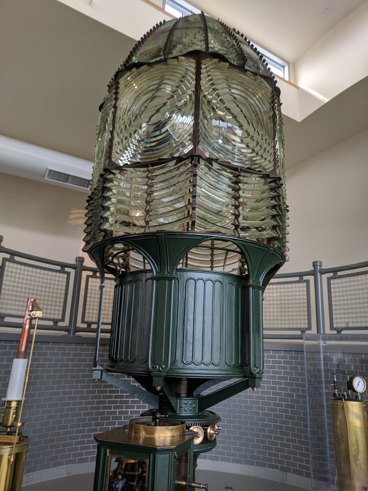
The light rotated with clockwork mechanics and had to be re-wound every four hours by the lightkeeper. The light was originally produced using an oil lamp, and the lightkeeper’s duties included trimming the wick, filling the oil, and polishing the glass.
The top layer of glass is intentionally misaligned (Image 2), as it was during operation, to cast a small beam of light right before the main beam (Image 3). This gave sailors a sneak peak, warning them that the main beam was coming.


This (Image 4) is the current set of lights in the lighthouse. It rotates, with a beam shining every 7.5 seconds. Today, it is used as a private aid to navigation and stands as a reminder of its important role in the maritime history of Fire Island.

Long Island Coastal Guardians
by Flynn DeLany
During our trip to the Fire Island Lighthouse we learned of another organization stationed adjacently to the lighthouse. Even though lighthouses are meant to guide and protect ships from running aground, they weren’t always successful. The early life savers on the island were the United States Life Saving Service (USLSS). The USLSS had lifesaving stations every 3-5 miles along the island, the first being adjacent to the lighthouse and built in 1848. The stations were small shacks ran solely by volunteers. These volunteers were local baymen and farmers dedicating their time to protecting their shores. These men ran drills every day, lived in the stations, and patrolled the beaches from sunset to sunrise.
If a ship ran aground the USLSS would carry a wooden cart with their necessary supplies. I this cart was a small cannon called a Lyle Gun which would fire a line from shore to the ship. (Figure 1). Then an apparatus called the Breeches Buoy would be sent across the line to bring sailors safely to shore. (Figure 2). This method saved over 7000 men 1871 to 1915. Eventually, the USLSS merged with the current US Coast Guard to continue protecting the shore of Long Island.
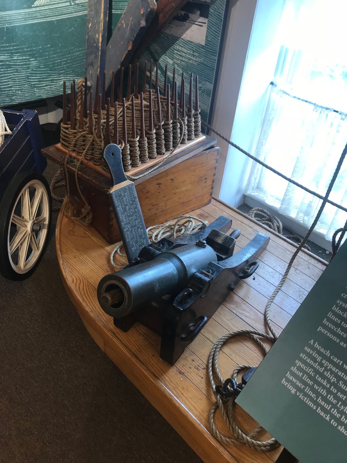 |
| Figure 1: The Lyle Gun was a small cannon (above) that shot a line from the shore to the ship. The projectile and line can be seen in a crate above the gun in the image. |
 |
|
Figure 2: The breeches buoy (above) was a life preserver ring with canvas pants tied to it. This allowed sailors to ride in the buoy across the line from their aground ship to shore.
|
From Swampland to Summer Spot: Robert Moses’s Vision for Jones Beach
by Brad McGuire
The southern shore of Long Island is famous for its beautiful sandy beaches and a popular destination for tourists, locals, and city folk alike to beat the heat during the summer. One of the most popular of these beaches of course is the infamous Jones Beach. Swimming, sunbathing, fishing, boating, spending time with friends and family, or even just enjoying a nice day: all possibilities for those who visit Jones Beach every year. Yet this much loved state park was not always as it currently is. The pristine beaches enjoyed by many did not naturally form in their present state, prefect and ready for summer fun. In fact, the creation of Jones Beach was a longtime in the making with nearly a decade spent simply trying to bring the state and local towns into agreement about how to go about making such a park and what sorts of effects it would have on the area. Ultimately it took the dedication of one man with a vision and a well of perseverance to bring about the creation of the well-known and beloved park. That man was Robert Moses.
Preceding Moses’s discovery of the area, Jones Beach had initially been a barrier island commonly thought to be completely unusable for any sort of developmental purposes. Covered in marsh grasses, laden with swampy terrain, and infested with mosquitos, the barrier islands were seldom visited save for the excursions of fishermen, rare ferries, and the occasional naturalist enthusiast. It wasn’t until Moses’s introduction to the area in 1921 that anybody had considered developing the area. He imagined a sprawling beach area which would attract both city folk and island locals as a day trip destination during the summer. Using his position as a member of the New York State Park Planning Commission, Moses began laying down plans for the park through 1922 and 1923 before getting the plan passed in the spring of 1924. Through the rest of the 1920’s, Moses worked with state entities and local communities to acquire land, workout logistical problems of transportation and parking, and bring his grand design to light. Concerns about the park ranged from congestion of the local roadways, a takeover of the area by tourists and city folk, and how the development would affect the environmental states of local shore communities. After several years of debating and reworking the original plan, an accord was reached and development of the park began late in 1926. Construction continued up through 1929 when the park was finally opened to the public. Although completed at a seemingly inopportune time, with the crash of the stock market the year looming on the horizon, Jones Beach survived the lean years of the 1930s, gaining some small scale visitation before the outbreak of World War II. The true birth of Jones Beach as we know it today came about during the late 1940s into the 1950s where the increased commonality of car ownership by middle class families allowed Jones Beach to become the hot summer destination which Moses had envisioned nearly 30 years earlier.
Unwanted Residency
by Adam Dean
While visiting Fire Island, New York this past week, I found it interesting to note the sheer scope of development on this barrier island. The idea that only about 250 people live full time on the island seems relieving, but when you’re up on top of the Fire Island lighthouse it doesn’t look that way. During the summer months, between part time homeowners and visitors, it isn’t uncommon that the island will have a population of 15-17,000 people – which has many adverse effects on the barrier island itself.
First off, is the treatment of our beaches, and this one is not necessarily specific only to Fire Island. People who primarily aren’t from here often don’t care or know much about our beaches, and will commonly disobey signage, and partake in other behaviors that damage our beaches. Often visitors will feed wildlife, which not only can help undo control efforts, but can also attract them toward roadways, or toward high visitor traffic areas, which is never good for wildlife. Many visitors will also walk on barrier dunes, either as shortcuts, or for pictures etc. – which can uproot dune grasses and significantly speed erosion if these plants do not quickly recover.
Secondly people often come with needs that must be met- and all this means development. Fire Island is one of the more developed barrier islands in the northeast United States, which can equate to an additional plethora of problems. All the island’s summer residents and visitors are likely contributors to Great South Bay’s famous nitrogen loading/eutrophication issue. On top of this, all the development helps to contribute to erosion in that it eliminates wetlands and helps to loosen sediment. Development also promotes insurance issues in that it gives hurricane forces a hard surface to impact, which makes these developed surfaces more easily destroyed. Once destroyed, property owners would usually argue these homes and buildings should be replaced- although it will result in insurance and state money being wasted to rebuild homes that are not going to be permanent, as they will be destroyed by future storms.
Another unnecessary resident of Fire Island, are its deer. The deer presumably have come to the island by means of swimming across the Great South Bay in order to try and avoid habitat loss to development on the mainland. The deer once they got to Fire Island though, have no natural predators or competition- and reproduce in an uncontrolled manner- consuming copious amounts of beach grasses and other shrub plants, which would otherwise help retain the sand on the barrier island. Other than organized culls on the herd, the main major step toward restoring balance is to have the deer being fed through feeders laced with birth control- to stop reproduction and create a better balance. This does seem to be working, and is coupled with rolling doors that the deer must enter through to get the food, which remove ticks and are helping to curb their populations as well.
Fire in the Hull!
by Courtney Stuart
Today our class attended the 29th annual Halloween Boat Burning hosted by the Long Island Maritime Museum. This fundraising event attracts visitors from all around Long Island and the greater NY state, and serves as a start-of-fall celebration. Each year, a large wooden boat—which is either too damaged to repair or has reached its retirement—is donated for the event. With the help of the West Sayville Fire Department, the boat is set ablaze in the center of the museum’s grounds, creating an enormous fire that amazes visitors and helps them overcome the fall night’s chill. In fact, this is the largest bonfire on Long Island—no wonder it has become such a popular tradition in the community. The death of one boat marks the birth of another, as the museum raffles off a new boat hand-crafted by their boat shop volunteers. The holiday raffle is an opportunity to showcase the beautiful, custom-built and restored vessels coming out of the Museum’s Moonbeam and Frank F. Penney Boat Shops. Additionally, there is live music from local artists, food vendors, Halloween costumes, and plenty of spooky spirit. All proceeds from the event go toward the museum’s educational programs and initiatives to preserve Long Island’s maritime history.
The Long Island Maritime Museum, originally called the Suffolk Marine Museum, has been dedicated to research, conservation, and maritime education since it opened its doors in the spring of 1968. Over the years, the museum has collected several vessels, historic buildings, and machines. These artifacts are on display in the museum’s exhibits and lend themselves to educational programs on the long-standing maritime history and heritage of Long Island. The museum itself is located on 14 waterfront acres, serving as the perfect location to discuss the connections between the local community and the sea. On any given day, visitors can expect to participate in interactive exhibits, explore the library and galleries, observe scientists conducting onsite research, and tour the Boat Shop, Bayman’s Cottage, and Oyster House. The museum offers programs for children and school groups, and hosts several events for the community in addition to the boat burning, including the Seafood Festival, the ‘Tis the Season Gathering, and the Priscilla Downrigging (which prepares the museum’s 1888 oyster sloop, Priscilla, for winter).
 |
| Image 1. Large flames can be seen engulfing the boat at the start of this annual fall celebration. As you can tell from the crowd, this is a popular attraction for Sayville community members and surrounding towns! |
 |
| Image 2. Although the large boat burned rather quickly, its pirate flag defended its position on board and remained upright for several minutes. When the pole finally came toppling down, the crowd erupted with delighted cheers and celebratory claps. |
Coastal Cultural Experience: Montauk Lighthouse and Walking Dunes
Montauk Lighthouse Blog Post
by Amanda Ackermann
The lighthouse at Montauk Point is a revolution era lighthouse that is still in use today. The actual light of the lighthouse is as fascinating and historic as the history of the structure itself. A kerosene-lit lantern was used to light the way for sailors in the Atlantic until 1858, when the Fresnel lens was installed. The lens was added to strengthen the beam farther out at sea and to add a series of flashes that can help sailors identify the lighthouse as Montauk Point.

This image is just a part of the Fresnel lens that was placed atop the lighthouse, as the full set can stand well over 6 feet tall. This lens replaced the first lens in 1903 and stood in place until 1987, when the modern one was installed. Fresnel was a French inventor that used the concept that light can be transferred via waves to manipulate the light to go farther and emit a stronger signal. The lens was sent to America Nowadays, a modern Fresnel lens is used with an electric and automatic light. The Coast Guard maintains the light and makes sure it still functions properly.. Below is the light as it is today.

Below is an example of what the LED light bulb looks like. Amazingly enough, the light bulb itself is quite tiny compared to the light it emits. The lenses do all the work in transferring the light across the water.

Montauk Lighthouse Museum: Montauk and WWII
by Stephen Havens
Montauk became an area of interest during WWII due to its location at the tip of Long Island, and close proximity to New York City. If an invasion of the United States were to occur, Montauk was a possible candidate. In 1942 the United States Army assumed control of all the land in Montauk and named it Camp Hero. Although no invasion ever occurred, a freight ship was sunk by a German U-853 submarine in May 1945 and throughout the duration of the war the lighthouse was often dimmed, in a form of light discipline to make it more difficult to see Allied vessels passing by. Pictured below (MTK1) is a sketch of the layout of Camp Hero. Following the conclusion of World War Two, Camp Hero was closed, and only continued as a training facility, then was taken over by the Coast Guard.
 |
| (MTK1) Photo credit: http://www.skylighters.org/camphero/largemap.gif |
Two 16-inch battery guns were installed at Camp Hero, Battery 112 and Battery 113. These guns were connected to each other via a 500-foot underground tunnel. Both guns had a range of more than 20 miles from the coast. Battery 113 was in service from 1943-1959 and Battery 112 (MTK3) was in service from 1944-1957. Neither gun was ever fired in combat. Due to significant erosion, one of the smaller battery guns (MTK2) fell off the side of the cliff and onto the rocks below the lighthouse and is still there to this day.
 |
| MTK2 |
 |
| (MTK3) Photo credit: https://www.camphero.net/timeline/coastdefense/battery112 |
Montauk Lighthouse Museum: Long Island Shipwrecks
by Jennifer Repp
Navigating the waters surrounding Long Island was, and continues to be, a challenge for ships. This model (Montauk_1) shows the 28 lighthouses from Manhattan to Rhode Island (this picture shows the eastern part of the model). These lighthouses serve to guide sailors around the forks and into Long Island Sound.
 |
| Montauk_1 |
Despite the many lighthouses, there have been hundreds of shipwrecks around Long Island. These can be attributed to several factors including the high volume of vessels that navigated these waters, the complex coastline, and weather conditions. This image (Montauk_2) shows the location of 20 prominent Long Island shipwrecks, many caused by running aground.
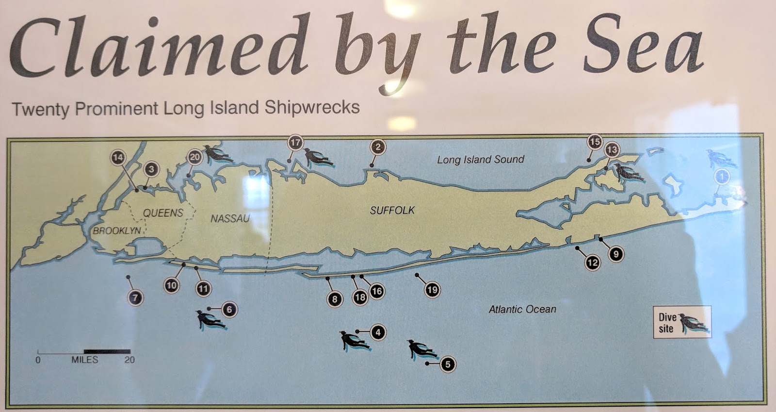 |
| Montauk_2 |
Pictured here (Montauk_3) is a model of the HMS Culloden, a 1659 ton British Royal Navy battleship. She ran aground during a winter storm in January of 1781 and then burned to the waterline. Her whole crew of 650 survived. The location of the shipwreck, Will’s Point, has since been re-named Culloden Point. On the map above (Montauk_2), this is shipwreck number 1. Standing on the shore of Montauk point (Montauk_4) on a relatively calm day, the wind and waves still seem powerful. You can imagine how a storm’s swells hide the rocks and shallow sand bars from a sailor’s view. Feeling the swift breeze, you can imagine the strong winds carrying ships in towards land and huge waves smashing their wooden hulls into the shore. With these forces, combined with the Long Island’s complex coastline, the frequency of shipwrecks in the area is hardly surprising.
 |
| Montauk_3 |
 |
| Montauk_4 |
Erosion of the Montauk Lighthouse Bluffs
by Sabrina Simone
When you visit the Montauk Lighthouse and gaze out into the open waters in front of it, you would be surprised that it once stood almost 300 feet from the water. Ezra L’Hommedieu chose the site in the late 1790’s and gave it 200 years until it ended up in the sea. While, 200 years have passed, the lighthouse is still standing today. Yet, it currently stands 90 feet from the breaking waves of the ocean. This is due to the growing issue of erosion. Caused by the breaking waves, storms, and even ground water, the bluffs protecting the Montauk Lighthouse have subsided greatly.
While some have thought to protect the bluffs by bringing in more sand or boulders, these methods did not work efficiently. In the 1970’s, the federal government began consideration to destroy the lighthouse and reconstruct a new one a few hundred feet farther back. It was Giorgina Reid who would help save the lighthouse.
Reid did not have any science background but used experience from protecting her own home from the Long Island Sound. Making their way up the bluff, she built terraces using lumber that were filled with a mixture of sand and reeds. She planted beach grass on top of each terrace to help reinforce the sand (Figure 1). Constructing Reid’s erosion control took a few years to complete but was completed using the help of countless volunteers (1). Today, her work is still standing and continues to protect the stability of the bluffs surrounding Montauk Lighthouse (Figure 2).

Figure 1 – The front page of an article with a cartoon illustrating how Giorgina Reid’s erosion control works. This article is on display at the Montauk Lighthouse Museum.

Figure 2 – A photo I took of Giorgina Reid’s erosion control currently in effect. I was standing on some boulders placed between the bluffs and the ocean for reinforcement.
Sources
1. Bleyer, Bill. “Her Light Still Shines / How ‘a Little Old Lady’ Named Giorgina Reid Stopped the Montauk Lighthouse from Tumbling into the Sea.” Newsday, Newsday, 2 June 2009.
It would seem Long Islanders have always wanted visitors to leave
by Adam Dean
However, since the foundation of the United States, this has proven to be quite a difficult sentiment. As Tumbleweed Tuesday came and went, these past few days have been quite irritating. Although the allotted memorial day-labor day time slot has now expired, I as a Long Islander still don’t have access to whatever parking spot I want, as I cruise down main street in Hampton Bays.
The reason I write about this, is that as I recently visited the Montauk Lighthouse; I was unexpectedly thrown into one of our country’s great forgotten stories – one that in a way explains our shared stubborn nature. Before the building of the Montauk Lighthouse was commissioned by our president George Washington in 1796, the soon to be fledgling United States was thrust into a war for its independence against the military might of the queen. One of the first battles of the American Revolutionary War happened in part right under the current site of the Montauk Lighthouse, and it involved George Washington leading the continental army, full of many Long Islanders, in a stubborn losing battle to try and maintain our island from being taken, as a strategic occupation site outside the transit hub of New York City.
The Battle of Long Island was a show of effort for many Long Islanders back in the day, and many people did as much as they could to try and keep from the inevitable British occupation. One smart yet comical strategy one of the generals had was to have the soldiers march the length of the beach at turtle cove in Montauk, and when they got to the end of the perimeter, they would walk back through the woods, change their coats inside out and go march it again to give the appearance of a much larger army. This is one of the factors which would cause the British to land further west on the island when their main invasion force arrived. Unfortunately for the Americans, Britain had one of the largest, and most impressive naval fleets of its’ day, and which led to them having a terrible advantage over the northeastern coastline. This was especially true of Long Island, which was vulnerable from all sides. Long Island was attacked from both the north and south, with the British focusing largely between Brooklyn Heights and Staten Island so that they could set up shop and aim at the rest of New England.
Although the battle was fairly sad for our home troops in terms of ground lost, it was arguably more important in terms of morale gained. If the Continental Army would stick around and fight for middle of nowhere Montauk and Staten Island, they really would stand and fight for their freedom in any circumstance. Another thing that the Americans did gleam from the Battle of Long Island was weaponry. The Continental Army began the battle without a single cannon, however somewhere in the mix; they did end up with one as they retreated. This is likely due to a shipwreck or one that was otherwise lost by the British, and because they had so many they decided to leave it behind rather than risk lives over worthless equipment. The downright loss at the Battle of Long Island allowed the British to occupy Long Island for the rest of the Revolutionary War. This overall resentment of visitors is very understandable considering that Long Island was known for housing its rowdy patriots, much like the rest of the northeast colonies.
The hallelujah felt by those who live here truly does goes back to a time when Long Island couldn’t even be called a part of its’ own country, and it goes back to a time before the coastline of our waters knew the Montauk lighthouse. The occupation of Long Island lasted for years, and to be honest I think I’d take up arms too if I had to go years without my precious freedoms and quiet beach access. The Montauk Lighthouse truly is an important sliver of Long Island’s history that we all should experience as locals- I highly recommend it as both a historical site of interest, and as a way to understand why we get so irritable come the end of the summer.
Trip to the Montauk Lighthouse
by Ana Shore
This week, our Coastal Culture Experience class took a trip to the Montauk Lighthouse. This lighthouse has been standing as a sentinel on the east end of Long Island for over 200 years. Throughout its history on the East End, it has served several important functions, including its current role as a museum. Aside from the indoor exhibits and the view from the top of the lighthouse, there is still another feature that many visitors find significant.
This feature is a statue outside the lighthouse that serves as a tribute to fishermen lost at sea. The monument was constructed about 20 years ago and is adorned on the base with the names and ages of those that were lost at sea while fishing. The monument shows a fisherman hauling in a line at the stern of his boat. The fact that only half the boat is shown in this memorial is characteristic of statues about shipwrecks. This powerful focal point at the edge of the sea remains important to the families of the lost fishermen and the history of the East End.
 |
|
A view of the Montauk Lighthouse from the surrounding beach. Barely visible to the right of the white surveillance tower is the Lost at Sea Monument.
|
 |
|
A close up view of the memorial at the Montauk Lighthouse. Just visible on the middle row of the base are the names of those that have been lost at sea.
|
Coastal Cultural Experience: Setauket Spy Museum & Port Jefferson Harbor
The more revered Paul Revere
by Claire Garfield
If I were to ask you about a certain patriot who rode his horse through enemy and danger to convey vital information about the British, you would probably tell me about the midnight ride of Paul Revere. But Paul Revere was not the only rebel rider. Another existed that made upwards of 400 trips to convey vital information to Georgia Washington and the Continental Army. This man goes by the name of Austin Roe and he is Long Island’s Paul Revere.
The American Revolution was won by the colonies in no small part due to superior intelligence. George Washington used a spy group called the Culper Ring that operated out of the British-occupied New York City. Austin Roe’s role in the flow of information was to relay intelligence gathered from Robert Townsend in New York City to Abraham Woodhull in Setauket. From there, the intelligence was carried across the Long Island Sound by Caleb Brewster to the Continental Army. Austin Roe would make the fifty-five-mile journey both ways in British occupied and patrolled areas.
Perhaps the most important information uncovered by the Culper Spy Ring was an impending attack on the French fleet harbored in New Port, Rhode Island by the British. The Continentals needed the French’s fleet and help to win the Revolution, and without this vital information discovered by the Culper Spy Ring, the revolution might well have been lost. Austin Roe carried the information about the impending attack and he, along with the rest of the Culper Spy Ring, saved the Continental Army and French Fleet from defeat.
 |
| Image 1. The route information took from New York City to the Continental Army. This information was collected and conveyed by the Culper Spy Ring. Infographic courtesy of the Three Village Historical Society. Image courtesy of Claire Garfield. |
Anna Smith Strong, the women behind it all
by Kim Marko
Anna Smith Strong was a part of a wealthy family living on the North Shore during the revolution. Her and her husband were very vocal over the fact that they were Patriots, while most of the people around them were Loyalist. Her husband was thrown into jail but was released. After his release he chose to move to Connecticut, but Anna and their six kids stayed on Long Island. Caleb Brewster was a whaleboat captain and when he was in the area he would often come and visit Anna and check in on her.
Caleb Brewster was also a part of the Culper spy ring. He would get the messages from Abraham Woodhull and bring them across the sound to Major Benjamin Tallmadge. So you may be asking, where does Anna come into all of this? When Brewster would come into port, she would allegedly leave different colored clothing on her laundry line, so Woodhull would know he was there and where to meet him. If she hung up a black petticoat it meant that he was in the nearby water and if she hung white handkerchief the number of them she hung up would correspond to what cove Brewster would be at.
Setauket at this time was completely invaded with British troops so spies trying to meet up to exchange their messages was very risky. Thanks to the system that Anna came up with the two spies were able to meet at nightfall and do what they needed to do with as little suspicions as possible. While there are no primary documents to prove that what Anna did actually happened, given the fact that she chose to stay in New York while her husband was in Connecticut it seems very likely that he had some connection to the Culper spy ring.
 |
| Image 1: A mural on the wall in the Setauket Spy Museum illustrating Anna Smith Strong and her contribution to the Culper spy ring |
Translation using Tallmadge’s Key: Setauket August 25th 1779
by Emily Richters
 |
| A letter written by Abraham Woodhull, a member of George Washington’s New York City Culper Spy Ring. This letter was written to Benjamin Tallmadge, the Chief of Intelligence, on August 25th, 1779. In this letter, he refers to Jonas Hawkins, who took turns with Austin Roe as a messenger, warning him about the dangers of British interception when traveling into New York City. |
 |
|
This is Tallmadge’s key to decipher codes. The letter was written using this code.
|
Sir. Jonas Hawkins agreeable to appointment met Robert Townsend not far from New York and received a letter, but on his return was under the necessity to destroy the same, or be detected, but have the satisfaction to inform you that there’s nothing of importance to advise you of. There’s been no augmentation by ships of war or land forces, and everything is very quiet. Every letter is opened at the entrance of New York and every man is searched, that for the future every letter must be written with the ink received. They have some knowledge of the route our letter takes. I judge it was mentioned in the letter taken or they would not be so vigilant. I do not think it will continue long so. I intend to visit New York before long and think by the assistance of a lady of my acquaintance, shall be able to outwit them all. The next appointment for Caleb Brewster to be here is the 1st of September very long but it cannot be altered now. It is on the account of their vigilance that it is prolonged. It may be better times before then. I hope there will be means found out for our deliverance. Nothing could induce me to be here but the earnest desire of Robert Townsend. Friends are all well, and I am your very humble servant,
Abraham Woodhull
The ink that Abraham Woodhull is referring to in the letter is the secret “sympathetic stain.” Since British Soldiers and Officers would stop and search men entering and leaving New York and read their letters, spies had to come up with a technique to fool the soldiers. They would write in code or use invisible ink to write in between the lines of what seemed to be a plain old letter. The invisible ink used was an acid that dries clearly and would not appear under heat or light, such as lemon juice. George Washington befriended a chemist who came up with a basic solution that interacts with acid in a way that caused the secret message to appear. Washington referred to this solution as a “sympathetic stain.” Only a select few members of the spy ring had access to this secret solution. The exact formula to this solution is still unknown even to this day. It was not ever written down to prevent the wrong hands from getting a hold on the secret formula.
Setauket
by Cassidy Bell
When the average person thinks about the start of the American Revolution, chances are they either think of the shot heard around the world or Lin Manuel Miranda proclaiming that he’s not throwing away his shot.
While Hamilton is certainly an interesting way to remember the dates and figures of early American history, the former thought may be a bit more rooted in fact. The Battle of Lexington and Concord was the first fight of the Revolution, with that single gunshot of unknown origin sparking the beginning of the war and, more importantly, of the United States. The battle took place in the April before the signing of the Declaration of Independence, meaning that although it was the first fight in the war, it was not the first fight of the United States. That distinction was left for a fight a little closer to home.
After regrouping in Canada in the wake of the Battle of Lexington and Concord, British troops devised a new strategy – to go South to Staten Island and take Manhattan. New York City was the political and trade center of the colonies, making a potential occupation of its harbor a serious blow to Patriot forces. George Washington, at that time a general rather than our Commander in Chief, spread his forces throughout the city, hoping to hold it against the British in a head-on battle despite being outnumbered and outskilled. In an unsurprising turn of events, the battle lasted only three days.
Although a three-day battle may seem like an inevitable failure to those looking back, George Washington was no fool. The general knew after the second day that his troops would not be able to hold the island and so, rather than wasting the life of himself or his soldiers, he planned out a hasty retreat. By the morning of the fourth day, the British soldiers woke up to an emptied city. John Glover, a seafaring man in the Patriot ranks, had ferried the army – 800 men, horses, and cannons – across the Hudson undercover of dark and fog. And just like that, the British had control of Manhattan, a new breadbasket in the form of Long Island, and their first significant victory in the war. However, despite all this, the Patriots had something too – an army to rally across the river and a general who had made a very important realization: this war would not be won by fighting, but rather by spying.
Port Jefferson Shipbuilding
by Emelie Einhorn
As one of two deep sea harbors on Long Island, Port Jefferson has been an important site in the history of the island. Until the end of WW1, the port had been able to sustain itself via the shipbuilding industry and hosted as many as 32 shipyards at its peak. As the need for wooden ships declined with the advent of steam power and metal hulls, the once flourishing port began to struggle. The only way to turn around the prosperity of the town was to transition to another source of income, such as tourism. With the introduction of the ferry, Port Jefferson now acts as a source of transportation between Connecticut and Long Island, bringing in both commuters and tourisms. The Ferry has been able to provide a source of income for people on both sides of the Long Island Sound. In addition to the ferry, the port also has a small village’s rustic vibe, which makes it a tourist attraction for Long Islanders. With only a small entrance/exit to the bay, the waters are calm and maritime activities such as sailing and fishing are accessible. The issue that now arises is balancing the need for tourism with the environmental impacts associated with an increased volume of traffic. This is a struggle many coastal communities are dealing with – not just on Long Island, but all over the world.
 |
| A statue honoring Port Jefferson’s shipbuilding history and all the men and women who worked in its shipyards. |
 |
| In the distance, a small opening can be seen in the bay. This is the only way to enter/exit the bay and explains the calm waves, even during windy or stormy conditions. |
 |
|
The Ferry that sails back and forth from Port Jefferson to Connecticut across the Long Island Sound, currently docked and unloading vehicles and passengers.
|
George Washington: Not Only the Father of Our Country, but the Father of The Spy-Ring
by Alyssa Shanley-Lente
When visiting the Three Village Historical Society exhibit, I was super excited because it was about spies during the American Revolution and the popular show Turn was based off the exhibits inside. One of the first things I learned was about George Washington, who of course everyone knows as the first president, but lesser known is that he is the father of the first successful well-organized spy ring. This was due to the fact that he believed that “Good Intelligence” was crucial to winning the war and he used the information from the men in the spy ring to learn about the British army’s plans and movements. This was extremely important because out of all the people who lived in New England only 1/3 of them were patriots and they were not trained for war.
Due to Washington’s men being poorly prepared for war and greatly outnumbered during the Battle of Long Island, Washington realized that they would never win and wanted to keep casualties as low as possible so they retreated in the cover of darkness to escape. After this he used surprise to outbattle the British with the help of spies and was very involved in everything going on around him. He was also known to write twenty-five to forty letters per day advising his men on what to do and where to go from the information he would obtain from the spy-ring. Washington was known to be brilliant man and would use his wits to outsmart the British and one such instance was known as Meigs Raid where patriot troops were able to surround and capture British troops and officers without firing a single shot because of the information from the spy ring.
In spite of how well the spy ring eventually became, when first creating the spy ring it did not go smoothly. Washington’s first spy ever was a man named Nathan Hale and had volunteered to go into the city to obtain information for them. However, he was a horrible spy and was quickly captured and hung two days later which Washington felt personally responsible for and was devastated. Washington later approached a man by the name of Benjamin Tallmadge to become the Chief of Intelligence and he was put in charge of the spies. With Tallmadge as the head of the spies Washington could focus on the battle side of the war where he didn’t want to know any of the men’s names so as to protect them and their families. Washington would also help them out of jams when they were close to getting caught by having a man make invisible ink which Washington referred to as “sympathetic stain” and Woodhull, Townsend and Tallmadge were the only ones who had this stain and reagent used to see the messages being sent. Without Washington and his idea for the use of a spy ring, things could have gone very differently, and the United States may not have been what they are today.
Coastal Cultural Experience: Sag Harbor Whaling Museum & Custom House
Sag Harbor
by Emily Richters
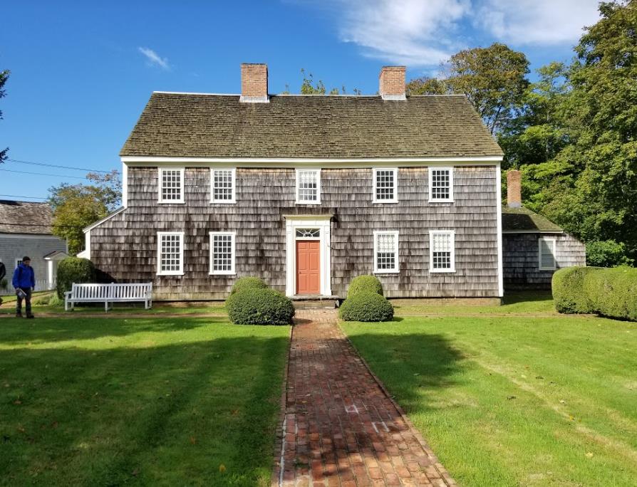
The Custom House belonged to Henry Packer Dering, who was appointed Custom Master/Collector of Port by President Washington in 1790. He served for 32 years. A custom master is someone who collects all the taxes on imports coming into the country from all over the world. Sag harbor was a very busy port at the time. The Federal Government did not provide an office for him, so he would operate in his own home.

This is found in the pantry of the Custom House. It is a lovely jar of peaches. It has only been sitting and fermenting since the 1840’s. Peach wine, anyone?

Found upstairs in one of the girl’s rooms. The children would sometimes like to keep a pet in the house. The big black cage on the floor is where a child would keep a pet squirrel. Squirrels were obtained as babies, and were taken care of by the children. The smaller cage on the bed is where a pet mouse would have been kept.

The big round pan located on the bottom right hand corner is called exactly what it looks like, a Hat Tub. Much smaller than a modern day bath tub, hat tubs had a similar purpose. Water was heated over the fire and poured into the tub. The family would consecutively take turns sponge-bathing themselves, starting with the father, mother, oldest child, and then the baby. Yes, they all shared the same water.
To Catch a Whale
by Delphine Mossman
Whaling is a fairly old profession, predating European contact with the New World, but it was the Europeans who turned it into a commercial and profitable venture. Part of this had to do with the development of ships that could stay out at sea for months or even years at a time, processing each captured whale down to oil, bone, and teeth. Another major part was the development of specialized tools to capture, kill, and refine the whale carcass. The tool that underwent the most change over the decades that whaling was in its heyday was the harpoon.

Harpoons through the years. From left to right: a two flue iron, a single flue iron, a grommet iron, a temple toggle iron, and two improved toggle irons, one closed and one open to 90 degrees. Picture taken at the Sag Harbor Whaling Museum in Sag Harbor.
When a whale was spotted, a smaller boat holding six men was launched in order to try and harpoon it. A harpoon was not meant to kill the whale; rather, the goal was to attach the small boat to the whale and ride along until it tired itself out. Only then was a lance used to strike through the skin, blubber, and muscle of the whale to attempt to pierce the whale’s heart or lungs, killing it. Only after the whale was well and truly dead could it be towed back to the main boat and processed.
One of the worst things to happen to a whaler would be if the harpoon did not stick in the whale as it thrashed and ran, allowing it to escape the smaller boat. As a result, the design of the harpoon was refined to attempt to make one that would stick in the whale no matter what. The eventual result of this evolution can be seen on the far right of the picture above. The head of the harpoon would be held against the shaft by a small piece of wood. When the harpoon entered the whale, the wood would snap, and the pulling of the whale on the harpoon would cause the head to rotate and form a right angle with the shaft. This greatly lessened the chances of the harpoon sliding out of the wound, and these harpoons were used for hunting whales by hand until the end of whaling.
Whaling techniques
by Amanda Ackermann
Whaling was one of the most important industries in coastal communities in Long Island. As time went on, whaling changed and evolved. Shore whaling was the original form of whaling in Long Island for settlers, with whalers mainly hunting Right Whales and the occasional Humpback. Native Americans often scavenged beached whales, but also built canoes to try and herd whales that were close to shore towards the beach, using loud noises to scare them inward. As whales became more scarce along the shore, deep water whaling became the primary method of harvesting whales. Below is an image of a typical boat used for shore whaling.

This seemingly small boat was stable enough to withstand being towed by a whale the size of a school bus, and could hold all the necessary equipment and people needed for the hunt. Its versatility allowed both ends to be used as the stern or bow, with the knob at the end seen in the picture as the place where the harpoon was tied off to. It would be the job of the boatheader to command the boat from where he stood at the stern. The boatsteerer would harpoon the whale when they were close enough. The rope would then uncoil rapidly, and the crew had to make sure to dowse it whenever it began to smoke. Once the whale was close enough, the boatheader would switch places with the boatsteerer (a dangerous procedure) and use the lance to kill the whale.

Whaling was a largely communal effort, with everyone in a town having a part in the business. This (slightly blurry) image depicts a typical scene from an algonquin tribe after a successful shore whaling hunt (or if they were lucky, a beached whale). Once the whale was on land, the processing would begin right away. The skin was stripped off of the whale, and the blubber was placed into large vats where it would be boiled (seen on the far right). This was a job usually left for women and those not young enough to hunt whales yet. Those impurities left over from the oil boiling would be used as fertilizer.
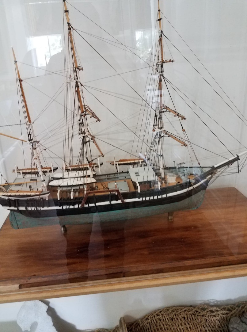
This image is of a whale vessel that would have been used in the 19th century, when shore whaling was no longer successful. These ventures would take the men out into the Pacific Ocean, where they could spend months to years trying to fill up the cargo hold with whale oil. There were six whaling boats attached to the ship, so when a whale was spotted the hunters would go into the smaller boats to pursue the whale. Once the whale was killed, the boats would tow the whale in towards the ship, where it would be chained up to the starboard side. It was then that the rest of the crew would quickly begin processing the whale, in a dangerous setting of sharp knives and a slippery deck. The head of the whale was most valuable, as it contained large amounts of oil, and they were able to remove the teeth and use it as scrimshaw to pass the time aboard. Whale oil would be boiled in tripots right on the ship, despite the danger. Waiting until they reach shore could risk spoiling, and the whalers wanted to make as much of a profit as they were able
Custom House
by Stephen Havens
The Custom House, in Sag Harbor was the house of custom master Henry Packer Dering. The custom master oversaw the collecting and enforcing of import taxes on shipments coming through the port of Sag Harbor. There were many interesting things in the custom house that revealed things about the way of life in the late 18th and early 19th centuries. All photographs used are credited to the Custom House Museum in Sag Harbor.
This was a bed, located on one of the children’s rooms in the Custom House. It had rope stretched across the bedframe instead of springs, and each evening before bed needed to be tightened with the wooden instrument on the foot of the bed.
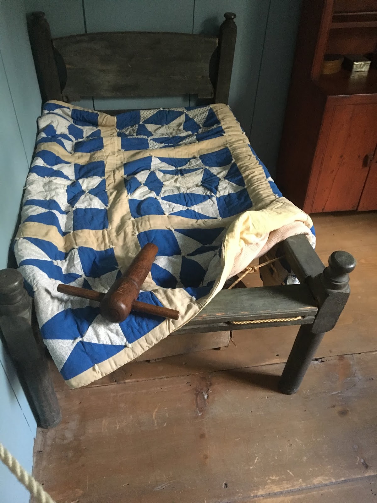
This was known as a “Pie Safe”. Constructed of thin wire mesh, it was where recently baked breads and pies would be placed to cool off. Cheeses were also stored here. The thin wire mesh would keep bugs off the baked goods, and a lock was even present to keep out the hungry kids.

Pictured here is a fruit press

and a popcorn and waffle maker

Fruits would be placed inside the device and the handles would be pressed down, squeezing the fruit allowing for juice to be produced. The waffle and popcorn makers had long handles so that they could be safely held over the fire while being used, as there were no stoves during this time period.
Daily Customs
by Adam Dean
Upon visiting the Custom House I was able to see that there are many items that were used back then, that we either don’t use now, or are altered in function. An example of something humans no longer use (but perhaps would have an equivalent modern market for) are the bed warmers of the day. Families in that day would often put hot coals in a metal bed warmer, and place the bed warmer within the sheets, to preheat the bed for the occupant. The closest thing I can think of to this in the modern day would be a heat blanket, although I’d argue most people don’t use them to preheat the bed.
On the topic of outdated everyday items, I would also like to talk about the idea of a pie safe. Most noteworthy people of the early 1800’s had a pie safe, which was almost like a breadbox in the shape of a chicken coop- raised off the ground, with wire mesh to keep out rodents, and of course with a lock to keep out children. Another interesting locked item of the day included clothing chests, which today would be unusual- although for some reason it made perfect sense, possibly because of the cost of nice clothing at the time. Other everyday clothing items included hats and canes. Nobody, not even children would be seen outside the home without a hat on in this time period, and the well to do almost always carried a cane or walking stick- something which is mostly reserved for those who need the assistance walking today.
Typical bedrooms of the day were separate, husbands and wives had their own sleeping quarters if they could afford it. Many couples today would either hate this feature, or have been asking for it every day for the past five years. Pertaining again to the sleeping situation, it was not uncommon to have ropebeds, where instead of a mattress; the sleeper would lie on sheets over a web of ropes, which would be tensioned before sleeping. Other bedroom anomalies include a bootjack, which is relatively equivalent in function to a modern day shoehorn- although instead of helping you hold back the lip of the shoe, a bootjack holds the boot in place as you cram your foot inside it. The shoes you put on would also be similar to those of today, although they would not be specific to your right and left foot, they would be completely identical. Lastly, on your dresser would often be a bloodletting tool- seeing as “releasing bad humor” from your body was seen as one of the most helpful and widely used home remedies for disease.
In short, many home items of the 1800’s serve a different purpose now, or have become obsolete. However, it can be very intriguing to see where some of your home appliances and everyday items come from. Who would’ve taken the time to think about how annoying it must have been to make toast back then, and appreciate not having to hold your bread on a fancy stick in front of a fire in the morning.
Coastal Cultural Experience: Bayman and Southampton Historical Museum
Sam Parrish & the Rogers’ mansion
by John Maniscalco
While spending the semester in Southampton [New York], it was both nice and interesting to get a brief, yet informative look into the history of Southampton. During our trip we spoke to Alex, who is a local bay man here in Southampton. While he spoke to us, he talked a lot about the lifestyle of bay men, in addition the future might be for his occupation as well as Shinnecock Bay. Afterwards, we made our way into Southampton where went to the Southampton historical museum located in the Rogers mansion.
 |
|
Figure 1: Roger’s mansion from the outside (Photo taken by me at the Southampton historical museum located in the Rogers mansion)
|
As stated before, the Roger’s mansion is home to the Southampton historical museum. The mansion stayed within the Rogers’ family until 1880. Then in 1899, Samuel Parrish purchased the property and for a lack of better terms made it his own. For starters, the current size of the house wasn’t achieved until Sam Parrish purchased the home; where the house was doubled in size. However, one very notable piece of information regarding the mansion, especially the increase in size, is the fact that the way the house’s size increased. This is because there were some odd architectural choices made by Parrish that can seen by as not fitting with the house. However, personally I believe these “oddities” add character the house in the sense that these features are uniquely a part of the mansion. With that said, let it be known that Samuel Parrish was not an architect. Instead he was very adamant about art, which is not only one of the more notable parts of the house, but also my favorite. Art can be found all over the walls of the mansion; leaving hardly an open space on the walls. In addition, much of the art found on the walls tie into the history of Southampton, Long Island, and even New England. Ultimately, Parrish lived in the mansion for the reminder of his days. Now, the mansion is home to the Southampton historical museum; where the mansion has been decorated interiorly to match that of the time when Parrish lived there. Personally, I feel the mansion/museum is a wonderful time capsule as it gives a concentrated look into Southampton history and culture. Without, the Rogers family, museum personnel, and Sam Parrish this piece of history may have been lost.


 |
| Figure 2: Some of the beautiful pieces of art found in the Rogers mansion (photo taken by me at the Southampton historical museum located in the Rogers mansion) |
The Protection of Oysters in Tiana Bay
by Alyssa Shanley-Lente
On a windy, cloudy day while driving around the town of Southampton my professor took the class down to the beach called Tiana Bay. As we got closer I saw that there was a dock and in between where the dock and the shoreline was there was these screens with pieces of colored foam floating on the water. At first I had no idea what these things were and I was very confused, but once my professor came over he explained to the entire class that they were oyster cages. These oyster cages had been placed there in order to help restore the populations of these shellfish and are very important for the local community to keep the populations alive and well.
This restoration project is interesting to me because the local community depends on these shellfish for their livelihood and as such they are doing their best to keep the populations healthy. Each one oyster cage holds up to one thousand individuals each and because they are in such close vicinity to each other the reproduction rate is high. Then once the oysters reach adulthood they are transported to an area where they can then begin to filter feed improving the water quality. Kurt also said that people are able to purchase an oyster cage for themselves and that as many as one hundred and fifty individuals can fit onto your fingernail!
Due to the fact that more and more people are becoming involved with the protection and restoration of the oysters their populations are beginning to increase. This outlook is good and as such the hope for the restoration of the oysters population is promising. This gives celebration for not only bay men and fish markets but also for the local oceans and bays around the area. If the oyster cages continue to work the local community will no longer have to worry about losing this important shellfish from the area.
Southampton blog
 |
| This is an exhibit at the Roger Mansion Museum in Southampton. They are some of the birds that are displayed in one of the rooms in the museum. The birds are there because the original owner of the house, Albert Roger, would bring back birds and they would hatch so there would be different birds around the house. |
 |
| These are artifacts that are on display on the outside of the Roger Mansion Museum in Southampton. They are called try pots. They were iron kettles that were used onboard whaleships to boil blubber and convert it into oil. The fire for the try pots would be inside the bricks that are located underneath them. |
 |
| This is a painting that is being displayed in one of the main rooms of the Roger Mansion Museum in Southampton. It is a picture of the Mayflower leaving Southampton, England in 1620. This picture gives us a view from the other side of voyage since we are used to seeing the Mayflower arriving the New World. |
Strange architectural choices and the toggle harpoon
by Diana Beckenhaupt
Whaling was a part of Southampton life, like most marine-based communities at the time. The tour guided showed us a piece of ambergris, chipped off a huge block that is now completely useless since ambergris is prohibited. (Ambergris is a byproduct of whaling that was used as a perfume fixative for a long time) At the museum, several whaling artifacts were on display, and our tour guide brought out a harpoon gun, which was almost too heavy to pick up. This harpoon was tipped by a ‘toggle iron’ which is basically a movable hook, that gets stuck in the whale once it is impaled. The toggle iron was invented by a black American man from New Bedford, CT in the 1840s. His name was Lewis Temple and he is often forgotten today because whaling is no longer an industry – but his invention was crucial at the time. Lewis Temple himself unfortunately died at 54 after a fall, leaving only debt and no heirs. (Source: http://nbhistoricalsociety.org/Important-Figures/lewis-temple/)
 |
| Toggle iron harpoon very similar to the one at Southampton Historical Museum. The pointed end moves on a hinge, which is what allows the weapon to be so effective. |
Source: https://www.liveauctioneers.com/item/27282625_ca-1880-toggle-harpoon-29-34-long
The whaling items were only a small part of the tour. The main focus of the Southampton Historical Museum is the Rogers Mansion. Built in 1648, it has been continually changed, moved and updated. Though originally inhabited by the Rogers family, others like Dr. John Nugent who bought the house in 1889 made their mark by adding parts, windows, or expansions to the mansion. Today, you can notice the strange details left over from multitudinous changes. Outside, I noticed the weirdly flat roof, and a window that looks out to the opposite wall. The tour guide told us that the roof pools water when it rains, and occasionally someone will have to bail it out. I’m no architecture buff, but even I could notice the stairs that are squared away in the wall in a haphazard fashion, and the fancy molding whose designs get cut in half by the adjacent wall. It’s slightly frustrating to see; the tour guide also said that when someone came to prepare an architecture report on the mansion, she told the museum staff she hated the house design. I personally liked the curved door though (the museum staff had hidden a mummy for Halloween behind it!). Overall the mansion became a lot more interesting to me once I noticed the poorly planned renovation details like the moldings, if slightly aggravating. The Rogers Mansion has been a part of Southampton town life since its beginning, and so it is a valuable resource for tracing the town’s history, including the renovations. I’m glad we got to visit it, and plan on making another trip into town to check out the other old historic buildings.
 |
| I was unable to find a photo of what I talk about here, but these are two of the moldings in the house. In several places, the face shown here is abruptly cut in half to make way for the intersecting wall’s corner. It just doesn’t make sense to do that, rather than carefully measuring ahead of time! |
Source: The Rogers Mansion Historic Structure Report, found at https://www.southamptonhistory.org/historic-structure-reports
Every morning I wake up, get to the boat house and put my waders on to get ready for the day. Me and the boys get the draggers ready and the bull rakes all set to take out on the boats. Today I’m in the bay raking for clams, so I made sure to wear my best waders since the water is starting to get a little colder now. We supplement our income with shellfish especially since the hard clam population has been rebounding and on the rise in Shinnecock Bay. Scallop season is coming up soon so that should help us a lot since it’s a longer season, hopefully there’s a good amount out there, we have to find the right spots to go to. At the end of the day, we bring some of our catches to the fish market right after the bridge; they take most of the east end catch as well, so they have a huge variety. The largest amount of catches go to the fish market in the Bronx called Hunt’s Point, formally known as Fulton Fish Market. They’re the biggest distribution fish market in the entire US, especially for the tri-state area, so we not only provide for our small community, but for the rest of the tri-state area and beyond.
Hopefully with the start of the new year, the DEC and National Marine Fisheries will come up with new catch limits for us because this is ridiculous. How are we supposed to make a living doing what we do when we have limits set on us, meanwhile New Jersey fishermen can come into our waters and take our resources. Southern states have nowhere near as strict of limits as we do, I don’t think I’ll ever understand why, but I wish it would change. We talked to the local politicians as much as we could, til we were blue in the face, but nothing has really changed to benefit us. This is all becoming too political, and not being managed in favor of the resources. Don’t they know we have families to take care of, they should be helping us. By taking care of us, we can take care of the community.
Most of the people I work with are men, but there is one woman in Southampton though. Most people stereotype baymen as just men, but they don’t understand that everyone in the families of the baymen are involved too. When we bring home shellfish, they shuck them in the kitchen, they take care of us and they should be considered part of the baymen community.
Coastal Cultural Experience: Kayaking and Seafood Cookout
The clam before the storm: Coastal Cultural Experience
by Claire Garfield
The only thing that disturbed the still and silent water of North Sea Harbor, aside from some very eager Coastal Cultural Experience students, was a lone fisherman trudging through the sediment in search of clams. Despite their unassuming appearance, clams and other filter-feeding bivalves have played an integral role in Long Island’s natural and cultural history.
When the first Europeans stepped foot on Long Island at Conscious Point, they used the water around them for food and other practicalities of everyday life in the 1640s; however, just like the college students that call Stony Brook Southampton home now, they wanted something familiar to eat. Lobsters, a delicacy now, were too unfamiliar to be palatable, but shellfish like clams, oysters, and mussels were reminiscent enough of home and therefore acceptable. Life in a new place is always tricky though and the early Long Island settlers wasted nothing of the shellfish they found. After eating the organism, the shells were ground up and used to whitewash homes.
Bivalves are still important in Long Island waters. They’re great cleaners, in fact, since the decline of clam populations in the Great South Bay from 1976 to 2005, time to filter the bay has increased from 3 days to 90 days [1]! Luckily, communities like Southampton recognize the importance of balancing cultivating and protecting the bivalves of North Sea Harbor. Within the harbor lies a protected area where clams are left undisturbed. Nearby are floating barrels for mussels that pop to the surface when the mussels are ready. The Southampton Conservation board works along international organizations like the Nature Conservancy to protect vital habitat. Despite a decline in bivalves in the past, people of the South Fork seem committed to conservation and a better future for our filter-feeding friends is in sight! A great impetus for us is how tasty they are as we were treated to a fish fry made from local seafood!
1. Bretsch, Kurt. Long Island Marine Habitats, lecture 3.
 |
| Figure 1. A sunset treated us as we enjoyed our fish fry complete with some local bivalves. Source: Claire Garfield |
The Trials of the Terrapin
by Brandy Jones
As we paddled through North Sea Harbor, we took in the overcast afternoon, feeling the increasing chill to the air as it swept away the final day of summer. Crossing into Fish Cove, a fellow Semester by the Sea student spotted what may have been the head of a diamondback terrapin turtle. As the only species of turtle in North America that lives in brackish environments, meaning a mixture of salt and freshwater, the diamondback can be found occupying coastal salt marshes, bays, coves, estuaries, and tidal creeks [1]. While our class discussion only touched on the terrapin turtle briefly, mentioning their petite size and usual habitats, it sparked an interest in me as we failed to spot any others while kayaking. Were the terrapins yet another species being over harvested in Long Island, or were they simply hiding from us?
Diamondback terrapin turtles have been a source of protein for hundreds of years. During the late 1800’s and early 1900’s, terrapin soup was considered a gourmet food and the unregulated capture of these animals decreased the population drastically in New York [1]. While the people of the early 20th century began to recognize the decrease of diamondback terrapins, it was not until 1990 that regulations were put into place to protect them [2]. Fast forward to today: terrapins not only face problems such as climate change, rising sea levels introducing inhabitable levels of salt into their homes, death by boats or cars while finding a spot to nest, predation, and pollution, they also fall victim to drowning in crab traps placed throughout Long Island [3].
Crab trap deaths of diamondback terrapins are one of the leading causes of their population decline. Organizations such as The Nature Conservancy and the Seatuck Environmental Association have teamed up with the New York State Department of Environmental Conservation (NYS DEC) in order to implement ways to reduce terrapin death by both crab traps as well as the capture and sale for human consumption. Thanks to their efforts, 2018 will be the first year that terrapins are prohibited from being directly captured anywhere in New York State, as well as the first year that the NYS DEC requires all crab traps placed in densely terrapin populated areas to contain Turtle Excluder Devices (TED’s) which will prevent them from swimming into these traps, but still allow for crabs to enter [2].
As I think about all of the wonderful creatures we have seen during our classes and field trips thus far, I feel hopeful that more and more young people like myself and the rest of the Semester by the Sea students will be able to see and learn about keeping our wildlife safe. With these changes, hopefully the subsequent classes will find more of the diamondback terrapin turtles during their kayak trips.
Works Cited
1. “Diamondback Terrapin – Watchable Wildlife”. Official Web Page of the New York State Department of Environmental Conservation, https://www.dec.ny.gov/animals/59652.html
2. LoBue, Carl. “Good News for NY Diamondback Terrapins!” Fire Island and Beyond, 2018 March 16, https://http://fireislandandbeyond.com/good-news-for-ny-diamondback-terrapins/ 3. “Long Island Diamondback Terrapin Protection Project”. Huntington-Oyster Bay Audubon Society, https://www.hobaudubon.org/diamondback-terrapin-protection-project.asp
Never Fight with a Pregnant Woman—A Brief History of Conscience Point, NY
by Courtney Stuart
This Friday’s “class” involved kayaking around Conscience Point in Long Island’s North Sea Harbor. Although the trip may have been slightly challenging for some of our beginner kayakers, it was nothing compared to the journey made by a small band of English colonists who first arrived at this very site in the summer of 1640. Despite the plan to head further west along the island, the pilgrims’ restless journey was cut short thanks to one very weary passenger, an eight-and-a-half-month pregnant woman. On what was planned to be a quick stop along the way, the exhausted and assuredly sick woman disembarked the vessel and could not be convinced to return—claiming that her conscience told her this is where they must stay. Her husband and the rest of the vessel’s members, knowing full well not to fight with an angry pregnant woman, agreed to stay and make this their new settlement.
The pilgrims, unfamiliar with their newly settled environment, learned an important lesson from the Shinnecock Indians who had been living in the area for centuries. That lesson was the difference between living alongside the water and living on top of it. As the Native Americans had probably learned the hard way, living on top of the water and facing the constant threat of coastal flooding was not ideal. Rather, it was best to build slightly inland, while still maintaining a close relationship with the seas. The remnants of this lesson can still be seen in the North Sea today, the original Conscience Point and surrounding marshes are undeveloped and wild. In contrast, modern houses, docks, and boats fill the opposite coastline, creating a stark juxtaposition between the two sides of this small bay.
As for Conscience Point today, it is now part of a 60-acre national wildlife sanctuary managed by the Long Island National Wildlife Refuge Complex. The sanctuary serves as a refuge for maritime grasslands, woodlands, and salt marshes, as well as the wildlife associated with these habitats—osprey, terrapin turtles, heron, fish, warblers, and the various shellfish that live within the protective habitat of the submerged vegetation [1]. An unforeseen stopping point for Pilgrims has become a crucial component of the modern coastline’s wetland network—known by Long Islanders as the Cow Neck Complex—which comprises over 300 acres of land and exposed tidal flats. The complex is partially owned by the Nature Conservancy, a global non-profit organization that has been dedicated to the protecting both the natural environment since 1951 [2]
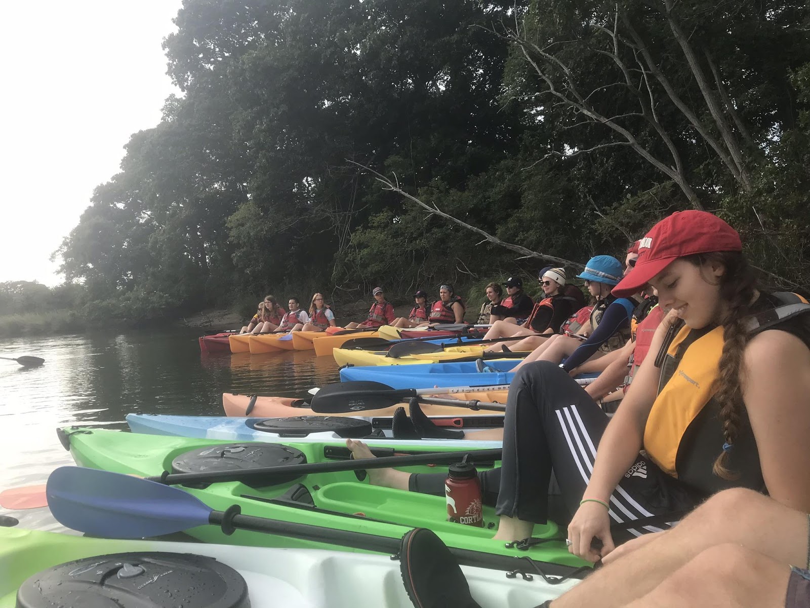 |
|
Figure 1. My Coastal Cultural Experience classmates enjoying a beautiful day and an exciting lecture in our outdoor “classroom”—right on the water of Long Island’s North Sea Harbor.
|
1. “Conscience Point – U.S. Fish and Wildlife Service.” Official Web Page of the U S Fish and Wildlife Service, 19 June 2018, www.fws.gov/refuge/conscience_point/.
2. “Who We Are.” The Nature Conservancy, www.nature.org/en-us/.
Easthampton Baymen’s Association
The greatest in theby nation
by Emily Richters
Cleverly coined, Bonackers, named after Accabonac Harbor, were the fishing families. These are the families that made a living off of what the bay provided. Anything living in it was game. From eel, to fish, to even clams and snapping turtles, all depending on the season [3]. Since the 1950’s, the Baymen’s Association is a fishermen’s organization that plays an active role in politics, kind of like a Union [3].
The Baymen’s lives depend on the waters. Since the 50s, it has been getting harder and harder for fishermen to get by. This has a lot to do with pollution, climate change and the environmental regulations in response to it. [1] Many fishermen came from a generations-long line of baymen, but because of the great dying off and the push back against fishing, these lines have ended. Fathers discouraging their sons to take up the family businesses, they saw no future for it anymore [1].
In 1992, the New York Sportfishing Federation pushed to make striped bass, the “Money Fish,” wanted the state to make them gamefish only. The East Hampton Town Baymen’s Association organized a civil disobedience protest at Indian Wells Beach [2]. Many participated, including Billy Joel, in picking bass from a haul seine in protest. Many were also arrested for doing so. Billy Joel even wrote a song, “Downeaster Alexa,” about a bayman who could no longer run his bass fishery due to state regulations [2].
Bonackers and fishermen today are still struggling to make a living. There once was thousands fishing and making a living off the bays, but now there are only a few left. This has largely got to do with environmental regulations killing the fishing industry. The fishing industry is one of the more important ones in the world. Tara Rider says that 80% of the world’s main source of protein is from fish. The waters give us life. But there has got to be a balance. Although it is important for fish to live in healthy waters and within healthy populations, one has got to think about the lives of the fishermen and the groups of people that they are feeding.
 |
| The East Hampton baymen association and supporters protesting state conservation laws in 1992. On the left is Billy Joel [1]. |
Citations
1. Drumm , Russell. “Recalling the Striped Bass War, 20 Years On.” The East Hampton Star, easthamptonstar.com/?q=Lead-article/2012628/Recalling-Striped-Bass-War-20-Years.
2. LeDUFF, CHARLIE. “Last Days Of the Baymen.” The New York Times, The New York Times, 20 Apr. 1997, www.nytimes.com/1997/04/20/nyregion/last-days-of-the-baymen.html.e
3. Smithsonian. “East Hampton.” Smithsonian Folklife Festival, Smithsonian, 2004, festival.si.edu/2004/water-ways/east-hampton/smithsonian.
An alewife is an unassuming little fish. A little bigger than your forearm, its flank is a shining silver, with dorsal and tail fins of a contrasting dark gray. It spends its adult life in the ocean, but returns to brackish streams several times over its life to spawn all along the eastern coast of North America. In spring, they pack in by the thousands, leaping and frothing masses.
In September, Fish Cove is calm and peaceful, with only the occasional silverside or menhaden breaking the surface. We drift with the wind, linked kayak-to-kayak to a dying tree with branches that brush the surface of the water. Alewives, Tara tells us, were once a massive fishery; but, like many before them, humans pulled them out of the water at unsustainable numbers. Population crash. Catch moratoria. Species of Concern listing with the U.S. National Marine Fisheries service. And so they limp along, slowly rebuilding their numbers, serving as food for many of the predators in the area.
I think about the first alewife that arrives at one of these brackish streams for the breeding season. Nosing its way into unfamiliar, or perhaps familiar, waters, driven by instinct that has called it so far. It is alone, genetics having gifted – or cursed – it with an altered sense of timing. Perhaps the silver scales catch in the light, a bright beacon to any with an eye to see it. And suddenly, it is plucked from its home, gasping, thrashing in talons that pierce its flesh. Perhaps in its last moments, it is still aware enough as the talons turn it to face forward, still aware enough to see the landscape flying below it, a sight no living fish has seen.
Osprey are fishers; indeed, one of their their names is “fishhawk,” and they have earned it. They are one of the many predators of alewives, and, as is often the case, one of the many species affected by reckless human behavior. In the 1940s, 50s, 60s, osprey suffered through high exposures of DDT, the “miracle” insecticide. The result: eggshells so thin that they shattered when parents attempted to incubate them, a devastating blow to their populations. Only when Rachel Carson cried out in alarm at the silent spring did humanity take notice. DDT is now banned nearly worldwide, and osprey populations have rebounded, once more able to feast on alewives and other fish on the eastern seaboard. Their curious habit of turning an unfortunate fish to face forward makes it more aerodynamic. Every shred of energy must be saved when working the waters.
I think about the alewife and the osprey, prey and predator, both affected by humans in different ways. They are the lucky survivors, plucked from the edge of extinction. There are those that were not as fortunate. How many species must be driven to the edge, to tumble over or be saved in their eleventh hour, before we will learn?
Our Futures in Sustainability
by Flynn DeLany
Sustainability arose from the earlier environmentalism movement of the mid 20th century. After the Great Depression and World War II, people started to leave their homes and towns. People started to have the extended time off allowing vacation time. They took the opportunity of the vacation time to take a road trip, go camping, see the natural beauty America has to offer. This new appreciation of the land they have been living on gave birth to the environmentalism movement in order for the people to protect what they are finally seeing with their own eyes. The movement of environmentalism flowed and carried through the years picking up ideas of conservation, preservation, environmental policy, and many more. These all combine to establish a new movement of the 21st century that encompasses all of the new ideas and values to save the planet, Sustainability.
Sustainability means just as it reads, with this ideology we are attempting to sustain the environment. As you can imagine, sustainability impacted many of us students in some way as we chose our degree to encompass marine science. We want to help save, protect, and manage on of the most important ecosystems on the planet. These thoughts continued as we sat around the campfire at the end of the day on Friday. Dr. Rider discussed a conference that she and some other Stony Brook faculty will be attending this upcoming week. She is going to a conference to open a discussion about coastal people’s resiliency. She’s was telling us this because she’s going to be missing class but most importantly that our future careers in the marine science field are going to be part of the sustainability of the marine ecosystem. We are going to be a piece of a larger puzzle, a network of people to work towards a sustainable future. As the fire of that night was put out, we were left with a greater question; how are our plans for our futures going to fit into the larger collective of sustainability?
Coastal Cultural Experience: Greenport
Rumrunners in Greenport
by Sarah Stromski
Today we visited my old stomping grounds of Greenport. As we sat on the grass-covered steps of Mitchell Park, I learned something I never knew before: Greenport Harbor played a big part in the 1920’s during Prohibition. Since the neighboring town, Southold was for the prohibition of alcohol (as were many of rural towns during this time), many ships carrying liquor and other types of alcohol had to go into Greenport Harbor. I had known that Greenport was a big whaling town, however I had absolutely no idea this little town had even more history hidden within.
There is one bar in Greenport Village called Brix and Rye, which is a speakeasy-type bar, however it was not an official speakeasy. They do make excellent drinks, though, I highly recommend (for those of you who are over 21, of course). Claudio’s, one of the oldest family-owned restaurants in the country (until recently), was an official speakeasy. Claudio’s actually has a “trap door” leading to a secret passage to hide the liquor. This is very fitting since Claudio’s Clam Bar has a very fun party atmosphere. Supposedly, speakeasies were not how they are portrayed in the movies, with a secret passcode and doorway. They were actually quite like normal bars, just with hidden passageways to hide the liquor.
Even though I have lived out on the North Fork, and going into Greenport Village basically every day, there are so many things I have yet to learn about my own town. It makes me want to go out and explore, maybe even convince someone from Claudio’s to let me go down the trap door behind the bar.
Greenport Blacksmith
by Diana Beckenhaupt
During our trip to Greenport, we visited a smithery near the museum. The blacksmith was historically an essential part of the local economy, responsible for manufacturing things like iron nails, metal parts of buildings, wagons, horseshoes – all crucial to transportation and daily life. In addition, items like clam rakes, anchors, and dredges are equally important to life in a coastal town. Greenport had a blacksmith named Paul during the 1920s to 70s, a German man who supplied the town with necessities, including his own specially reinforced scallop dredges, which are locally prized today. And during WWII, Greenport Village was the largest builder of defense vessels, all with iron parts that could only be made by a blacksmith.
What exactly does a blacksmith do? First, he needs a place to work. The current smithery in Greenport is a repurposed onion drying shed. In the past, smitheries were also cheap wood buildings. As the danger of being burnt down is quite high, no blacksmith would have put much effort into the building. This building must have a chimney and a place to heat up the metal.
 |
| The Greenport Smithery’s interior, showing the blacksmith at work. Source: Brad McGuire |
Blacksmiths gained their name because unlike other metalsmiths they work with black iron. Different grades of iron exist, depending mostly on the carbon content. As today’s blacksmiths are largely artisans, the strength of the iron matters less than it would have for Paul. One historic type of iron is “bog iron” gathered from the Peconic Bay, then purified in a foundry.
To shape the metal, the blacksmith must heat it up to just under 2000 degrees Fahrenheit. To get such high heat, anthracite coal was used. Anthracite coal is rare, and only found in 2 locations in the US. It is unearthed as “green coal” and must be burnt initially to purified it into a hard, glassy substance (coke) that burns without any smoke.
The iconic anvil is still used to shape the metal. And there are even different minds of anvils – the blacksmith we watched was using a London Anvil, invented by Peter Wright a long time ago.
 |
| An article from 1914 detailed the history of the anvil, including this illustration of the various shapes used by metalsmiths for different purposes. Source: http://www.metalsmith.org/pub/mtlsmith/V05.3/Hist-anvil.htm |
Each blacksmith customizes his anvil edge as needed; the anvil we saw was reportedly Paul’s original one. Another tool used is the hammer with a flat side (used, unsurprisingly, to flatten metal) and a rounded side (used to draw out surface area).
Blacksmithing is a rare hobby today, and it’s hard to imagine how dependent the world was on black iron for just about everything. The Greenport Museum’s working blacksmith shop is a good way to show visitors how the process would have worked, despite being a recent addition to the town. The original is long gone.
Long Island and Maritime Artifacts
by Christian Iniguez-Ulloa
 |
| This picture is on display at the Maritime Museum in Greenport. The picture shows a man surrounded by piles of oyster shells. Seeing this picture gives people an idea of how important shellfish were to settlers in areas like Long Island. These oysters were not only used for consuming and selling but also their shells were grinded up and used as chicken feed. |
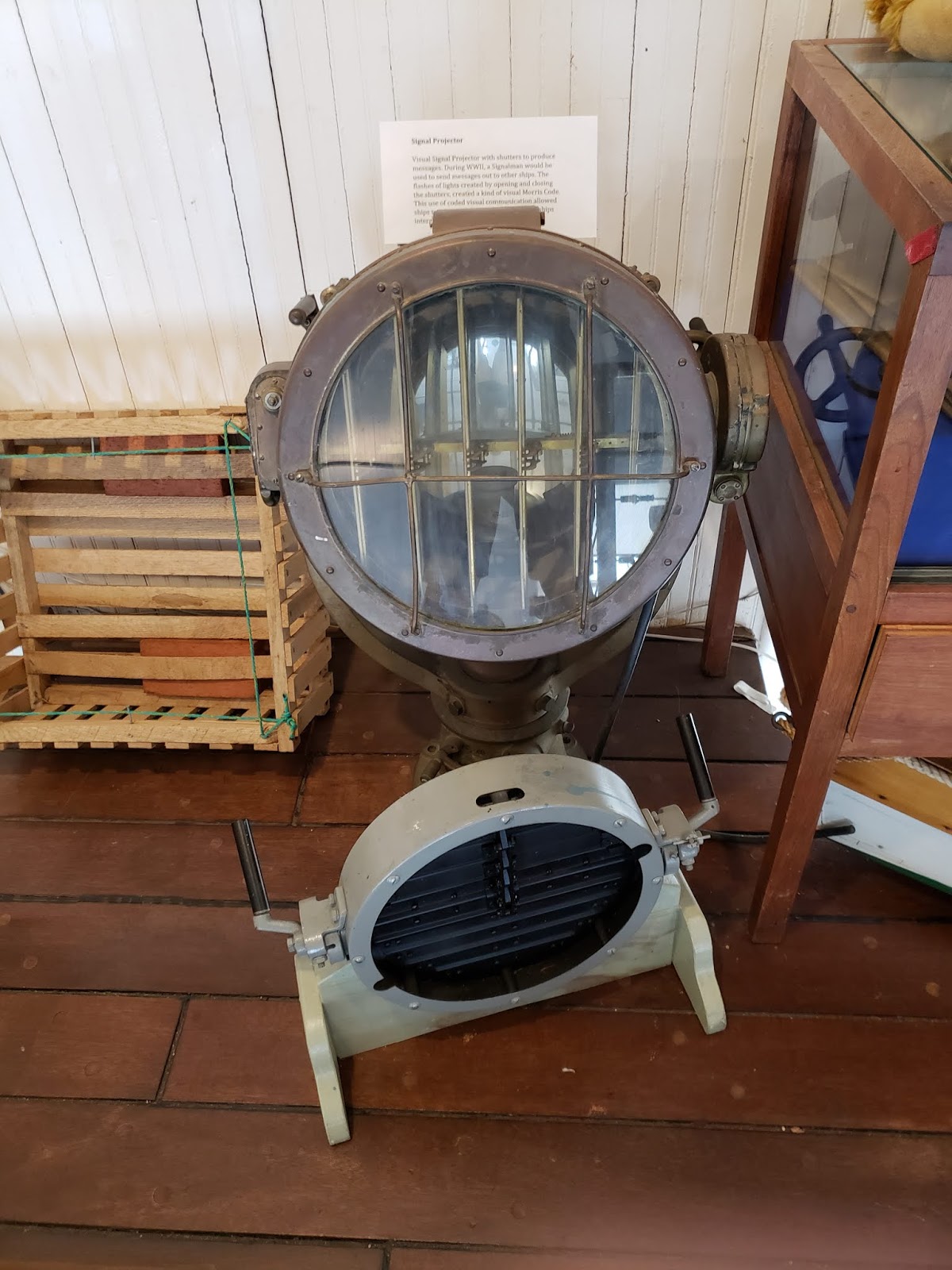 |
| This artifact is called a signal projector and it can be seen at the Maritime Museum in Greenport. This equipment uses shutters to created flashes of the light by opening and closing the shutters. This provides almost like a visual Morris code for ships to communicate with each other. It was mostly used during WWII to send out messages without the risk of enemy ships intercepting the messages. |
 |
| This might look like a normal rock at first, but it is actually a tool used by Native Americans and it is on display at the Southold Indian Museum. This native American tool is called a stone mortar. Stone mortars can have two wells in them like the one shown in the picture or one or three wells which they also had displaying along with this one. These mortars had multiple uses for the Native American. They were used to grind corn, beans, nuts, used to prepare clay so they can be turned into pots and also used to grind materials that were used to make paints. |
Trip to the Greenport Maritime Museum
by Ana Shore
This Friday, 9/7, our Coastal Culture Experience class took a trip to the Greenport Maritime Museum on Greenport Harbor. The museum had tons of interesting artifacts and several models set up to show how ships from the past few centuries looked. One of the models I found interesting was the one pictured below of a ship on a marine railway. Marine railways, or patent slips, were used for ship repair and construction in the 19th century.
The slips were built from the water and extended inland following a slight incline. The ships would be steered onto a cradle which was placed on the railway and then hauled up the incline onto land. Once on land, the ships could be repaired and then easily moved back into the water by being brought back down the slip. This method was a relatively inexpensive way to bring ships out of water at the time.
 |
|
A model of a ship on a patent slip at the Greenport Maritime Museum. This device was used to assist with boat repairs in the 19th century.
|
Here is another picture I took at the museum that features the work of Chris Hamilton. This display at the museum showed several photographs of life at sea from Chris’s collection. I liked this image a lot due to how bright and colorful it was.
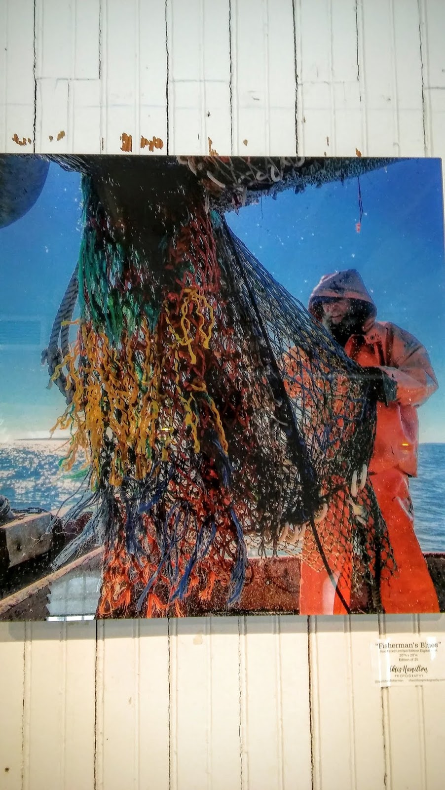 |
| An image from Chris Hamilton’s portfolio at the Greenport Museum. This picture shows the life of a fisherman aboard a trawling boat. |
East End Seaport Museum Sailmakers Exhibit
by Jennifer Repp
One of the exhibits in the East End Seaport Museum is a Sailmaker’s studio. There is a sign above the exhibit that reads: “ W. J. Mills & Co. Sailmakers”. Starting in 1880 making canvas sails, this company is based in Greenport, NY and is still around today! (source) This photo shows the whole exhibit, arranged as a typical New England sailmaker’s workspace of the time.

This photograph shows the main materials necessary for making sails in the late 1800s and early 1900s: canvas cloth and rope. Although only these few materials were needed, sail making was still profitable as many large vessels for exploration and trading were sail powered before the invention of the motor. Additionally, sails would wear down in the weather and could tear.

Here you see a close-up of the workbench. Like materials, few tools were needed, especially when compared to other trades. The main tools are needles and thread to sew the canvas. Metal eyelets were added to reinforce the holes the line runs through, as you can see in the partially complete sail at the top end of the bench.

Blog Post #1
by Brad McGuire
True to form, the Friday Costal Cultural Experiences class trip to Greenport included the discussion of several topics which had been broached on Wednesday night in Professor Rider’s Maritime Traditions of Long Island session. Of these topics, one which drew my interest in particular was the discussion of who the first European settlers of Long Island were and what combination of forces brought them to the new world. Such driving forces included imperialist forces by the larger European nations to stake out colonies which could produce wealth for the mother countries as well as changes in the structure and dynamics of religion and worship throughout Europe as a whole.
One of the greatest differences between those Europeans who settled on Long Island, let alone throughout the whole of the New England area, and those who settled places such as Cuba or Brazil, was that the men and women who settled along the Northern Atlantic coastline did so to escape persecution. Following years of religious turmoil in England through the years of Henry VIII’s split with the Catholic Church, the differing opinions of his children with regard to the Church of England, and the final introduction of the grandiose taste of the FOP Scot rulers, many believers in England longed for simplicity of worship and practice. Out of this thinking came the movement to “purify the English Church” which resulted in the creation of the Puritans: a sect of the Protestant Church which believed in a simplicity of worship and the ability for one to interpret the teachings of the Bible by oneself.
These Puritans ultimately were the first Englishmen to settle the rocky Northern Atlantic coast and had direct effects upon the physical and cultural composition of the New England and Long Island areas. A desire to take control over one’s own fate and religious destiny ingrained the traits such as active participation in representative government and a fierce disdain for misuse of power and authority, which are commonly recognized to be ingrained in the New England area as a whole and ultimately brought the voices of New Englanders to the forefront of tensions with England preceding the American Revolution. As the initial colony of Massachusetts became more and more crowded with independent worshippers, Puritans continued to expand into the newly created adjacent colonies of Connecticut and Rhode Island. Following this same tendency, the first English settlers of Long Island came from the colony of Connecticut, founding the first settlements of Southampton and Southold in 1640. The eastern end of Long Island ultimately came to be settled by these sort of New England-esq communities, giving the area its distinctly New England flavor despite its eventual inclusion into the colony of New York by the English crown after the acquisition of the previously Dutch territory. Although these forces do not entirely encompass the reasons for why Long Island developed the way it did, they do explain where a number of distinct aspects and traditions of Long Island culture derive from and greatly interest me as a progression of historic events.
Coastal Cultural Experience: Boat Tour of Shinnecock and Peconic Bays
A brief look into Native American history on Long Island
by John Maniscalco
As someone who is currently not a permanent resident of Long Island, its pretty safe to say when I decided to come to Stony Brook University I had a bit of trouble pronouncing some of the names of certain places out here. These places include, but are not limited to Patchogue, Setauket, Massapequa, and Quogue. However, I am not writing only about my struggles to pronounce certain names of places in Long Island. Instead, I want to write about the origins, history, and ultimately the significance of these names as they pertain to Long Island history. In other words, where do these names come from, what is their story, and why are they important.
Just as a brief side note, this semester I have the distinct pleasure of being able to participate in the semester by the sea program offered here at the Stony Brook Southampton campus. While here, myself and my classmates are taking a special class known as coastal cultural experience. Anyway, it was during this class that it was revealed [at least to me] that many of the names of places in Long Island originate from the Native Americans who lived here many years ago. As the class went on, we also learned that the tribes in Long island are a part of the Algonquin system. Algonquin in this context serves as an umbrella term in the sense there were many Native American tribes that were Algonquin. To compare, this is like in Europe in the sense that there are many countries, but that the people who live there at one time or another will identify as European. Furthermore, this umbrella term can be used in the sense of language as well. What I mean by this is that many of these tribes spoke very similar languages; sort of like how in Europe the Italians, French, Spanish, and Portuguese all speak languages that are based in Latin. Thus, resulting in four separate languages that are very similar as well. As for the tribes of Long Island and New England area, the same can be said for their languages too. At one point in time, there were thirteen tribes in Long Island. Some of these tribes included the Setaukets, the Matinecocks, the Shinnecocks, and the Montauks. However, as of today only the Shinnecocks and Montauks remain in the eastern part of Long Island.
The fact of the matter is quite simple, at one time Native Americans were quite prominent in much of the continental United States, especially here in Long Island. Unfortunately, in Long Island like many other places, many of the Native American people and their tribes have been eradicated for various reasons. With that said, the point I mentioned in the beginning comes into question. It come into question in the sense that even though many places in Long Island have Native American names to remember this group of people, it can also be said that naming places after them is only a small way to remember the Native Americans of Long Island. Ultimately, the Native Americans were a prominent part of Long Island history, and I am glad to know that at least the first step to honoring and remembering this group of people properly is in place. However, as I’ve mentioned before there is still more that can be done to honor the Native Americans of Long Island, and I personally have the coastal cultural experience class to thank for broadening my horizons and my knowledge of Long Island history. I can’t wait to see what happens next week!
Shinnecock Bay Boat Tour
by Emelie Einhorn
We all know traffic in the Hamptons is something out of your worst nightmare, but have you ever considered using the water to travel around the area? If you wanted to move between the South Fork and the North Fork, for example, you could just swing through the Shinnecock Canal, the last functioning canal on Long Island. It’s a necessary and useful installation, as it allows for quick travel between waterways that would otherwise be impossible. Since there is a difference in water level, the boat you are travelling in must either be raised up or sunk down several feet. We experienced both as we travelled through the canal in both directions. There are enormous black locks that, when closed, create an isolated pool of water where your boat is floating. Depending on which direction you’re travelling, the depth of water in the pool will either be increased or decreased depending on the water level of the bay you’re travelling to. Sometimes the locks aren’t even necessary if the water levels between the two bays are similar enough, but during our trip that wasn’t quite the case, so we were able to experience the rising and falling of the water trapped within the locks.
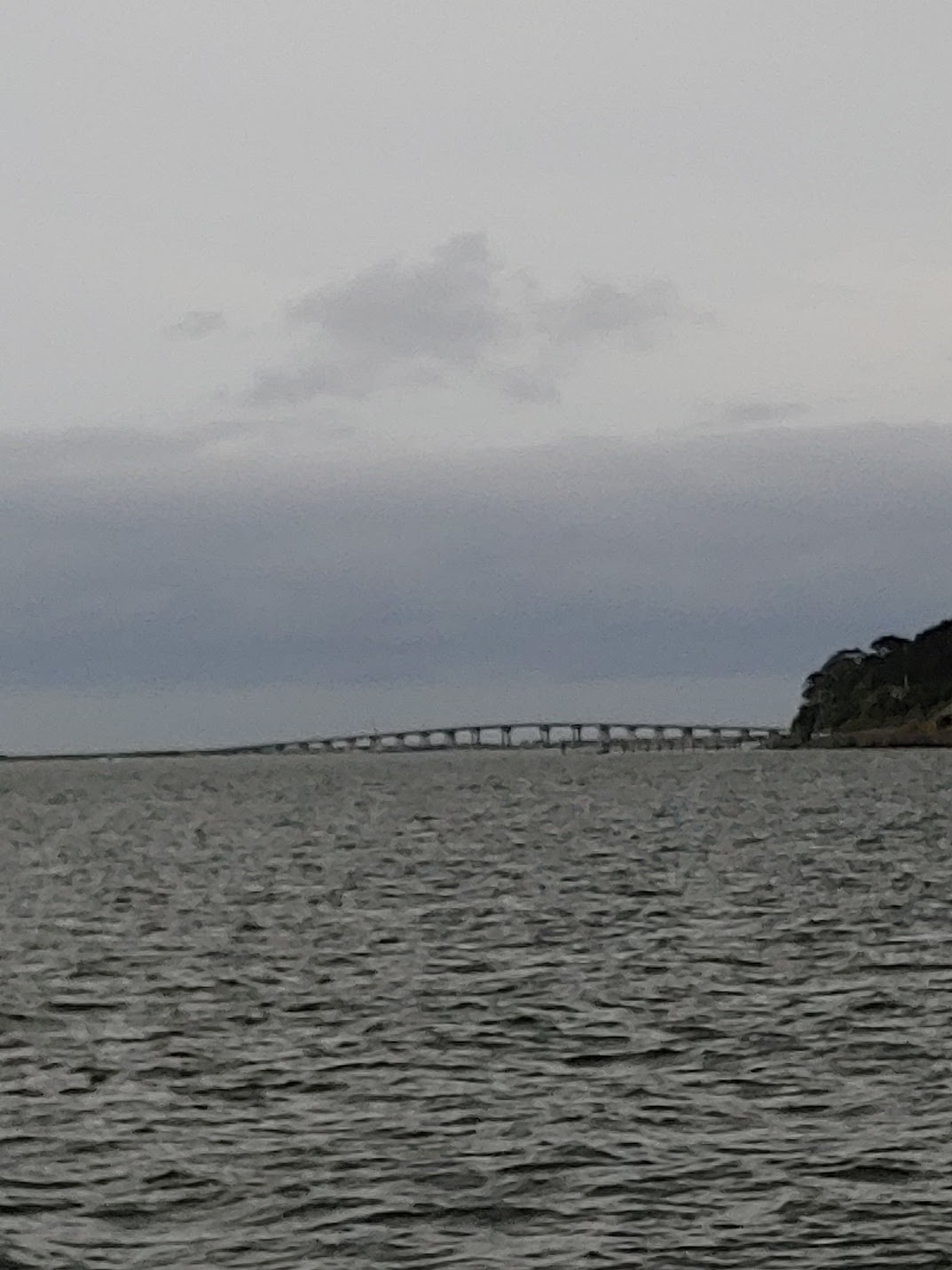 |
| A photo of Ponquogue Bridge. It serves as a landmark in East Shinnecock Bay as it is easily visible throughout almost the entire area on a clear day. While not evident in this instance, the metal of the bridge shines very brightly in the sun. |
 |
|
The two black locks are closing as we begin to prepare to enter the Peconic Bay. This canal has a long history and was once referred to as Canoe Canal when it was used by the Native American tribes in the region. This canal is the last functioning canal on Long Island and it serves its purpose well.
|
 |
| Here we can see the change in water level as the locks are being drained. The difference in water level between the East Shinnecock and Peconic Bays was about 2.5 feet at the time of our trip, with the Shinnecock being higher and the Peconic being lower. If not for the locks, there would be an enormous outflow from the Shinnecock into the Peconic, which would create more than a few problems for the communities – human and marine – living around and in the bays. |
Shinnecock and Peconic Bay Boat Tour
by Kim Marko
This week was the first of many trips exploring the New England area to learn about the coastal history, so it was only fitting that we started the semester with a boat ride in local waters. As we were cruising though the Shinnecock and Peconic bay, Dr. Kurt Bretsch and Dr. Tara Rider were walking around the boat answering any questions we had and telling us all about the history of Southampton and the surrounding areas. I have driven through the Hamptons countless times going to the beach or going out to Montauk and one of my favorite things has always been looking at the huge houses.
Today when you hear the words ‘The Hamptons’ most people thing ‘rich’ ‘beach’ or ‘the Kardashian’s’ but the Hamptons weren’t always like they are today. In the 1920’s, there wasn’t much to see or do out here, which was a strong pull for writers and artists. Not long after more and more people from all over started coming out to the Hamptons to spend the summer. Those huge and gorgeous houses I talked about earlier were used as summer houses, that is until the 2008 recession hit.
In 2008 the Stock market crashed, sending the country into a recession. Suddenly these houses that were being rented out from Memorial Day to Labor Day were staying empty because people could no longer afford to stay out in the Hamptons for that long. In order to rent out the houses, the owners of these houses had to start doing week and weekend rentals instead of full summer rentals; which creates a slightly different scene than what it used to be out here. Now when you’re out in the Hamptons most of the people you see are out here for a few days either for the beach or to go to the vineyards.
Hampton Bays: The evolution of Long Island Wine
by Alyssa Shanley-Lente
My first real taste of long island began on a wonderful sunny day as the Coastal Culture Experience class took off on their first field trip of the year. With a light breeze and the tide going out we began our boat trip to learn about the Shinnecock and Peconic Bays. Throughout the entire trip I learned lots of new information due to the fact that I am originally from New Mexico and know absolutely nothing about the area, but it wasn’t until we were on our way back that I heard something that particularly caught my attention. This piece of information happened to be about the wineries on long island and how they have changed over time.
Now this subject only caught my attention so much because one of the professors began talking about Martha Clara Vineyards which are a big staple of the area. She then began to say that when the vineyards around the area first opened throughout the 1970’s they were scoffed at by others around the country. This was because although the wine bottles were labeled as “Long Island Wine” the wine only consisted of about ten percent of grapes that had been grown in long island while the rest were from other areas around the country. However, only in the more recent years have local wineries been able to find their footing due to some of the best soil for grape growing.
Nowadays, local winemakers have crops that are able to produce enough grapes for the wines produced to actually be considered a “Long Island” wine. These vineyards also happen to be the biggest leader in European wine grapes nationwide which I found really interesting since there are so many places that produce wine within the country such as California. All in all it was a great trip and I got to learn a lot more about the local wine and vineyards located throughout the island.
Shinnecock Bay Boat Tour
by Cassidy Bell
Maybe it’s just me, but I don’t imagine sleeping on a pile of seagrass would be all that comfortable. Although to be fair to the early settlers here in the Hamptons, using eelgrass as a resource for filling cushions probably made more sense than it does now. During much of the 17th century, the demand for products such as beds and sofas was met by utilizing one of the most abundant resources available to coastal settlers: eelgrass. While the use of eelgrass in these products was partially due to its abundance at the time, it also had several benefits as a component of household items, such as its resistance to rot. Instead, eelgrass simply dries with age, allowing it to be compacted for use in cushioning as well as in insulation for the walls of houses. Unfortunately, while this process of drying may have been preferable to rotting at the time, the long term effect was noticed more recently in the 1900s. The process of drying lead to the grass dropping down and creating air spaces within the walls, causing the entire wall system to become highly flammable and leading to many old homes going up in flames quickly and completely.
Outside of its historical uses in the home, eelgrass is incredibly important for its ecological role in marine systems such as the one here in Shinnecock Bay. Eelgrass forms the foundation of the bay’s marine habitats, providing everything from sediment stabilization to increased habitat complexity for different marine animals (Pickerell et al.). Perhaps one of its most important roles in Shinnecock Bay is its mutualistic relationship with shellfish. Clams and scallops rely on the eelgrass for protection from predation and tidal currents while the eelgrass living in these habitats can provide nutrients that the eelgrass needs to stay healthy (Pickerell et al.). The destruction of eelgrass habitats and the heavy removal of shellfish have led to large declines in both that have noticeably damaged the ecosystem of the bay and surrounding areas. This has been combatted by groups like the Shinnecock Bay Restoration Project that are actively working to restore local habitats and support the historically and ecologically important eelgrass as it begins its journey to recovery.

Coastal Cultural Experience: Mystic Seaport
Whaling on the Charles W. Morgan
by Elaine Alberts
One of the highlights of our Mystic Seaports tour was exploring the Charles W. Morgan (often referred to as the Morgan). This beautiful whaling vessel was built in 1841 in New Bedford, MA. Whaling vessels were designed to last approximately 20 years, the Morgan just had her 176th birthday. She is the last wooden whaleship in the world. The Morgan went on 37 voyages as a whaling vessel, and was retired in 1921. In 2014, she went on a three-month voyage visiting ports throughout New England.
We were able to explore the three levels of the ship, trying to imagine what life would have been like on a whaling ship. We started on deck, at the top of the mast there was a small perch for a sailor to keep an eye out for whales on the horizon. When a whale was spotted they would call out “Whale ho!” along with the direction and distance to the whale. On deck, there was also a large pulley system to lift large strips of whale blubber called Blanket Pieces over the rail so that they could be lowered into the Blubber room below the deck.
The Blubber room is the largest room on the ship. It comprises almost half the length of the ship. This is where the blubber would begin being processed. The sailors would cut down the Blanket Pieces into 4’ X 6” strips called Horse Pieces. These sections of blubber were brought back onto the deck and cooked down in the Try Pots. The Morgan has two large Try Pots on deck. They would boil down the oil and store it in barrels below the Blubber room. There is an original beam down below with the barrels. The sides of the beam are worn from rubbing against the sides of the barrel. Whaling vessels were factories and they would not return home until they had collected a sufficient amount of oil.
The Charles W. Morgan could hold 90,000 gallons of oil. During her 37 voyages, she was never completely filled. My classmates and I were familiar with whaling and how the sailors would process the oil. It was amazing to see this on an actual whaling vessel. Seeing all the parts of the ship in person really cements all the concepts we have been learning about. This was definitely one of my favorite field trips this semester, I can’t wait to return to Mystic Seaport again.
 |
| Mast of CWM: The mast of the Charles W. Morgan. This is where the sailor would watch for whales and call “Whale ho!” when a whale was spotted. |
 |
| Try Pots of CWM: The Try Pots is where the smaller strips of whale blubber would be boils down into oil. |
 |
| Barrels on CWM: These barrels sit below deck on the Charles W. Morgan. Once oil is boiled down it is stored below deck for safe keeping. |
 |
| Image of CWM: An image hanging in the Mystic Seaport Museum of the Charles W. Morgan on her 38th voyage. |
James D. Driggs Shipsmith
by Gregory Paul
One of the most entertaining parts of this trip, for me, was the James D. Driggs Shipsmith. The shipsmith was built in New Bedford, Massachusetts in 1885 by Driggs himself. It is the last remaining blacksmith of the old whaling industry that is still operational today. Currently, it serves to make replacement parts for the Morgan, a national historic landmark and the last wooden whaleship in the world.
Blacksmithing has always been a craft that interested me, so I was very excited to learn about the functions of the shop as we walked in. We were happily greeted by one of the smiths, and she immediately began teaching us about the history of the shipsmith. Starting in 1846, Driggs built his first shop by Merrill’s Wharf, partnered with Joseph Dean. This partnership lasted nearly 30 years. After Dean’s retirement, Driggs continued his smithing, and in 1885, relocated and opened a new shop at the wharf. This is the same shop that is now on display at Mystic Seaport which we had the pleasure of entering.
The smith had also gone into the history and development of harpoon technology, as there were several harpoons on display. The whaling industry started with double and single-fluked harpoons that soon proved to be ineffective. To be sure, they could penetrate the flesh of the whales, but the holes they produced were too large for the whalers to stay attached to it. Eventually, as the smith told us, a toggling harpoon was developed to fix this issue. The penetrative power of the harpoon remained, but this time the hook could “toggle” into a horizontal position that would keep the harpoon within the whale’s tissues, allowing the whalers to stay attached to the whale. This harpoon was invented in 1848 by Lewis Temple, Jr., and employee of Driggs & Dean.
 |
| Fig. 1 Storefront of the James D. Driggs Shipsmith, featured and functional at Mystic Seaport. |
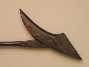 |
| Fig. 2 Example of a toggle harpoon head, invented by Lewis Temple, Jr., apprentice of James D. Driggs |
Mystic Seaport
by Michael Cashin
 |
|
Fig 1. Ornate Asian bed brought back from a trans-Pacific voyage. This voyage also brought a variety of medicinal plants, teas, silks, and lumber. Many of the symbols on the side of the bed had meanings such as: “cloud” meaning wisdom, and “dragon” meaning strength and fertility.
|
 |
| Fig 2. Within the collections of the Mystic Museum we were lucky enough to see a variety of canes related to the maritime world. Many of them were made of different types of wood, while a few were composed of ivory! Most had intricate designs along the stems, filled with gold, mother of pearl, and silver. |
 |
|
Fig 3. Many of the canes that were shown were decorated with a headpiece. The designs of these ranged from horses (pictured here), knots, orbs, triangles, and even an elephant head!
|
Mystic Seaport: Traveling Back In Time
by Madeleine Keefe
Everyone always says “save the best for last” and in our case, the best trip was definitely saved for last. Our trip to the Mystic Seaport in Connecticut was amazing every second we were there. All semester we have been learning about whaling, but being able to walk through the same quarters at the whalers was unreal. One of my favorite places we visited was the archives of the whaling museum. Most museums only show about 10% of their collection to the public. It was amazing to see everything they have from Megalodon tooth to a Blue Whale fetus to jet skis. It is crazy to think that actually makes up Maritime history. No one would ever think jet skis belong there but it all has shaped the maritime culture.
Another really good experience was being able to go to the very bottom of the Morgan. It was the weirdest feeling being down that low, knowing that you were now under water. It was an amazing experience that is so hard to explain. We never see the underneath of boats, it’s really a mystery to most because we are all so captivated by the sails and the underdeck, but it is really an interesting part of the boat. Walking through this part really puts us in the mind set of these sailors, who spend 100% of their time during the duration of the voyage in these quarters, which can last from a couple months to a couple of years. The longest whaling voyage was 11 years. It is crazy to imagine being in these small rooms for that long.
The entire trip was just amazing. Every part of the day taught us new things about whaling but also we could see in person the aspects of maritime history that we have been learning about in class. It is so amazing to see all of this in person and experience this. I felt like we when back in time when we stepped foot on the Mystic Seaport grounds and I was in awe the entire time.
 |
|
Figure 1. Megalodon tooth in the archives of the Museum.
This tooth was bigger than the average human hand. |

 |
| Figure 2. A comparison of the deck of a sailing boat and underneath where the sailors spend half their time. |
Mystic Seaport
by Kaitlyn Fenster
 |
| Figure 1. Model of the Benjamin F. Packard vessel built at Mystic Seaport by William S. Quincy in 1977. The real Packard, which is no longer afloat today, was built in 1883 and had an impressive size, (244.2 feet long, 43.4 feet wide, and a draft depth of 27.6 feet). |
 |
|
Figure 2. Figurehead of an American Indian, which was at the
bow of the clipper ship Seminole. It was carved by James Campbell
and John N. Colby in the late 19th century. The image of the American
Indian was romanticized and represented the brave personalities of
the Seminoles. |
 |
| Figure 3. Cloth corset from the late 18thor early 19th century (right) compared to a modern corset by Rosa Lee (left). Baleen from Mysticeti whales was a common product of the whaling industry and was often used to make old-fashioned corsets. |
Will These Ships Leave You Dazzled?
by Makenzie Conover
A gorgeous day in Mystic Seaport Connecticut, our groggy class climbed out of the vans, greeted by crisp morning air as we prepared to start the long day ahead of us. After running around the square looking at souvenirs and pining for local fudge, we headed over to the Mystic Seaport Museum of America and the Sea to check out the exhibits inside. Upon entering, to the left there was this large black and white patterned painting on the wall. Curious, I made my way over and thought it might be a nice little photo opportunity, not yet understanding the wall’s significance. Unable to steal any of my classmates away from their exhibits, I went to the closest one that taught the museum’s audience about ship dazzling.
Ship dazzling is a brilliant optical illusion. When looking at a boat approaching you or far off in the distance, it is fairly easy to determine the direction that the ship is heading in as well as the ship’s approximate speed. But when looking at a boat that has been dazzled, these boats have been painted with various patterns specific to each boat, sometimes in colors but often in black and white. Broken lines in the design cause the optical illusion that the ship is turned in a different direction than where it is actually headed, or distort the shape of the boat from the onlooker’s eyes. The goal of these designs was to protect and distort vital parts of the ship in case of any threat imposed upon it by confusing anyone looking at the ship from afar to keep any torpedoes or assault weapons from hitting the most vital parts of the ship. Interestingly enough, the exhibit I was learning all of this from had an interactive portion to the exhibit, where you looked through a telescope-like lens and you see many ships crossing your field of view. In the viewed field, a dazzled ship was accompanied by a plain white ship to compare side by side as they were moving, allowing the audience to see the illusion for themselves. As I participated, I noticed that because your eyes naturally linger on the dazzled pattern longer trying to make sense of what you are seeing, it appears to be moving slower than the white ship, even though they are moving at the same speed. In a real-life situation, this would help the dazzled boat move farther away from or closer to another ship at a quicker rate than it would appear.
 |
|
Figure 1:
HMS Irresistible in 1914 with a parti-colouring pattern.
Source: The Dazzling Zoologist |
 |
|
Figure 2:
HMS Dartmouth in 1915 with a classic camouflage pattern. Patterns on the smokestacks were in different directions to muddle the direction that the ship was actually pointing in.
Source: The Dazzling Zoologist |
As far as the work that goes into these painted designs, painters were hired and able to complete these intricate designs, following chalk lines drawn on the boat. These designs were typically painted and complete within a handful of days, and these vessels could be incredibly large. Many of the designs for the ships were created by Griffith Coale along with a team of scientists and designers, whose focus was on the natural camouflage patterns we find in nature, such as zebras. It’s amazing to think that something so simple as breaking or curving lines and combining with alternating colors in our field of vision is capable of enough deception to protect these ships. Sometimes, these patterns were intricate enough to make it confusing as to which end was even the bow or the stern of the ship. These techniques helped fleets in WWI survive attacks and saved many lives as well as vessels. To help further demonstrate what the patterns on these vessels may have looked like, below is a picture of our classmate Emily, who I was able to snap a picture of as we were about to leave the exhibit.
 |
|
Figure 3:
Our much loved Emily posing with the dazzling wall. She looks a bit farther away from the camera than she truly was, due to the design pattern of the wall.
|
Image sources:
Murphy, H., and M. Bellamy. 2009. “The Dazzling Zoologist: John Graham Kerr and the Early Development of Ship Camouflage.” NORTHERN MARINER. 19, no. 2: 171-192.
Below deck on the Charles W. Morgan ship
by Joshua Farber
After spending weeks learning about whaling in lectures and at multiple museum visits in Coastal Culture class, we finally got to climb on board an actual whaling ship at the Mystic Seaport. The Charles W. Morgan is a 176 year old vessel and was built in New Bedford, Massachusetts. Over her 80 year career as a whaling ship, she made 37 voyages around the globe which produced countless barrels of whale oil.
By climbing below deck, we were able to see how the sailors lived and worked on board. At the stern of the ship were the captains quarters and dining area, which seemed cramped at first glance, but once compared to the Forecastle at the bow (a dormitory for the 22 seamen on board), it seemed mighty spacious.
Between the captains quarters and the Forecastle was the steerage cabins where the mates slept, as well as the all important blubber room. Here is where whales were cut up and processed before being sent up on deck to be rendered in the tryworks. Once rendered down, the oil would be stored in large wooden barrels and stacked in the blubber room. Up to 90,000 gallons of oil could be stored on board, which would require about 60 whales to be caught. This could take upwards of three years, and despite the long voyage, the blubber room would only be used about 100 days of that time.
Being located next to the blubber room, the Forecastle would not be anyone’s first choice for a sleeping location in modern times. The smell from the processed whales and the constant pounding of waves, combined with the dark, damp, cramped space and poor ventilation all made for a rather dismal setting. Nonetheless, this is where up to 22 men would sleep nightly. Each seaman had a full bunk as well as a small private space for belongings, which was more spacious than other ships, where oftentimes men would have to sleep in a hammock or sometimes would be forced to share beds.
It’s still nowhere I would like to sleep, especially for three years straight. Seeing the dormitory as well as the areas on the ship where whales were processed, combined with other experiences at Mystic, were all an incredibly valuable experience, since it brought to life what we learned in class over the last few months.
 |
| Picture 1: A brief lecture in the Blubber Room, below deck of the Charles W. Morgan |
 |
| Picture 2: My classmates experiencing first hand how cramped the space was in the Forecastle |
 |
| Picture 3: Some of the bunk beds in the Forecastle |
Coastal Cultural Experience: The Riverhead Foundation, Iron Pier Beach, & the Big Duck
Cold Stunning and the Importance of the Riverhead Foundation
by Kaitlyn Fenster
As someone who used to volunteer at the Riverhead Foundation, I did have some previous knowledge of how the process of rehabilitating cold-stunned sea turtles works before we came here for class. Cold stunning causes sea turtles to become immobile due to a decrease in the water temperature. Sea turtles around Long Island’s waters that have not yet migrated south by October or November, when the water reaches about 50 degrees Fahrenheit, can often find themselves in this unfortunate situation. The rescue and rehabilitation team from the foundation uses three tests to determine the degree of severity that a turtle is cold stunned, these are the nose-touch test, the head-lift test, and the eye-touch test, all of which test the turtle’s responsiveness. There are four different classes of cold stunning, with class 1 being the least severe and with class 4 being the most; during the most extreme case, the animal does not move and its body is very limp. Fortunately, the Riverhead Foundation has had a lot of success in rehabilitating cold stunned turtles. The turtles are placed on hot pads and under heating lamps and are also given antibiotics and fluids. It is important that cold stunned sea turtles are warmed very slowly. In the past, the normal procedure was to warm the turtle at about 2-4 degrees an hour; this can be very dangerous for the turtle as their brain and metabolic activities are not able to recover as quickly as their body is being reheated. Now, turtles are warmed by about 5 degrees per day, increasing their chance of surviving and being released back into the wild.
While I didn’t personally rescue turtles through the Riverhead Foundation, I was able to educate the public on how the foundation operates, something I really enjoyed. It was encouraging to see how many people cared about the fate of these turtles and all of the other animals that the foundation rescued. Visitors in the foundation’s center could view the patients through video monitors in the back of the animal hospital and enjoyed hearing about their progress. Sometimes, patrons would purchase one of the stuffed animals in the center, the funds for which all went to purchasing supplies and food for the animals in the hospital. I would also inform people that they could virtually adopt one of the animals that the Riverhead Foundation had rehabilitated; the funds through adopting these animals are also used to help the foundation’s programs operate, including its response to animals that are stranded or cold stunned. The foundation not only educates those who visit the aquarium, but also participates in many community outreach events to spread awareness on a larger scale. I have volunteered for the foundation at Stony Brook’s Earthstock and an event in Southampton where we set up a booth and had many people come up to us asking questions about what we do. I would highly recommend becoming involved with this organization through volunteering or interning; it is very rewarding to know you are making an impact on the lives of these animals
My Internship Experience at RFMRP
by Gregory Paul
In the short time that I spent as an intern at the Riverhead Foundation, I can certainly say that I enjoyed every minute of it. Throughout my experience, I learned many new things and gained many skills that I can carry along with me into the field of marine science. Though it was technically sea turtle season while I was an intern, that aspect of the internship did not pick up until around Thanksgiving weekend. Regardless, there was still much to learn, and everything I did was valuable to keeping things organized and structured along with the rest of the RFMRP team.
The first thing I learned at the Riverhead Foundation was the Level A form and how they were filed, and transferring them onto the computer in .pdf format, since it was necessary that NOAA had the updated files. These forms were essentially logs for both live and dead sea turtle recoveries. I then learned how to feed the sea turtles., which involved slicing whole squid into bite-sized pieces. Medication was usually placed in the triangular piece at the tip of the squid’s head. There were three sea turtles present at the time of my internship, but it seems Chestnut is the only remaining sea turtle from my experience. Medusa, a seal with cataracts, was mentioned during the trip. I had the privilege of working with Medusa while she was still at the Riverhead Foundation, and I one of my responsibilities was performing water changes for her tank—one of my favorite tasks.
Towards the end of the internship, I did many more hands-on things that I can certainly say I enjoyed doing. The first of which was recovering a dead seal’s body from the beach. I was still shocked by how heavy it was and how difficult it was to carry both to the box truck, and from the box truck to the post room. I also had the privilege of seeing a giant, fully grown leatherback in person. I always found these turtles to be magnificent, and though it was dead, it was still a nice experience to take its body measurements. Lastly, I was trained for the procedure of rescuing dolphins and properly putting them in the stretcher, though I was never fortunate enough to put this training into practical use. The last few weekends of the internship I spent doing necropsies in the post room. Bad smells usually accompanied this task, but it was definitely one of the more interesting things I had to do at the Riverhead Foundation. I highly recommend interning for the Riverhead Foundation, as my time spent there has been extremely valuable!
 |
|
Figure 1 Chestnut swimming in his tank during the time of my internship. He was seen during the trip under a heat lamp to dry a honey treatment for his shell, a procedure which had not been started while I was an intern.
|
 |
|
Figure 2 Medusa playing with the stream of water that fills her tank during a routine water change. The brush is used to gently guide her back into the tank in case she jumps out during the water change. This was one of my favorite activities!
|
 |
| Figure 3 The deceased leatherback sea turtle I had responded to. It was found by a marina in East Moriches, where its body measurements were taken and incident code was spray-painted onto its shell. |
The Big Duck
by Zerfana Khan
Big Duck was built to attract people to the Maurer family Pekin duck farm. One way to attract people to an area, is to architecturally build something big and strange or with some relation to the business. Since 1931, the Big Duck has attracted many motorists passing by. Today there is a mini museum and gift shop inside for those who wish to stop and visit.
The construction of the Big Duck was created by George Reeve and brothers William Collins and Samuel Collins. They used an actual Pekin Duck to make an accurate model before building. The whole Duck is made out of solid concrete. In addition, the eyes of the Big Duck are from an old headlight of a Model T Ford. At night the eyes light up red, making the duck look a little creepy. The eyes and bulbs are still maintained.
Duck Farms contributed to a big part of the water quality issues on Long Island. Even though we no longer have duck farms on Long Island, we still have these water quality problems due to other factors. Nevertheless, duck farms definitely exacerbated those problems with water quality.
With the closing of duck farms, the Big Duck itself has been moved four times. It is now back in its original location. It is interesting to note that the Big Duck is technically located on Suffolk County property, regardless of it being in Southhampton. Suffolk County owns ten ft of the land surrounding the duck.
The end of duck farms on Long Island economically affected the restaurant and tourism industries. They look a direct blow with loosing local duck being served in restaurants. Tourism is big on the east end and having something local but not too local encouraged tourists to the area. Long Island duck is still available, but on a very small scale. Certainly not big enough for ducks to be served in restaurants consistently.

Saving Seals
by Genevieve Rappold
The Riverhead Foundation, located inside the Long Island Aquarium, has been there before the aquarium was even built. It was founded to help the many sea animals that wash up on our shores. They focus on a cycle of Rescue, Rehabilitation, Release, and Research. The foundation is a part of the National Oceanic and Atmospheric Administration (NOAA), which regulates the way people must help animals to ensure the most successful survival rate. The Riverhead Foundation helps animals such as turtles, seals, dolphins, and porpoises. Some of the issues the animals face are due to the area we live in, and the striking changes in temperature we can experience. The other problems are more widespread. Some are natural like seal pox and natural disabilities, but others are man-made like pollutants and boat strikes.
Seals are a common visitor to the Riverhead Foundation. They have volunteers patrolling the beach and a hotline for anyone to call in case of a beached animal. Seals are especially difficult to bring in because they are heavy and can be quite aggressive. Once they are brought into the facility, they are brought into a room separated from the rest of the foundation in case of contagions. In this room, blood samples and x-rays can be taken to check the health of the animal. Anyone working with the seals must wear chainmail gloves to protect themselves from strong seal bites. The seals are assessed and if they are healthy, released back into the wild. If the seals are unhealthy, they are put into tanks personalized for their specific needs. The seals are then closely watched to determine when or if it can be released to the wild.
The most common seals around Long Island are Harbor Seals, Grey Seals, Harp Seals, and Hooded Seals. Seals can be found sick all year long, but February through May is especially bad for seal pups. This is the time of year children start losing their mothers and have to learn to live on their own, which is a very difficult and stressful process. The most common illnesses for seals are seal pox and influenza. Ice seals in particular like to eat ice in their native home of northern Canada, but end up eating rocks down here which can cause serious problems to the digestive system. A more human problem though is pollutants. Seals often mistake plastic and fish line for food, and even if they don’t eat it, they can get wrapped up in it and be unable to swim. To further the problem, boats sometimes hit these animals, especially when constrained by plastic, and cause permanent damage to them. This is just to say, it’s not just the foundation’s job to protect the animals, but ours as well.
Chestnut the turtle
by Emily Kollmer
The aquarium in Riverhead is a major attraction for lots of folks. There are plenty of cool fish to visit, some cool sharks, a place to pet some rays, and even a few birds which you can feed. I personally spent a semester here at the aquarium for a class I took, so I know the place inside and out. I have my favorite exhibits, but without a doubt I can say that Chestnut the turtle is my favorite resident at the Aquarium.
Chestnut is a green sea turtle that made his way to the aquarium via the Riverhead Foundation. Many people who have been to the aquarium know about the foundation because it is one of the last exhibits as you leave. The Foundation does a lot of great work rehabilitating sick and injured seals, turtles, and cetaceans. So when someone found Chestnut washed up on Jones Beach in 2010, they called Riverhead Foundation.
The diagnoses didn’t look good for Chestnut. The poor little dude had been struck by a boat and was all torn up. Not only was Chestnut’s shell severely damaged, the boat had chopped off the tip of one of the front flippers. The wonderful people at the Foundation did a good job taking care of Chestnut and for the most part, Chestnut got better. The shell healed and closed up and the flipper healed up just fine. At this stage, the Foundation considers releasing the turtles back into the wild. It soon became apparent that this wasn’t an option for Chestnut.
Chestnut has what the workers at the foundation like to call “bubble butt.” When Chestnut’s shell healed, a bit of air got trapped inside. This makes the shell really buoyant; Chestnut’s butt floats. This makes it really difficult for Chestnut to swim at any kind of depth or even breath at the surface. If Chestnut wants to take a breath, they have to crane their neck at a strange and uncomfortable angle. It is because of this unfortunate diagnoses of bubble butt that Chestnut was deemed unreleasable. Now Chestnut lives as a permanent resident at the Riverhead Aquarium where they can be taken care of by the wonderful staff who take care of Chestnut’s every need. If you want to adopt Chestnut, you can do it on their website! Chestnut has become a favorite for many and continues to use their charm to steal the hearts of everyone who visits him.
In this picture, Chestnut is getting a treatment to help fix their shell.

Fish Ladders – No better place to learn than out in the field
by Josh Farber
In between our visits to the Riverhead Foundation and the Big Duck, our class stopped at a boat launch on the Peconic River in Calverton. These stops, which always incorporate a short lecture by Professors Rider and Bretsch, are common on our Friday field trips, and provide a learning experience that you don’t get in the classroom.
At this spot, located in a rural area within earshot of the Long Island Expressway, featured a fish ladder that was installed last year by the New York State Department of Environmental Conservation. In the roughly 20 minutes we spent at the site, our class learned about two aquatic species that migrate up and down the Peconic River: Alewife and American Eel.
Alewife migrate up the river to spawn in the shallow headwaters of the Peconic, while the eels live in fresh water but migrate downriver to spawn in Peconic Bay. Once the eels spawn, the adults die off and the young swim back upriver.
A series of old dams, including one at the site we visited in Calverton, proved to be an insurmountable obstacle for the fish and eels trying to swim upriver. The new fish ladders, including a special one for eels, will help to restore upwards of 20 miles of important habitat along the river. Until two more dams between Calverton and Riverhead are removed, alewife won’t be able to utilize the new ladder, but dam removal is in the works and the fish will be able to finally swim further west than Riverhead before too long.
These short lectures at different sites are always one of my favorite parts of the Friday field trip class. Whether it be at this boat launch in Calverton, on a pier in Sag Harbor, under a pavilion on the Port Jefferson waterfront or on a dock in Sayville, little tidbits of knowledge about maritime history and environmental conservation never fail to make their way into my notebook. Each lecture is connected to the spot we visit, which provides a much more engaging learning experience than if we had been exposed to the same content in a classroom.
 |
| The newly installed fish ladders on the Peconic River in Calverton, just west of Edwards Avenue. The eel ladder is on the left, and the alewife ladder is on the right. |
 |
| Looking upstream of the dam and ladders |
Coastal Cultural Experience: Sayville Maritime Musuem & Boat Burning
Sayville
by Elaine Alberts
The field trip to Sayville was one of my favorite field trips to date. Generally, field trips start at 9AM, but today everyone got to sleep in until 2PM. We toured a couple of sights at the Sayville Maritime Museum, including an old cottage, and a warehouse filled with boats from different time periods on Long Island. Near the end of the field trip we sat down on the edge of the dock to talk about some of the environmental projects in Great South Bay. Sayville is much farther west on Long Island than the Stony Brook Southampton campus. If we stood up on the dock, we could actually see the Fire Island Lighthouse which we toured 2 weeks ago. As we all sat down on the dock, we learned about some of the environmental issues facing Great South Bay. The bays on Long Island are relatively sensitive ecosystems. Many of our bays are not flushed out by the ocean frequently. Without proper filtration, the water quality in the bays decreases. In the past, the populations of oysters and clams were extremely high, and able to filter all the water in the bays. Oysters and clams are filter feeders, meaning that they specialized filtering structure that allows them to strain particles and small organisms out of the water. Unfortunately, in 1938 the Long Island express hurricane decimated the oyster beds with approximately 12 feet of over wash. This took out the substrate essential for oyster populations, and almost 80 years later the oysters have not recovered.
In New York City, and here on Long Island there are several ongoing projects to help restore the shellfish populations to the bays, and in turn improve these ecosystems. In New York City, there is the Billion Oyster Project. Their goal is to improve the water quality of New York harbor. There are a variety of factors that damage the productivity of a body of water. In NY harbor the major shipping lane is a source of a huge volume of fuel and exhaust. It is also important to note that the sewage of the city causes a huge increase in nutrients in the water. The final factor is the watershed that drains into the New York harbor. Fertilizers and heavy metals from Upstate NY drain down into the harbor and increase the level of nutrients. Although a high level of nutrients sounds good in theory, it can actually severely damage an ecosystem. The high level of nutrients can result in an algal bloom, this can result in massive fish kills and decreases water quality. The Billion Oyster Project is using shellfish to combat these algal blooms, and increase the water quality in New York harbor. As we looked out over Great South Bay, we talked about projects here on Long Island. In Southampton, we have the Shinnecock Bay Restoration Program (ShiRP). I have been very fortunate to have had the opportunity to work with ShiRP during the semester. Our goal is similar to the Billion Oyster Project in NYC. In the long run, we would like to create a positive feedback loop, that helps partially restore the bays’ ecosystems. When I am working on the project, I usually help with clam deployments. When these filter feeders begin to improve the water quality, native plants like eelgrass will re-establish in the bay and create more habitat for other species to return as well.
In Sayville, they are on the forefront of protecting their bays. A local high school began the movement to outlaw pesticides. Now legislation is backing their cause. One of the reasons I love Long Island (honestly how often do you hear people say that?!?) is because environmental issues are taken very seriously here. I have met everyone from fishermen to policy makers, and collectively they have a higher level of environmental awareness than anywhere else I’ve ever been. After finishing our mini lecture on the dock, we jumped off the dock and tip-toed over beds of Spartina patens to the edge of Great South Bay. I stopped to take a couple pictures of the water and reflect on the restoration projects we had just discussed. It was just before golden hour, and Great South Bay looked beautiful and peaceful.
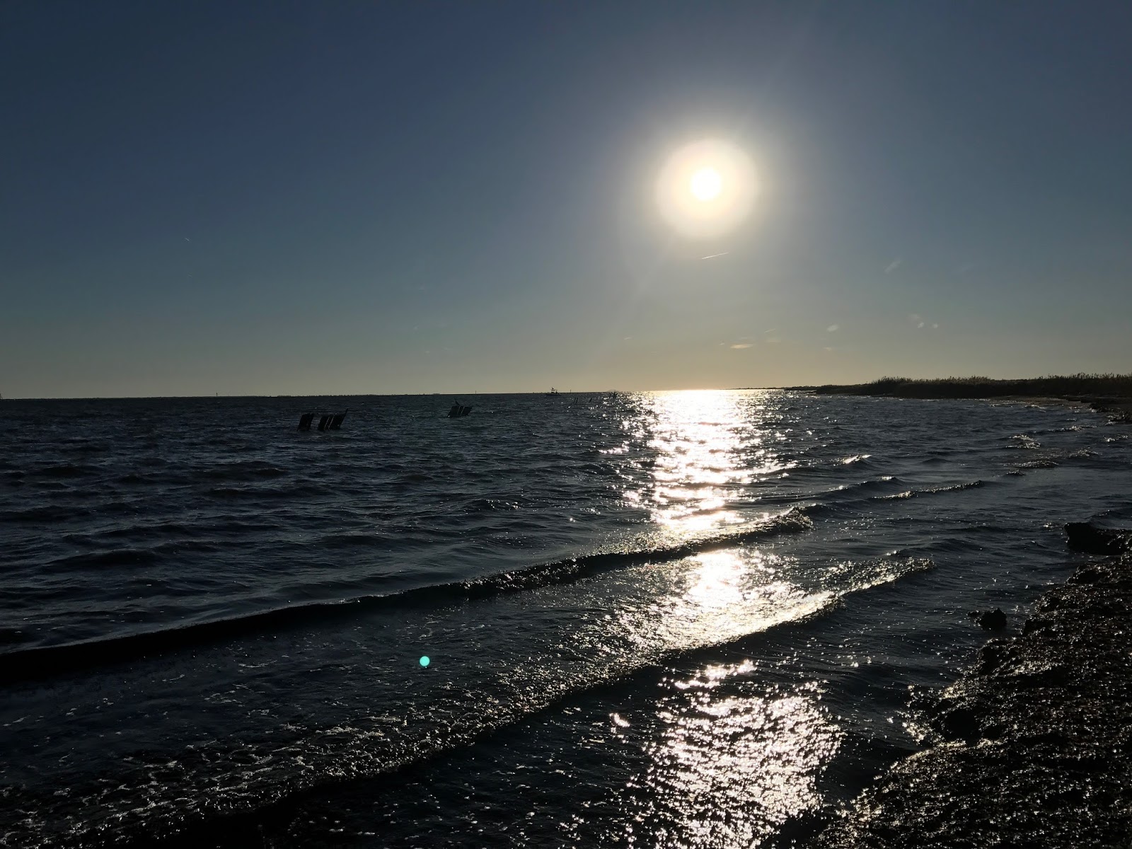 |
| Great South Bay : Image of Great South Bay after our lecture on the dock |
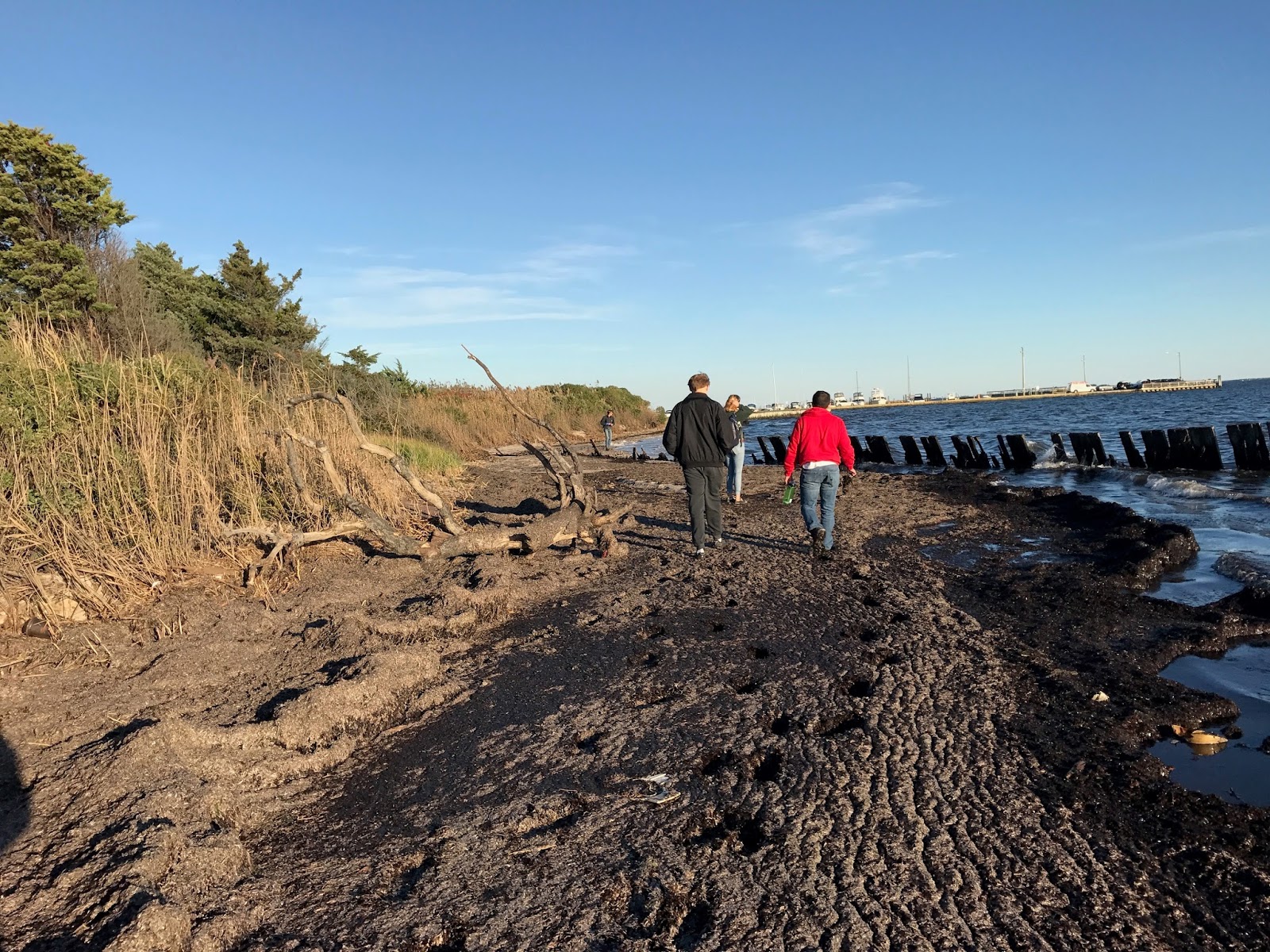 |
| Shoreline of Great South Bay: My friends walking along the wrack line of Great South Bay after out lecture. |
Origins of Sanitation in Sayville
by Antonio Fanizzi
This weeks trip took us to the Sayville Maritime museum to watch the spectacular boat burning. Once we got there, we still had several hours before the fire would start, so me visited several historical buildings on the site, including a small cottage that belonged to the original owner of the property. The interior of this house was considered public area and public area was expected to be very ornate among the wealthy. Nearly every inch of the structure of the cabin was made from fine wood which was considered a good indicate of the wealthy. The cottage had very high ceilings considering the time period that it was built in. Back then it was very expensive to keep homes heated so ceilings were often low to provide less room for heat to spread, it was not because the average height was shorter at the time. The designers of this house clearly did not mind having to throw in extra money to provide multiple heaters to keep the house warm. The most prominent feature of the house was the grand, self-playing, wind up piano located in the parlor, another indicate of a wealthy manor.
At this cottage is where we also learned about the history of New York sanitation. In the mid-nineteenth century, New York took in immigrants from Italy, Germany, and Ireland. Most of these people came from farmlands where it is custom to simply throw your garbage out of your window. It became so bad that people had to carry umbrellas when walking under window openings out of fear of getting hit. Some say that this is where the common phrase “look out below” originated from. Clothing was also redesigned just for walking through filth, as women started wearing heels and men wore wooden clogs to protect their feet. Even women’s dresses and men’s pants started to get shorter. Another big problem with filth came from the rise of horse drawn carriages. A healthy adult horse can produce over thirty ponds of feces and two gallons of urine each day. This is why horses on the streets of New York today are required to wear special feces catchers. People were so desperate for an easy clean up that they began to release pigs onto the streets of New York City. Pigs are considered extremely easy to take care of because they will eat absolutely anything, even bacon or horse feces. This would have been a great idea if it weren’t for the fact that these pigs could grow to over eighteen hundred pounds. They began attacking people in attempt to steal their food, and would even tip over trolleys and break down doors in search of their next meal. By 1880, it was made illegal to own a pig in New York City and it is still illegal today. The problem was finally addressed properly in 1895 when the sanitation department was created. People were able to make their living just by picking up garbage and feces off of the streets. This organization still exists today and likely will as long as the city streets stay cluttered.
“On the Half-Shell”
by Finn Morrissey
The claim to fame that Long Island holds most dear, besides the highest concentration of road rage, was the vast commercial shell fishing market. Even before the European invasion, Native Americans harvested hard shell and soft shell clams as well as taping into the oyster beds that spanned the salt waterways such as Great South Bay. After Europeans arrived, the early settlers used shellfish to survive as they were an easily accessible, abundant source of protean. As the years passed the harvest of shellfish, especially oysters turned from a survival based gathering to a commercial enterprise. The increase in technology from rakes to dredges massively increased the production of the famous Blue Point Oysters from the Great South Bay. In the 1930’s two separate events led to the disappearance of the fabled oyster populations of the past. Oyster larvae need a hard substrate to settle out on in order to successfully mature into adults. Oyster beds are made up of living and dead oysters growing layer upon layer. The adults signal to the larvae that they can settle before they do. The use of the oyster dredge sucked up live oysters and the beds themselves leading to less and less substrate for larvae to grow on leading to years of poor recruitment. In 1938 the Long Island Express hurricane rolled through and completely changed the water quality of the local bays including the Great South Bay. The hurricane opened up a new inlet into Great South Bay changing the hydrology which effected variables such as salinity and temperature. Also, the storm surge buried many of the oyster beds in sediment leaving little substrate for the oyster larvae.
The oyster rake, up until modern technology took over, was a baymens best tool to harvest oysters at moderate depths. The basic rake was similar to barbecue tongs, where two curved tooth rake heads were hinged together and attached to a long wooden handle. Baymen would take this rake and drift over piles of oysters scooping up as many as the basket could hold then doing another drift. This was common practice, and good honest work for Long Islanders to make a living. You can see an example of a rake below the article in figure one. As technology was made better, the ability to harvest oysters in more efficient ways became a more lucrative enterprise. The oyster dredge became the best way to commercially procure oysters. An oyster dredge, in laymen’s terms, is a beam trawl that digs into the bottom collecting its contents. A metal frame with teeth at the bottom sends a net to the sea floor. As the dredge is pulled the teeth force the frame into the sediment and oyster are scooped up and filtered out by the net. A common dredge can be seen below in figure two. Oyster from the Great South Bay harvested by rake and dredge were a delicacy all over the world especially with the invention of ice boxes and artificial refrigeration. The Blue Pont Oyster was so highly regarded that New Jersey baymen steamed over to the Great South Bay, just to steal the oysters. Also people were coming with their pre-harvested oyster and dipping them in the bay to then claim they were Blue Points. This led to the rule that Blue Point oysters were ones that spent at least three months in the Great South Bay. That is Long Islands legacy and no one else’s, so the next time you see official, recognized, Blue Point oysters on the menu, just say; I’ll take ‘em on the half shell.”
 |
| Figure 1. Oyster rake |
 |
|
Figure 2. Oyster dredge
|
The Vessels of the Long Island Maritime Museum
by Kaitlyn Fenster
While I have enjoyed learning about the fishing practices and maritime traditions of eastern Long Island, I especially enjoyed this trip because I used to live in Sayville and have spent a lot of time around Great South Bay. I remember taking the ferry across to Fire Island and seeing the other boats passing by over many summers during my childhood. It was fascinating to learn about the vessels that used to sail across the same body of water that hold such significance in Long Island’s maritime history. In the boat warehouse, there were a variety of vessels of different sizes and functions. I really liked the design of the vessel “Two Brothers” and its abundance of ropes and mechanisms. “Two Brothers” was used as a training vessel for sailors; it is difficult to imagine being expected to know how to operate it with just 48 hours of training! Another interesting vessel I noticed was “Eight Ball,” designed by Benjamin Hallock as one of the many vessels he built for the 1909-racing season. The warehouse also mentioned another shipbuilder, Gilbert Monroe Smith, who built more than 400 boats over his sixty-six years of working in the Patchogue River boatyard. Some of these boats were also known for their racing capabilities, and also had special features, such as its light displacement and large sail area that allowed it to sail quickly even in shallow waters.
Unlike the superbly crafted vessels we saw during class, there was one vessel in particular that was not quite as attractive but captured everyone’s attention. This was, of course, the boat that was chosen for Sayville’s annual boat burning event. The boat selected is usually damaged beyond repair and holds no value to the Long Island Maritime Museum’s collection of historic vessels. The Sayville boat burning has been a tradition of the museum’s since 1990 and has served as an important cultural event that connects Long Islanders with the maritime community. Watching the boat burning was an incredible experience; people stared in awe with similar expressions to those seen during a beautiful firework display. Though Sayville’s boat burning has not been an especially long practice, the act of having a bonfire around the time of harvest is an extremely old tradition, as the museum’s documents mentioned. I loved learning about the traditions of Long Island’s maritime community and being able to witness its cultural significance firsthand.
Sayville Boat Burning
by John McGee
Sayville, along with other communities along the Great South Bay, such as Bayport and Blue Point, have long relied on the natural resources of the bay in order to make a living. Shellfish, in particular, were the bread and butter of these settlements. Of these shellfish, oysters were the standout. In its heyday, oyster farming and harvesting was an international business. Oysters from Great South Bay were transported all over the world, and were enjoyed by common folk all the way to the likes of British Royalty. Great South Bay quickly became known for the quality of its oysters, and many were eager to get in on the business. Often, fishermen from New Jersey would come to Great South Bay and steal oysters, or simply dunk their oysters in the water and claim them as “Great South Bay” oysters. The local bayman obviously took issue with this, but found no help from the toleration officers or from the governor. Therefore, in the 1860’s, as the Civil War is taking place, local bayman attempted to secede from the United States as ‘The Republic of the Rockaways’. This quickly brought an end to the issue has the toleration officers and governor sought to prevent this from happening.
For many decades, the oyster industry and those involved was bountiful. Great South Bay proved to be the prime local for growing oysters due to the natural make up of the bay. On the eastern end. The salinity was low as there was little ocean water input. At this salinity, a main predator of seed oysters, the oyster drill, was unable to survive, leading to a high survivorship among seed oysters. Once they were of size, these oysters were than moved to the more saline, western end of the bay that had a large amount of ocean water input. Here, the oysters grew fat and plump until they reached market size. However, this natural blessing came to an end in 1938 at the hands of the Long Island Express. This famed hurricane opened many inlets on the eastern end of the way, and thus the salinity increased. With this came the oyster drill and less survivorship among seed oysters. The hurricane also buried many established oyster beds with sediment, and so larvae had no place to settle out on! In addition, many duck farms were situated along the edges of the bay. These farms introduced excess waste and nutrients into the bay, leading to blooms of a weedy alga that smothered seed oysters. As oyster production fell off, many bayman adapted by beginning to harvest hard clams. Until then was seen as a form of supplemental summer income.
Coastal Cultural Experience: Setauket Spy Museum & Port Jefferson Harbor
Revolutionary War Spies?! Were Women Spies Too?
by Courtney Jansen
During the Revolutionary War, George Washington soon realized the importance of intelligence. Since Patriots were greatly outnumbered by British soldiers and far less skilled, their only hope was to outsmart and, therefore, out-spy the British. To protect the identity of the spies, code numbers were given to them, which represented their names. The only known list of code numbers representing members of The Culper Spy Ring, based in Setauket, only listed male spies. There is evidence that there were female spy supporters, however. These women aided the spy ring, but they were not given aliases or codes.
There is a primary source of a letter written by Abraham Woodhull to Benjamin Tallmadge on August 15, 1779. In the letter, Woodhull says, “Every letter is opened at the entrance of New York, and every man is searched,” so he planned to go to New York accompanied by a lady to “outwit them all,” meaning the British. This primary source tells us women were used to smuggle information undetected. The Culper Spy Ring used the social construct of how women were to be treated in the patriarchal society to smuggle information to other Culper spies under the British radar. Every man was searched. Women were not. It was thought wrong to search a woman because a strange man would be touching her.
It is suspected that Anne Strong Smith was the woman who accompanied Woodhull into the city because there are many stories of her involvement as a spy aid. She would be the perfect candidate because she was known by the members of the Culper Spy Ring, related to Woodhull and Brewster through marriage, and, most importantly, had two loyalists brothers living in the city at the time.
Anne was considered a spy-supporter. A woman would not be able to have the title and duties of a spy during this time because women were viewed as helpless beings needing protection and saving by men, so Anne would not be able to be a spy. She also had six kids that were dependent on her, so she could not put herself in too much danger.
It is unknown whether it is true or just a rumor that Anne helped the Culper Spy Ring pass the information between Woodhull and Brewster. Brewster was the leg of the loop that moved between Connecticut and Long Island, so his ship could enter many bays along the northern shore of Long Island. It is suggested that Woodhull knew which cove or inlet to find Brewster based on what Anne hung on her clothesline. Since there is only word-of-mouth suggesting this and no primary source to back this up, it is unknown whether this is true or not.
For this reason, primary sources are extremely important for uncovering true facts of history and piecing together history’s large and complicated puzzle. History is never dead because new sources are constantly being discovered and their part in the puzzle hypothesized and figured out. It is important to include these oral stories because they might shed some light on new pieces of information discovered, or they might refute them, like the case with Nathan Hale’s famous line that turned out to be a quote from a play and not his words at all. He did not wish to have more lives to die over and over for his country. He just did what was asked of him. As new documents are discovered and their relevance and part in history determined and placed, the story becomes more complete, and our knowledge grows. Perhaps there is still much more to learn about the Culper Spies. Only time will tell!
Port Jefferson Harbor. History and Economy
by Zerfana Khan
Shipbuilding shaped the Port Jefferson area throughout the 19th century. Ship building and whaling have close ties.Whaling declines with discovery of oil in Pennsylvania, gold out West, stone fleet of sinking ships, and technology. As whaling declines so does shipbuilding (of woods vessels). The demand for whale oil was high during the Civil War but quickly declines. The demand for other whale resources such as bone, disappears with the old fashion corsets in the early 20th century.
Ship building also declines because of ships like USS Monitor and the USS Merrimack. These ships were steam and ironclad US Navy warships, that were used at the time of the American Civil War. With that said, we saw a huge shift from wooden to metal boats. The steam powered propulsion and iron armor made these ships less vulnerable as opposed to other wooden vessels.
The Port Jefferson environment was very much focused on wooden boats and as it begins to decline, the area struggles economically. At this point, areas like Port Jefferson and Cape Cod experience drastic slowdown. They will eventually experience a rebirth due to tourism. In addition, the ferry also helps to spur economic growth. The Port Jeff Ferry travels across the Long Island Sound to Bridgeport, Connecticut. They make that trip several times per day, and people can bring their vehicles. This builds on the connection between Long Island and the New England area. Today it also helps those who wish to bypass New York City traffic. The Grand Republic and P.T. Barnum are a couple of the ferries used in Port Jeff today. An interesting fact is that P.T Barnum was a circus organizer who was going to base his circus in Port Jefferson. He instead up takes it up to Bridgeport. Nevertheless we honor him with his own ferry.
Traditionally, shipbuilding and whaling attracted a certain crowds. Today with tourism we also see other groups of people come down. Some people commute via ferry, yacht club members, motorcyclists…
Lastly, when visiting Port Jefferson, one might be interested to look at the memorial to the shipbuilding industry and to those lost at sea. Port Jefferson Harbor is also home to the Seawolf West campus research vessel.
The Need for Good Intelligence
by John McGee
“There is nothing more necessary than good intelligence to frustrate a designing enemy, and nothing that requires greater pains to obtain.” At an age close to most of us in Coastal Cultural Experience, George Washington uttered this insightful quote, unaware of the truth it would bear for him some two decades later. In late August 1776, just a month after declaring our independence as a nation, George Washington commanded patriot troops against the British in Brooklyn, in what is now known as The Battle of Long Island. After the British left Boston, they regrouped in Nova Scotia and then sailed down to Staten Island to prepare for battle. New York was to be their next headquarters. Besides having good harbors, having control of New York City and Long Island, and the Hudson River effectively allowed the British to split the population centers of the colonies in half, cutting off trade, information, and other vital components of the United States needed to succeed. Despite being severely outnumbered, 30,000 trained British troops against a band of 8,000 ill-prepared farmer soldiers, Washington knew the importance that New York and Long Island held. However, the battle proved to be a huge defeat for Washington and his army. Under the cover of darkness, he and those remaining troops fled under the cover of darkness to Manhattan, and further upriver in New York. He would not return to Long Island of the city for 7 years.
After this crushing defeat, Washington knew there was no way they could beat the British head on. He realized in order to beat the British, calculated strikes and reliable, inside information would be his means of victory. And so, Washington sought to set up spy rings to take down the British. Since New York was the new British headquarters and a loyalist stronghold, information from this area would be of vital importance. Asking among his soldiers, Washington needed a brave soldier willing to risk his life for the cause. Enter Captain Nathan Hale from Connecticut. Hale studied classics and dramatics at Yale University, and so it was thought he would be easily able to disguise himself. However, after arriving in Huntington on September 15, 1776, he was captured in Queens on September 21. Hale seemed to have the habit of stopping into taverns to play his role, and after having a bit to trick, his character would become less and less convincing. The next day, Hale was brought to a British headquarters in Manhattan and executed around what is now 66th and 3rd. Hale’s demise brought to light the need for protection for the spies, and for reliable, unsuspecting spies with reasons to be where they were. This became an important point for Setauket native Benjamin Tallmadge, Washington’s chief of intelligence, Hale’s best friend at Yale, and the eventual founder of the famed Culper Spy Ring.
A Little Bit of History in Our Back Yards
by Madeleine Keefe
I thought I knew a little bit about almost everything about the American Revolution. From school to also living in Boston, I believe I had a general idea about the events and the people who took part in the revolution. After we visiting Setauket, we learned about a huge part of the revolution, that without it, the outcome may have been drastically different. The Culper Spy ring helped the colonists defeat Britain and remained a part of history lost until the 1900s. This spy ring took place on Long Island, and connects this area to a huge part of history.
Benjamin Tallmadge, the groups organizer, lived in Setauket, New York and based the spy ring out of this area. He recruited a couple of men from his childhood who he knew he could trust and led one of the greatest spy rings at the time. To be a spy, you must blend in to your surroundings and not be questioned where ever you end up to be. George Washington hired Nathan Hale as the first spy in the revolution, but because of his ability to standout where he was sent, Hale was caught by the British. Washington needed someone to blend in to their surroundings. Tallmadge kept the spy ring in his home town of Setauket because no one would question him being there. Everyone recruited into Culper was a strategic move on Tallmadge’s part.
Walking through the historical museum made my eyes widen with every new story about the Culper Spy Ring. I have no idea this was a major part of the revolution, or even a thing in its entirety. Everything done in this ring was very intricately planned out and was clearly very successful. My respond to everything was “that’s so clever”, because everything truly was. I never knew this was a part of history, or that we were all so close to this being on Long Island.
The Culper Spy Ring and the Battle of Yorktown
by Kaitlyn Fenster
I really enjoyed learning about the Spy Ring based out of Setauket. Having lived in Port Jefferson Station my whole life, it was fascinating to discover that people who lived so close to where I do less than three centuries ago played such a vital role in the Revolutionary War. Though the Culper’s made significant contributions in gaining intelligence throughout the war’s entirety, their impact on the Battle of Yorktown was especially interesting; without their help, the Patriots would have likely lost this battle and possibly the entire revolution. As a child, I learned that the Siege of Yorktown was the last battle of the Revolutionary War, securing American’s independence from Britain. American troops led by George Washington were able to defeat the English forces due to the assistance of French troops. However, if not for the bravery of several Long Island natives, America may not have had assistance from the French and may not have had the manpower to win the war.
Throughout the war, George Washington sought to regain control of New York City from Britain. Towards the end of the war, there was a French fleet stationed in Rhode Island, and Washington had heard rumors that Britain knew of the fleet’s location and planned on sailing out of New York City to sink the French fleet. Washington used the Culper spies to investigate the validity of this rumor. Through their investigation of British forces between Setauket and New York City, the spies determined that the claim was true; Britain did intend to defeat the French forces. With this crucial information, Washington planted false information that he intended to attack New York City. Once British forces heard of this plan, they called their fleet back to the city and never reached Rhode Island. This allowed the French to sail down the east coast where they would help secure the victory in Yorktown. If it were not for the Culper Spy Ring, who knows how the events of the war would have played out and what effect this would have had on America’s ability to establish itself as an independent nation.
Coastal Cultural Experience: Fire Island
Fire Island Lighthouse and Hike
by Courtney Jansen
Lighthouse History and Architecture
It was my first time visiting Fire Island. It is 32 miles long and the only developed barrier beach in the Unites States. We parked in the main parking lot, which is where all cars park from April to November, limiting the traffic on Fire Island. During these months, people navigate the island either by foot or bike. There were boardwalk paths to take to the beach and the lighthouse. While walking along the path, we encountered a few surprise critters! There was a fawn grazing on vegetation along the boardwalk, and she nonchalantly posed for her photoshoot. We learned the deer population on Fire Island began from deer swimming across the bay from the south shore of Long Island, looking for a new habitat. We also came across a woolly bear caterpillar inching along the boardwalk.
We walked onto the beach to enjoy the view. I was surprised to see a little sand cliff on the beach, called scarp, which is an erosional feature. Many of us took to running and jumping into the air off the sand ledge and found how well we could stick our landings. The less-coordinated among us were the ones to tumble into the sand, only to laugh it off and try again. The photo below shows the edge of the scarp on the bottom of the image, and the dark sand was lower and in front of the little sand cliff. You can see all of our footprints from jumping down.

We made our way to the lighthouse, and we learned that the lighthouse we climbed up and saw in front of us was the second lighthouse built on Fire Island. The first one was built in 1826, at 89 feet 3 inches high, and could be seen about 14.5 nautical miles away at sea. The lighthouse was plain stone, which made it difficult to see under different weather conditions and differentiate it from other lighthouses at the time. There were many shipwrecks that occurred, so new plans were made for the lighthouse in 1852. Instead of fixing the current lighthouse, a new one was built. The Connecticut River Stone that the first lighthouse was made of was used as the foundation of the second lighthouse. This lighthouse was built 168 feet tall and still stands today.
Due to new safety laws, all lighthouses by 1890 were uniquely colored and marked, so sailors could identify where they were approaching. The marks also make it easier to spot the towers under many weather conditions. In August 1891, the second lighthouse on Fire Island was painted with 2 black stripes and 2 white stripes, with black at the very top, followed by white, black, white.
While I was climbing the tower, I stopped to read the information at each window. Each description stated how thick the walls of the tower were at that point. I never knew lighthouses had much thicker walls at the base than the top. The first window landing, facing north, is located at the 26th step going up the lighthouse, and the walls are 8 feet thick. The walls, interestingly, are not solid. There are ventilation channels in the walls to allow moisture and condensation to drain. This also allowed the mortar to cure properly. It is thought that the tapered shape of the lighthouse was based on John Smeaton’s 1759 stone lighthouse near Plymouth, England. Smeaton’s lighthouse took the shape of an oak tree with its wider base rooted, and the curved, slimmer pillar above to keep the “center of gravity low.” The second window faces southwest, and its landing is located at the lighthouse’s 52nd step, where the walls of the tower are 6 feet 4 inches thick. Here, there was information regarding the tower’s decommission in 1974. The tower was determined to be in poor condition. The Fire Island Lighthouse Preservation Society raised $1.3 million, restored the lighthouse, and turned the light back on in 1986. The third window landing is at step 78, where the lighthouse walls are 5 feet 3 inches thick. From this window, facing southeast, the National Park Service Ranger Station, built in 1906, can be seen; it was originally a Navy radio station. The fourth window faces north, the landing is located at step 104, and the tower’s walls are 4 feet thick. An American flag can be seen out this window, and the height of the original lighthouse was about the same height as the flag pole. It is very neat to be able to visually compare the height of the old and current lighthouses, and it is evident why another was built.
Atop the lighthouse, we could see the entirety of Fire Island. Circling around the walkway at the top of the lighthouse, we could see Fire Island in all directions. The photo below shows the residential area of Fire Island in the distance straight ahead. We also watched a doe and her fawn walk around and cross over a boardwalk. We could see the water between the south shore of Long Island and see different features of the water and its currents from our vantage point as well. Up high, it was humbling. We could even spot Stony Brook Hospital! It is amazing how much can be seen from standing about 160 feet above the ground. Fire Island is beautiful, and I’d love to come back and explore it further.

Robert Moses and Jones Beach
by Antonio Fanizzi
For this week’s trip, our class visited the beautiful and iconic Fire Island on the South shore of Long Island. The first thing we did when we got there was go on a long hike through the fields and salt marshes. The nature we saw on this hike was breathtaking, especially when we came across some young fawns feeding on the bushes. At the end of our hike, we passed the iconic Fire Island lighthouse and ended up on the sandy Fire Island beach. The high tide had clearly left its mark on the beach by turning the shoreline into an enormous sand cliff that was around six feet deep. It was here on the beach beside these cliffs that we began our initial lesson on Fire Island’s early history.

Robert Moses was a New York metropolitan public official who may have been one of the most important men behind the Long Island tourism industry. His vision started on Jones Beach Island located directly west of Fire Island. It was the 1920’s when Moses first pitched his vision for a Long Island beach attraction for tourists from all over the world. Back then, what we know as Jones Beach was actually uninhabitable swamp land filled with lots of biting insects, so they had a lot of work ahead of them. It took several years, but his project was finally finished in August of 1929. The earliest visitors were impressed by how much detail was put into the establishments. For example, they had baby bottle warming stations for mothers and the handles on the drinking fountains were shaped like pirate ship wheels to stay true to the nautical theme of the beach. This was far from Robert’s only remarkable project as he ended up putting a total of over six billion dollars into his life’s work including Shea Stadium and the New York World’s Fair. The Western end of Fire Island is now linked to Jones Beach by the Robert Moses Causeway which was funded by, of coarse, Robert Moses. Many people today blame him for the traffic problem on Long Island because he designed most of Long Island’s highways to lead to the beaches and increase tourism.

Perhaps one of the greatest factors behind the success of this new beach was that the stock market crashed and the Great Depression began in October of 1929, just two months after the beach opened. Within the first month, one third of America’s GDP had disappeared. Long Island actually had it a lot better than most of the country, especially New York City, because unlike in the city, Long Island had good access to food and farmland. The Long Island fishing fishing industry was extremely important at this time so they had a train route called the “Fisherman’s Special”. It carried New York fishermen from Penn Station to Long Island, and it even had freezers that they could store their catches in. Long Islanders were praising Jones Beach because it created new employment opportunities that generated several million dollars for the Long Island economy. Thanks to Robert Moses, Jones Beach was named the greatest beach in the world three times, which is the maximum limit. I cannot help but compare Moses to the Fire Island high tide as they both have the ability to shape their surrounding environments into breathtaking sights.
Fire Island, and Asset to Long Island from the Great Depression to Now
by Makenzie Conover
During the beginning of the 20th century, Long Island was seen as an escape from the hustle and bustle of New York City, a place of peace and serenity set apart from the grimy city conditions. It was considered secluded enough that it was used as a quarantine location during disease outbreaks, such as the outbreak of influenza in 1917. There was also an outbreak of cholera in 1892 aboard a ship sailing from Europe to New York City, where the passengers landed and were kept on Fire Island until it was decided that quarantine was no longer necessary.
 |
|
Figure 1:
Ship and its passengers during the cholera outbreak of 1892.
Source: Fire Island Museum |
New communities were on the rise, distinguished by their own personalities and traditions that were falling into place, and projects such as Robert Moses and his plans for the creation of Jones beach on Fire Island as a sought-out destination were being finalized. However, Long Island became more than an escape from the busy city life and pretty scenery when the Great Depression hit. The worst stage of the Great Depression was between 1931 and 1932, where approximately one third of the United States’ entire GDP was gone and continued to plummet more still. People didn’t have enough to eat, and breadlines weren’t the best solution for city areas since the amount of food available for distribution was often based on how much businesses and people were able to donate. People in the city began to grow small plants on their fire escapes just for a little extra food that wouldn’t cost them any money.
 |
|
Figure 2: Fire escape in New York City during the Great Depression. Along the top of the photo, multiple planting pots are visible, showing that people used the space on their fire escape to grow food when necessary.
|
People who lived out on Long Island and Fire Island were better off than the people in the city however. This is because Long Island had settlements and communities but with a huge amount of land that they had access to as well as ocean access. For food they could go fishing, clamming, basically obtaining anything available from the ocean without having to spend the money. Smaller scale farming also became more common for sustaining these communities during the era of the Great Depression. Some families sent children out to relatives and friends in Long Island and Fire Island because they were more likely to have access to enough food than if they had stayed in the city, also relieving pressure from the families left behind in the city with fewer mouths to feed. The Fisherman’s Special became a popular way for families to obtain food outside of the city. With this system, fishermen were sent by train to Montauk at five o’clock in the morning. The train was a series of ice boxes for fishermen to bring their catch back from Montauk and keep it preserved long enough to bring back to feed their families. Because of the state of living during this era, Long Island gained a reputation for being more than what it been seen as before. It was a place able to sustain its inhabitants enough that even when the economy was failing, living conditions were in significantly better shape than other areas of the country.
Despite the public and isolative advantages of Fire Island in the past, today it is still considered remarkable and is sought out by may Long Islanders and city residents as a place to escape to and enjoy the natural beauty it beholds. Many people have seasonal homes along the coast of Fire Island because it offers them a beloved reprieve from busy city life, and others have built homes for permanent living, 337 people to be exact. Robert Moses beach was elected the best beach in the world for 3 years and continues to see hundreds of thousands of people every season. Standing on the beach with the class and taking the time to thoroughly experience the serenity and picturesque quality of Fire Island gave us all a new appreciation for this beloved treasure of Long Island.
Fire Island Lighthouse’s Fresnel Lens
by Josh Farber
One stop on our field trip to the Fire Island Lighthouse was to the Fresnel Lens Building, which now houses the historic First Order Fresnel Lens that illuminated the current lighthouse from its construction in 1858 until 1933. At the time, it was the largest lens of its kind, and magnified light to be visible by ships up to 21 nautical miles away.
The light was an important one for ships coming from Europe, since it was the first lighthouse visible during the journey. The Montauk Point Lighthouse, which we visited a few weeks ago, was too far north for shipping vessels coming from Europe to see it, since it was outside of the main shipping lanes. Until switched to kerosene fuel in the 1880s, the lighthouse relied on sperm whale oil and lard to illuminate the light. Also in the earlier years, the keeper would have to turn a crank every 4-½ hours to keep the rotation of the light in motion. The light would be visible for five seconds out of every minute.
In 1931, the lighthouse became nearly three times brighter when an incandescent oil vapor lamp was installed, which vaporized preheated kerosene to burn a silk mantle. This replaced the Funck Hydraulic Lamp, which dated back to 1869. Together, the lens and lamp would continue to provide light until 1933, when the lens was replaced by one from the former Shinnecock Lighthouse, which was decommissioned in 1931.
After being dismantled, the lens was shipped to Philadelphia, where is was on display at the Franklin Institute until 2000. At that time, the National Park Service was interested in bringing the lens back home to Fire Island, despite not having a suitable location to display the lens. Packed up into more than 30 crates, the lens went into storage until the Fire Island Lighthouse Preservation Society constructed the current Fresnel Lens Building adjacent to the lighthouse, which opened in 2011. Seeing the enormous lens really made an impact to our visit, especially since we saw it right before climbing the lighthouse tower.
 |
| The First Order Fresnel Lens on display at the Fresnel Lens Building at the Fire Island Lighthouse. |
 |
| Looking through the lens, which flipped the image of classmates standing on the other side. |
Fire Island
by John Hardie
This week we visited Fire Island on our Friday field trip course. I was excited to see what was in store for me considering I had never been there before. After parking in the main parking lot, we took a walk to the beach and observed the erosional features of the beach. As we ate lunch, we discussed how longshore drift was gradually extending the length of Fire Island westward. This is because sediment is eroded from the east end of Long Island by waves coming from the East. All of the sediment is then carried along the south shore of Long Island in the westward direction by the longshore current.
The talk of this erosion led to the fact that the lighthouse was not built where it stands today. Rather it was built a few hundred feet west of the current location. After lunch, we began walking towards the lighthouse. On the way there, we stopped to look at the ruins of the original lighthouse. Only the base remained, and the bricks that once supported a 90 foot tall lighthouse were falling apart. We learned that this location was once situated at the western end of Fire Island when the original lighthouse was first built, but longshore current has since extended the island by hundreds of meters. In addition to Longshore Current, regular waves coming in to Fire Island from the ocean are eroding the island and pushing it farther back towards the mainland of Long Island. This process occurs at a rate of about 1-2 feet per year, therefore at some point, Great South Bay will close up and Fire Island will crash into Long Island.
Coastal Cultural Experience: Sag Harbor Whaling Museum and Custom House
Good Ben Huntting
by Gregory Paul
The whaling industry of Sag Harbor has been a keystone to its history and culture. One of the most prominent figures of such is Benjamin Huntting I. Sponsoring the first whaling venture out of Long Island, Huntting is considered the father of Long Island’s whaling operations. Additionally, by the time Long Island’s whaling industry had come to an end, the Huntting family held the record for most sponsored whaling ventures out of Long Island.
Huntting and his partner Stephen Howell helped revolutionize the early whaling industry, not of just Long Island, but of the world. He was the first to suggest the use of try-pots onboard, which greatly increased the efficiency of whaling. Whalers would be able to process whale oil out at sea rather than having to bring back barrels of blubber to be processed on land.
The Huntting House has since been appropriately turned into the Sag Harbor Whaling Museum, which was also designated as a National Treasure by Hillary Clinton in 1998. There is much that can be found on display–a number of whaling ship models, paintings depicting whalers out at sea, trinkets made from whalebone, and genuine scrimshaw! While we were there, sculptures made of garbage found at sea, created by artist Cindy Pease Roe, were strewn about what used to be the Huntting’s living room. I thought her exhibit was very interesting, and there was a clear contrast between Roe’s work and the traditional historical pieces. Tara had also informed me that there were several artifacts that must have been in storage, since she did not see them on display. Considering how interesting the rest of the museum was, I would love to see the artifacts Tara was thinking of some day!
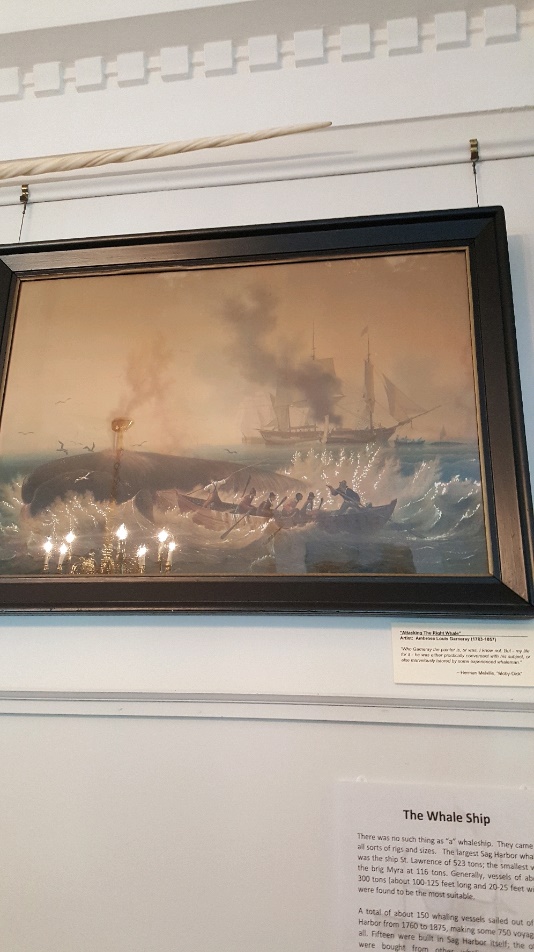 |
| Fig. 1 A display of “Attacking the Right Whale” by Ambrose Louis Garneray. The dark clouds above the whaling ship were common in paintings of whaling, as they depicted the thick stench that loomed over the vessels. |
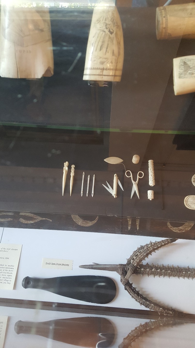 |
|
Fig. 2 Various objects made from whalebone, including a pair of scissors and a multitool. According to Gregg Therriault, the museum’s site manager, many objects made of plastic today were most likely made of whalebone during the era of whaling.
|
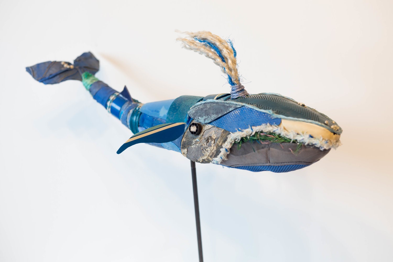 |
| Fig. 3 An example of Roe’s recycled works for her exhibit, Beauty and the Beast |
The Importance of a Deep-Sea Port
by Elaine Alberts
The Sagaponack Harbor commonly known as Sag Harbor is a small town on the Northern shore of the Southern fork of Long Island. Although it is currently regarded as a swanky New England town filled with galleries and boutiques, in the 18th century it was a middle-class town that prided itself on its hard-working residents. Sag Harbor was an essential part of the New York economy, especially in the 19th century, when whaling was in its hay day. This was one of the 4 most important harbors in New York, because it is a deep-sea harbor.
Long Island was formed by glaciers approximately 21,000 years ago. When the glacier receded, it left behind a massive pile of sediment. These mounds of sediment are called moraines; these moraines have soft slopes on the southern edge, and end abruptly on the northern edge. Sag Harbor is on the northern edge of the Ronkonkoma moraine. Sag Harbor is very deep and well protected. The town was destroyed by fires four times, including during the war of 1812, but it was rebuilt every time. Most cities would not have been rebuilt so many times, but the location and importance of Sag Harbor was enough to motivate residents to rebuild. It was more convenient for ships coming from England to sail into Sag Harbor than to go all the way to New York City. Combining all of these factors made Sag Harbor a cosmopolitan hub.
One of the more notable events in Sag Harbor’s history was Meigs raid. In 1777, 90 British were captured by the Patriots without firing a shot. The Patriots had discovered the payday of the British soldiers, they attacked and rounded up the drunken soldiers and sent them to Connecticut as prisoners. Every year, Sag Harbor holds a reenactment of Meigs raid (I’ve heard it is pretty amusing). Another key part of Sag Harbor’s history is whaling. Families like the Huntting family made their fortune by sending ships out to find and kill whales for their oil. The deep waters in the harbor were ideal for whaling vessels to unload their precious cargo. The duration of a whaling venture often varied, ships would not return to the harbor until their hold was filled with oil. The longest voyage out of Sag Harbor was 11 years. During the 18th Century the Navigation Acts called for the building of a custom’s house. The customs house was managed by a man named Henry Dering. The building still exists, and because of the generous donations of the Dering family, almost everything in the house is original. The Huntting family home and the customs house have been moved next to each other and are now used as museums to retell the history of Sag Harbor and the importance of this deep-sea port.
 |
| Sag Harbor: A picture of Sag Harbor’s deep-sea port. |
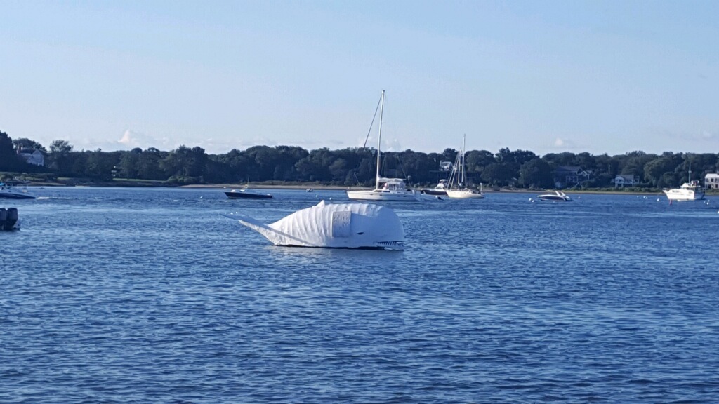 |
| Sag Harbor Whale: A picture of an artificial whale that is “harpooned” every year at the annual Sag Harbor Whaling Festival. |
The Sag Harbor Whaling and Historical Museum
by Zerfana Khan
Sag Harbor was one of the key places to be in during the height of whaling industry in the 19th century. Many families made a living off this industry including the Huntting family who made a substantial fortune. The Huntting family fortune allowed them to obtain all the attributes associated with upper class citizens. This can be demonstrated by viewing their estate. Today we visited their home which has been converted to The Sag Harbor Whaling and Historical Museum, considered to be a National Treasure.
It was very interesting to visit the museum from a architectural and artistic perspective. My first initial look threw me off as it incorporated many Greek architectural features. The corinthian capitals and columns are what stood out the most. The home was built in 1845 by Minard LaFever. Surprising enough, the architect was American from New York. LaFever’s goal was to make the building stand out, displaying the enormous wealth and power of the Huntting family. Furthermore, other elements on the outside included Greek keys, and a triangular pediment with alternating whale tooth and blubber spade figures referring to whaling. In addition, the museum also displayed the jawbone of a whale outside of the frame of the front entrance.
The same idea continued throughout the rest of the museum. The ceiling and doors are detailed with shapes of waves, harpoon looking reliefs, and tails through the use of a sand plaster casting method. The doors were made out of solid wood with carved patterns. And the staircase had an irregular shape, with a beautiful dome shaped skylight. Moreover, it is obvious how well LaFever did in representing the wealth of the Huntting family. The European ornaments he used and be seen in many government buildings.
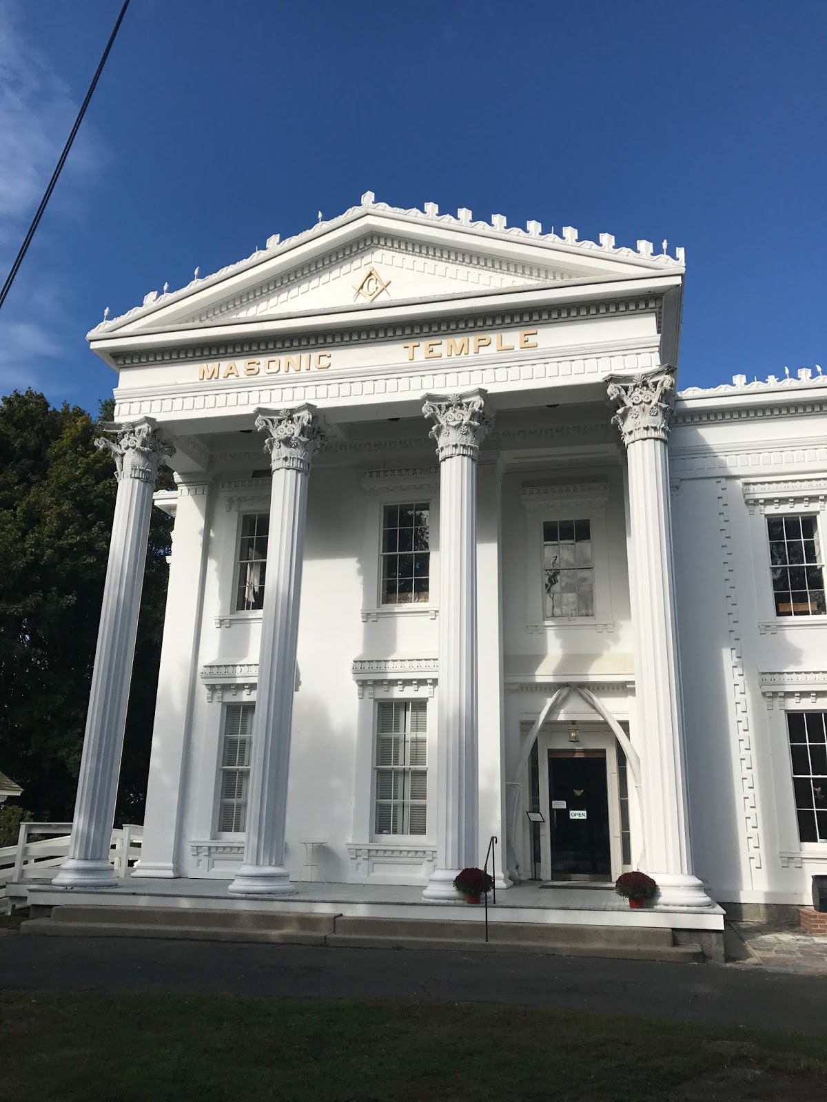 |
| Figure 1: Shows the front of the Sag Harbor Whaling and Historical Museum. Here you can see the many Greek architectural elements. |
 |
| Figure 2: Shows the ceiling of the inside if the museum. |
Sag Harbor
by Amanda Dias
On this sunny Friday morning, we jumped in the van and made our way to the beautiful town of Sag Harbor. When we got to the town we split into two groups and went to explore the museum and the Custom house. We learned a lot about the practice of whaling and the impact a maritime culture had on this worldly community.
The Custom House was a very important house back when Sag Harbor was one of New York’s two major ports. The house was owned by the U. S. Custom Master, Henry Packer Dering, who lived there with his family. The house itself was used both as a residence and an office for Mr. Dering. As you walk through this house, that stands a few blocks from its original location it has a very charming look to it. The first room you walk into, that was restored to look as it did when the Derings lived there, is the parlor. The parlor was relatively spacious and had windows that would make it hard for people to look into the room, because not only did they count money inside but they kept some valuables of the towns people as well.
 |
|
Figure 1: A clock in the parlor of the Custom House which was originally owned by the Dering family, the hole in the ceiling even dates back to when they owned the house.
|
As we toured the rest of the house there was a plethora of artifacts from both the Dering family and pieces from the same time period that they lived in the house. The different rooms were filled with different colored wallpapers imported from France. Also during their time in the house there were four rooms with wall to wall carpeting imported from India, even one carpet per household was very uncommon. They had a fairly large kitchen with two pantries stocked with many different gadgets and foods, including a waffle maker and a 100-year-old jar of peaches. Then as we went to the dining room there was a table filled with beautiful imported china. As we moved upstairs we looked at the different bedrooms belonging to the Derings and their children. Which was filled with fun artifacts like a mouse playhouse and indoor bathrooms.
Both museums, while small, were very informative. The guided tours definitely helped you really become immersed in the history. They hold so much of the history of Sag Harbor.
 |
|
Figure 2: Photo of the kitchen with all the different gadgets that would be used for and around the fireplace.
|
Whaling’s History and Influence in Sag Harbor, NY
by John McGee
In the mid 19th century, Sag Harbor, NY was an economic powerhouse and major worldwide port thanks to deep-sea whaling. Whale oil became an essential part of 19th century life, used in everything from soap to lubricants. Its chief purpose, however, was as fuel for lamps. Along with Nantucket and New Bedford, Sag Harbor was a major hub of whaling in America. Whaling vessels would leave the naturally deep, safe harbor and circumnavigate the globe in search of whales. If fortunes were good, a vessel could return to port in as little as 18 months filled to capacity with barrels of liquid gold. A typical trip lasted between 2-4 years, sailing from the North Atlantic, to the waters off East Africa, and even as far as the South Pacific!
For many, deep-sea whaling had extreme pay-offs. Captains, first mates, and those who financed the voyages could all expect to make off handsomely well after a successful voyage. As for the rest of the crew, pay was not fantastic, was it was steady and dependable. But for many young men, whaling offered more than just a paycheck. Whaling offered a world full of promise, never before seen destinations, and exotic women. Many people were born, lived, and died in their hometown without ever leaving. Knowing this, whaling was marketed as a break from the norm, with the chance to see the world and be somebody. Unfortunately, this was not the reality of life on the high seas.
Inexperienced new recruits, known as green hands, had to adapt quickly or risk death. Their quarters were at the bow of the ship, the area most prone to high turbulence and leaking. A steady diet of salted pork, potatoes, and a crunchy shortbread known, as tack could be all a man ate for months on end. This would be washed down with grog, a mixture of 50 parts rum and 50 parts water that used utilized in order to make drinking water consumable on long sea voyages. If a whale was spotted, green hands then got to take part in the hunt, which involved chasing after whale in a 30 foot row boat to harpoon it, tire it out, kill it, and then drag it back to the boat. If a whale was killed and brought back to the vessel, along with the crew, in one piece, the process of stripping the whale for its blubber and bones then began. All rendering and processing took place on the deck of the ship. Conditions were extremely dangerous, as blood, oil, wood, waves, knives and fire make the perfect storm for an inexperienced whaler. If injury or disease did occur, a sailor was left to his own devices, with the exception of a small first aid medical kit, in order to get well. No doctors were brought on the vessels, and many perished at sea.
While the marketing promises made to young men in Sag Harbor were often far from the truth, it is understandable how they fell for such ploys. Ships and crews from all over the world came to Sag Harbor to take part in the whale oil trade. In the streets, you could hear people speaking English, Algonquin, Chinese, Portuguese, and many other languages. Crews often employed local Shinnecocks and Montauketts, as well as African Americans. If you were good at whaling, your race was irrelevant at sea. Whaling quickly brought with it an affluence and diversity uncommon to the east end of Long Island. Even today, Sag Harbor is considered much more cosmopolitan than other villages such as Southampton or Easthampton, and diversity has endured as well. Although it has not been practiced for over a century, whaling still continues to influence the day to day life in Sag Harbor.
The Importance of a Deep-Water Port in Sag Harbor
by Genevieve Rappold
“Port of Entries” were set up by George Washington soon after the Revolutionary War to manage imports, exports, immigration, and emigration. Sag Harbor was one of four Port of Entries in New York because it was easier to get to than New York City (another Port of Entry) and because it had a protected port with deep enough water for large ships to enter. Each Port of Entry had a customs house which served as the office and home of the customs master. In Sag Harbor this was the office/home of Henry Packard Dering, a much respected man as he had stayed in the position until his death. Since this town had a fair amount of trade and immigration, Sag Harbor became a cosmopolitan town, full of different kinds of people you couldn’t find anywhere else in the early United States.
The port of Sag Harbor was also the home of a large whaling industry. The whaling industry was so big, in fact, that Benjamin Huntting was able to build a huge house because of his success in the whaling industry. This house was designed with beautiful detail that is reminiscent of a castle. The whaling industry was so lucrative because of the oil that came of it since that oil was needed to keep lamps lit. These whaling ships were very large and would go out for years at a time to fill the ship with oil. It was a very dangerous task that was said “to turn boys into men”. It was this whaling industry that influenced many aspects of the town, such as the detailing that went into Mr. Huntting’s mansion and even today with an annual event where people compete to “harpoon a whale”, or really attach a plunger to a cartoonish man-made whale.
Coastal Cultural Experience: Being a Bayman & Southampton Historical Museum
Southampton Historical Museum; The Role of Women
by Emily Kollmer
It is widely known that whaling was the cash crop for the European settlers on Long Island. A single right whale could yield 60 barrels of oil; enough to buy a farm three times over. At first these whaling ventures only lasted a few days and began when someone happened to see a whale offshore and hunt it down. As the area became more settled and grew in population however, people began to actively hunt whales. Some journeys lasted months; it wasn’t unusual for a whaling voyage to last two or three years. In this era, whaling was a man’s job. The whaling men were going on the voyages no matter what, but the wives of the men had two options: to stay at home or to go along with them.

The women that followed their men aboard were typically restricted to their small cabin. Unless they got really seasick and were vomiting, women were not allowed on deck. On most ships, it was expected of women to be seasick the first few days out at sea. For the lucky few that were immune to sea sickness, the men took it upon themselves to make sure that the expectation was kept up. If a woman was not sick, they would feed her ipecac syrup to induce vomiting.
Once the sickness had passed though, the women were sent back to their cabin where they would live for the rest of the voyage. Staring at the same four walls for a several years journey got pretty boring, so most women took it upon themselves to write and keep journals to pass the time. Because of this, a lot of history is preserved between the pages of sailors’ wives’ journals and are some of the best resources for historians.
Southampton
by Genevieve Rappold
 |
| (Image 1/Chicken Coop) Buildings other than the house on a person’s property were called “necessities”, such as outhouses. Chicken coops were also common and are a trend that hasn’t completely gone away today. They were often raised off the ground to protect from foxes and other predators and to help get rid of waste. |
 |
| (Image 2/Outhouses) The outhouses in colonial times were built to be small and easily moveable. These are exciting areas for historians because, during times of chaos, these were common areas for hiding valuables. Most families only had one outhouse, except for the wealthy, and some had two spots for mothers and their daughters to use together. |
 |
|
(Image 3/Department Store) This is a picture inside Hildreth’s, the United States’ oldest department store, having been established in 1842. On the windows they had advertisements from their early history for things such as cigars, “Five Boys”, and tootsie rolls. It’s much smaller than even today’s smallest department stores.
|
Early Southampton History
by Antonio Fanizzi
For this weeks trip, we visited the Southhampton historical museum. This museum was once a home to Samuel Parrish and is considered part of one of the oldest English settlements on Long island, but only by about a week. It was fascinating to get a glimpse of the lifestyle and living space of the earliest Southhampton residents. However, my blog will be focusing on the Southampton history that we learned right before our tour started.

It is a common misconception that Long Island was a very peaceful place to live during the early days of English settlements. In reality, Long Island was the site of what is considered the bloodiest war up until the Vietnam War. June 1675 was the start of the King Phillips War, also known as the Metacom’s war. It occurred between the New England natives and the settlers along with their native allies. Almost all men between the ages of sixteen and sixty were a part of their town militia and people would rarely leave their homes without carrying a gun. By the end of the war, one third of New Englanders had been either wounded or killed. However, this was the first war that New England had fought without any help from the British empire, so it was still an important part of establishing ourselves as an independent nation.
Even in this time of bloody war, the Hamptons still held their relationship with the Shinnecock Indians. It was common practice for the Shinnecocks to train the early New Englanders in the practice of whaling. They would even occasionally join them on their whaling expeditions. However, there was a law that whenever Native Americans joined whaling expeditions, it had to be put into the town records. They did this to limit the amount of money that they were allowed to earn because they were afraid that if they started to make to much money, they would be able to start buying their land back. In the 1650’s, they passed a law banning alcohol from being involved in making deals with Native Americans because the New Englanders would often try to get the Natives drunk in order to make it easier to solicit more land from them. This part of the trip was a great example that history is not always pleasant, but it is still how we all ended up where we are today.
Exploring Southampton
by John Hardie
This week in our Coastal Cultural Experience class, we explored the town of Southampton. Our first stop was a beach where we listened to a Southampton bay-man talk about his lifestyle and the struggles that come with his profession. Of all the things he spoke about, the thing that stood out most to me was that bay-man in Southampton need to diversify in order to make a living. As the speaker said, this brings additional challenges as it is often difficult to do business with restaurants. Restaurants need a steady supply, and a diversified bay-man may not have what the restaurant needs whenever they need it as some days are devoted to fish that the restaurant might not need. Because of this, Southampton bay-men often sell their product wholesale. This allows all types of fish that are caught to be profitable rather than relying on what a restaurant needs at any given time. Being a diverse bay-man also brings challenges, as it is impossible to focus your energy on any given fishery. A bay-man who only collects clams can devote all of his energy into mastering that fishery, but a diversified bay-man has to master three or four different fisheries at the same time, which requires more time and energy.
After learning about the lifestyle of the typical Southampton bay-man, we visited the Southampton Historic Society. The main museum area featured a typical dining room and parlor room from 17th century Southampton. Upstairs, there were typical bedrooms that you would find in this time period. I noticed that the mattresses looked short and lopsided. The center of the mattress was the highest points, and the sides got progressively lower. It looked as if anyone who slept on it would roll off. I hypothesized that the mattress was probably stuffed with eelgrass, but I didn’t know for sure. Curious, I asked about the bed and found out that it was actually made from down. The mattress was so short because it was thought during this time period that sleeping upright would prevent diseases. This answered my other question because if someone was sleeping upright, they wouldn’t fall off the bed. After we explored the museum, we went outside to look at some old-fashioned style buildings that you might find in Southampton during the 17th century. This trip was very informative of the lifestyles of Southamptonites, past and present.
Coastal Cultural Experience: Montauk Point
Montauk Point Blog Entry
by Josh Farber
Even the Montauk Point Lighthouse Keepers House couldn’t shield us completely from the winds coming in off the ocean. After collecting ourselves and making sure our hats weren’t blown away, we stepped into the Keepers Bedroom, which contained four models of the Montauk Lighthouse depicting how the lighthouse has changed since its construction in 1796.
The lighthouse was built at a cost of $22,300 from sandstone brought from Connecticut and hauled by oxen. Originally the only structures on the site were the lighthouse and the keepers house, which included a whale oil storage room. 1,800 gallons of whale oil could be stored, providing enough oil for nearly a year of operation. For the keepers of the lighthouse, it was a rather lonely existence. To get to East Hampton took upwards of six hours, if Napeague was even passable.
Our step through history, narrated by Doug Haak, a Montauk Lighthouse docent, continued in 1860. In addition to a garden, an annex was added to the keepers house, providing a place for visitors to stay. 14 feet of height was added to the lighthouse tower for the installation of a Fresnel Lens, which would magnify the light produced so boats could see the lighthouse from a greater distance. The pattern of light was changed to flash once every two minutes.
By 1903 the lighthouse entered a new era. Telegraph signals were erected, a baymark was added to the exterior, and another new Fresnel lens was installed in the tower. This lens, which now lives in the former oil room as a museum artifact, was the light of the lighthouse until 1987 when the lighthouse transitioned to automation.
As Doug continued his narration about the history of the lighthouse during World War II, you could feel the building shake in the fierce winds coming in off the ocean. A surveillance tower was added to the lighthouse property by 1942, and by the 1960s efforts had begun to try and combat the ever-present threat of erosion. Even though we couldn’t go up into the tower, it was still an interesting experience seeing the history of the lighthouse and learning about its significance to Long Island’s East End.
 |
| One of the models of the Montauk Point Lighthouse. This model depicts the elevation of the bluff with exaggerated topography, while also showing the constant erosion eating away at the land. |
My First Time in Montauk
by John Hardie
It was a windy and stormy day, but none of us were discouraged. We set out in the Stony Brook Southampton vans in search for a day of adventure. When we arrived at Montauk, it looked pretty much how I expected it to look. Surprisingly, despite spending the entirety of my life living on Long Island, I had never been to Montauk Point. After exiting the vans and pausing for a few photo ops, I entered the museum, eager to learn everything about the history of this Long Island historic site. We were met by a tour guide who told us about how the lighthouse and the surrounding landscape had changed throughout time. Because Montauk Point is a peninsula, winds come from all directions and erode the land. This is exacerbated by the strong waves that help to erode the beaches. At one point, Montauk was an island separated from Long Island. Due to long shore currents that transport sediment west, the water was filled in and Montauk was connected to Amagansett.
While exploring the museum, I noticed a glass panel on the floor of one of the rooms that was marked “cistern.” Curious, I asked one of the museum guides what it was. She told me that it was used for storing oil, but it was covered up when the coast guard left the lighthouse and discovered accidentally in the late 2000’s by museum staff. The cistern was a large hole in the ground about twelve feet deep. It was lit by an interior light that I couldn’t see, but it casted an eerie glow on the cement hole. The same man who had taught us about the changing landscape of Montauk Point came up to me to offer an anecdote about the cistern. He said that a couple of years ago, a custodian was in the cistern for regular maintenance. Since it was around Halloween time, he left a plastic skeleton down in the cistern. The skeleton wasn’t discovered until two years later by the tour guide himself. Apparently, some garden snakes had found their way into the cistern and were crawling inside of and around the skull of the skeleton. This personal and unpublished anecdote from the museum made me feel as if I had learned some insider information, and I will always remember this and share it with whomever I go to Montauk with next.
After we finished in the museum, we grabbed our lunches and made our way down to Turtle Cove. I saw many fishermen who had been surf casting, but appeared to have had no success. As I bit into my peanut butter and jelly sandwich, I noticed the head of a striped bass laying on the rocks on the beach. A gull picked delicately at the exposed flesh. Intrigued, I began to make my way over towards the fish. The gull backed away tentatively, as I began to examine what was left. I notified Kurt, who picked the head up on a stick to present it to the class. Although most identifying characteristics were gone, the villiform teeth of the striped bass were still intact. After asking some questions about the fish head to the class, Kurt placed it back on the ground, and the gull resumed its meal. It made me happy to see nature come full circle. Some fisherman had caught the fish, beheaded it, and kept the meat to eat or sell. By leaving the head on the beach, he fed some birds and gave a talking point to a college field trip. Nothing is wasted. That’s how life should always be.
Montauk Blog Post
by Michael Cashin
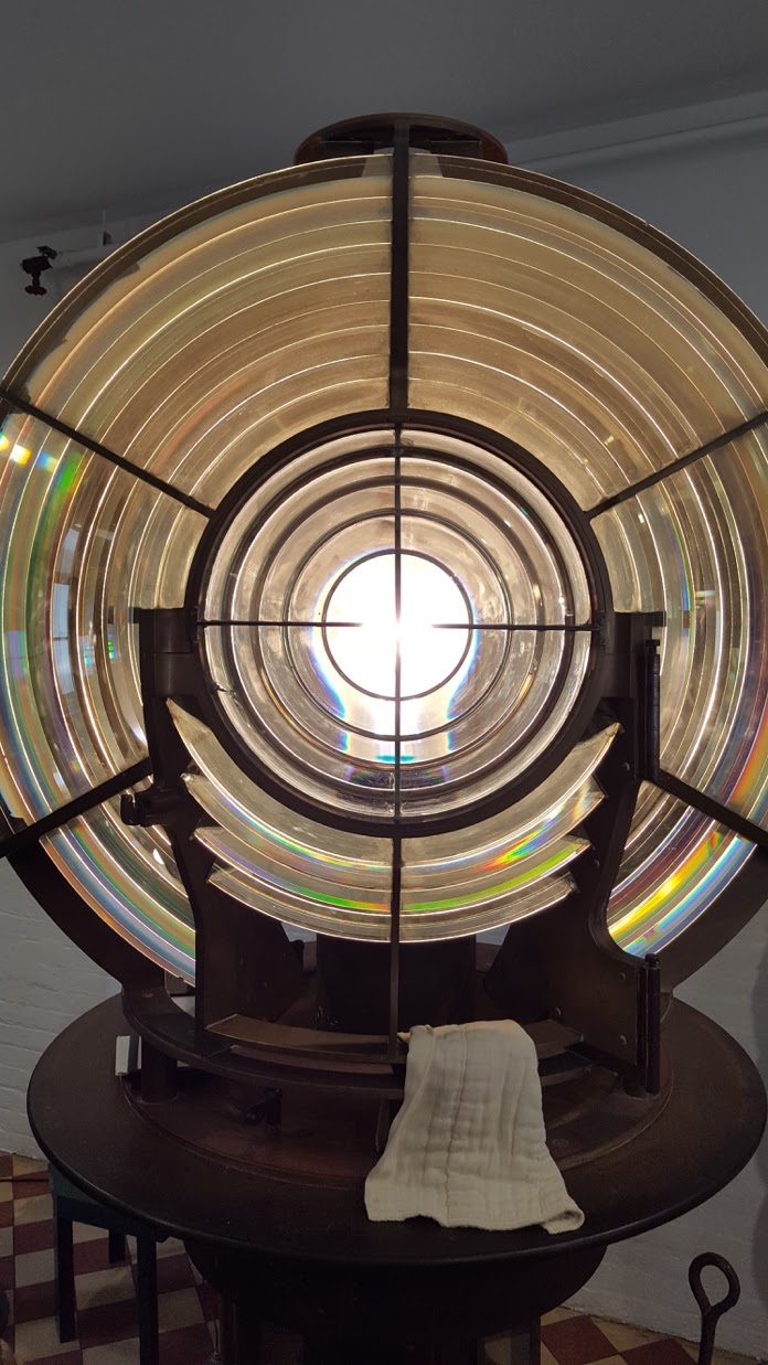 |
|
Fig 1. This is the first electric powered search light that was used within the top of the Montauk Lighthouse. There is a single bulb in the center which is amplified by the glass rings surrounding it. This search light Is composed of brass and is dwarfed by another older searchlight that can be found within Greenport on the North Shore of Long Island. (Image source: Michael Cashin).
|
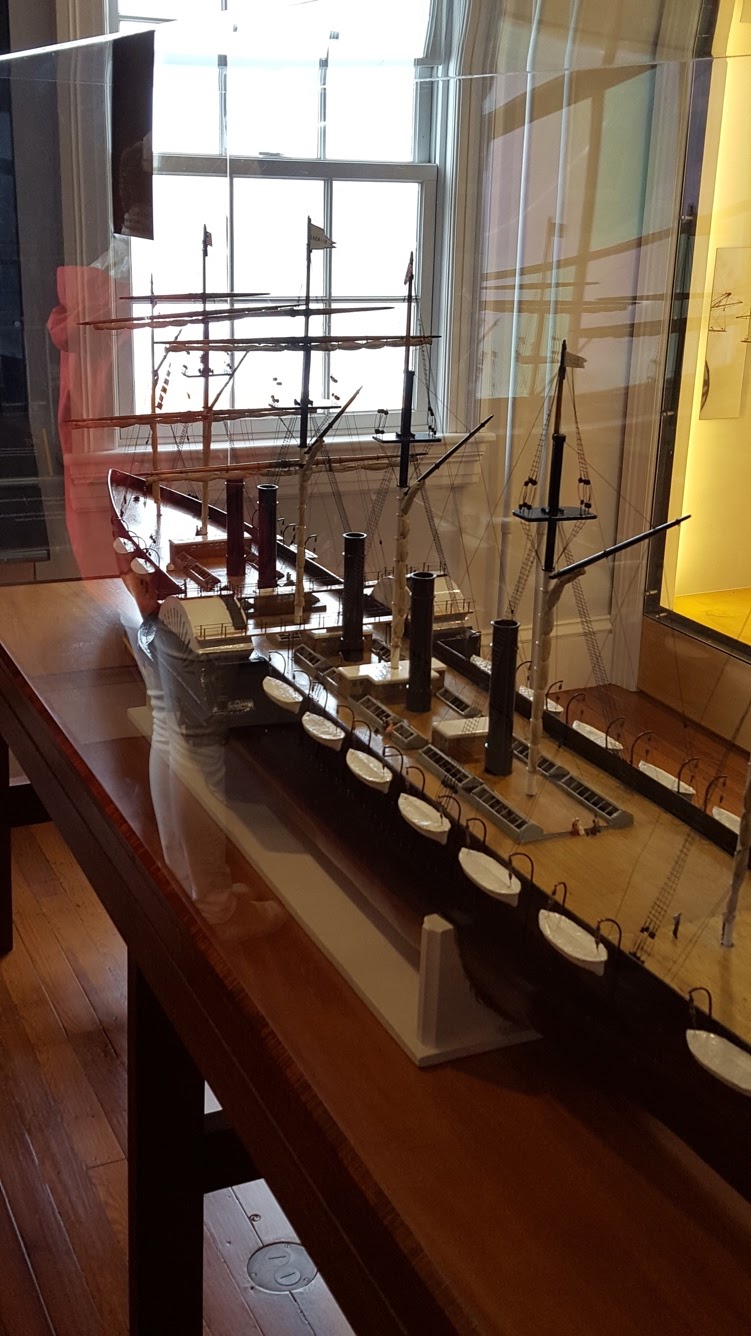 |
| Fig 2. Seen here is a 1:95 replica of the American ship called the “Leviathan”. It is over 800 feet long and was the world’s largest ship up until 1899. This massive vessel was constructed in 1853 and was powered by large rotating paddles on the port and starboard sides. A fellow student had pointed out that he had worked on a professional fishing vessel that was 85 feet long and had compared it to the massive size of this ship, which dwarfed it in comparison. There were also many sailing flags strung about the ship but I could not identify any based on my photos. (Image source: Michael Cashin) |
 |
| Fig 3. In this photo, we have a purse made by the Princess Pocahontas Pharaoh of the Montaukets. The Pharaoh family seemed to be the most prominent Montauket family throughout the 19th and 20thCentury as many of their portraits and constructs were shown throughout the lighthouse museum. I was very intrigued by the bead work, as it is similar to the work I saw at the Shinnecock Powwow earlier this month. (Image source: Michael Cashin) |
Theodore Roosevelt, Bull Moose of Montauk
by Jay Panko
After our tour of the Montauk Lighthouse Museum, our intrepid group braved gale-force winds for a few moments, congregating again in the fog signal building behind the lighthouse proper. Here, along with learning of the environmental conservation efforts that Montauk is known for, we got a glimpse into the personal history of one of America’s most noted conservationists, Theodore Roosevelt.
This part of the lesson began with a brief history of Montauk’s wartime role. During the time of the Spanish-American War, the greatest threat to life and limb came not from the field of battle, but rather the infirmary. Disease ran rampant, and Montauk itself served as a kind of quarantine location. The distance between Montauk and basically everything else made The End the ideal place for this function. After the war, with so many soldiers having come down with the plethora of diseases they’d encountered in the tropics, Roosevelt and the rest of the returning army spent a month in Montauk, after which Theo was named the Governor of New York.
It turns out, though, his skills weren’t solely in warfare and general survival, but also in diplomacy. Among his many accomplishments, he acted as the neutral mediation between the leaders of Russia and Japan during their time of conflict. He held these mediations not at the White House, but at his home on Long Island, Sagamore Hill. His role was to make the playing field level between both parties… neither one could be led to believe the other was held in higher esteem. He accomplished this in a creative way- he widened the door to his house so that two men could walk in side by side. Typically, the last person through a door in a formal setting is seen as the most important, so when the Russian and Japanese leaders entered the portal into his home, they did so as equals.
The other issue Tara mentioned was that, regardless of the shape of one’s dinner table, someone would end up eating to the right of the host, a spot seen as one of honor. As there were two guests of honor and no other way to make that clear, Theo Roosevelt did away with the idea of a typical, sit-down dinner, and rather led his guests on a walking tour of his home, snacking on hors d’oeuvres. His diplomatic skills were unquestionable, and his role in brokering a peace between Russia and Japan made him the first (of only two) sitting US presidents to receive the Nobel Peace Prize.
Fishing.
The End
by Finn Morrissey
This week on the Coastal Cultural Experience field trip, we visited “The End” as its been
tagged. Montauk has been settled since the mid-seventeenth century and is home to the
United States’ fourth oldest and still operational lighthouse which we as a class visited. The
museum holds artifacts regarding the lighthouse itself as well as from the history of the
surrounding area. One side room was home to a small selection of artifacts regarding the
harvesting of the sea, as it were. This includes pieces of fishing, shell fishing, and whaling
equipment. In the fishing section was an array of tackle such as old casting and boat fishing
rods, bate casting reels, harnesses and lures ranging in sizes up to approximately eight inches in
length. Big game fish and commercial stocks were brought in using this equipment, much of
which has stayed relatively the same in style and technique up to the present (Fishing
equipment can be seen in figure one below). The shell fishing gear shown in figure two also has
stayed similar through out the years with a pair of waders and a clam rake on display. Whaling
has long been made illegal in the united states but harpoons and tools for processing were on
display. Today, whales can still be see migrating off the coast of Montauk, and charter boats
such as the Viking fleet run trips specifically to see them.
At lunch, we went down to the shore to eat, relax and take in the salt air. On the beach
countless fishermen suited up in waders, wet suits and enough fishing gear to arm a fleet threw
cast after cast into the turbid waters that make up the end. These fishermen were most likely
attempting to catch bluefish and stripers that had followed the tide in looking for baitfish to
eat. Long Island has an abundance of well managed, offshore and inshore fisheries. Different
locations on the Island have access to different parts of these stocks. Of all the coastal towns,
Montauk has the blue ribbon for being in the midst of the best fishing in New York and with it
comes the largest commercial harbor in the state. Fishermen, such as the ones I viewed, on the
coastal cultural trip, have harvested the water surrounding the light house and the entire point
for generations.
*all photos by Finn Morrissey
 |
| Figure one: Fishing equipment on display. |
 |
| Figure two: Shell fishing equipment on display. |
 |
| Figure 3: Whaling tools on display. |
Coastal Cultural Experience: Kayaking in North Sea and Seafood Cookout
One with Nature
by Courtney Jansen
The day was Friday, September 15, 2017. The sun was shining, not a sign of stormy conditions to come, and a nice breeze was blowing southeast. As the 19 of us made our ways to the kayaks, I had my eye on the middle blue one (my favorite color). But I couldn’t keep my eyes on the kayak! There were countless fiddler crabs running at my feet! I weaved between them as I danced my way to my target. Once in my kayak, I paddled out into the bay and waited for the rest of the class. I noticed many birds flying overhead: laughing gulls, herring gulls, cormorants, osprey, and yellow-crowned night herons. They were all seen frequently throughout the day as well.
After a plethora of photos taken by Professor Bretsch, our group made its way under a bridge to shallower waters. We had to stay away from the concrete walls lining the bridge’s underpass because there were so many barnacles living on them. Just beyond the bridge, there were fish jumping out of the water. This was most likely in attempt to escape predators like blue crabs. At the first stop we made came more pictures, and that naturally put a smile on our faces. Professor Bretsch made us students feel like we are all on one big family vacation where he’s the dad taking all the photos at every site. It really does bring us closer though, not just while taking the pictures, but having the memories to look back on and taking moments to pause and really let the surroundings sink in. This was a day where we learned about the environment we kayaked in while enjoying the outdoors and bonding with one another, creating a more family-like atmosphere.
At this first stop, I learned schools of alewife fish come up these areas to spawn at certain times of the year. Unlike salmon, alewives make multiple migrations to spawn in their lifetime. This was very interesting to me. I am excited to learn more about their osmoregularity differences for migrations in Professor Bretsch’s Ichthyology class. I love how the information we learn on Fridays tie into many of our other courses at Semester by the Sea.
After that, we went back towards the bay and cut across the middle. We noticed many big black cages submerged with little wind turbines on the tops made of an X of thick wire with little red metal cat shapes on the ends. Apparently, those scare birds away. These cages held oysters from a conservation effort to revive oyster populations and bring more filter-feeders into the area to clean the waterways more. This is awesome and much-needed. Long Island used to have a seemingly endless supply of shelled organisms in its waterways that filtered out all the water in the bays in a relatively short period of time. Clams were overfished and the stocks crashed, and the water quality declined greatly as well. There are a few restoration projects on Long Island for filter-feeders, and these projects are critical for water quality improvement for removing harmful algal blooms and other particles and impurities clouding the water. The incredible day ended on a beach, where I did yoga with some classmates beside the serene sunset over the water. I was beside myself that this was my class. I saw so many species today, and it made me wonder how many different animals or bugs are around me daily that I do not take the time to appreciate like I did today. I wish every day was like this.
Fish Facts and Kayaks
by John Hardie
The day had finally come for our class kayak trip and cookout. Although I had never kayaked before, I couldn’t wait to get out on the water. After going over the basics, we all took off towards our first stop; a fallen tree in a creek. As we stopped for a photo opportunity, we learned the migratory patterns of the Alewife. The Alewife population migrates into streams and creeks, like the one we were in, to lay their eggs. Unlike other fishes, the Alewife migrates back out to sea and starts the process all over again. These fish can make multiple migrations throughout their lives opposed to many fish that spawn and then die. During the migratory season, you can sometimes see the water become alive and sparkling as thousands of Alewives pour through the bay to reach their destination.
After kayaking across the bay and a couple more photo ops, we paddled upstream into Peconic Bay and beached. As the food was being prepared, I learned some interesting facts about one of the fish on the menu, the puffer fish. The population was once so large, with puffer fish being considered almost a nuisance, and reaching sizes much larger than we see today. However, like many other fish species, the puffer fish suffered years of overfishing, leaving the population as it is today. Although puffer fish have seen some success in recent years, their numbers don’t reach what they once were. The interesting seafood medley preceded hot dogs and burgers cooked to perfection and delicious brownies. We all sat around the bonfire as we heard tales of witches in American history and watched some beach goers set off an array of fireworks. The night came to a close by observing ctenophore bioluminescence and stargazing.
Lecture by the Campfire
by Elaine Alberts
The Coastal Cultural Experience class is hard to compare to any other class in college because it takes a completely different approach to education. Not many people can say they have taken a lecture in a kayak, or sitting around a campfire watching fireworks and listening to ghost stories. We were fortunate to have perfect weather for a kayaking trip. We paddled around leisurely, and learned about local ecology and the history of the Hamptons. We covered different kinds of conservation efforts in the area. We talked about bird sanctuaries, and how subsidized farming retains the peaceful reputation of the Hamptons. We glided through the water laughing and occasionally bumping into each other. Luckily the kayaks were extremely stable, and no one went swimming unexpectedly. After a few hours of exploring, we beached our kayaks on a stretch of the Peconic Bay, where there was a beach cookout waiting for us.
We took a little break and went swimming and a few of us did yoga while watching the sunset. We splashed around and attempted to catch comb jellies. Comb jellies are ctenophores, instead of having stinging cells like cnidarians, comb jellies have sticky cells. When held up to the sunlight, comb jellies have a slight iridescence, but when they are in the water they are nearly impossible to see. Personally, they are my favorite species that we have learned about in the Semester by the Sea program. After playing in the water, we dried off and sat down to eat. We tried a huge variety of local seafood including Pufferfish, Squid, and Porgy. As we sat down around the campfire, on our beach towels, for our last mini lecture of the day, two things occurred to me. First, I feel like I have known my classmates for years even though we are only three weeks into the semester. Second, I became aware that I was actually in class. It feels like a family vacation, everyone is constantly laughing and smiling for pictures. I wasn’t even aware of how much I had learned in the past five hours because we were having so much fun.
Our final lecture of the day was about the more chilling history of Long Island. Professor Rider’s talk was briefly interrupted by a firework display down the beach. After stopping to watch the fireworks, everyone listened intently to stories of witch trials, and betrayal. Finally, we learned about the history of the Stony Brook Southampton campus and the friendly ghosts that live there. I didn’t know that the campus was previously an estate, but it definitely explains why there is a mansion in the center of the campus. We learned about the building of the windmill, and the ghostly candle that appears in the window that overlooks the Shinnecock Bay. After listening to ghost stories and eating as many brownies as physically possible, we packed up and trekked back to the vans in the dark. We paused briefly to look up at the Milky Way one last time before heading back to campus. Tired, but still overexcited from our fantastic day we walked the long way back to our dorms. We took a detour through the center of the campus, passing by the old mansion and the windmill in hopes of seeing a phantom candle watching over the Shinnecock Bay.
Double, Double Toil and Trouble
by Emily Kollmer
Fire burn and cauldron bubble. After our amazing kayak adventure, we beached ourselves on the shore where Capt Andy had a grill going with a wide variety of food. Once we had all tucked into our meals, each of us trying something new like pufferfish or porgy, we went swimming and sat around the campfire. As the sun set and the bugs came out, the subject turned to ghost stories. Professor Rider never disappoints when it comes to cool history and she delivered.
First, she told us all about one of our campus ghosts. Way back before the area of land we call Stony Brook Southampton was a university, it was an estate to a rich, old man. A little bit later in life he married and had a little girl, who to all accounts meant the world to him. It seemed that he would do anything for her. Being a good father, he wanted to set aside a space for his little girl to play. Most people would set aside a small space in the living room for their child to play or, if they had the space, have a room in the house that would be dedicated as a playroom. Not this guy; for his little girl he built an entire windmill for her to play in. She absolutely loved it. It was a tradition of hers to light a candle in the top window as a way to let the fishermen and boat captains below out in the bay know that she was watching. Unfortunately, when she was nine years old, she contracted tuberculosis and died. It is rumored that on days when the weather is foul unfavorable for boats, she still lights her candle in the top window. She is often described as a friendly ghost, just here to keep an eye out.
All of our campfire stories were not about ghosts though. Once we had discussed and shared stories of the hauntings at the windmill on campus, the topic shifted to witchcraft. The first witch trial the Europeans held in the new world was here in the Hamptons; almost thirty years before the all-famous Salem witch trials. What happened was a girl had just given birth when she pointed to an empty corner and shouted that a witch was there to torture her. The midwives passed it off at first, but grew more suspicious when the girl died 24 hours later. This was unusual since the girl was young (16 at the time of her death) and healthy. There were whispers and suspicions but eventually the accusation fell on Goodie Garlick; a midwife. She was sent to Connecticut where she stood trial and was found “not guilty.” At the time, ‘not guilty’ didn’t mean the same thing it means today. It was a somewhat happy medium between ‘innocent’ and ‘guilty;’ meaning that they think she did it, but they didn’t really have the evidence to pin in down on her. She returned to the Hamptons where she lived into her 90’s. In fact, she still has descendants here in the Hamptons today.
Another cool witch story that we learned had to do with the trials in Salem, Massachusetts. The year they took place was a wet and windy season for their crops. These soggy conditions are perfect for a variety of funguses, but more importantly, ergot. This fungus grows on rye and is a derivative of LSD. In the Salem witch trials, a lot of the girls that were having visions, convulsions, or other symptoms brought on by ‘bewitchment’ were working closely with the rye the inhabitants of Salem were growing. Not only that, but all of Salem was eating the rye. It is hypothesized that the entire fiasco that we now know as the Salem witch trials were brought on by a bunch of settlers who were tripping out on this tainted rye.
We left our campfire with a lot of spooky tales and cool facts to think about. This was an amazing day with an amazing end and I hope that we, as a class, have many more memories to make and scary stories to tell around those future campfires.
‘Yakin
by Finn Morrissey
Although Kayaking is one of the worlds most popular recreational activity, kayaks were originally used for transportation, fishing and hunting by early north Americans. Approximately fifteen thousand years ago, humans coming from Siberia crossed the land bridge into modern day Alaska. The Inuit tribes of the Alaska formed from these early Americans and these tribes developed the first kayaks. Considering the fact that the position of the Inuit tribes was located in a baron region, the frame for these early kayaks were made out of drift wood. The frame was covered in water proof seal skin and the whole vessel was lashed together using sinew, a thread of sorts made out of the tendons and tissues of the animals the intuits hunted. The kayak was meant to be light easy to move on land or in the water for the game sought out, such as seals and Cariboo are agile quick prey. A double bladed paddle, often made of wood, was used to propel the vessel. The double bladed paddle offered higher levels of efficiency, speed and maneuverability than the single bladed paddle often associated with canoeing. Kayaks today are made out of plastic and other synthetics, but the wooden framed seal skin models can still be found. The kayaks used on the Coastal Cultural Experience trip were self bailing ocean kayaks. Self bailing refers to holes that are put through the plastic hull of the vessel to allow water to flow freely out upon entering the seat. These inherently stable kayaks were relatively light (two persons to move or one really strong person) and easy to master even for those who had previously never operated this type of vessel.
On the trip, the class explored the salt marshes surrounding the protected salt ponds that feed into Peconic bay. As a class we explored a river mouth that emptied into the salt pond. The river was a breeding ground for alewife (Alosa pseudoharengus) an semelparous andadromous fish. Andadromous fish spend their adult life at sea and migrate up-stream to spawn. Semelparous means that each individual has the potential to spawn repeatedly through out its life cycle. Following the conclusion of the alewife talk we paddled across the salt pond observing the oyster farms below us. On the other side of the pond we discussed the difference between conservation and preservation, and the necessity of both. The nature reserve we were next to had been preserved, left untouched, and the oyster farm we paddled over was helping with oyster conservation, the use but not over use of a resource. Then, for the finale we did a hard core back, shoulder and ab work out by paddling against the flood tide into Peconic Bay. The ability for the class to experience kayaking, an ancient north American use of the waterways, while learning about the culture and processes of the natural world that is our local area, was an impressive experience. Being in one on one contact with the water and the concepts we are learning about puts a new perspective on the happenings of semester by the sea.
Coastal Cultural Experience: East Hampton Maritime Museum, Mulford Farm, & Cemetery
East Hampton Maritime Museum: Sunken Treasures
by Makenzie Conover
Our second outing for the Coastal Cultural Experience left our handful of students a closely-knit crew as we left our lives in the hands of Dr. Rider, Dr. Bretsch, and the trusty Southampton Chevy vans to navigate through early morning Hamptons traffic. A sunny and scenic drive led us to the East Hampton Maritime Museum on September 8th, 2017. The museum contained numerous artifacts of different aspects of Long Island’s maritime history. One of the most interesting stories was unveiled in the lower level of the museum: a tribute to the sunken HMS Culloden. What makes the story so intriguing is the circumstances of the time period and specifically what happened the night the ship sank.
The HMS Culloden was a British man-of-war ship that sailed to Long Island in 1781 in lieu of the revolutionary war as an attempt to offset the French in the war and thus bring an end to the war. During this time period, there were no lighthouses for ships to know where land was, specifically Montauk in this instance. However, there would be bonfires instead that people on ships could see in time to turn their vessel in the direction they were headed, and avoid hitting land. The night that the HMS Culloden sank, there was no bonfire and the crew aboard did not know to turn their vessel before it was too late.
What makes the story so interesting is that it is unknown if the lack of bonfire was accidental or intentional. Dr. Rider explained to us that piracy and smuggling was common in this time period, especially on the shores of Long Island. In one story that Dr. Rider told us, there was a ‘disappearance’ of a ship in 1757 that was stocked with Calico, where the town records had reported that the ship had never been seen. Curiously enough, that summer was nicknamed the Calico Summer because everyone in town was wearing new calico. Coincidence? The most likely story is that the ship carrying it was intentionally sunk by people setting bonfires in locations that would lead to sinking or being grounded.
Dr. Rider also informed us that it is possible to see many shipwrecks by diving around Long Island, the Culloden included. A major multimillion dollar project was conducted a few years ago that brought some the artifacts from the Culloden up from the sunken ship, now on display in the East Hampton Maritime Museum. Artifacts like these are amazing because they allow us to see new things from time periods we have little information about. I personally love the unique qualities of historical artifacts because why read a textbook when you can have walking encyclopedias and storytellers like Dr. Rider and Dr. Bretsch, accompanied by physical pieces of history that you can see and gauge how they would have been used centuries ago? If you’re a history buff or an artistic connoisseur, I would highly recommend taking the scenic drive to East Hampton to see all aspects of this museum.

East Hampton Maritime Museum
by Amanda Dias
Our exploration of East Hampton was very informative and a fun experience. We started the day off at the East Hampton Maritime Museum where we talked extensively about the tedious process of whaling and its extensive effect on the people in the area. Whaling has been a part of the culture of East Hampton for so long and can be said to be the source of some of East Hamptons “old money”. Whaling was one of the more highly regarded professions as the oil produced made the men who took down the beast very rich.
Dr. Rider detailed the process by which the town hunted and killed these animals. First a whale must be spotted, usually by the children of the town, and from there the clock starts ticking. About 6-8 men jump into a boat and start to chase the whale. Once close enough, one man uses the harpoon to latch the boat to the whale. They ride alongside the whale to tired it out. The men are prepared to cut off their ties to the animal at a moment’s notice, in case the whale decides to dive to escape its captors. Once tired out the men taking to putting the giant beast out of its misery, having to stab through layers of tough skin, blubber, and other body parts. This whole scenario was in fact beautifully demonstrated by Dr. Rider and volunteer whale, Greg.
Once the men returned to shore covered in whale, they were seen as heroes, strolling around town, showing off the proof of their wealth and ability to provide for a family. However, on shore after the kill is where the real work begins, to process the animal into useable goods. This process started with the slicing of the whale into strips to be more easily transported. Dr. Rider was sure to point out the tools showcased on the walls of the museum, now no long sharp from dis-use and with a rusty look. From here the strips were processed further to making the melting into oil portion easier. Dr. Rider was eager to point out that this is where we start to see women of the time become involved with the whaling industry. Helping boiling and making the oil ready to be traded. The whole town was really involved and benefited from the whaling industry.
The museum featured a host of artifacts and pictures depicting the procedure of whaling. Each wall adorned with different things to help visitors imagine exactly what it would feel like to be a part of this whaling community. Although small it is definitely worth the ride out to experience the history of this beautiful town.
 |
| Figure 1: Personal Photo of harpoons used in the hunt for whales. The first harpoon used to latch then eventually to kill the animal. |
The Josephine
by Madeleine Keefe
Food is a huge contributors of a society’s dynamic, from location to jobs and much more. Long Island was a huge whaling colony in the 1800s. Men would venture out in the ocean on a small boat and go whale chasing. Right Whales were the common prey, and the communities learned to rely on them. The Maritime Museum in East Hampton gave an excellent display of the techniques they used to hunt these whales and how they used every bit of the animal for themselves. There was one exhibit that retold the stories of some tales of whaling from the 1800s. Some of these stories caught my eye and were very fascinating.
The Josephine was a ship that set out from Sag Harbor in 1846, just the beginning of a very long journey. This ship, captained by Hiram Baker Hedges, sailed past the Caribbean, to Chile, down to the Southern Sea, and onto Hong Kong and Russia. This trip was extremely long and successful, bringing home over 2,000 barrels of Whale oil (while 1 whale can yield about 60). Trips like this is was sustains the community and allows them to prosper.
 |
|
Figure 1. A map of the path the Josephine took that
yielded over 2,000 barrels of whale oil
|
Another interesting fact that was included was the captain ran into problems with Huntington’s Disease, with him and his family. To see a disease that is still affecting people today on records from the 1800s is amazing. Some of the key doctors in researching this disease resided in East Hampton. George Huntington was the doctor who worked with this disease, and the inspiration for the name of the illness. Along with his Father and Grandfather, George and Able respectively, the Disease became well researched which helped with the diagnosis of future cases and knowledge about how it is inherited.
After the museum, we took a walk through the cemetery in East Hampton that has grave stones dating back to the 1700s. Many notable Long Island people are buried on this ground, including Able Huntington, one of the researchers of Huntington’s Disease. This trip taught us an incredible history of the people of 1800s long Island that gets omitted from American History.
 |
|
Figure 2. Able Huntington’s Grave in East Hampton. A few
other members of the Family are also buried here.
|
Perseverance of East Hampton Culture
by Jay Panko
There’s something transcendent about visiting a museum centered in one’s own culture. Visiting the East Hampton Maritime Museum, for example, gives a much better understanding of life today on Long Island, and more specifically in the East Hampton area. Museums such as this really fill in the archival blanks, the “how” and “why” of so many things you see, especially as an outside observer driving past the old-money houses and cute oceanside stretches of shops in East Hampton. The most striking thing to notice is that the old-time whaling community was famously persistent in recycling and reusing everything they could, and over time that tendency hasn’t changed a bit. Nowadays whaling is no longer the cash crop of this settlement, and considering that we now are more cognizant of how barbaric and cruel the practice was, that’s a good thing. However, the tight-knit community that whaling required – after all, bonds get strongly forged in hunting down such giant beasts – hasn’t changed all that much.
It’s not uncommon for small towns and villages to hold fast to their histories, and East Hampton is no exception. Certain local intramural sports teams still bear names such as “Baymen” and “Bonackers,” the latter referencing the clam-fishing peoples of an earlier time. This term, bonacker, used to be almost derogatory, a dig at the lower class of residents who made their livings fishing for clams and scallops (until the latter mostly died out in the late 1900’s). Having repurposed the name, East Hampton shows its roots proudly – at least in the case of the sports team that sports the name.
Another trend that Tara pointed out to the class was the tendency of placing decorative lobster traps on one’s property. This used to be more of a practical practice, as every family in the area used to have a few lobster traps put out into the water near their homes in order to catch the crustaceans. However, like the scallops, the lobsters abruptly died out due to a number of factors. Among these factors were mass migrations to colder waters, disease, and the influx of pesticides which also affect lobsters (mosquitos and lobsters are both arthropods). Since the sudden drop-off in the lobster population, these traps were largely left unused, but still they adorn the yards and porches of the East Hampton area. There are many great examples of East Hampton’s ability to repurpose its history into current cultural quirks, too many for one short blog… It’s well worth the drive from anywhere else on the Island, and definitely a nice day trip for those who enjoy the maritime environment and culture.
Coastal Cultural Experience: Shinnecock Bay Tour
Hampton Bays: Experiencing the Water Exchange and Movement
by Courtney Jansen
The excursion on the RV Peconic research vessel began on a sunny, breezy Friday morning on the first of September. The professors stood with giant maps and pointed out two large bays, the Shinnecock and Great Peconic, that were connected by a canal. It is strange to think that what we were looking at was not what existed when the Europeans first colonized Long Island. Shinnecock Bay was nearly stagnant and did not get much water movement; there was not a direct connection to the Atlantic. It was not until 1938 that a direct inlet was created after a hurricane broke through the barrier beach. The storm broke about 11 new inlets to Shinnecock and Peconic Bay from the Atlantic, allowing fresh ocean water exchange with the Shinnecock Bay and easier access to the ocean (Dr. Tara Rider). Interestingly, this aided the clam industry. Nutrient build-up could be flushed out into the ocean, and salinity was able to be adjusted to support marine life better. Even today, although there is water exchange between the ocean and bays, the water exchange is limited and so is the amount of available dissolved oxygen. Dr. Kurt Bretsch told us about a school of Bunker that were recently chased through canal and into Shinnecock Bay. Since there were tens of thousands of Bunker and they were stressed, they used up all the oxygen in the bay’s water and suffocated. This was deemed a naturally-caused tragedy. If that could happen after Shinnecock Bay had an established direct connection to the Atlantic, I wonder how often fish die-offs would occur if the inlet were never created. Also, human nutrient input has increased into the bays over the last century. With greater nutrients and no fresh ocean water to flush the bay, it makes me wonder how different the southern fork of Long Island would be. Natural history greatly impacts the economy, travel, and surroundings of the Hampton Bays we know today.
The major inlet into Shinnecock that was created by the hurricane was reinforced with massive stone and jetties. On our way back to the Southampton campus, we explored this passage to the Atlantic, and it was obvious which direction was east and which was west. There is a longshore drift current which generally transports water from east to west. This causes sediment to move this direction as well, and it gets deposited on the eastern side of jetties and objects that protrude out into the ocean. Looking out at the ocean from the inlet, we could see the jetty on the left created a beach that stuck further out into the ocean than the jetty on the right. It is incredible to see and experience what we learn in the classroom in the environment that is located nearby. Seeing this evidence with my own eyes makes the information seem more relevant and easier to remember.
Today, the available water exchange is a clear important aspect to allowing organisms to thrive in the bays. Amazingly, we noticed crab larvae in the water by the boat when we docked in Great Peconic Bay just beyond the canal. When I observed them, they reminded me of something out of “Star Wars.” They appeared to be little space ships zooming through the water attacking microorganisms. It is remarkable what we notice when we observe our surroundings and take a minute to look at what is right in front of us. There is so much to discover in Long Island’s bays.
If you asked me what the best part of the trip was, I would have to say it was getting an interesting lecture about Long Island and the Hampton Bays while sitting on a jetty on a Hampton Beach. Our class took a boat to our lecture location: a beach! The information was history of the location we were at, and we learned about the waterways we traveled on. It definitely feels like the information is more relevant when we’re in the presence of where we are learning about.
 |
| Figure 1. This image shows crab larvae in sea water in a clear container. Another student is holding the bucket as we watched the larvae move their developing claws to catch microorganisms and bring their prey towards their faces to eat them. |
Cormorants of Shinnecock Bay
by Jay Panko
It’s 9:30 on a beautiful, cloudless day in Southampton, New York. A vessel carrying twenty or so SeaWolves makes its exit from the no-wake zone and begins to pick up speed. The salt spray lightly batters those nearest to the edge as our two captains ferry us toward the Shinnecock Canal. On deck, Drs. Bretsch and Rider begin to mingle with the students to answer questions and impart their nautical knowledge. As a personal aside, at this time I found myself wishing more classes were structured in such a way, with relevant facts being presented as interesting tidbits rather than bullet points to be memorized. I suppose the context helped too- there is nothing quite like being on the water to energize the mind. It’s hard not to daydream in a classroom setting, but when you’re surrounded by daydream-worthy scenery, there is no cause for your thoughts to wander.
As I listen to Dr. Rider discuss the geographical significance of the Shinnecock Inlet (currently just a small blank spot in the distance), what looks to be a large black goose-gull hybrid flies overheard, catching the attention of a few of us. Dr. Bretsch – Kurt, as he introduces himself to the class – takes notice as well. He tells us about the cormorant, an odd duck of a bird which he refers to as the “flasher bird.” Unlike many other sea fowl (such as ducks), the cormorant does not have the buoyant oil on its skin and feathers that allow it to quickly resurface. These birds are divers, using their webbed feet to swim underwater and catch their aquatic prey, and the oil found on other fowl would simply serve to pull them back up to the surface too quickly. As a result, their feathers remain sopping wet after a dive. In order to dry off, cormorants perch on a rock or on a shore and spread their wings in the sun. This pose is why the professor took to referring to them as “flasher birds.”
Cormorants aren’t just great divers- they’re notably efficient at this method of fishing. They also, according to Dr. Kurt, have become increasingly common in the Shinnecock and Peconic Bays, often competing with local fishermen due to their continually expanding numbers. If you wish to see them for yourself, a large portion of cormorant flocks can be found nesting on Warner Islands to the east of the Ponquogue Bridge, along with about four other common types of water fowl (ie; seagulls), and they’re quite distinctive due to their drying behaviors and deep black plumage. They’re not the prettiest of birds, but they’re quite interesting. Get out on the water before the cold settles in, and keep an eye out for them! Dr. Kurt also mentioned, for anyone interested, that occasionally he and a group of others in the Southampton area go out to Warner Islands to help clean up the habitat a bit. If this is something that interests you, please contact him for more information!
Canals. What are they good for? Absolutely everything.
by Michael Cashin
Our semester long exploration of New England started with a local tour of the waterways of Shinnecock and Peconic Bay. Now, I am a native Long Islander, and I am ashamed to say that I DID NOT realize that Shinnecock Bay and Peconic Bay were connected by a canal! Every time I drove over the canal and looked north I thought I was looking at Connecticut from across The Sound, rather than the north fork of Long Island and the waters of Peconic Bay. This lovely view would not be possible without the nautical innovation provided by the Shinnecock-Peconic Bay canal system.
The Shinnecock Canal was first dug as a brief attempt to connect the two bays in 1654 with little success. Even though the early canal way was brief, it makes you think how difficult it must have been for early settlers to create, and dig out a canal between these two turbulent waterways. Since the Shinnecock Bay and Peconic Bay operate with temporally different tidal patterns, it wasn’t until 1892 until Long Islanders were able to construct a modern canal. However, this modern canal system could still not stand the varying tidal patterns of the bays and thus, the lock system was created to ease canal passage.
Traveling through the canal for the first time, I was able to see the lock system up close. I greeted it with a chuckle as the system is much like a road intersection, complete with traffic lights! However, the traffic lights make sense as it would be chaos without any stop-and-go commands in place. This system goes to show how critically important this modern canal is to the economic and environmental status of Shinnecock Bay and Peconic Bay!
Trek Across the Atlantic
by Madeleine Keefe
As our boat left Old Fort Pond and we heading toward the Peconic Bay, it is crazy to think Long Island was very different than it is today. With the Tribes of Indians habiting the area and the Europeans also finding land, the history of this area and how it came to be discovered is interesting. As we sat on the jetties protecting the shore and the Shinnecock canal, our two professors explain the history of the geology and the settlements. Southampton was the first New York settlement, after the setting first in Boston and New haven. Those two cities, first Boston, were focal points for the Europeans when they first made the trek over across the Atlantic.
Boston was going to be known as the beacon for the people in Europe. A paradise for all. When asked in class if we thought Boston was a paradise, mixed answers were said. Of course, Boston is a great city, but it is not the paradise that it was 300 years ago. A built up city is not what the Europeans saw when they first set foot on land. Flat ground, covered in trees, animals running everywhere. A very different experience from England, where royalty has ruled for years. The Atlantic Ocean connected two lands that were vastly different. The pilgrims and others who followed after spent weeks on a boat, with the hopes they would reach this new land. We were all trying to imagine what it would be like to be on a boat, crossing the Atlantic, with the hopes you will land where you want. It seems like a crazy risk to take but to these Europeans, the new world was everything to them. Learning about what these people did to cross the Atlantic was crazy!
 |
|
Figure 1. A cartoon rendition of the Mayflower when the pilgrims
Crossed the Atlantic to the New World.
|

Coastal Cultural Experience, Mystic Seaport
Mystic Seaport: Charles Morgan
by Nicole Cruz
On our last field trip this semester, and by far my absolute favorite, we went to Mystic Seaport in Connecticut! We hopped on ferry at Orient Point and headed off to learn more about whaling and the vessels, or more importantly, one vessel in particular that was used during the time of whaling.

It was here that we saw the Charles W. Morgan, the last surviving American wooden whale ship built in 1841 in New Bedford. The Morgan made 37 voyages during an 80 year whaling career where they hunted whales for blubber for oil and baleen and bone for other products. The Morgan retired in 1921 and brought to Mystic Seaport in 1941. In the summer of 2014 the Charles Morgan made a ceremonial 38th voyage where it peacefully sailed amongst humpback, fin, and minke whales in Stellwagen Bank National Marine Sanctuary.

When we boarded the Morgan, I was surprised to see the amount of room that was on deck, though space was needed when you had 30 to 36 crew men working aboard the vessel, however that was still on the deck, and when you went to under to the captain’s quarters it was a little more cramped.

It you look more closely on the bow, you’ll the see the windlass. This is where they would haul the blubber on board where they would lower it below deck, into the blubber room where they would cut up it in assembly line fashion. I happen to think it’s pretty cool if not disgusting when you think about all the blood that followed.

We then saw the captain’s quarters, which in comparison to what you have seen above was quite small and cramped, like I mentioned before. It was quite lovely though because it was the captain’s quarters. It was here that the captain would host dinners with other captains of other vessels and their families. There was a nice velvet couch and an ‘indoor bathroom’, and polished, or what looked to be polished table for meals.

The Charles W. Morgan has a long standing history, and I’m happy my class and I were fortunate to see the vessel up close and personal.
Another side to Mystic
by Tara McPhillips

As well as all of the other really cool things we saw and got to do at Mystic, we also were able to see the Collections part of the museum that housed hundreds upon hundreds of artifacts, pictures, paintings and even ship log books dating back hundreds of years! Our wonderful guide Crystal showed us around the artifacts room and we saw lots of things from scrimshaw done on sperm whale teeth, to scrimshaw on sawtooth fish and even baleen. Scrimshaw is the designs and carvings into whale bone or teeth done by sailors on boats. There was boat figureheads and even tapestries and ship half models which were used to build the actual boats. Seeing the collection was really cool because its not something the ordinary person gets to see. We were really lucky. 90% of museum collections are in their back area so it was really an experience.

Before we’d gone to the Collections, we had walked around the period specific town they had set up. There was lots of different buildings that people could all walk in and view the items and get a real feel for how the building would have looked. All the buildings we were told, had come from States nearby and were saved by the Mystic Seaport. Some of the buildings included a Print Shop, Boat Shop, Cooperage which was a barrel maker, and even a Drug Store and Bank. The Blacksmith Shop there is apparently the last one left from the 19th century to survive. Overall it was interesting to see the layout and designs of how these buildings would have looked 100-200 years ago.
Our last adventure at Mystic included Sea Shanties by Geoff in the Greenmanville Church. He regaled us with many tales all inside a tune that were actual shanties sung by sailors at the time. We even got to participate on the chorus lines. Geoff pointed out that you could really get a feel for the cadence and for how the shanties were used especially in times of work to keep the men moving in a certain way.
After our singing, we headed to dinner at the famous Mystic Pizza and then made our way home. What a day!
Mystic Seaport
by Nicola Kriefall

At the Mystic Seaport, among other fabulous exhibits, is one specifically on whaling, titled “Voyaging in the Wake of the Whalers.” The exhibit is full to bursting with interesting items ranging from artwork and interactive displays to skeletons and poetry. Outside the building lies a very cute, painted sperm whale.

This picture gives you an idea of just how much there is to look at inside the building. At the bottom of the display case is a full set of sperm whale teeth, the size of which are quite formidable and are used to consume large prey. These teeth contrast the baleen just above them, which baleen whales use to filter feed for plankton and other miniscule critters, despite these whales being the largest animals in the sea. Above the baleen is a narwhal tusk, which were often collected purely for novelty from the “unicorns of the sea.”

This display gives the audience a sense of just how vast whales are, which is often hard to comprehend without seeing a live whale. To the left are human sized body parts (a hand, tongue, eyeball, brain, and heart) and their whale counterparts lie to the right. The tongue of a grey whale takes up the majority of the display, because it is eight feet long!

Clearly, the whales that whalers sought were colossal, which made for a very dangerous voyage. Interestingly enough, the payoff for whaling for the average crewman was abysmal. This pie chart shows how the seamen, greenhands, and cabin boy (these men making up the majority of the crew) would often receive 1/160th, 1/190th, and 1/400th of the profit, respectively, from their whaling ventures.

So why did whalers undertake this dire mission if their rewards were often so low? There was still the chance that great fortunes were to be made from these trips, which was typically a point that was emphasized when they were being recruited. There are many other potential reasons: love of adventure & travel, escape from a bad life on the mainland, no other chance of employment, and so on. Even after the height of whaling passed, and petroleum began to replace whale oil, the fashion industry kept whaling alive and kept these men employed. For instance, shown here is an example of a corset containing whalebone, a popular commodity.

Coastal Cultural Experience, Riverhead Foundation, North Shore, Big Duck
The Riverhead Foundation
by Marissa DeBonis

Today we had the pleasure of visiting the Riverhead Foundation and received a behind the scenes tour of the facility. The riverhead foundation is the only organization in New York for marine mammal and sea turtle rescue and rehabilitation. They are also the only rescue and rehabilitation facility in the North East with the means to aid a cetacean (whales, dolphins or porpoises). The Riverhead Foundation is full of caring employees and volunteers, who all work hard to do rescues of seals and sea turtles, perform research, rehabilitate the animals in the facility back to health and finally release the newly healthy animals back into the water.
The class was able to get a background look at the facility, which included tanks for both seals and sea turtles and a large cetacean tank, a lab where they are able to do blood work and an emergency room (with an ultrasound and radiograph). Currently they were rehabilitating a male harbor seal, which is doing well! They were also aiding a loggerhead sea turtle, which is healthy and awaiting the warmer weather (or a trip to Florida) to go back to his home in the water.

At the Foundation they also have their two resident sea turtles, Rudy and Chestnut. Rudy is a Kemp’s Ridley sea turtle that was originally brought to the facility because of a boat strike. Unfortunately because of her injuries she was not able to be returned to the wild, although she is healthy. Chestnut is a Green sea turtle that was originally brought in after being found cold stunned (hypothermia for turtles) and with injuries from a boat strike. Chestnut is also non releasable.
The Riverhead Foundation is a great organization and they do a lot of important work for our marine environment. If you get the opportunity, visit the Long Island Aquarium and be sure to stop at the section for the Riverhead Foundation!
The Big Duck
by Haena Lee
Have you ever seen a gigantic duck on the side of Flanders road? The Maurer family constructed this giant duck to attract people into their duck shop. They envisioned The Big Duck during their road trip to California and seeing the coffee shops shaped like a giant coffee pot. The Big Duck finished construction in 1931. During this time period, Long Island had a lot of duck farms because they were a popular trade. The duck trade came from China who gave Long Island Peking ducks for their succulent meat. Currently, there are no more duck farms left in Long Island due to the ducks polluting the water.
 |
| The inspirations the Maurer family had for the Big Duck on their road trip to California. |
Looking closely at the Big Duck, you can see The Big Duck has red eyes. The eyes were made from old taillights of a Model T Ford who would have known! Even though they may be a little frightening at night, the red eyes were meant to reflect car lights on the dark road. Also if you knew any differences between a duck and a chicken, you would notice that The Big Duck is not actually a duck but a chicken because of the tail (should not be sticking up).
 |
|
The Big Duck
|
Even though The Big Duck does not sell duck eggs or meat anymore, it is still a historic symbol of Long Island especially in Suffolk County. The Big Duck was going to be demolished in 1987, but the community of Suffolk County made a huge effort to save The Big Duck. It is now listed on the National Register of Historic Places.
 |
| A sign inside “The Big Duck” when they sold ducklings. |

Coastal Cultural Experience, Long Island Maritime Museum & Boat Burning


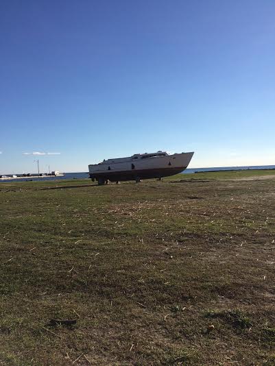
But if you live in The Great South Bay you might have heard ‘the oyster is your world’. The Long Island harbor was a driving force of the booming oyster industry following the civil war. Blue Point was especially notorious for it’s gourmet breed of oysters, which by 1880, a barrel of these shellfish were worth their weight in silver! Members of the wealthy upper class around the world would have Blue Point oysters shipped to them overseas. This demand made the industry extremely competitive, to the extent that Blue Point oysters had to be legally defined and to qualify, a Blue Point oyster must spend at least three months in The Great South Bay. It wasn’t just about bragging rights either, New Jersey fishermen actually tried to dip their oysters into The Great South Bay and call them Blue Point oysters. This was a law that actually had to be enforced by Bay Patrol.
Sayville Maritime Museum
by John Carswell
This week we went to the Sayville Maritime Museum. The museum consisted of multiple buildings each with different historical exhibits. One of the buildings we went into was an old house on the water, or at least it used to be by the water. The house had blue clapboards, with people working on the back of the house, perhaps painting the back side of the house. It was not a large house, but was in great shape. When we went inside, it was soon obvious that this house was from the early 1800s. The walls were covered in a beautiful dark colored wood, with detailed molding around the doors and corners of the room. The ceilings were high, which I always like. Being 6 foot 4 inches, I am used to hitting my head on low ceilings and doorways in old houses, but it is always nice to not have to continuously bend down. The ceilings were not high because people living there were tall, but rather as a status symbol. The tall ceilings and detailed molding showed that the original home owners were well off, or at least rich enough to afford the extra cost of the tall ceilings. Tall ceilings not only meant you had to buy more wood to make them, but they also were more expensive to heat in the winter. The original home owner of the house was most likely a ship owner.
The economy of Sayville, and majority of south shore of Long Island during the 1800s through today, is dependent on the water. During the time the house was built, whaling was dying out due to the rise of petroleum oil, and the shell fishing industry was rising. The Native American people living on Long Island were shell fishing thousands of years before the Europeans arrived. The Dutch, who settled Long Island, started the shell fishing industry on Long Island. Sayville was a Dutch Town originally, and the house we were in was Dutch.
The first room we went into was the kitchen, which was fully furnished with kitchen supplies and furniture from the 1800s. There was a living room, and a couple bedrooms. The living room had a player piano, which was another sign of wealth. In one room connected to the bedroom, there were toys and some clothing. There were a couple creepy dolls and an old teddy bear, but what was brought to our attention were a pair of wooden clogs. I always knew that clogs were Dutch, but always assumed they were worn by farmers and people living in the country side. We learned that clogs were much more common during the 1800s, especially in the city. The streets of New York City had lots of puddles at this time, but not puddles of water. There was not a very effective sewer system at that time, so sewage was in the streets. Clogs were worn over shoes to keep sewage off their clothes.
The house was a great experience. We learned a lot about the life in Sayville during the 1800s.
Sayville Maritime Museum & Boat Burning
by Nicola Kriefall
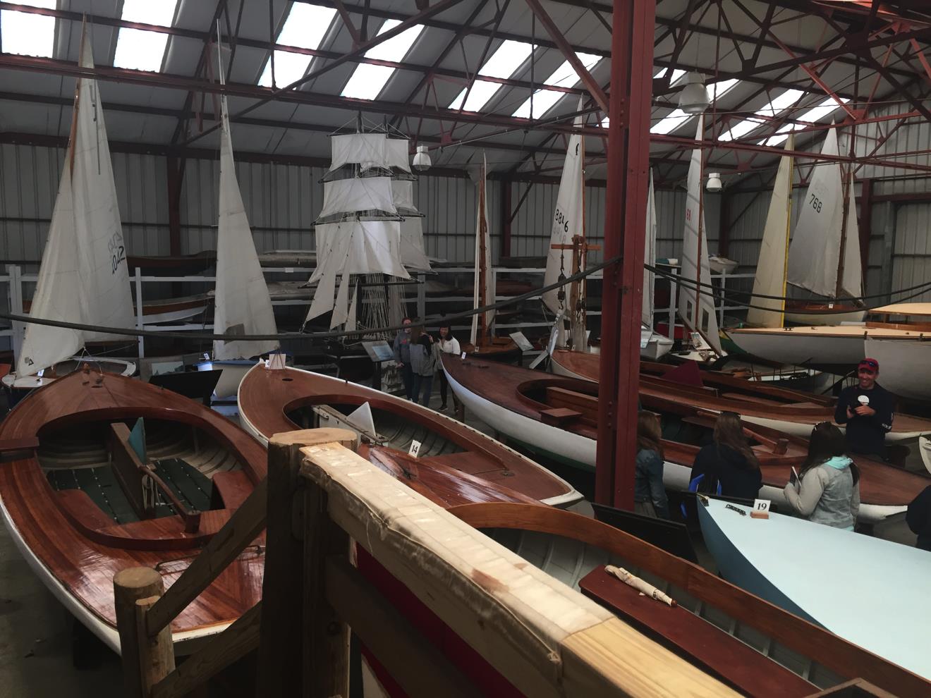
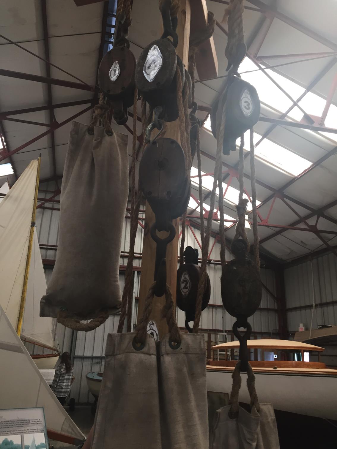


Coastal Cultural Experience, Long Island Spy Museum & Port Jefferson Harbor
Setauket & Port Jefferson Harbor
by Nicola Kriefall

SPIES! Exhibit: Located in Setauket, NY, the SPIES! exhibit synthesizes maps, reenactment, and informative narration to paint a picture of George Washington’s use of spies during the Revolutionary War. Primary sources provided all the information gathered and presented here. The location of this exhibit is significant because a good number of the spies and their associates were Setauket natives.

George Washington’s Spies: George Washington, pictured here, believed from a very young age that spies were vital assets, but also believed that good ones were hard to obtain. After the start of the Revolution, he began a spy ring to gather information from New York City, which was under the control of the British. He began the ring with the help of Benjamin Tallmadge (of Setauket), whose code name was John Bolton, or code number 721. Tallmadge then recruited people he’d known for years, people that he knew he could trust for this difficult task.

Benjamin Tallmadge’s Code: Benjamin Tallmadge assigned a number to 800 significant terms, for use as a code between the spies. This was of the utmost importance because information had to be sent between a number of people across vast distances to make it from the source up to Washington or his affiliates. At any time, the British could have intercepted this information, but the code prevented them extracting anything vital from spy documents.

The Letters: Pictured here is an actual letter of the time from a spy (code name Samuel Culper Sr., or #722), as well as a clear transcript of it. As you can see, the code’s numbers have replaced many of the words in the letter, so that the letter’s meaning is not distinguishable without knowledge of the code. This letter appears to be written in regular ink, but our tour guide informed us that many of these letters were written in invisible ink, to keep the valuable information even more hidden.

Mission Accomplished: The tour guide of the SPIES! exhibit told us about one of the most significant duties performed by George Washington’s ring during the war. French allies of the Patriots had landed in Rhode Island, and once the British learned of this, they planned to attack there. However, the spies learned of this attack, and the Patriots’ side was able to react in two ways. They informed the French so they could safely relocate, and also informed the British that Washington’s army planned to attack, so that the British would keep troops from traveling to Rhode Island. The spies’ action here prevented a great deal of loss on the Patriots’ side.
Spy Museum
by John Carswell
For this week’s class trip, we went to the Long Island spy museum in Setauket, which we had a little trouble finding at first. We got a little lost on the way, but we did end up seeing a lot of Setauket on our way to the museum. The museum was small, but packed full of very interesting information and stories about the revolutionary war. The first room we went into we were greeted by a tall cut out of George Washington. This room focused on the Battle of Brooklyn, the first major battle after the Declaration of Independence. The British wanted New York City because it was not only the largest city in the Colonies at the time, but it was also a major port that connected the Atlantic Ocean to upstate New York and other colonies in Canada. If they could control New York and the Hudson River, then the British could in a way divide the colonies. The southern colonies were more dependent on trade with the British, so a large amount of the people in the southern colonies were Loyalist. Florida at this time was controlled by Spain, which was an enemy to the colonist. The British protected Georgia and the Carolinas from Spain, so they were more dependent on the British. So the British thought by separating the North and South they could stop the South from fighting.
Severely outnumbered, Washington’s army lost the Battle of Brooklyn, and were forced to retreat. The British troops numbered somewhere in the 20 thousands, while the American troops were only about 9,000. The British troops were well trained, while the American troops had little to no training at all. The British troops had cannons and guns, while the American troops had much fewer guns and no cannons. Washington had no chance of winning the war, which begs the question as to why he even decided to fight at all. The battle was fought to show the British that the Americans would not go down without a fight. The Americans were able to escape cross the East River in the middle of the night and avoided surrender. After that, the British had control of New York City and Long Island, and had control for the remainder of the war.
In the same room, there was also a wall that talked about one of the first spies of the war, Nathan Hale. We learned at the museum that Washington asked for someone to go into the city as a spy, and Nathan Hale volunteered. Hale went into city, and was caught very quickly and hung. He stored his info in his boot, which was not the best place to hide stuff. All this information was in just one small room. The museum was not very large, but it had tons of information. I learned a lot at the museum, and had fun. Our guide in the museum was very lively, and at many times treated us like 4th graders, but in a good way. She had us reenact battles and decode war messages. I would recommend the museum to anyone, and I would take my family and friends there if I were in the area.
Port Jefferson
by Emily Recchia
If you are a fan of Netflix’s ‘House of Cards’, you might have noticed in Season Two, there is negotiation of building a bridge connecting Milford, Connecticut to Port Jefferson, New York. It is referred to in the series as the “Port Jefferson Bridge”. House Of Cards might be a mostly fictional story but this proposal has been under consideration for years, though it’s more likely the bridge would connect to Bridgeport, Connecticut- not Milford. Gazing out at Connecticut from the Port Jefferson harbor, watching the ferries glide back and forth everyday, you can imagine the convenience of such a structure.
As perfect as the location might seem, the quaint tourist town of Port Jefferson couldn’t handle the heavy traffic a bridge like this would certainly attract. In order for the town to make the structural sacrifices something like this would require, there’s no doubt Port Jefferson would lose it eclectic maritime charm for something more industrial. As a local, I am happy to hop on a ferry or drudge through the city when I have to get to Connecticut. The history of Port Jefferson is richer than the revenue the Island could collect from a bridge.
Or maybe we should just say that we learned our lesson with relying on transportation niches for economic stability. In 1836, Port Jefferson was nothing but a Drowned Meadow. That was actually the name of the town, Drowned Meadow, until Thomas Jefferson funded the project that would transform it into the bustling port town it became. Soon after, Port Jefferson harbor and shipyard industry became the largest in Suffolk County. The main role of Port Jefferson in the 19th century was to build and support vessels engaged in coastal freighting trades. However, when materials like oil and steel became more accessible and affordable, the shipyard industry suffered greatly. In 1923, Port Jefferson harbor became a rough place offering not much more than a coal-fired power plant, oil transportation, and rum running during the prohibition era.
In 1963 Port Jefferson pulled itself together with a little help from the Town of Brookhaven and became the Incorporated Village of Port Jefferson. The village transitioned to a tourist-based economy. The ferry lines running across the sound provide a profitable and appealing attraction to visitors as well as many hotels, restaurants, specialty shops, and bars. The general vibe of Port Jefferson remains reminiscent of its shipyard roots but you’ll have to look a little further for any evidence of bootleggers or drowned meadows. Thomas Jefferson knew the location of this little harbor town was profitable, with New England just a stone’s throw away. I can’t help but wonder what he would think of a bridge if he had been around for the demise and revival of the port town named in his honor.
Coastal Cultural Experience, William Floyd Estate and Fire Island Lighthouse
Fire Island National Park: The William Floyd Estate
by Meg Carr
During our excursion this week, we had the chance to explore some national parklands. An annex to the Fire Island National Seashore, the William Floyd estate is a beautiful piece of land with a rich history…and some nice hiking trails! Though the estate was 4,400 acres during its prime, the 613 remaining acres were donated to the National Parks Service by the Floyd family in 1965. Shortly afterwards the family donated the 25room house on the property under the stipulation that it should not be altered. Since then, the house has been used as an educational museum.
With an ocean view, access to freshwater streams, marshlands, and its own forest, the estate is home to a great variety of wildlife. One of the most recent ecological triumphs at the site involves a pair of bald eagles selecting the estate as a nesting ground. Having found a convenient, prebuilt osprey nest, the birds rearranged it to suit their liking and successfully nested for the first time this year. This is only the fourth known bald eagle nesting pair on all of Long Island since their disappearance in the 1930s. The first nesting pair to return was discovered on Gardiner’s Island in 2006. Though these birds are no longer endangered, recent sightings provide hope that they may once again be a common sight in LI.
 |
| The William Floyd House (also known as the Old Mastic House) was built as a 6room home in 1724. Since then, it has undergone a number of additions. Photo by Haena Lee |
Walking through the William Floyd Estate
by Emily Recchia
Walking through the William Floyd Estate, you might feel like you’re in an antique shop. Over the span of 250 years, various pieces of furniture, art, books, tools, and architecture have been preserved within the house, providing visitors with a snapshot of American history. In 1976, on the Bicentennial of the United States, the Floyd family gifted all 613 acres of this time capsule to the National Park Service under the condition they maintain the house and keep everything as it was left. As we carefully shuffled through the 25 rooms on display, each presented a synergistic expression of three centuries of life in Mastic, New York. An active family cemetery on the property where descendants of William Floyd still retain burial rites suggests that the story of the Floyd estate is coming to a quiet ending. Despite this, the rich history of the Floyd family resonates throughout Long Island culture for centuries to come.
William Floyd was the oldest son of Nicoll Floyd and Tabitha Smith. Born in 1734, William was only 20 when he inherited the estate following his parents’ death in 1755. He was successful regardless, managing the plantation and becoming involved in local Brookhaven politics despite very little formal education. William Floyd was so successful and affluent that he was the only signer of The Declaration of Independence from Suffolk County and the youngest of the four New Yorkers that signed. In 1776 while it was unsafe for the Floyds to live in Mastic, William fled to Connecticut for safety with his family. Returning in 1783, he found his family estate to be stripped of all crop, livestock, and timber by the British. The Revolutionary War was certainly devastating to Long Islanders and Floyd was no exception. However, he was able to rebuild the plantation and the estate and family became prosperous once again.
Floyd remained politically influential and left the Old Mastic house to his only son, Nicoll when he was 70 years old. William Floyd continued the family name and inhabitants of the estate for a long time after he died in 1821 but he will always be fondly remembered for his role in American history and Suffolk County’s local history for signing the Declaration of Independence.
Fire Island Lighthouse in History
by Tara McPhillips
The first lighthouse was built in 1826 and stood about 90 feet tall and could be seen 10-14 miles off shore. It was an important beacon for trans-Atlantic ships heading toward New York City, since the Montauk lighthouse wasn’t visible from NYC. There are no pictures of the old lighthouse, only drawings and depictions of what it was supposed to have looked like. Octagonal with stripes of Connecticut Blue Stone going upwards. It had been built at the end of the inlet, but due to littoral drift, which is the winds pushing the sand westward down the coast, the inlet is now about 6 miles west of the lighthouse. All that remains of the old lighthouse is the very base, a circle of bricks, next to the lighthouse keeper’s building which had housed the keepers of the lighthouse at the time when keepers were needed on premise at all times. The picture is sketched into the window in the exact area where the old lighthouse was, and is a depiction of what it would have looked like, with 3 windows on each opposite side of the lighthouse.

The new lighthouse was built in 1857 and unlike its predecessor, was taller at 168 feet, but also had a new lens. The old lighthouse used an Argand Lamp style with panels of reflectors around a rotating lamp chandelier. Whale oil was used as the fuel. The new lighthouse had a Fresnel Lens though. This allowed a weak light to be concentrated by refracting and reflecting glass prisms, into a very strong light that could be seen for many many miles at sea. The lighthouse had a First Order Fresnel lens, which was the largest size, but had an approximate range of 22 miles. This picture shows the original Fresnel Lens from the second (current) lighthouse.

Fire Island Lighthouse Presently
By Haena Lee
The lighthouse standing on Fire Island is the “newer” version of the Fire Island Light Station Tower in the 1826. In 1858, they replaced the 1826 lighthouse. The lighthouse is 168 feet taller and more technologically advanced. However, after a flash tube optic was installed in a nearby water tower, the lighthouse was under threat of being demolished. From many donors, the Fire Island Lighthouse Preservation Society (FILPS) was able to raise over $1.3 million to restore and preserve the lighthouse. It is now placed on the National Register of Historic Places.

The lighthouse was relit in 1986 and is now privately owned by FLIPS and not by the United States Coast Guard. It is the only remaining lighthouse that is a private aid to navigation on seas. Fire Island lighthouse is lit by two 1000-watt bulbs and rotates counter-clockwise giving a flash every 7.5 second. The light is also visible almost 24 miles away! As our class was driving to the lighthouse, I counted the seconds and it really does flash every 7.5 seconds and can be seen very well far away!

The steps of the Fire Island Lighthouse were very long and tiring. There is 182 steps! That is about 50 more steps compared to Montauk Lighthouse! But it was definitely a trek to be made for the beauty to be seen on the top of the lighthouse!

 |
| ABSOLUTELY BREATHTAKING! |
Coastal Cultural Experience, North Sea Oyster Hatchery and Kayaking
Oyster Hatchery
by Nicole Cruz
On Friday right before we went kayaking we were fortunate enough to visit an oyster hatchery in North Sea. It was there we learned more about what an oyster hatchery was and how it works

This was where we started our “surprise activity” of the day and where each of us obtained a new slogan, “don’t waste a crisis”. It was here that we learned where the Oyster hatchery did most of their work and how vital the hatchery is. We also learned the percentage of graduating classes in NY, but that’s beside the point. Josh told us about the shellfish population all around range of Long Island, and what each zone symbolized. He also showed how he grew and contained algae (have to keep it pretty toasty). It was here that we actually saw how little the shellfish population was (so much red!) and what they were doing to restore it. We also learned many professors at Stony Brook Southampton were apart of helping the hatchery, as it was said, it is a community project.

After we learned about what the oyster hatchery was and why it was established we got to see how it actually worked. Here two of my classmates helped Josh bring up a barrel containing oysters to show what is going on inside of the barrel.

These are just more photos of the upwelling system (FLUPSY) and the pipelines that Josh was telling us about. To be honest this all seems very complicated but also pretty cool!

Under each barrel is a mesh that holds the oysters in place, this allows the population to flourish and this hatchery seems to be doing a pretty great job. There’s many opportunities to intern and learn more about what they do, I suggest learning more about it. We didn’t get much, everyone was excited about kayaking, so I’ll let my classmates tell you about that!
Kayaking Trip
by Jenna Pitta
Today on our field trip we went off to the North Sea Harbor. Here we got in our kayaks from Captain Kayak and started to explore. The winds were strong and the tide was pulling us around but to say the least it is definitely and experience. We started off paddling past a double masted sail boat heading towards Fish Cove. We paddled underneath Noyack Road into the dead end of Fish Cove. This was where we learned about the Alewife runs. From here we paddled across the North Sea Harbor again and we headed back towards the double masted sail boat. We met up at Conscience Point for a brief break before paddling to a cove on the Conscience Point National Wildlife Refuge. Here we stayed for a while and spoke about the National Wildlife Refuge. After we were done here we paddled against the wind and tide to paddle back to our starting point to call it night.
The Alewife fish has a run that goes through the North Sea Harbor. These fish will come from the Peconic Bay through the North Sea Harbor. From here they make their way to the Alewife Drain which leads to Big Fresh Pond. Big Fresh Pond is a fresh water pond that is fed by the surrounding water sheds. This fresh water pond provides a safe spawning area for the Alewives. The juveniles will eventually leave Big Fresh Pond and make their way back through Alewife Drain to the North Sea Harbor and back out to the Peconic Bay. This is an important run for the Alewives to be able to reproduce. There is also another major Alewife run that goes up the Peconic River. In the Peconic River there are more obstacles such as dams to prevent the fish from moving into more fresh water. To combat this issue, fish ladders were built on multiple dams to let the fish continue their run to be able to reproduce and repopulate the Alewife population. The fish ladder is more of a gradual slope that the fish are able to swim and jump through to reach their spawning area.
Conscience point is a key historical point here in the Southampton area. This is the point that on June 12th, 1640 a small group of English Puritans from Lynn, Massachusetts landed. Southampton is the oldest English’s settlement in the state of New York. This was the place where the settlers came ashore and the one woman on board the vessel came off the boat and said “For conscience sake, we are on dry land once more.” It was such a rough voyage from just north of Boston that the woman was so grateful to be dry land again. The story is told that she was so happy to be on dry land again that she did not want to go on anymore forcing the men to settle Southampton. This is supposedly how the town of Southampton came to be. Because of this woman settlement was started which eventually turned into a major English settlement on the east end of Long Island.
Kayak Trip
by John Carswell
Towards the end of our kayak adventure around North Sea Harbor, we paddled our way across the bay into a shallow muddy series of creaks surrounded by beautiful salt marshes. There were giant clouds in the sky with strong winds foreshadowing the storms we would receive later in the day. The sun was starting to set, making the giant clouds all different sorts of colors. We ended up in a small circular bay. I saw a crab scurry underneath my kayak after something, and then disappear back into the mud. As we waited for some stragglers, who were still fighting the current to get into the small bay, many of us were washed into the smelly black mud on the sides of the salt marsh by the winds. After some struggling, we all made our way out of the mud back towards Kurt.
Kurt pointed out a small sign in the marsh. The sign meant that this area was a protected area, and was part of the Conscious Point National Wildlife Refuge. Because it is a protected area, permits are needed to do many things in it, like studies, research or fishing. Protected areas can be owned by the federal government, like Fire Island, which is a national park, or they can be owned by the state, like Montauk Point. Protect areas can also be owned by the county, like many salt marshes on shelter island, or they can be owned by villages. Private people or organizations can also have protected areas. The Nature Conservancy is a group that has a lot of protected area on Long Island. These protected areas are very important to everyone for many reasons, they all provide ecosystem services. The Pine Barrens in central Suffolk County provide a large area of wilderness where no development is allowed. This helps protect our aquafer on Long Island, which we all need for clean drinking water. Areas like Conscious Point provide areas for shellfish to grow and spawn, which in turn can help filter the water. It also provides important protected nursery areas for many fish species, like the alewife. Last but not least, these protected areas are beautiful, which can drive tourism in many towns. After Kurt explained to us about the different types of protected areas, we all were given candy to give us the strength we would need for our long trip back to the shore where the van was. Against the wind and the current, we all trucked back to shore, taking in the beauty of the giant storm clouds over the swaying salt marsh.
Coastal Cultural Experience, Shinnecock Museum & Southampton Historical Museum
Today, myself and the other Semester by the Sea students had the privilege of going to the Shinnecock Indian Museum. It was a really great opportunity for us to learn about the history of the Shinnecock tribe, which is still intact today locally in Southampton. One thing that struck particularly interesting to me was the effect that the European settlers had on the Shinnecock. Before the 1600’s, Native American tribes were the primary settlers of the land on Long Island. Although they started off as hunters and moved from location to location to follow the caribou, they began to settle down on Long island. They created villages and established a community for the tribe. The tribe transitioned from solely being hunters to also being gatherers and farmers. Another major resource for the Shinnecock was whaling. The whales were abundant and supplied them with food, blubber and bone. Resources were plentiful for the Shinnecock.
In the 1600’s, Europeans began to explore the “New World,” which included Long Island. This period of time is referred to as the contact period; when the Europeans came into contact with the Native Americans. The Shinnecock transitioned from living in a village with their clan, to transitioning into living in a fort like structure as shown in the picture. This structure was made in case of conflict. There would only be one entrance into the area, so the thought was that having the barrier would give the clan the opportunity to move the women and children into safety.
Another difference that the Shinnecock faced after the settlement of the Europeans was the effect on whaling. As the Europeans came to Long Island, they too saw the value in whaling. The Europeans and Shinnecock had an agreement to share the resource between the two communities. But the whales were of great importance to the Europeans economy. They would hunt the whale, process the oil and transport it back to Europe to light the towns. Majority of the time, the European whaling boats would have a member of the Shinnecock tribe with them, to help and guide them throughout the journey. The Shinnecock used their skills to aid the European towns people in exchange for a very low wage. Not only were the whale resources beginning to deplete, the Shinnecock began to feel like
they were losing touch with their true identity.

by Tara McPhillips
The second half of our day was visiting the Rogers Mansion and Museum. This historical property was once the home of a whaling captain, Albert Rogers. The house was built from more than just a farmhouse style in 1843 and included something called a “Widow’s Walk”. Easily dubbed this because wives were able to walk about this rooftop terrace and see the shores, watching for their husbands. Before the additions, it had been first bought in 1648 by one of Roger’s previous family.
 |
| The Rogers Mansion as it stands today. |
Before Parrish, a physician named John Nugent was owner of the house about 35 years after Captain Rogers died in 1854. He was born in the area and after schooling, moved back to Southampton as the resident doctor, on call day and night.
Aside from its many owners, the Mansion had a few areas of real intrigue, even though we were only able to go on the first floor and grounds, because the second floor was under renovations. One room was done as a 1920’s sitting parlor and had chairs and a love seat for guests to sit in, and listen to smooth music on a phonograph. There was also a large dining room, where you could see the areas where the room was expanded each time, and two shelving units of fine china, from Captain Rogers, showing the wealth of the family to be able to purchase such fine dishes. Outside, there is a total of eleven structures, all modeled for different time periods that the house was around during. They included a one room school house, which was Southampton’s oldest and a carriage house built during Dr. Nugent’s time. There was also a few buildings that were built during the 1800s, and were remodeled with preserved artifacts and redone as 1900s buildings. There’s a Carpenter’s Shop, a Decoy Shop, which had many different fowl decoys which were used by bay men after the shellfish season was over. Also, there was a goods store, which has items circa 1903, when electricity was brought to Southampton. Three other structures were a blacksmith shop, a corn crib, which kept corn feed for animals from going bad, and a Paint Shop.
 |
| A sign hanging in the paint shop. It translates to a humorous phrase meaning “Don’t let the bastards grind you down”. |
 |
| Above is the 3 of the buildings, half of the schoolhouse on the far left, the schoolhouse center, and the Carpenter’s Shop and then the Blacksmith’s Shop on the the right. |
by Emma McCauley
The Shinnecock people were dependent on their native land of Long Island for survival, whether that meant using local trees to build homes, hunting off shore whales for meat and oil, or using the herbs that grew around them to make medicine. The quahog, or hard clam, was an especially plentiful natural resource which the Shinnecock people used for the purpose of making wampum. The dark purple edges of the quahog were made into beads, which could hen be fashioned into bracelets, necklaces or other trinkets and used as a form of exchange. While most European-Americans today have the conception that wampum was just Native American money, it had a much deeper meaning than that. The quahog was seen as a gift from the Creator, for it provided not only wampum but also food. Therefore, wampum had a spiritual meaning and if you were gifted with wampum, it meant that you were very respected in the community. Shinnecock sachems and elders were usually draped in wampum. Wampum was also important for inter-tribe relations. If two sister tribes were forming a treaty or making a deal, they would often exchange wampum with a particular pattern to represent their negotiation. Luckily, a huge array of different style and patterns of wampum has been preserved.
Another aspect of the Shinnecock culture that I really enjoyed learning about was the perception and role of women in their society. A massive contrast to traditional women’s roles in European society, the Shinnecock women’s opinion was crucial in determining the future of the tribe. A Shinnecock women’s domain was not in the house but in the garden, which meant she had a spiritual as well as a physical tie to the Earth and a huge responsibility for the survival of her tribe. For this reason, women were seen as the strength of the nation. The women decided where the tribe would settle as her input on where to begin to plant was final. The elder women were also usually the final say on the new sachem, and it was not unusual for a woman to be sachem herself. While this role was not unanimous across all Native American nations, it was concrete among the Shinnecock people, and Shinnecock women today maintain a strong role in tribal decisions.
 |
|
The quahog shell with beads inside. The outer purple edge was the most valuable part for wampum.
|
 |
|
a finished wampum belt.
|
Coastal Cultural Experience, Sag Harbor Customs House and Whaling Museum, Sept 18
Sag Harbor
by Emily Recchia
Sag Harbor, Long Island during the early 1700’s was the first whaling village in New England. Whale oil, which was rendered from the blubber, was the first and most profitable cash crop of Long Island. There weren’t newspapers at the time to recruit the men who would embark on these voyages, but if they did, it might sound like the one above- except with a whole lot of fine print! For this reason, men would typically only embark on a single voyage in their lifetime, granted they were lucky to make it back alive.
It’s not surprising that when shore whaling became less copious, deep-water whaling was the next logical option to meet demands. The whaling community was already experienced in the process and Sag Harbor was an ideal location since it is a deep-water port. They downsized their tripods so trying off could be done on ship, hired a cooper to make barrels to store the oil, and traveled for about six months to the South Pacific whaling grounds where the hunt would take place for what could be the next two to six years.
Whaling was definitely adventurous and highly unpredictable. Whales could be spotted and hunted often or a crew could wait weeks or months without any luck. Regardless, being on the ship was not the romanticized journey a poet might envision it to be. Setting the sales was extremely dangerous and required constant maintenance even after they were set. Living conditions were sweltering and crowded. The only options on the menu were likely to be grog (water cut with rum, to make it palatable and safe to drink) or hard tack (flour, water, and salt).
When a whale was spotted, six men would set out on a smaller boat designed to easily sneak up and harpoon the whale. If they survived the ‘Nantucket sleigh ride’ that proceeded, the whale would be brought back to the ship and the blubber would be cut into blanket pieces so it could be rendered into oil on ship and stored in barrels. Each blanket piece weighed roughly one ton so you can imagine the hard (and messy) work that ensued over the next few days. If the men were lucky, the process would begin all over again. Deep-water whaling was described as a sad, dangerous, and lonely existence. In a crew of about thirty-five men it was average for about two or three to die during a voyage. Though the men probably built very close relationships, had experiences of their lifetimes, and also enjoyed recreational activities during downtime on deck- I’m sure most were thrilled to return home to their farms and simple lives. You can still see today the great wealth whaling brought to the community, evident in the beautiful and ornate Sag Harbor Whaling Museum. Its even likely whale oil helped Long Island survive The Great Depression. But I think most from the past and the present would agree: petroleum is a much better alternative.

Customs House
by Emma McCauley
Taxes have always been a source of debate in the United States, even being the catalyst for the Revolutionary War. In the early days of the United States, the government was careful not to push the issue of taxing the citizens of the young republic for fear of outcry, however the country had garnered a war debt that needed to be paid off if the people hoped to move forward as a nation. Therefore, one of the only, and the highest, taxes Congress established in that day was on imports. This import tax made ports of entry imperative for the success of the early US, and one of these crucial ports was the village of Sag Harbor. Sag Harbor is the only deep-water port on the South Fork of Long Island, meaning that it was a great place to unload goods destined for NYC. Recognizing this stopping point, George Washington established Sag Harbor as a federal port of entry in 1789. He further appointed Henry Packer Dering, a Patriot, graduate of Yale and all-around Renaissance man, Harbor Master.
Dering, one of the first and few federal bureaucrats, had the vital job of boarding shipping and whaling ships as they docked in Sag Harbor. Dering assessed the vessel’s entire inventory, whether it was barrels of processed-on-board sperm whale oil, or elegant chairs and wallpaper from the most fashionable French designers, and determined how much tax needed to be collected from the ship. Dering’s house survived as an office, a cultural center for discussing philosophy and politics, a lending library, and the home of his family of nine children. Dering’s children also led interesting and complex lives. His last child died in 1904, impressive for a man born in 1763. One of his sons, Nicol, left Sag Harbor behind to head west and participate in the California gold rush.
Dering remained a Patriot throughout his life, serving as customs master for three decades while also operating the Sag Harbor Arsenal during the War of 1812 and creating ”certificates of enrolment” in an attempt to protect American seamen who British naval officers would frequently pick up and force them to serve in their Navy. Dering was also a smart investor and while he was rich for most of his adult life, putting too much money in the burgeoning whaling industry eventually led to his financial demise.
Sag Harbor Whaling Museum and Customs House
by Jenna Pitta
There has always been a deep history with whaling on Long Island that can be dated back to the Native Americans. When the new settlers from Europe arrived to the New World they learned the trade of shore whaling from the Native Americans that lived here. Soon the new settlers began to venture into deeper and further waters from their home towns. These voyages would last years at time before the sailor returned home ports and to their families. Ideally the crew would what to be able to harpoon a sperm whale being these whales would have the finest blubber to make oil, but any whale they could find and kill was a success towards filling the barrels.

Once a whale has been spotted the smaller whale boats would be launched off the sides of the main vessel and would go after the whale. There would be about six people on these small boat which included four men to row, one harpooner and one navigator. They will chase down the whale and once the whale was with in throwing distance the harpoon was thrown and stuck into the blubber. At this point the small crew would hold on while the whale swam around and tired out until they were able to pierce the heart or lungs of the whale. If the lungs was pierced blood and mucus would ooze out the blow hole and the term “Fire in the hole” may have originated from this being the red blood resembled fire. The whales would be dragged back to the main vessel and processed on board.
Processing the whale on board includes multiple steps. The whale would be restrained to the side of the vessel by using ropes and chains. The crew would then cut up and the blubber into large slabs that could be moved about the ship. Then the larger slab would be harvested and then put in the try pots to be refined. The blubber would be boiled in these pots to be turned into whale oil. Only so much can be down on the ships so once the barrels of oil were brought back into a port it would be further refined to get the most pure of oils. This would be done by boiling the blubber and oil again to its purest form. It had to be refined again on land because there couldn’t be so many open fires on the decks of the ships and the more pure of the oil the more money they could get for each barrel. But this was sometimes a process that wouldn’t happen too often because the whales would be far and few between.

To pass the time the crew would try and keep themselves busy. They would do this by taking the bones and teeth from the whales and carving them into different things. Some of the teeth would very detailed scenes of whaling experience at sea. This was some of the only documents that came back to shore that accounted what happened when they were at sea. The sailors would also make forks and knives and pie crimpers to bring back home to the wives they left behind in their home towns. These objects would be incredibly detailed since the crew had a lot of time to spare. These carvings into the whale bone was known as scrimshaw. This was some of the key art pieces of the time period of whaling.